

Crag Fell
Good walks are even better shared.
NY0914 : From Crag Fell
Michael Graham Photo source
Overview
Crag Fell: A Gem of the Lake District
Crag Fell stands proud at an elevation of 651 meters, making it a noteworthy feature in the stunning landscape of the Lake District. This Hewitt and Nuttall offers a delightful experience for hikers of various skill levels, with routes that cater to everyone, from families to seasoned walkers seeking a challenging jaunt.
Geology
The fell is largely composed of volcanic rocks, primarily andesite and basalt, giving rise to its rugged terrain. The area's geological history has shaped Crag Fell into a wonderland of fascinating features, from sharp ridges to gentle valleys.
Routes
Hikers often choose between the Black Sails Route, which offers steep climbs paired with beautiful woodland views, or the more leisurely Ennerdale Water Route. Both are rewarding in their own right, boasting views that could make a postcard jealous.
Summit Features
Upon reaching the summit, the striking cairn provides the perfect backdrop for your Instagram shots, so make sure to snap a few before heading back down!
Terrain Type
Prepare for a bit of everything – rocky paths, grassy slopes, and yes, a few sneaky bogs that might catch you off-guard.
Views
When you finally stand at the top, you’ll be greeted with stunning vistas stretching across the Ennerdale Valley. On a clear day, the silhouette of Pillar and Great Gable will frame your view like an exquisite painting. To catch the best views, consider visiting in spring or early autumn when the landscape is at its finest.
Hazards
As always in the Lake District, keep an eye on the weather. The saying goes: 'If you don’t like the weather, just wait five minutes!' Slippery rocks can also prove tricky, so make sure your footwear is up to the task.
Access
Getting there is a breeze! Park at Ennerdale Bridge before setting off on your adventure. If you prefer not to drive, there are convenient bus services from Whitehaven to the village.
Facilities
While the fell doesn’t offer amenities, Ennerdale Bridge is just a stone's throw away, featuring a local pub and café where you can recharge after your hike.
History
The name 'Crag Fell' perfectly encapsulates its rugged allure. Revered since the 19th century, it remains a favourite among outdoor enthusiasts.
Crag Fell is more than just a hike; it is an experience! So, lace up your boots, grab your walking stick, and get ready to make some memories in one of England's most spectacular landscapes.
Whether you're there for the views, the exercise, or just to enjoy a slice of nature, Crag Fell will certainly not disappoint.
Happy hiking! Stay safe and enjoy your time outdoors.
Explore routes near Crag Fell
Walks starting near this hill. Open a route to check its map, distance and full itinerary.
Steeple, Scoat Fell and Haycock from Ennerdale
View route
Scafell Pike via Brown Tongue and Hollow Stones
View route
Scafell Pike from Seathwaite via the Corridor Route
View route
Whinlatter dark skies walk
View route
Route planning notes
These notes describe possible approaches. Check a route's map and access information when planning your walk.
The Black Sails Route
A scenic route starting from the village of Ennerdale Bridge, taking you through lush woodlands before tackling the gentle slopes of Crag Fell.
Ennerdale Water Route
A flatter, more leisurely route that circles around Ennerdale Water, providing lovely views before a short ascent to Crag Fell.
Make a day of it, together
Find someone to share the walk with, or organise a day out along a route you like.
Photo Gallery
View all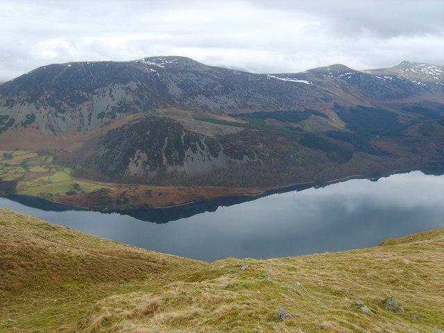 Photo could not load
NY0914 : From Crag Fell
Michael Graham
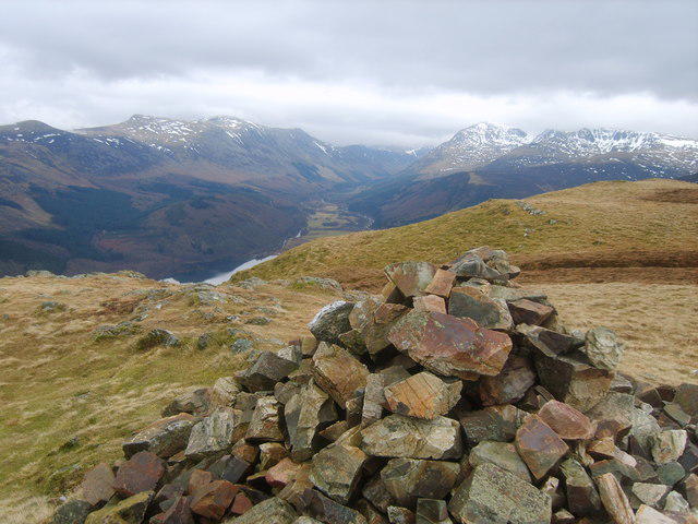 Photo could not load
NY0914 : On Crag Fell
Michael Graham
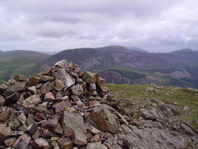 Photo could not load
NY0914 : Summit Cairn, Crag Fell
Michael Graham
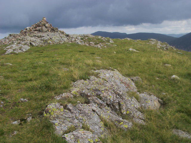 Photo could not load
NY0914 : Crag Fell
Shaun Ferguson
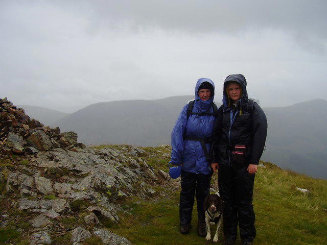 Photo could not load
NY0914 : Crag fell summit.
steven ruffles
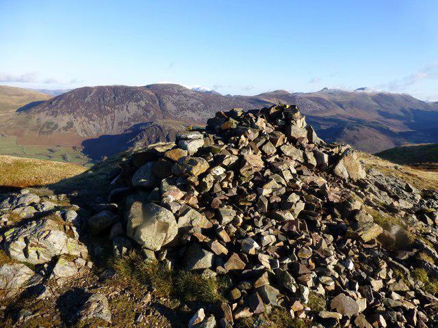 Photo could not load
NY0914 : Crag Fell Summit Cairn
Rude Health
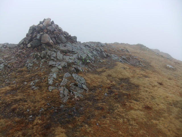 Photo could not load
NY0914 : Crag Fell
David Brown
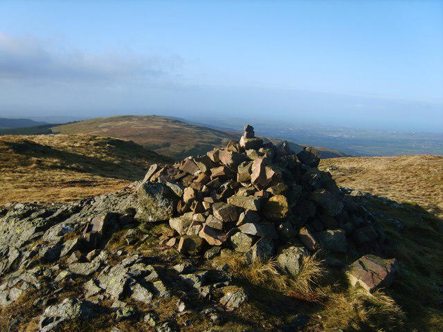 Photo could not load
NY0914 : Summit Cairn, Crag Fell
Michael Graham
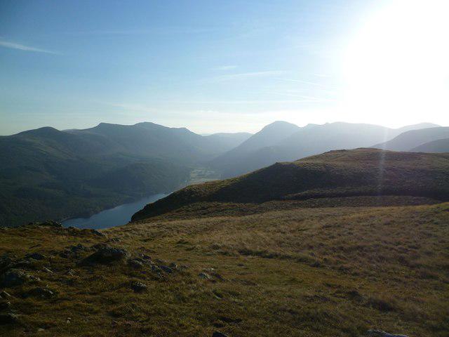 Photo could not load
NY0914 : On Crag Fell
Michael Graham
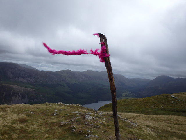
NY0914 : On Crag Fell
Michael Graham
Hill facts and local notes
Classifications
Elevation
523m
1,716 ft
Prominence
114m
Coordinates
54.5167, -3.3961
NY097143
OS Map
89
Explorer: OL4S 303
At the Summit
The summit is marked by a prominent cairn, offering a perfect photo opportunity for those who love a good selfie.
Terrain & Geology
Crag Fell is primarily composed of volcanic rocks, featuring andesite and basalt, which are remnants of ancient volcanic activity. This gives the fell its rugged charm and creates a variety of interesting geological features.
Views & Scenery
From the summit, you can enjoy breathtaking views of the Ennerdale Valley, along with neighbouring peaks such as Pillar and Great Gable.
History & Heritage
Name Origin
The name 'Crag Fell' derives from the rugged cliffs and crags that characterise its slopes.
Historical Significance
It has been a popular destination for walkers and climbers since the 19th century and holds significant cultural importance as part of the Lake District National Park.
Getting There & Facilities
Parking
There is parking available at Ennerdale Bridge, which can accommodate several vehicles.
Public Transport
Buses run from Whitehaven to Ennerdale Bridge, making it accessible for those using public transport.
Nearby Facilities
There are no facilities directly on Crag Fell, but Ennerdale Bridge offers a pub, a café, and public toilets.
Safety Information
Known Hazards
- Beware of sudden weather changes common in the Lake District; always check forecasts before heading out.
- The rocky paths can be slippery, especially in wet conditions, so sturdy footwear is advisable.
General Safety Tips
- Check weather conditions before setting out
- Carry appropriate clothing and equipment
- Let someone know your planned route
- Take a map, compass, and GPS device
- Carry emergency supplies: food, water, first aid kit, torch
Hills
Some common questions about the hills answered
Are there group walks up Crag Fell?
Many walkers use Walkmates to join or organise walks with others. You can check for group walks around Crag Fell through the maps
Are there other walkers around Crag Fell?
Activity varies by location and time, but Walkmates lets you see whether others have shared walks or shown interest in this area. Find other people through the walking friends search walking friends for Crag Fell search or of course create your own walk for Crag Fell
Can I organise a walk to Crag Fell?
Yes. If there aren’t any walks listed already, you can create a walk and make it available for others to join.
If you're signed up to Walkmates, you can create a walk to Crag Fell.
How do I find a walk up this hill?
There are often multiple ways to walk this hill, depending on experience and route preference. Walkmates helps you explore walks and routes that others have shared.
Can I suggest a new route up Crag Fell?
Yes. You can suggest or create routes to share with others. Walkmates focuses on the social side of walking, so routes are used to help people organise walks and explore areas together, rather than as detailed navigation tools or route libraries.
Other uses really appreciate knowledgeable walkers sharing their routes. Share your favourite route to Crag Fell here
The is an error or something incorrect about this hill. How do I let you know?
We always strive to keep the information on Walkmates as accurate as possible. If you find an error, please let us know through the contact form and we'll aim to correct it as quickly as possible
Community Discussion
Comments
Location
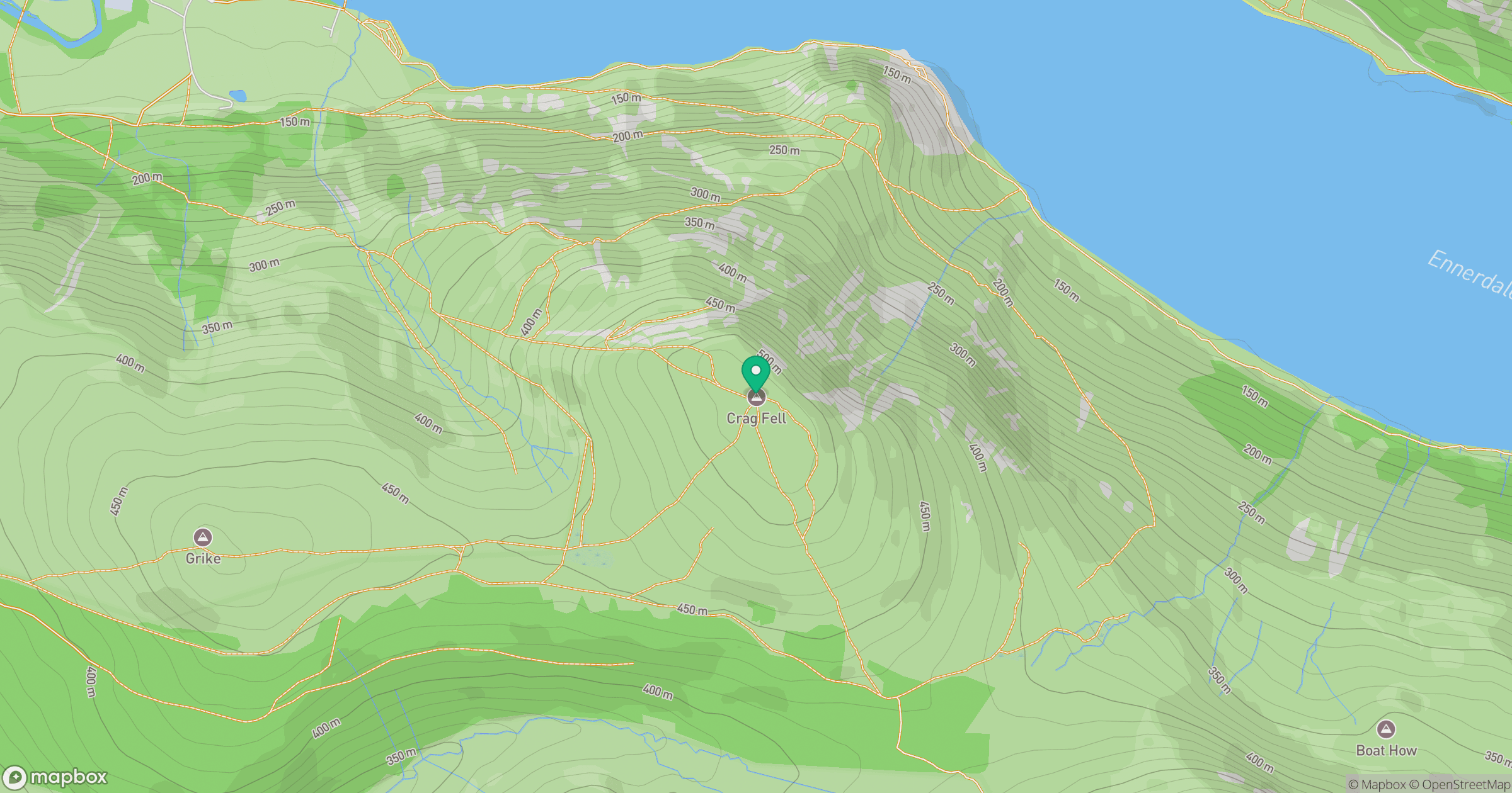
Grid reference: NY097143
View on OpenStreetMapOpens a map in a new tab, centred on the hill.
Nearby Hills
High Stile [Grey Crag - High Stile]
806m
Pillar
892m
Grasmoor
852m
Crag Hill [Eel Crag]
839m
Fleetwith Pike
649m
No comments yet. Be the first.