

Cold Pike
Good walks are even better shared.
NY2603 : Summit Cairn ,Cold Pike
Michael Graham Photo source
Overview
Cold Pike: A Hidden Gem in the Lake District
Cold Pike, standing tall at 739 meters, is a fantastic yet slightly lesser-known destination for hikers in the Lake District. While it may not have the same fame as its nearby giants, it quickly endears itself to those who venture up its rocky paths.
Geology
As a product of volcanic activity, Cold Pike's andesite rock formation provides a glimpse into ancient geological processes. This rugged landscape is not just a feast for the eyes, but also a vital educational resource for geology enthusiasts!
Routes
Wetherlam Circular Route
If you're up for a challenge while savoring the scenery, take the Wetherlam Circular Route. This about 10.5 km trek will have you sweating in a good way while you're greeted with magnificent views of the surrounding landscapes.
Harrison Stickle Route
For those feeling a tad adventurous, the Harrison Stickle route is a direct ascent that is sure to get your heart pumping and your spirits soaring. At about 7 km, it's a steep climb but offers some breathtaking moments along the way.
Summit Features
When you reach the peak, you'll be greeted by a sturdy stone cairn—a perfect backdrop for the ultimate summit selfie. Not to mention the sense of accomplishment you’ll feel when you beat gravity herself!
Terrain
Expect rocky scrambles interspersed with grassy patches. A few boggy areas might pop up to surprise the unprepared hiker, so sturdy footwear is recommended.
Views
Perched atop Cold Pike, the views are to die for; you'll be astounded by the panorama stretching across the Langdale valley and the majestic peaks surrounding you. Early mornings in spring bring the most vivid vistas, but don't overlook the kaleidoscope of autumn colours!
Hazards
Be mindful of loose rock—taking a tumble is a small price to pay for stunning vistas, but we’ll try to avoid that, shall we? Weather can turn on a dime, so pack that waterproof jacket like it's going out of style!
Access
Parking
The Dungeon Ghyll car park is your go-to parking spot, but get there early unless you enjoy the adoring gaze of a long walk just to start your adventure.
Public Transport
Frequent buses link Ambleside and Windermere to the Langdale valley, so public transport can be your friend as well!
Nearest Town
Ambleside is the nearest town, boasting plenty of cafes where you can indulge in some well-deserved cake post-hike.
Facilities
While basking on Cold Pike will give you all the joy, note that there are no facilities directly up there. Plan to pop your head down to Ambleside for refreshments and the loo!
History
Cold Pike's name straight away conjures up images of chilly peaks, derived from Old Norse. It’s been hiker-friendly for ages and is fully woven into the fabric of the Lakes' popular trails, especially in Alfred Wainwright's esteemed guides.
In conclusion, if you haven't yet ventured to Cold Pike, grab your map and prepare your hiking boots; this peak is waiting to welcome you with open arms. Just don’t forget to take plenty of photos!
Explore routes near Cold Pike
Walks starting near this hill. Open a route to check its map, distance and full itinerary.
Great Carrs Halifax Wreckage from Wrynose Pass
View route
Bow Fell from Langdale
View route
Tarn Hows Fast Route
View route
Coniston to Tarn Hows: Monk Coniston Gardens and Woodland Circuit
View route
Route planning notes
These notes describe possible approaches. Check a route's map and access information when planning your walk.
Wetherlam Circular Route
A scenic and moderately challenging loop that offers stunning views of the surrounding fells.
Harrison Stickle Route
A steeper approach from the Langdale valley, this route is direct and rewarding, ideal for those looking for a challenge.
Make a day of it, together
Find someone to share the walk with, or organise a day out along a route you like.
Photo Gallery
View all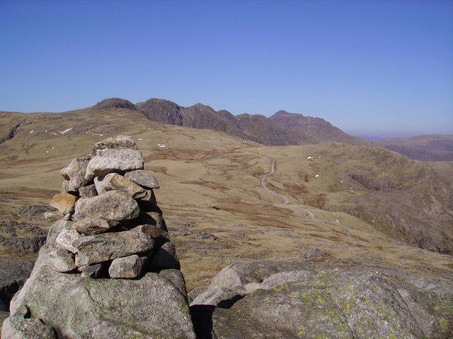 Photo could not load
NY2603 : Summit Cairn ,Cold Pike
Michael Graham
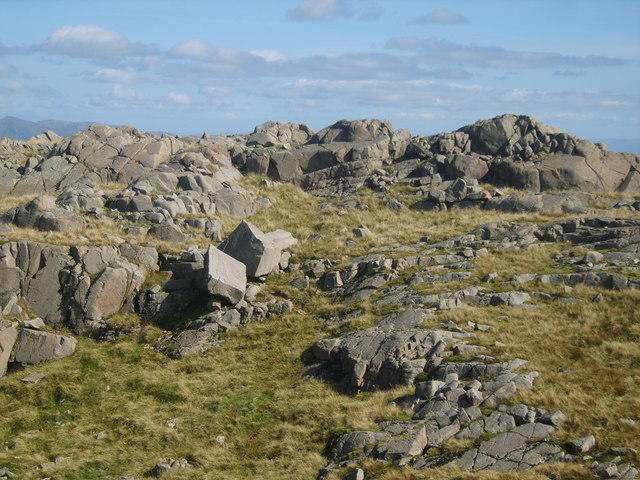 Photo could not load
NY2603 : Split Rock
Michael Graham
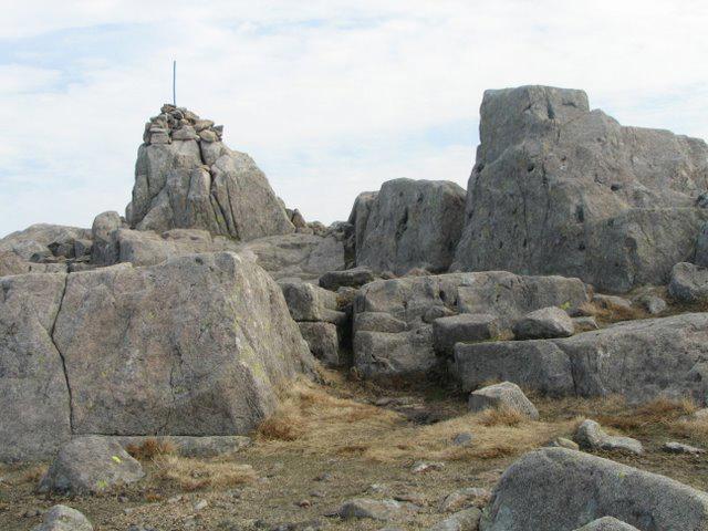 Photo could not load
NY2603 : The Summit and Cairn of Cold Pike
K A
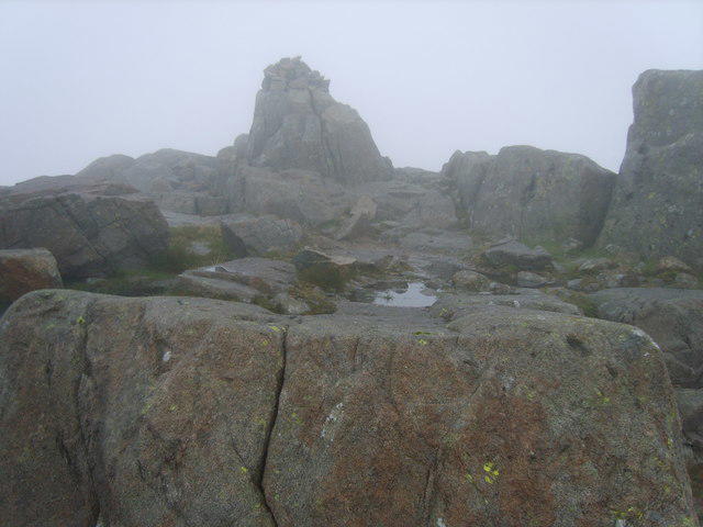 Photo could not load
NY2603 : Cold Pike
Michael Graham
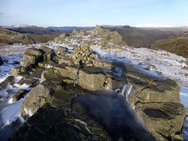 Photo could not load
NY2603 : Cold Pike View Across To Summit
Rude Health
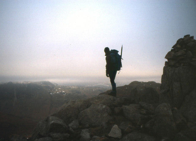 Photo could not load
NY2603 : Summit Cairn, Cold Pike
Peter Bond
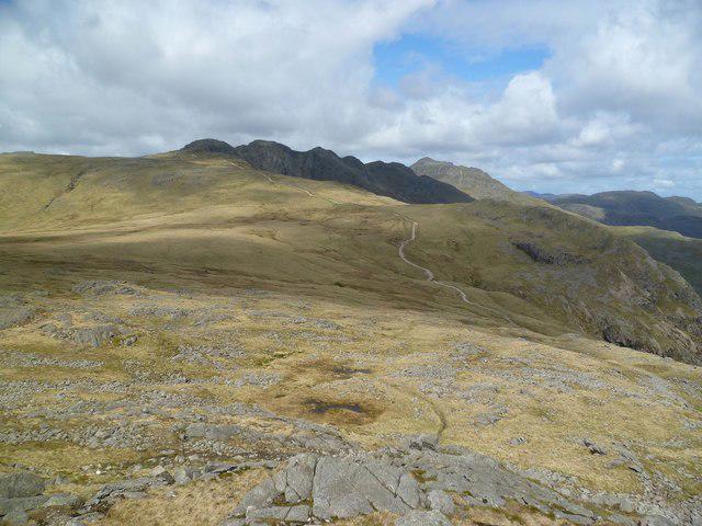 Photo could not load
NY2603 : On Cold Pike
Michael Graham
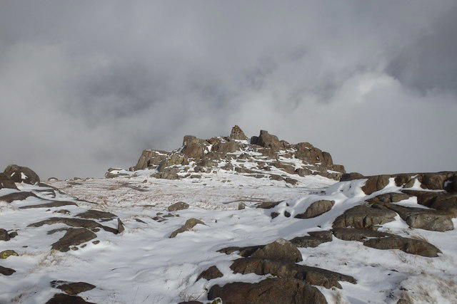 Photo could not load
NY2603 : On Cold Pike
Michael Graham
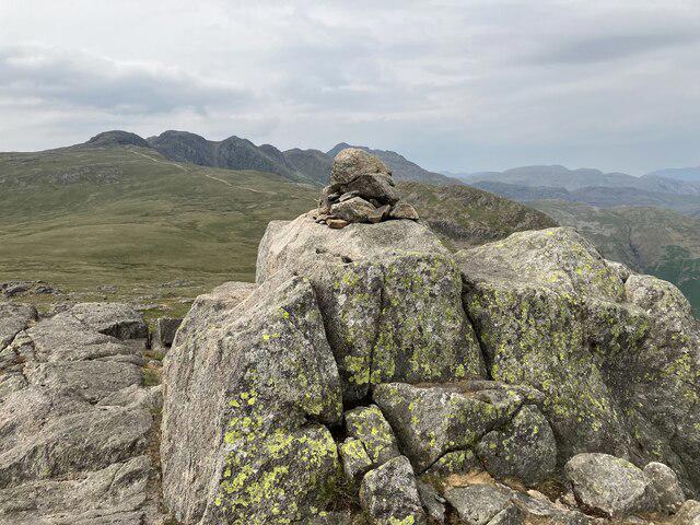 Photo could not load
NY2603 : Cold Pike summit cairn
Anthony Foster
Hill facts and local notes
Classifications
Elevation
700m
2,297 ft
Prominence
46m
Coordinates
54.4226, -3.1376
NY262036
OS Map
89 90
Explorer: OL6N
At the Summit
The summit features a well-constructed stone cairn, making it an ideal spot for a rest and reflection while soaking in the expansive views.
Terrain & Geology
Cold Pike is predominantly made of volcanic rock, primarily andesite, which adds to its dramatic crags and rugged terrain. This ancient rock formation provides excellent insights into the geological history of the area.
Views & Scenery
From the summit, you can enjoy breathtaking views of the surrounding peaks including the Great Knott, Bowfell and the Langdale Pikes, as well as expansive views across the valleys.
History & Heritage
Name Origin
The name 'Cold Pike' likely comes from the Old Norse 'kol' meaning 'cold', a fitting descriptor for the peak especially during winter months.
Historical Significance
Cold Pike has been a beloved choice for hikers for many years, featured in Alfred Wainwright's guides, it embodies the popular accessible beauty of the Lake District.
Getting There & Facilities
Parking
The nearest parking is at the Dungeon Ghyll car park in Langdale, which offers limited spaces and is a popular spot for walkers. Arrive early to secure a spot.
Public Transport
Regular buses operate from Windermere and Ambleside to the Langdale Valley. Check local timetables for the most current routes.
Nearby Facilities
There are no facilities directly on Cold Pike, but nearby Ambleside offers a range of cafes, shops, and public toilets. Be sure to grab a piece of cake to refuel!
Safety Information
Known Hazards
- Take care with loose rocks and sudden changes in weather which can occur rapidly in mountainous areas. Visibility can drop quickly in fog, so navigation skills are a must.
General Safety Tips
- Check weather conditions before setting out
- Carry appropriate clothing and equipment
- Let someone know your planned route
- Take a map, compass, and GPS device
- Carry emergency supplies: food, water, first aid kit, torch
Hills
Some common questions about the hills answered
Are there group walks up Cold Pike?
Many walkers use Walkmates to join or organise walks with others. You can check for group walks around Cold Pike through the maps
Are there other walkers around Cold Pike?
Activity varies by location and time, but Walkmates lets you see whether others have shared walks or shown interest in this area. Find other people through the walking friends search walking friends for Cold Pike search or of course create your own walk for Cold Pike
Can I organise a walk to Cold Pike?
Yes. If there aren’t any walks listed already, you can create a walk and make it available for others to join.
If you're signed up to Walkmates, you can create a walk to Cold Pike.
How do I find a walk up this hill?
There are often multiple ways to walk this hill, depending on experience and route preference. Walkmates helps you explore walks and routes that others have shared.
Can I suggest a new route up Cold Pike?
Yes. You can suggest or create routes to share with others. Walkmates focuses on the social side of walking, so routes are used to help people organise walks and explore areas together, rather than as detailed navigation tools or route libraries.
Other uses really appreciate knowledgeable walkers sharing their routes. Share your favourite route to Cold Pike here
The is an error or something incorrect about this hill. How do I let you know?
We always strive to keep the information on Walkmates as accurate as possible. If you find an error, please let us know through the contact form and we'll aim to correct it as quickly as possible
Community Discussion
Comments
Location
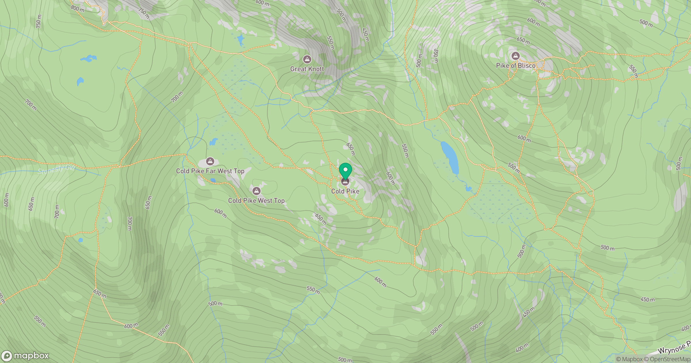
Grid reference: NY262036
View on OpenStreetMapOpens a map in a new tab, centred on the hill.
No comments yet. Be the first.