

Cnocan Conachreag
Good walks are even better shared.
Overview
Cnocan Conachreag: A Hidden Gem in the North Highlands
Nestled within the enchanting North Highlands, Cnocan Conachreag may not be the tallest mountain on the block, but it certainly packs a punch in terms of scenic beauty and outdoor adventure. Standing at 398 meters, it’s classified as a Marilyn, which means it offers a prominence that rewards hikers with stunning views and a sense of accomplishment without too much sweat.
Geology
The hill is primarily formed of schist and granitic rocks, which tell a geological story of upheaval and transformation over millions of years. The rocky outcrops and varied terrain are not only fascinating to geologists but also create ample opportunities for a comfortable (if a bit rugged) hike. Be prepared for some rocky steps!
Route Details
The recommended route is the Cnocan Conachreag Circular Route. This trail provides a delightful stroll through heather-covered slopes and rocky trails that wind beautifully around the hill. At 5.5 km, you can complete this route in about 2.5 hours, making it suitable for most moderate hikers. Remember to stretch those legs after a good meal from Dufftown!
Summit Features
At the summit, you'll be greeted by a quaint stone cairn that acts as a perfect backdrop for your summit selfie. It’s a flat plateau, ideal for a well-deserved snack — no sandwich left behind here!
Views
The vistas from the top are simply breathtaking. On a clear day, you can gaze upon Ben Rinnes and the sparkling Moray Firth. The colourful landscape transforms as the seasons change, offering new sights with every visit. Expert tip: Pack your binoculars to spot the locals... particularly the majestic red deer that roam the hills!
Hazards
While hiking Cnocan Conachreag is generally safe, be wary of sudden weather shifts typical of the North Highlands. Also, when the rain falls, the rocky patches can become slippery, so it's recommended to keep an eye on the footing and avoid those embarrassing slips — stay upright and proud!
Access & Facilities
Parking is handy along the A941, just south of the mountain, and it’s free! If public transport is your preferred mode, the bus service in Dufftown has you covered, though prepare for a decent walk from there. The nearby town also offers a range of cafes, perfect for refuelling. Don't forget to stop by the toilet facilities — trust us, you’ll thank yourself later!
Conclusion
Cnocan Conachreag might not hold the tallest title, but it surely features on the list of must-visit spots in the North Highlands, perfect for those looking to immerse themselves in nature without the hustle and bustle of more famous peaks. Come for the views, stay for the peace.
Now go grab your hiking boots and get out there — adventure awaits!
Explore routes near Cnocan Conachreag
Public walks starting within 80 km of this hill. Nearby does not mean a route reaches the summit; check its map and access before setting out.
Ben Klibreck
View route
Loch Migdale from Torroy: Spinningdale pinewood and loch shore walk
View route
Findhorn guided night walk
View route
Elgin guided night walk
View route
Route planning notes
These notes describe possible approaches, not verified navigable routes or permission to cross land. Check current paths, local access rules and conditions before setting out.
Cnocan Conachreag Circular Route
This circular route begins at the base of the hill and takes you through a mix of heather-covered slopes and rocky trails, providing a delightful walk with excellent views.
Make a day of it, together
Find someone to share the walk with, or organise a day out along a route you like.
Photo Gallery
View all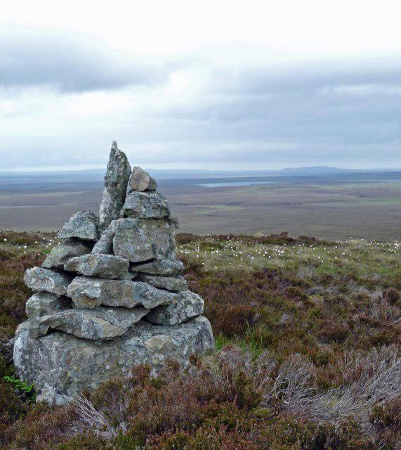 Photo could not load
ND1136 : Cairn, Cnocan Conachreag
Claire Pegrum
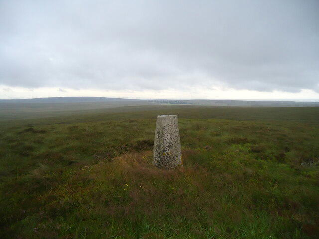 Photo could not load
ND1136 : Cnocan Conachreag summit
Michael Earnshaw
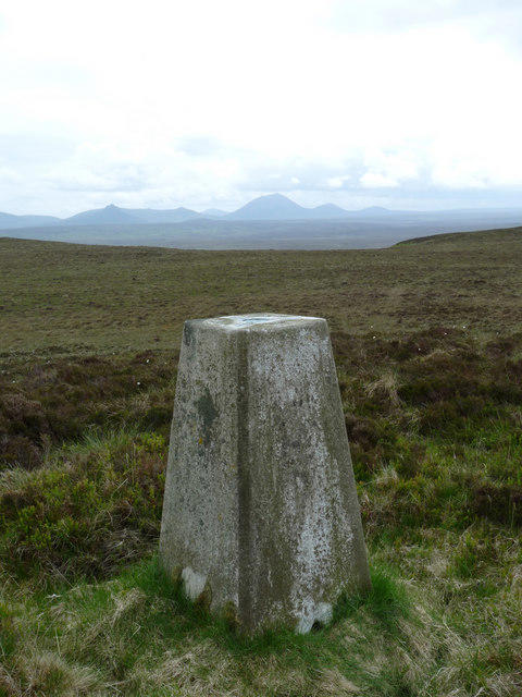 Photo could not load
ND1136 : Triangulation pillar, Cnocan Conachreag
Claire Pegrum
Hill facts and local notes
Classifications
Elevation
269m
883 ft
Prominence
101m
Coordinates
58.3104, -3.5135
ND114367
OS Map
11 17
Explorer: 450W
At the Summit
The summit is adorned with a small stone cairn, which provides a perfect Instagram opportunity for those seeking social media likes. There's a flat plateau that makes for a great picnic spot — just remember to bring crumbs, not a feast, lest you attract a curious sheep!
Terrain & Geology
Cnocan Conachreag consists mainly of schist and granitic rocks, which provide a stable base but also create some interesting ridge features. The bedrock's geological history hints at tectonic activity, resulting in the rugged terrain that hikers enjoy today.
Views & Scenery
On a clear day, summits like Ben Rinnes and the Moray Firth can be seen, as well as the expansive landscape of the North Highlands. Don’t forget to look around for the local wildlife, especially the elusive red deer.
History & Heritage
Name Origin
The name 'Cnocan Conachreag' roughly translates to 'Little Hill of the Ridges', reflecting its physical characteristics as well as its scenic prominence in the area.
Historical Significance
The mountain is a less-trodden gem in the North Highlands, often overshadowed by its larger neighbours but offers a rich habitat for local flora and fauna, making it significant for nature lovers.
Getting There & Facilities
Check current local access restrictions, parking rules and transport timetables before travelling. These notes do not confirm public access to the summit.
Parking
Parking is available at the roadside on the A941 just south of the hill, typically no charges apply. Please park considerately to avoid blocking access.
Public Transport
The nearest bus service is in the village of Dufftown, with connections from larger towns like Elgin. It’s a good two-hour walk from the bus stop to your starting point, so plan your timing wisely.
Nearby Facilities
Dufftown has several cafes and shops, with toilets available at the visitor centre. Be sure to grab a slice of cake for the trail — a hiker's best friend!
Safety Information
Known Hazards
- Beware of sudden weather changes; conditions can change in a heartbeat. Also, the rocky terrain can be slippery, especially when damp. Be mindful of low visibility days.
General Safety Tips
- Check weather conditions before setting out
- Carry appropriate clothing and equipment
- Let someone know your planned route
- Take a map, compass, and GPS device
- Carry emergency supplies: food, water, first aid kit, torch
Hills
Some common questions about the hills answered
Are there group walks up Cnocan Conachreag?
Many walkers use Walkmates to join or organise walks with others. You can check for group walks around Cnocan Conachreag through the maps
Are there other walkers around Cnocan Conachreag?
Activity varies by location and time, but Walkmates lets you see whether others have shared walks or shown interest in this area. Find other people through the walking friends search walking friends for Cnocan Conachreag search or of course create your own walk for Cnocan Conachreag
Can I organise a walk to Cnocan Conachreag?
Yes. If there aren’t any walks listed already, you can create a walk and make it available for others to join.
If you're signed up to Walkmates, you can create a walk to Cnocan Conachreag.
How do I find a walk up this hill?
There are often multiple ways to walk this hill, depending on experience and route preference. Walkmates helps you explore walks and routes that others have shared.
Can I suggest a new route up Cnocan Conachreag?
Yes. You can suggest or create routes to share with others. Walkmates focuses on the social side of walking, so routes are used to help people organise walks and explore areas together, rather than as detailed navigation tools or route libraries.
Other uses really appreciate knowledgeable walkers sharing their routes. Share your favourite route to Cnocan Conachreag here
The is an error or something incorrect about this hill. How do I let you know?
We always strive to keep the information on Walkmates as accurate as possible. If you find an error, please let us know through the contact form and we'll aim to correct it as quickly as possible
Community Discussion
Comments
Location
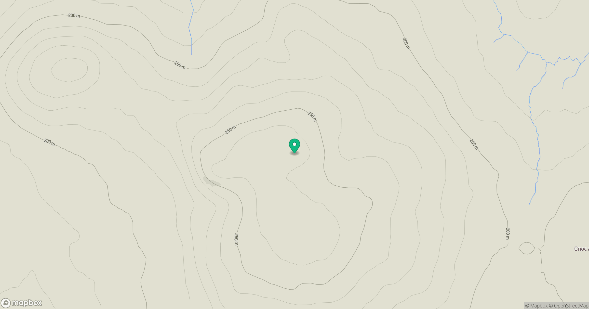
Grid reference: ND114367
View on OpenStreetMapOpens a map in a new tab, centred on the hill.
Hills within 30 km
Straight-line distance, not a walking route or confirmation of access.
No comments yet. Be the first.