

Creag Thoraraidh
Good walks are even better shared.
ND0318 : Polite Notice
thejackrustles Photo source
Explore routes near Creag Thoraraidh
Walks starting near this hill. Open a route to check its map, distance and full itinerary.
Loch Migdale from Torroy: Spinningdale pinewood and loch shore walk
View route
Ben Klibreck
View route
Culbin Forest: Hill 99, Gravel Pit Ponds and Dragonfly Pool
View route
Craigellachie to Aberlour: Speyside Railway Path Return
View route
Route planning notes
These notes describe possible approaches. Check a route's map and access information when planning your walk.
East Approach
A well-trodden path starting from the minor road at the eastern base of the hill, providing a straightforward ascent with some stunning views over the surrounding landscape.
West Ridge
This more challenging route climbs from the west side, offering the thrill of a steeper ascent and the chance to navigate some rocky outcrops.
Make a day of it, together
Find someone to share the walk with, or organise a day out along a route you like.
Photo Gallery
View all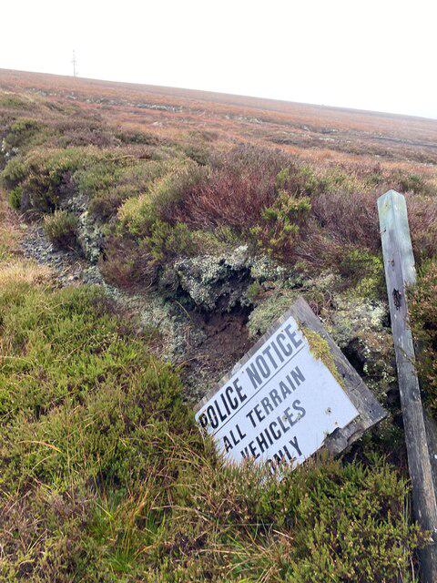 Photo could not load
ND0318 : Polite Notice
thejackrustles
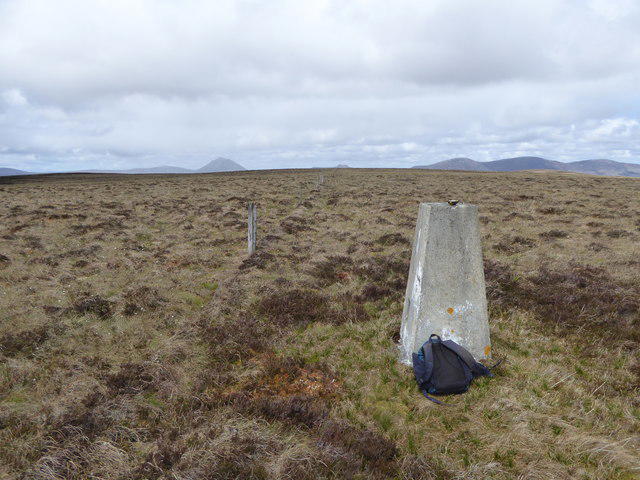 Photo could not load
ND0418 : The trig point on Creag Thoraraidh lies in a soggy cotton-grass bog
Mick Crawley
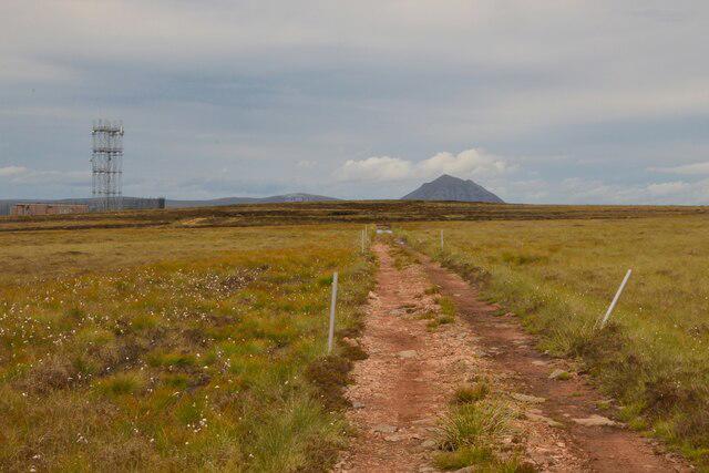 Photo could not load
ND0318 : Access Track on top of Creag Thoraraidh, Sutherland
Andrew Tryon
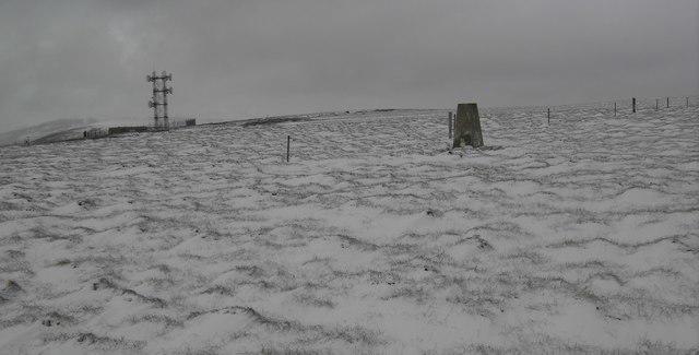 Photo could not load
ND0418 : Creag Thoraraidh trig
Colin Kinnear
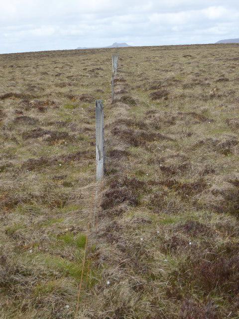 Photo could not load
ND0418 : A non-functioning stock-fence on Creag Thoraraidh
Mick Crawley
Hill facts and local notes
Classifications
Elevation
404m
1,327 ft
Prominence
155m
Coordinates
58.1473, -3.6315
ND040187
OS Map
17
Explorer: 444E
At the Summit
The summit is marked by a small but charming stone cairn, which provides a perfect spot for a well-deserved snack or an impromptu philosophical discussion. Be sure to take a selfie with it to avoid family disgracing you with a lack of photographic evidence!
Terrain & Geology
Creag Thoraraidh is primarily composed of ancient Lewisian gneiss, offering a glimpse into the geological history dating back over 3 billion years. The rugged rocks have weathered over millennia, presenting a landscape rich with both flora and fauna.
Views & Scenery
From the summit, adventurers can enjoy breathtaking views of the Moray Firth to the northeast and the wild landscapes of the Cairngorms to the south. On a clear day, the sight is an absolute cracker!
History & Heritage
Name Origin
Creag Thoraraidh translates to 'Hill of the Swamp' in Gaelic, a name reflecting its landscape and the surrounding boggy areas.
Historical Significance
Traditionally, this hill has been a point of local folklore, believed to hold a few tales of mischievous spirits, so keep your ears perked for any ghostly whispers!
Getting There & Facilities
Parking
Parking is available along the minor road close to the eastern trailhead. It can accommodate several vehicles, but be cautious during peak season as spots may become limited.
Public Transport
The nearest public transport services run from Inverness, with buses connecting to nearby villages. The closest bus stop is approximately 7 km away from the trailhead.
Nearby Facilities
Fochabers has a local café and a convenience store, perfect for filling your water bottle or grabbing a bite after your hike. Toilet facilities are also available in the village.
Safety Information
Known Hazards
- Rocky sections may be slippery, especially when wet. Take care in foggy conditions as navigation can become tricky. Also, be on the lookout for the occasional overzealous grouse!
General Safety Tips
- Check weather conditions before setting out
- Carry appropriate clothing and equipment
- Let someone know your planned route
- Take a map, compass, and GPS device
- Carry emergency supplies: food, water, first aid kit, torch
Hills
Some common questions about the hills answered
Are there group walks up Creag Thoraraidh?
Many walkers use Walkmates to join or organise walks with others. You can check for group walks around Creag Thoraraidh through the maps
Are there other walkers around Creag Thoraraidh?
Activity varies by location and time, but Walkmates lets you see whether others have shared walks or shown interest in this area. Find other people through the walking friends search walking friends for Creag Thoraraidh search or of course create your own walk for Creag Thoraraidh
Can I organise a walk to Creag Thoraraidh?
Yes. If there aren’t any walks listed already, you can create a walk and make it available for others to join.
If you're signed up to Walkmates, you can create a walk to Creag Thoraraidh.
How do I find a walk up this hill?
There are often multiple ways to walk this hill, depending on experience and route preference. Walkmates helps you explore walks and routes that others have shared.
Can I suggest a new route up Creag Thoraraidh?
Yes. You can suggest or create routes to share with others. Walkmates focuses on the social side of walking, so routes are used to help people organise walks and explore areas together, rather than as detailed navigation tools or route libraries.
Other uses really appreciate knowledgeable walkers sharing their routes. Share your favourite route to Creag Thoraraidh here
The is an error or something incorrect about this hill. How do I let you know?
We always strive to keep the information on Walkmates as accurate as possible. If you find an error, please let us know through the contact form and we'll aim to correct it as quickly as possible
Community Discussion
Comments
Location
View the hill's mapped position and surrounding paths.
Grid reference: ND040187
View on OpenStreetMapOpens a map in a new tab, centred on the hill.
No comments yet. Be the first.