

Cnoc Uamh nam Fear
Good walks are even better shared.
Overview
Cnoc Uamh nam Fear
Cnoc Uamh nam Fear stands proudly at 513 meters, offering splendid views of the Scottish Highlands. Nestled near the village of Clifden, it is a delightful destination for both seasoned hikers and those looking for a gentle stroll wrapped in splendid scenery.
Geology
The rocky foundation is primarily schist and gneiss, both of which have seen some serious weathering over centuries. You might even spot some fascinating rock formations along the way — after all, rock climbing isn't just a pastime; it’s geology in action!
Access
Getting to Cnoc Uamh nam Fear is a breeze. There’s some limited parking in Clifden, but if you fancy a more spontaneous adventure, feel free to park at the A83.
Hop on a bus from Glasgow to Tarbet, and then prepare to stretch those legs! The nearest town has enough cafés to fuel your hike, so don't forget to grab a slice of cake before you go.
Routes
- The Northern Approach: This lovely route can take around 3.5 hours. A more gradual incline, you’ll appreciate the surrounding scenery without breaking a sweat.
- The Southern Path: For those who crave a challenge, this path leads straight from the A83 and takes about 2.5 hours to the summit.
Summit Features
At the top, you’ll find a modest yet charming cairn that often leads to debates among hikers about its artistic merit. Is it really a cairn, or is it modern art? You decide!
Terrain
Expect a mix of rocky outcrops and rolling grassy slopes; watch those boots in the boggy spots! It’s all part of the charming experience of hiking in Scotland, right?
Views
The views from the summit are nothing short of breathtaking, with the magnificent Loch Fyne stretching before you and the peaks of Arran peeking in the distance on a clear day.
Hazards
As beautiful as it is, remember the Highland weather loves to keep you guessing. Be cautious of slippery paths after rain; our good friend, Mother Nature, can surprise you!
Nearby Summits
If you're feeling adventurous, consider tackling Ben Donich or Beinn an Lochain while you're in the area!
History
The mountain’s name tells of its illustrious past, meaning 'Hill of the Cave of the Man', connecting it to fascinating local lore.
In summary, Cnoc Uamh nam Fear is more than just a hike; it's a journey filled with spectacular views, rich history, and a few giggles along the way. So lace up those boots and get out there!
Explore routes near Cnoc Uamh nam Fear
Public walks starting within 80 km of this hill. Nearby does not mean a route reaches the summit; check its map and access before setting out.
Crinan Canal: Bellanoch and Dunardry towpath return
View route
Portballintrae to Giant's Causeway: railway path and Blue Trail return
View route
Route planning notes
These notes describe possible approaches, not verified navigable routes or permission to cross land. Check current paths, local access rules and conditions before setting out.
The Northern Approach
A scenic route beginning from the village of Clifden, providing a gradual ascent with stunning views of the surrounding hills.
The Southern Path
This pathway offers a steeper ascent directly from the A83, leading up to the summit with fewer distractions and more glorious panoramic views.
Make a day of it, together
Find someone to share the walk with, or organise a day out along a route you like.
Photo Gallery
View all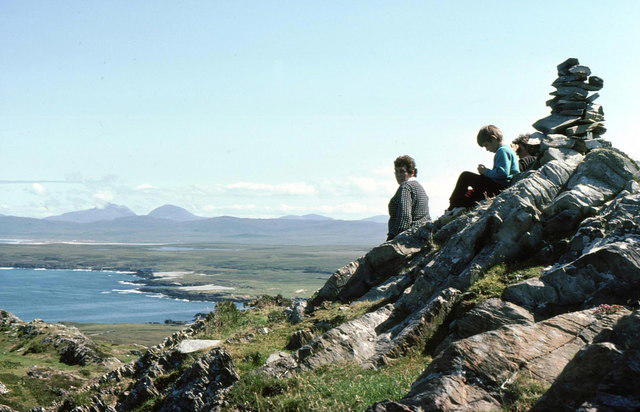 Photo could not load
NR2171 : Cnoc Uamh nam Fear
Russel Wills
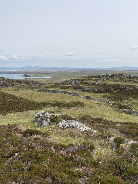 Photo could not load
NR2170 : Views on the way to Cnoc Uamh Nam Fear
thejackrustles
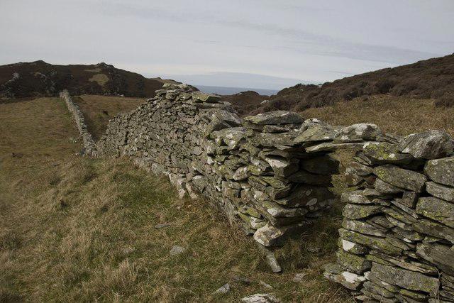 Photo could not load
NR2170 : Gap in the Dry Stone Wall south of Cnoc Uamh nam Fear, Islay
Becky Williamson
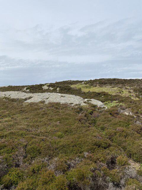 Photo could not load
NR2170 : First view of the top of Cnoc Uamh Nam Fear Trig Point
thejackrustles
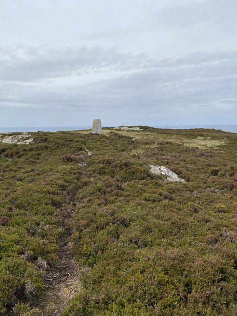 Photo could not load
NR2170 : Nearly there Cnoc Uamh Nam Fear Trig Point
thejackrustles
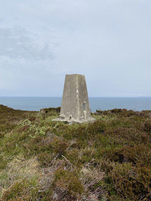 Photo could not load
NR2170 : Cnoc Uamh Nam Fear Trig Point S9078
thejackrustles
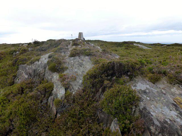 Photo could not load
NR2170 : Cnoc Uamh nam Fear
Rude Health
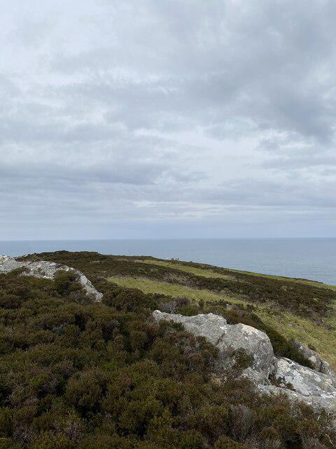 Photo could not load
NR2171 : Views out to sea Cnoc Uamh Nam Fear
thejackrustles
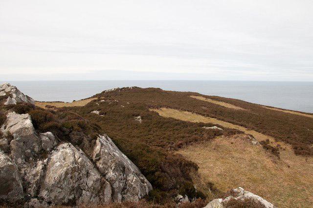 Photo could not load
NR2171 : Just below the summit of Cnoc Uamh nam Fear, Islay
Becky Williamson
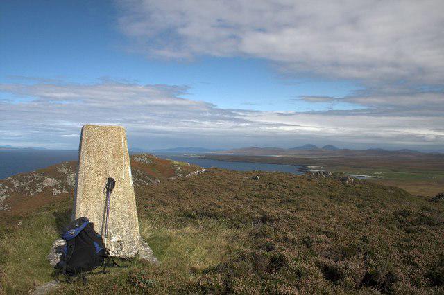
NR2170 : Trigpoint at Cnoc Uamh nam Fear, Islay
Becky Williamson
Hill facts and local notes
Classifications
Elevation
128m
420 ft
Prominence
101m
Coordinates
55.8516, -6.4467
NR217709
OS Map
60
Explorer: 353W
At the Summit
The summit features a modest cairn, which seems to often be mistaken for a trendy minimalist art installation.
Terrain & Geology
Cnoc Uamh nam Fear is primarily composed of rugged schist and gneiss, which give it a beautifully weathered appearance. The rocks here have seen their fair share of glacial sculpting, creating features that draw in geologists and hikers alike.
Views & Scenery
From the summit, you can gaze upon the breathtaking Loch Fyne, the jagged peaks of the surrounding hills, and on a clear day, even the distant Isle of Arran.
History & Heritage
Name Origin
The name 'Cnoc Uamh nam Fear' translates to 'Hill of the Cave of the Man', likely referring to historical habitation in the area.
Historical Significance
The region is steeped in folklore, often linked with stories of mythical creatures and ancient tribes that once roamed these hills.
Getting There & Facilities
Check current local access restrictions, parking rules and transport timetables before travelling. These notes do not confirm public access to the summit.
Parking
There is limited parking at Clifden, but ample space is available at the nearby A83 layby for those taking the Southern Path.
Public Transport
Public transport options include bus services from Glasgow towards Tarbet, though a car is recommended for reaching the trailheads directly.
Nearby Facilities
Facilities are basic, but Tarbet offers a few cafes and public toilets to prepare before your trek.
Safety Information
Known Hazards
- Be wary of sudden weather changes; the Highlands are notorious for their mood swings. Also watch for slippery terrain, especially in wetter months.
General Safety Tips
- Check weather conditions before setting out
- Carry appropriate clothing and equipment
- Let someone know your planned route
- Take a map, compass, and GPS device
- Carry emergency supplies: food, water, first aid kit, torch
Hills
Some common questions about the hills answered
Are there group walks up Cnoc Uamh nam Fear?
Many walkers use Walkmates to join or organise walks with others. You can check for group walks around Cnoc Uamh nam Fear through the maps
Are there other walkers around Cnoc Uamh nam Fear?
Activity varies by location and time, but Walkmates lets you see whether others have shared walks or shown interest in this area. Find other people through the walking friends search walking friends for Cnoc Uamh nam Fear search or of course create your own walk for Cnoc Uamh nam Fear
Can I organise a walk to Cnoc Uamh nam Fear?
Yes. If there aren’t any walks listed already, you can create a walk and make it available for others to join.
If you're signed up to Walkmates, you can create a walk to Cnoc Uamh nam Fear.
How do I find a walk up this hill?
There are often multiple ways to walk this hill, depending on experience and route preference. Walkmates helps you explore walks and routes that others have shared.
Can I suggest a new route up Cnoc Uamh nam Fear?
Yes. You can suggest or create routes to share with others. Walkmates focuses on the social side of walking, so routes are used to help people organise walks and explore areas together, rather than as detailed navigation tools or route libraries.
Other uses really appreciate knowledgeable walkers sharing their routes. Share your favourite route to Cnoc Uamh nam Fear here
The is an error or something incorrect about this hill. How do I let you know?
We always strive to keep the information on Walkmates as accurate as possible. If you find an error, please let us know through the contact form and we'll aim to correct it as quickly as possible
Community Discussion
Comments
Location
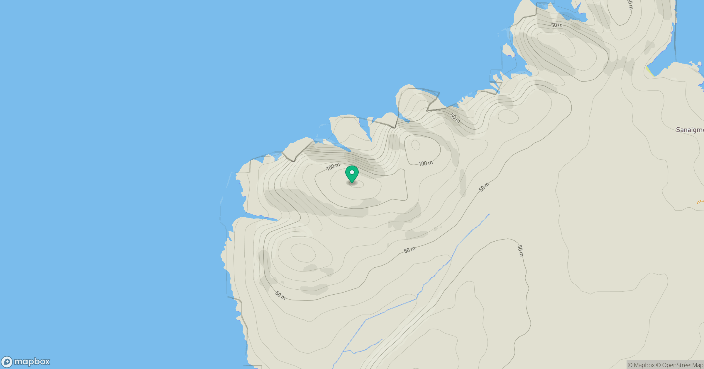
Grid reference: NR217709
View on OpenStreetMapOpens a map in a new tab, centred on the hill.
Hills within 30 km
Straight-line distance, not a walking route or confirmation of access.
Beinn an Oir
785m
Turnaichaidh [Creag Mhor]
170m
Beinn Tart a' Mhill
232m
Sgarbh Dubh
294m
Giur-bheinn
317m
No comments yet. Be the first.