

Chinley Churn (old GR)
Good walks are even better shared.
SK0383 : Abandoned stone quarry on Cracken Edge
Graham Hogg Photo source
Overview
Chinley Churn (old GR)
Overview
Chinley Churn, standing proudly at an elevation of 482 meters, is a Marilyn within the stunning Peak District. This delightful hill offers hikers a unique combination of history, geology, and magnificent views, making it a perfect destination for both novice and experienced walkers alike.
Geology
As you tread the pathways of Chinley Churn, your footsteps echo a prehistoric past dominated by limestone formations. Fossils can be spotted if you know where to look, and who knows, you might even uncover a relic of a bygone era!
Hiking Routes
The main route begins in the picturesque village of Chinley, covering a distance of 4.5 km, and typically takes around two hours to complete. This moderately difficult trek winds through tranquil farmland and scenic moorland, leading you to the iconic trig point at the summit. Pack your sandwiches, because you won’t want to rush through lunch with views like these!
Summit Features
Upon reaching the summit, you'll be greeted by the famed trig point, surrounded by serene rocky outcrops. It's a great spot for a photo op, so snap away!
Terrain
Expect a mix of grassy hills and uneven rocky outcrops along the route. It’s like nature decided to throw in a fresh fitness challenge!
Scenic Views
The summit offers breathtaking vistas of Kinder Scout, the High Peak, and the rolling hills of the Dark Peak. You’ll want to bring your camera, or at the very least, a keen eye to capture the beauty.
Hazards
Keep an eye on the weather, as it can change quicker than a cat can pounce on a laser pointer. The terrain can also be slippery, so tread carefully, especially in muddy patches.
Access and Facilities
Chinley village provides ample parking spaces, though it may be a bit snug during peak times. The nearby train station makes this attraction accessible by public transport too!
Once you’ve conquered the hill, reward yourself at a local café or pub—it’s just the thing to celebrate a day well spent outdoors.
Conclusion
Chinley Churn is more than just a hill; it’s a canvas painted with panoramic vistas, rich history, and geological wonders. Whether you’re a budding botanist, a geological enthusiast, or simply a lover of the great outdoors, you’ll find something to cherish here. So lace up those boots and embark on your adventure to Chinley Churn. Happy hiking!
Explore routes near Chinley Churn (old GR)
Walks starting near this hill. Open a route to check its map, distance and full itinerary.
Mill Hill Liberator Wreckage via Harry Hut
View route
Edale and Castleton circuit
View route
Edale and Castleton circuit
View route
Edale and Castleton circuit
View route
Route planning notes
These notes describe possible approaches. Check a route's map and access information when planning your walk.
Chinley Churn Walk from the Village of Chinley
A gentle ascent from the charming village of Chinley, this route offers a mix of farmland and moorland, leading to stunning views at the summit.
Make a day of it, together
Find someone to share the walk with, or organise a day out along a route you like.
Photo Gallery
View all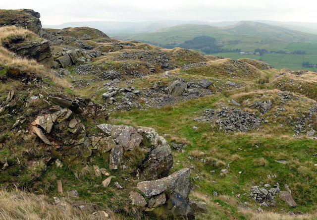 Photo could not load
SK0383 : Abandoned stone quarry on Cracken Edge
Graham Hogg
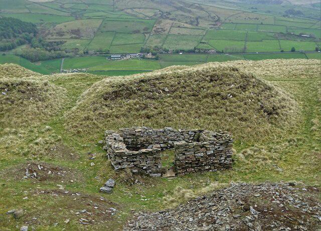 Photo could not load
SK0383 : On Cracken Edge
Neil Theasby
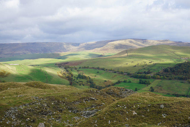 Photo could not load
SK0383 : Quarry remains on Chinley Churn
Bill Boaden
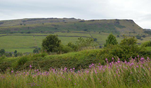 Photo could not load
SK0383 : Chinley Churn landscape
Bobby Clegg
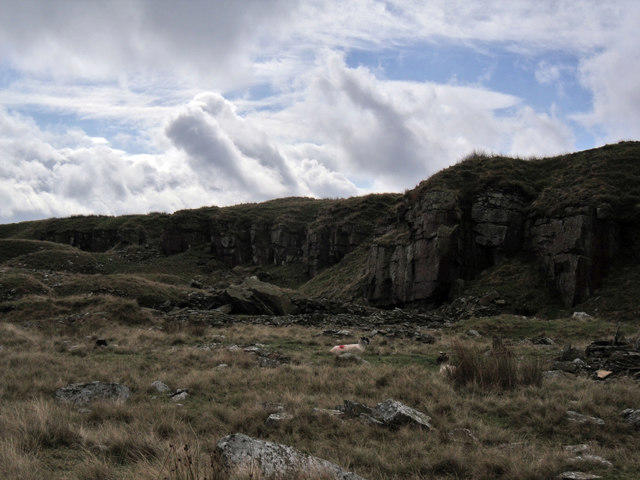 Photo could not load
SK0383 : Cracken Edge
Stephen Burton
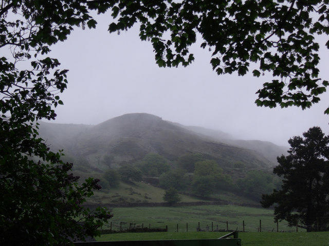 Photo could not load
SK0383 : Chinley Churn
Stephen Burton
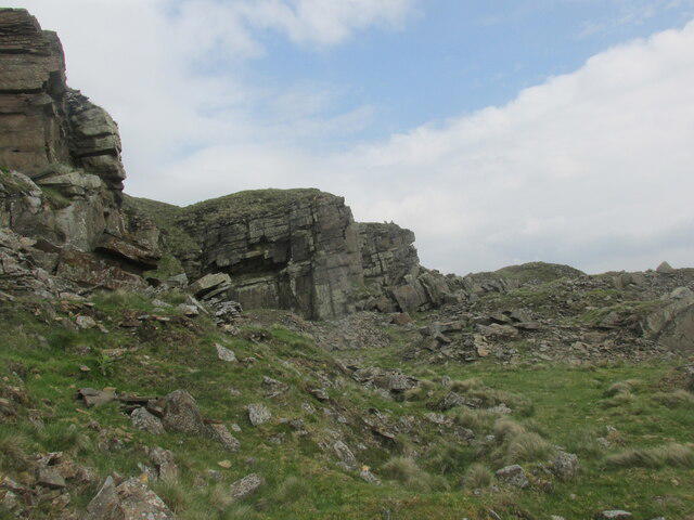 Photo could not load
SK0383 : Old quarry workings along Cracken Edge.
steven ruffles
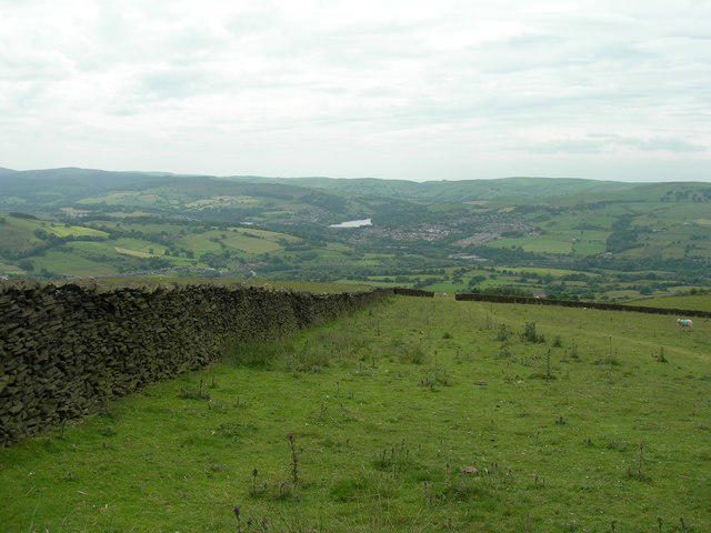 Photo could not load
SK0383 : Field Boundary Wall
John Topping
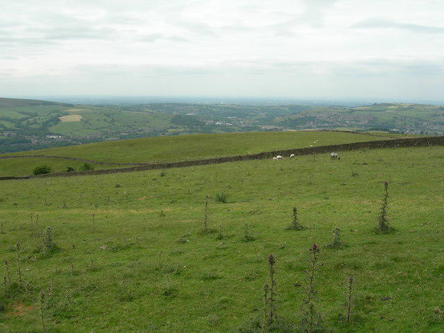 Photo could not load
SK0383 : Western View from Chinley Churn
John Topping
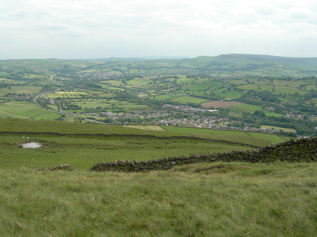
SK0383 : Southeastern view from Chinley Churn
John Topping
Hill facts and local notes
Classifications
Elevation
452m
1,482 ft
Prominence
17m
Coordinates
53.3497, -1.9481
SK035836
OS Map
110
Explorer: OL1W
At the Summit
The summit features a prominent trig point, which has seen more selfies than some celebrities. There are also scattered rocks that offer a perfect spot to rest and enjoy the panoramic views.
Terrain & Geology
Chinley Churn is predominantly comprised of limestone, indicative of the area's geological history. The limestone formations are home to various fossils dating back to the Carboniferous period, which are a testament to the ancient seabed that once existed here.
Views & Scenery
From the summit, you'll be treated to expansive views of the High Peak, Kinder Scout, and the distant hills of the Dark Peak area, as well as the charming surrounding valleys.
History & Heritage
Name Origin
The name 'Chinley' is believed to be derived from the Old English words for 'chin' and 'leah', meaning 'clearing'. Hence, one could say you've reached a 'clear' decision to hike!
Historical Significance
Chinley Churn holds local historical significance as a part of the Peak District's industrial age, being associated with the limestone quarrying that contributed to the region's economy.
Getting There & Facilities
Parking
There is a small parking area in the village of Chinley, which can fill up quickly on weekends, so arrive early or prepare to park at the end of the pub car park instead.
Public Transport
Chinley is well-served by frequent train services from Manchester and surrounding areas. The station is a short walk from the village centre, making it a convenient starting point.
Nearby Facilities
The village of Chinley has a lovely café and a couple of pubs where you can grab a bite to eat or a refreshing drink post-hike. Public toilets are available at the village hall.
Safety Information
Known Hazards
- Beware of sudden weather changes, as the Peak District can be notorious for turning foul faster than a pub quiz.
- Watch your step on rocky sections and in muddy places, as they may become slippery, especially after rain.
General Safety Tips
- Check weather conditions before setting out
- Carry appropriate clothing and equipment
- Let someone know your planned route
- Take a map, compass, and GPS device
- Carry emergency supplies: food, water, first aid kit, torch
Hills
Some common questions about the hills answered
Are there group walks up Chinley Churn (old GR)?
Many walkers use Walkmates to join or organise walks with others. You can check for group walks around Chinley Churn (old GR) through the maps
Are there other walkers around Chinley Churn (old GR)?
Activity varies by location and time, but Walkmates lets you see whether others have shared walks or shown interest in this area. Find other people through the walking friends search walking friends for Chinley Churn (old GR) search or of course create your own walk for Chinley Churn (old GR)
Can I organise a walk to Chinley Churn (old GR)?
Yes. If there aren’t any walks listed already, you can create a walk and make it available for others to join.
If you're signed up to Walkmates, you can create a walk to Chinley Churn (old GR).
How do I find a walk up this hill?
There are often multiple ways to walk this hill, depending on experience and route preference. Walkmates helps you explore walks and routes that others have shared.
Can I suggest a new route up Chinley Churn (old GR)?
Yes. You can suggest or create routes to share with others. Walkmates focuses on the social side of walking, so routes are used to help people organise walks and explore areas together, rather than as detailed navigation tools or route libraries.
Other uses really appreciate knowledgeable walkers sharing their routes. Share your favourite route to Chinley Churn (old GR) here
The is an error or something incorrect about this hill. How do I let you know?
We always strive to keep the information on Walkmates as accurate as possible. If you find an error, please let us know through the contact form and we'll aim to correct it as quickly as possible
Community Discussion
Comments
Location
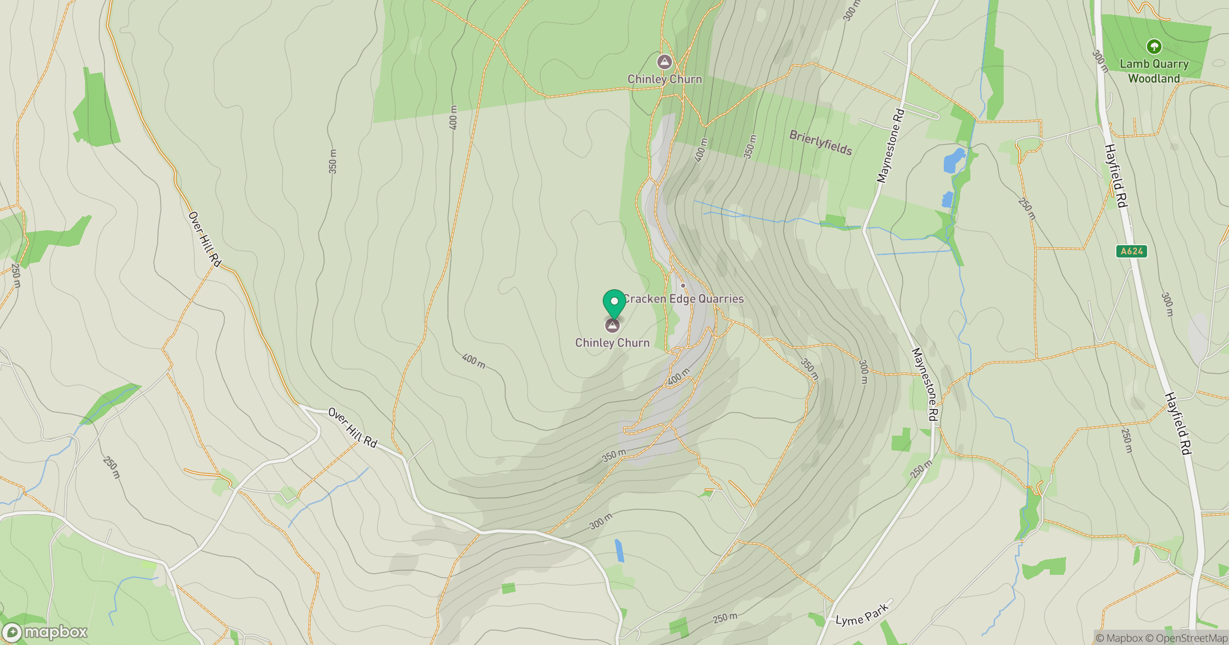
Grid reference: SK035836
View on OpenStreetMapOpens a map in a new tab, centred on the hill.
Nearby Hills

Kinder Scout
636m
The Roaches
505m
Rombalds Moor [Ilkley Moor]
402m

Pendle Hill
557m
Winter Hill
456m
No comments yet. Be the first.