
Carn Mor
Good walks are even better shared.
Overview
Discovering Carn Mor
Overview
Nestled in the heart of the Scottish Highlands, Carn Mor stands proud as a Munro, reaching a height of 1033 meters. As its name suggests, 'Big Cairn,' the summit offers not just altitude but also a sense of grandeur and history.
Geology
The mountain’s geology features a mix of schist and granite that tells a tale as old as time, shaped by the fierce hands of glacial movement. You'll feel the ruggedness underfoot—a reminder that this land has withstood the test of time.
Routes
One of the most popular routes is the Glen Shiel Route, covering approximately 10 km. Expect stunning scenery on the way up, making it a moderate undertaking for hikers wanting to enjoy both challenge and beauty.
Summit Features
Upon reaching the summit, take a moment to admire the sizeable cairn that stands as a tribute to the many hikers who have made the trek. It’s a stellar spot to catch your breath and snap some photos—just be sure to secure your hat!
Terrain
The terrain is a delightful mix of rocky paths and grassy slopes. Patches of vibrant heather add a splash of colour, especially in late summer. However, tread carefully; nature sometimes likes to keep us on our toes!
Views
Expect breathtaking views stretching out to the Cuillin Ridge and Loch Duich, especially when the sun sets; the landscape glows in hues of orange and purple—as picturesque as a postcard.
Hazards
While the walk is rewarding, please remain cautious of the uneven paths and ever-changing weather. Packing appropriate gear is a wise strategy. Safety first, fun second!
Access
To reach Carn Mor, you'll find convenient parking at the start of Glen Shiel, with a short jaunt from the A87. Dornie, your nearest town, is a charming spot to refuel before your adventure.
Facilities
Although facilities are sparse near the mountain, Dornie hosts a few charming shops and cafes where you can grab a bite or use the restroom. Always nice to have a fun snack post-hike!
History
The name 'Carn Mor' resonates with local significance, a marker in a landscape steeped in stories and lore. Many a tale has been spun about this mountain, its elevation a sought-out subject for those mapping their Scottish adventures.
Enjoy your trek up Carn Mor, where every step is a piece of history!
Explore routes near Carn Mor
Walks starting near this hill. Open a route to check its map, distance and full itinerary.
Unled club outing: West Drumochter/Beinn Udlamain (coach departure)
View route
Unled club outing: Glenesk (coach departure)
View route
Unled club outing: Xmas Walk - Bankfoot - Dunkeld (coach departure)
View route
Unled club outing: Angus coastal walk (coach departure)
View route
Route planning notes
These notes describe possible approaches. Check a route's map and access information when planning your walk.
The Glen Shiel Route
A moderate trek that takes you through a beautiful glen before the ascent to the summit. Ideal for those keen on enjoying the scenery and a good leg stretch!
Make a day of it, together
Find someone to share the walk with, or organise a day out along a route you like.
Hill facts and local notes
Classifications
Elevation
874m
2,868 ft
Prominence
47m
Coordinates
56.8583, -3.4610
NO110750
OS Map
43
Explorer: OL52N 387N
At the Summit
At the summit, hikers will find a sizable cairn and a rocky outcrop with expansive views, making it a perfect spot for that all-important selfie (just watch for the wind!).
Terrain & Geology
Carn Mor is primarily composed of ancient schist and granite, offering a rugged landscape that showcases the geological history of the area, shaped by glaciation and erosion over millennia.
Views & Scenery
From the summit, you can see the majestic peaks of the Cuillin Ridge and the tranquil Loch Duich, particularly stunning during sunset.
History & Heritage
Name Origin
Carn Mor translates to 'Big Cairn' in Scots Gaelic, which fittingly describes its prominent stature in the landscape.
Historical Significance
Historically, Carn Mor has served as a prominent landmark for navigation and is steeped in local folklore.
Getting There & Facilities
Parking
There is a dedicated parking area at the start of the Glen Shiel, just off the main road A87.
Public Transport
Local bus services run from nearby towns, but it's advisable to check current timetables as they can be a bit sparse in rural areas.
Nearby Facilities
While there are no facilities directly at the foot of Carn Mor, Dornie has small shops and cafes for refreshments.
Safety Information
Known Hazards
- Uneven terrain, sudden weather changes, and potential for loose rocks; proper footwear and preparation are essential.
General Safety Tips
- Check weather conditions before setting out
- Carry appropriate clothing and equipment
- Let someone know your planned route
- Take a map, compass, and GPS device
- Carry emergency supplies: food, water, first aid kit, torch
Hills
Some common questions about the hills answered
Are there group walks up Carn Mor?
Many walkers use Walkmates to join or organise walks with others. You can check for group walks around Carn Mor through the maps
Are there other walkers around Carn Mor?
Activity varies by location and time, but Walkmates lets you see whether others have shared walks or shown interest in this area. Find other people through the walking friends search walking friends for Carn Mor search or of course create your own walk for Carn Mor
Can I organise a walk to Carn Mor?
Yes. If there aren’t any walks listed already, you can create a walk and make it available for others to join.
If you're signed up to Walkmates, you can create a walk to Carn Mor.
How do I find a walk up this hill?
There are often multiple ways to walk this hill, depending on experience and route preference. Walkmates helps you explore walks and routes that others have shared.
Can I suggest a new route up Carn Mor?
Yes. You can suggest or create routes to share with others. Walkmates focuses on the social side of walking, so routes are used to help people organise walks and explore areas together, rather than as detailed navigation tools or route libraries.
Other uses really appreciate knowledgeable walkers sharing their routes. Share your favourite route to Carn Mor here
The is an error or something incorrect about this hill. How do I let you know?
We always strive to keep the information on Walkmates as accurate as possible. If you find an error, please let us know through the contact form and we'll aim to correct it as quickly as possible
Community Discussion
Comments
Location
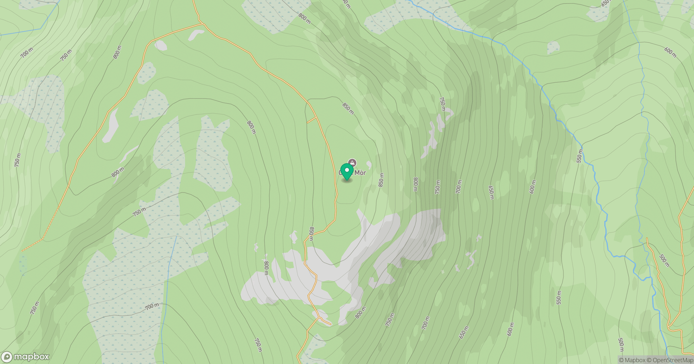
Grid reference: NO110750
View on OpenStreetMapOpens a map in a new tab, centred on the hill.
No comments yet. Be the first.