

Carn Etchachan
Good walks are even better shared.
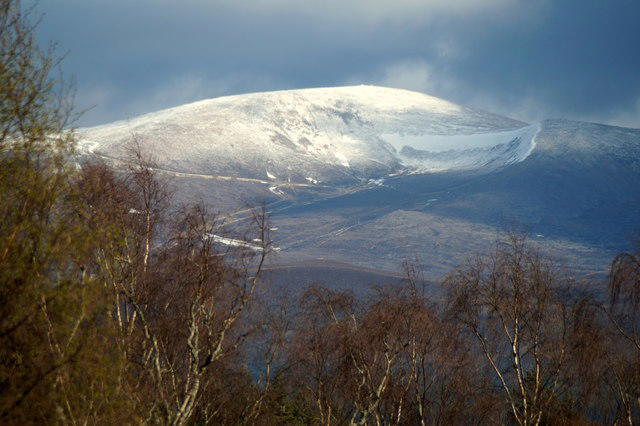
NJ0000 : Carn Etchachan
Alan Hodgson Photo source
Overview
Carn Etchachan
Nestled in the heart of the Cairngorms, Carn Etchachan stands proudly as one of Scotland's Munros, reaching an elevation of 1010 meters. Its rugged granite structure offers not only a delightful challenge for adventurers but also sweeping views that make the effort worthwhile.
Geology
Carn Etchachan’s landscape is primarily shaped by glacial activity, featuring neither soft hills nor timid rocks. It’s all granite here—think ancient, tough, and surprisingly complex. Keep an eye out for fascinating geological formations and remember, while granite may be great for rock climbing, it’s less forgiving if you trip!
Routes
There are various well-trodden routes to conquer this beast. The Western Approach from Loch Etchachan is a challenging 14 km trek that can take about 5.5 hours, suitable for seasoned hikers. For those seeking a more moderate experience, the Eastern Route from Braemar, approximately 11 km and taking roughly 4 hours, provides a gentler ascent with equally stunning views.
Summit Features
Upon reaching the summit, you’ll find a majestic cairn shining in the sunlight—or sometimes snow, depending on when you visit. Either way, it’s the perfect spot for a well-earned break and to survey the unending beauty of Scotland’s Highlands.
Terrain Type
The terrain can be classified as rocky, with patches of grass here and there trying their very best to hold on as you climb. Be prepared for stray boulders that may make it seem like your path was styled by a particularly mischievous giant.
Views
From the top, you can admire the formidable sight of Ben Macdui and its charmingly named siblings. Make sure to plan your visit in late spring or autumn for the best spectacle; you’ll appreciate the landscape even more when it’s dressed in vibrant colours. Just don't forget to bring your camera!
Hazards
Be cautious of rockfall risks—after all, no one wants a surprise boulder dropping at the foot! And as charming as unexpected weather can be in stories of adventure, it’s not quite as fun when you’re up a mountain. Prepare for all sorts of scottish shenanigans weather-wise.
Access
The nearest access points are at the Linn of Dee car park, which can become bustling during summer months. If you prefer the bus, Braemar provides bus services from nearby towns. Don’t forget your snacks; Braemar’s options may lead you to have a gourmet picnic instead of a hasty meal!
Facilities
While limited, Braemar offers a few cafes to soothe those post-climb appetites. Make a stop for a warming bowl of soup or a scone—who could resist?
History
In terms of history, 'Carn Etchachan' means 'the pile of stones of the old men', adding a sprinkle of ancient reverence to your hike. The mountain is a proud member of the Cairngorms National Park and forms an essential part of Scotland's cultural tapestry.
When you’re ready to tackle Carn Etchachan, remember that every mountain has a story, and every hike brings a mix of sweat, splendour, and perhaps a little smack of the unexpected. Happy hiking!
Explore routes near Carn Etchachan
Walks starting near this hill. Open a route to check its map, distance and full itinerary.
Rothiemurchus: Beaver Trail and Lochan Mor
View route
Aviemore: Loch an Eilein and the Croft Track from Rothiemurchus
View route
Cairngorms night walk and stargazing (event meeting)
View route
Cairngorms night walk and stargazing (event meeting)
View route
Route planning notes
These notes describe possible approaches. Check a route's map and access information when planning your walk.
Western Approach from Loch Etchachan
A scenic but challenging ascent leading from Loch Etchachan up to the summit, suitable for seasoned hikers.
Eastern Route from Braemar
A more straightforward route ideal for those wanting a moderate day out with stunning views along the way.
Make a day of it, together
Find someone to share the walk with, or organise a day out along a route you like.
Photo Gallery
View all Photo could not load
NJ0000 : Carn Etchachan
Alan Hodgson
Hill facts and local notes
Classifications
Elevation
1,120m
3,675 ft
Prominence
26m
Coordinates
57.0883, -3.6466
NJ003009
OS Map
36
Explorer: OL57S 403S
At the Summit
The summit of Carn Etchachan is marked by a prominent cairn, standing as a testament to the countless adventurers who have stood atop this magnificent peak. The view is largely unimpeded, offering a stunning panorama of the surrounding Cairngorms.
Terrain & Geology
Carn Etchachan is primarily composed of granite, characterized by its rugged terrain and characteristic glacial features formed during the last Ice Age. You’ll encounter scattered boulders and smooth rock faces that are remnants of ancient glacial activity.
Views & Scenery
From the summit, hikers can enjoy views of Ben Macdui, the highest peak in the Cairngorms, as well as the expansive landscapes of the Scottish Highlands, including several lochs and glens.
History & Heritage
Name Origin
The name 'Carn Etchachan' translates to 'the pile of stones of the old men', likely referencing ancient burial practices or local lore.
Historical Significance
The mountain has historical significance within Scottish culture and is part of the Cairngorms National Park, an area renowned for its natural beauty and wildlife.
Getting There & Facilities
Parking
The closest parking is available at the Linn of Dee car park, approximately 10 km from Braemar. The car park can be busy during peak seasons, so arrive early if possible.
Public Transport
The nearest public transport options are from Braemar, which is accessible via bus services from Aberdeen or Ballater. Check local timetables for current routes.
Nearby Facilities
Braemar offers basic amenities, including cafes, shops, and public toilets. Be mindful that options may be limited; it’s wise to carry sufficient provisions.
Safety Information
Known Hazards
- Rockfall hazards in certain areas, especially during wet conditions. Always mind your footing.
- Rapid weather changes are common in the Cairngorms; it's essential to be prepared for all conditions, including rain, snow, and strong winds.
General Safety Tips
- Check weather conditions before setting out
- Carry appropriate clothing and equipment
- Let someone know your planned route
- Take a map, compass, and GPS device
- Carry emergency supplies: food, water, first aid kit, torch
Hills
Some common questions about the hills answered
Are there group walks up Carn Etchachan?
Many walkers use Walkmates to join or organise walks with others. You can check for group walks around Carn Etchachan through the maps
Are there other walkers around Carn Etchachan?
Activity varies by location and time, but Walkmates lets you see whether others have shared walks or shown interest in this area. Find other people through the walking friends search walking friends for Carn Etchachan search or of course create your own walk for Carn Etchachan
Can I organise a walk to Carn Etchachan?
Yes. If there aren’t any walks listed already, you can create a walk and make it available for others to join.
If you're signed up to Walkmates, you can create a walk to Carn Etchachan.
How do I find a walk up this hill?
There are often multiple ways to walk this hill, depending on experience and route preference. Walkmates helps you explore walks and routes that others have shared.
Can I suggest a new route up Carn Etchachan?
Yes. You can suggest or create routes to share with others. Walkmates focuses on the social side of walking, so routes are used to help people organise walks and explore areas together, rather than as detailed navigation tools or route libraries.
Other uses really appreciate knowledgeable walkers sharing their routes. Share your favourite route to Carn Etchachan here
The is an error or something incorrect about this hill. How do I let you know?
We always strive to keep the information on Walkmates as accurate as possible. If you find an error, please let us know through the contact form and we'll aim to correct it as quickly as possible
Community Discussion
Comments
Location
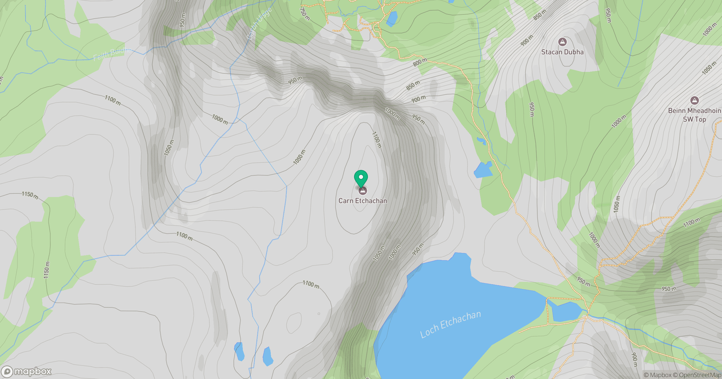
Grid reference: NJ003009
View on OpenStreetMapOpens a map in a new tab, centred on the hill.
No comments yet. Be the first.