

Brock Crags
Good walks are even better shared.
NY4213 : Old gateway near Brock Crags
Michael Graham Photo source
Overview
Brock Crags: A Hidden Gem in the Lake District
Nestled in the enchanting landscape of the Lake District, Brock Crags might not be the highest peak, but it sure packs a punch with its breathtaking views and charming character. At 600 meters, this Marylin offers a moderate challenge for hikers of varying skill levels, making it an ideal excursion for families and seasoned walkers alike.
Geology
Brock Crags is formed predominantly of volcanic rock that hails from the Pleistocene epoch. This interesting geology not only contributes to the rugged aesthetics of the mountain but also gives insight into the area’s ancient volcanic activity. Watch your step, as the rocky outcrops and crags create an ever-changing terrain.
Routes
The most popular route is the Brock Crags Circular Walk, starting from Brothers Water. This route stretches about 8 km and takes approximately 3.5 hours to complete. It contains gentle ascents that allow plenty of time to enjoy the stunning scenery—a fashionably leisurely pace is encouraged!
Summit Features
Upon reaching the summit, hikers are greeted by a small yet venerable stone cairn. It's a perfect stop for a brief respite or to whip out that sandwich you packed (let's face it, the best part of hiking is the snacks!). The vistas from Brock Crags are simply marvellous—with a view of Ullswater Lake sprawled below and the impressive peaks of Helvellyn and Fairfield dominating the skyline.
Terrain
The terrain is an exciting mix of rocky paths, grassy slopes, and boggy areas that may surprise unwary boots. Don’t be fooled by a sunny morning—rain can turn a hiking path into a mini-lake quicker than you can say 'Gators!'
Views
The views from the summit are most breathtaking in autumn and spring, where nature provides a vibrant tapestry of colours. Grab your camera; Instagram awaits!
Hazards
As with all hikes in the Lake District, be prepared for the unpredictable nature of the weather. Steep sections can be slippery in wet conditions, so proceed with caution.
Nearby Summits
If you’re keen to extend your walking adventure, consider summiting Hartsop Dodd and St. Sunday Crag, both offering their own stunning views and wonders.
Access
Parking is available at the Brothers Water car park; just be sure to arrive early on sunny weekends—the early bird catches the worm! The nearest bus service runs from Windermere, dropping you conveniently at Brothers Water—hiking couldn’t be easier.
Facilities
While there are no facilities directly on the mountain, the bustling village of Patterdale offers a quaint café and toilets, perfect for that post-hike recovery.
History
Brock Crags, derived from Old Norse meaning 'badger's crags', tells tales of its geological and cultural history in the Lake District. A hike here isn’t just about reaching the summit; it’s about connecting with Britain’s stunning natural heritage.
In conclusion, whether you visit for the stunning landscapes or the peaceful solitude, Brock Crags promises a memorable day in the heart of the Lake District. Pack your water, lace up your boots, and enjoy the great outdoors—nature is calling!
Explore routes near Brock Crags
Walks starting near this hill. Open a route to check its map, distance and full itinerary.
Striding Edge, Helvellyn and Catstye Cam
View route
Helvellyn via Striding Edge
View route
Bow Fell from Langdale
View route
Tarn Hows Fast Route
View route
Route planning notes
These notes describe possible approaches. Check a route's map and access information when planning your walk.
Brock Crags Circular Walk
A scenic circular route starting from Brothers Water, offering splendid views and gentle ascents.
Make a day of it, together
Find someone to share the walk with, or organise a day out along a route you like.
Photo Gallery
View all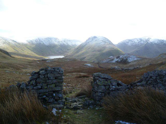 Photo could not load
NY4213 : Old gateway near Brock Crags
Michael Graham
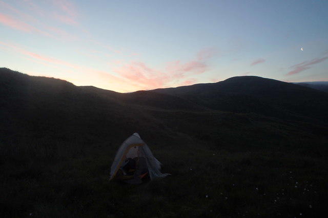 Photo could not load
NY4113 : Sunrise from the Tent
Michael Graham
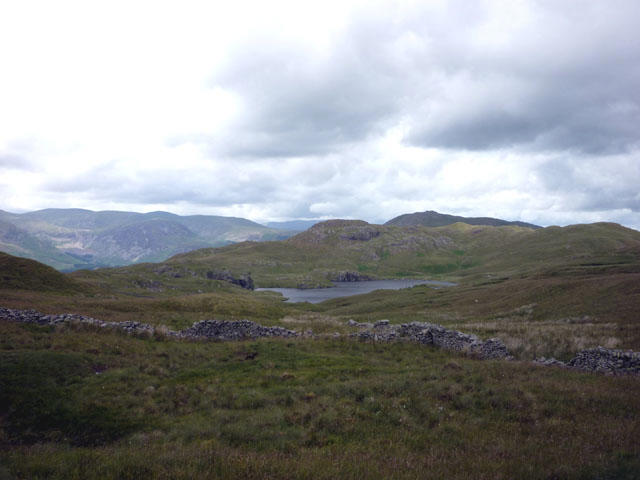 Photo could not load
NY4213 : Wall, Brock Crags
Karl and Ali
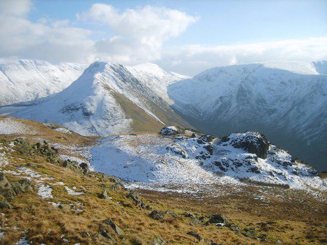 Photo could not load
NY4113 : From Brock Crags
Michael Graham
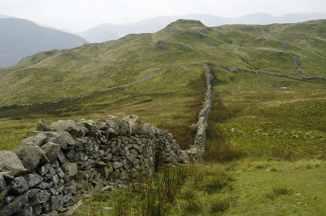 Photo could not load
NY4213 : Wall and Brock Crags
Tom Richardson
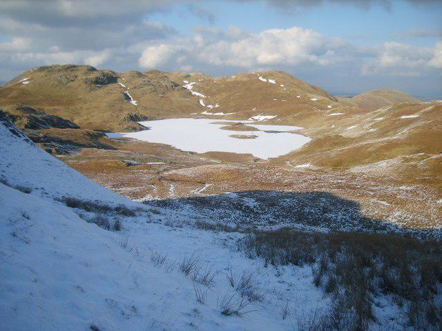 Photo could not load
NY4113 : Descending Brock Crags
Michael Graham
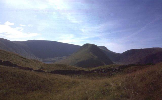 Photo could not load
NY4213 : View towards Grey Crag
Richard Webb
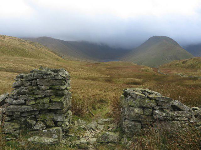 Photo could not load
NY4213 : Gap in the wall
Graham Robson
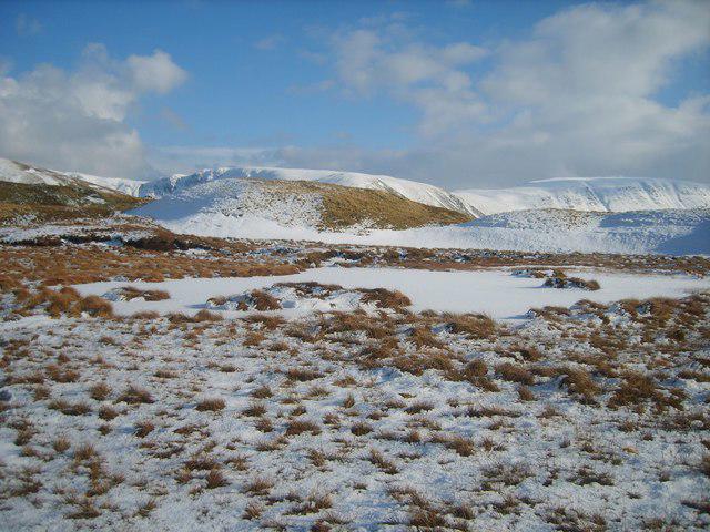 Photo could not load
NY4113 : On Brock Crags
Michael Graham
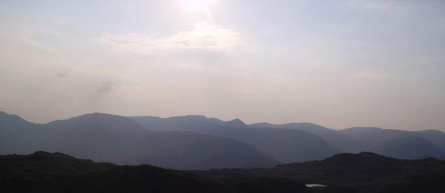
NY4213 : Eastern Fells
Michael Graham
Hill facts and local notes
Classifications
Elevation
564m
1,851 ft
Prominence
28m
Coordinates
54.5153, -2.8989
NY419137
OS Map
90
Explorer: OL5S
At the Summit
The summit features a small stone cairn and offers panoramic views of the surrounding peaks and valleys. It’s the perfect spot for a group selfie—or a solitude break; your choice!
Terrain & Geology
Brock Crags is primarily composed of volcanic rock, dating back to the Pleistocene epoch, offering insight into the area's geological past. The summit showcases some fascinating crag formations that give the mountain its rugged charm.
Views & Scenery
From the summit, you'll catch a glimpse of the stunning Ullswater Lake, the peaks of Helvellyn, and the majestic Fairfield.
History & Heritage
Name Origin
The name 'Brock Crags' is thought to derive from the Old Norse 'Brokkr,' meaning badger, combined with 'crags' referring to the rocky outcrops.
Historical Significance
The mountain holds cultural significance for local hikers and outdoor enthusiasts who treasure the Lake District’s formidable landscape.
Getting There & Facilities
Parking
There is a small car park at Brothers Water, which serves as the perfect base for your adventure. Be sure to arrive early, as it fills up fast on sunny weekends.
Public Transport
The nearest bus service operates from Windermere. You can hop on the bus and ask the driver to drop you off at the Brothers Water stop.
Nearby Facilities
There are no amenities directly on the mountain, but Patterdale offers a charming café and public toilets.
Safety Information
Known Hazards
- Slippery rocks, particularly in wet conditions; be mindful of sudden weather changes typical of the Lake District.
General Safety Tips
- Check weather conditions before setting out
- Carry appropriate clothing and equipment
- Let someone know your planned route
- Take a map, compass, and GPS device
- Carry emergency supplies: food, water, first aid kit, torch
Hills
Some common questions about the hills answered
Are there group walks up Brock Crags?
Many walkers use Walkmates to join or organise walks with others. You can check for group walks around Brock Crags through the maps
Are there other walkers around Brock Crags?
Activity varies by location and time, but Walkmates lets you see whether others have shared walks or shown interest in this area. Find other people through the walking friends search walking friends for Brock Crags search or of course create your own walk for Brock Crags
Can I organise a walk to Brock Crags?
Yes. If there aren’t any walks listed already, you can create a walk and make it available for others to join.
If you're signed up to Walkmates, you can create a walk to Brock Crags.
How do I find a walk up this hill?
There are often multiple ways to walk this hill, depending on experience and route preference. Walkmates helps you explore walks and routes that others have shared.
Can I suggest a new route up Brock Crags?
Yes. You can suggest or create routes to share with others. Walkmates focuses on the social side of walking, so routes are used to help people organise walks and explore areas together, rather than as detailed navigation tools or route libraries.
Other uses really appreciate knowledgeable walkers sharing their routes. Share your favourite route to Brock Crags here
The is an error or something incorrect about this hill. How do I let you know?
We always strive to keep the information on Walkmates as accurate as possible. If you find an error, please let us know through the contact form and we'll aim to correct it as quickly as possible
Community Discussion
Comments
Location
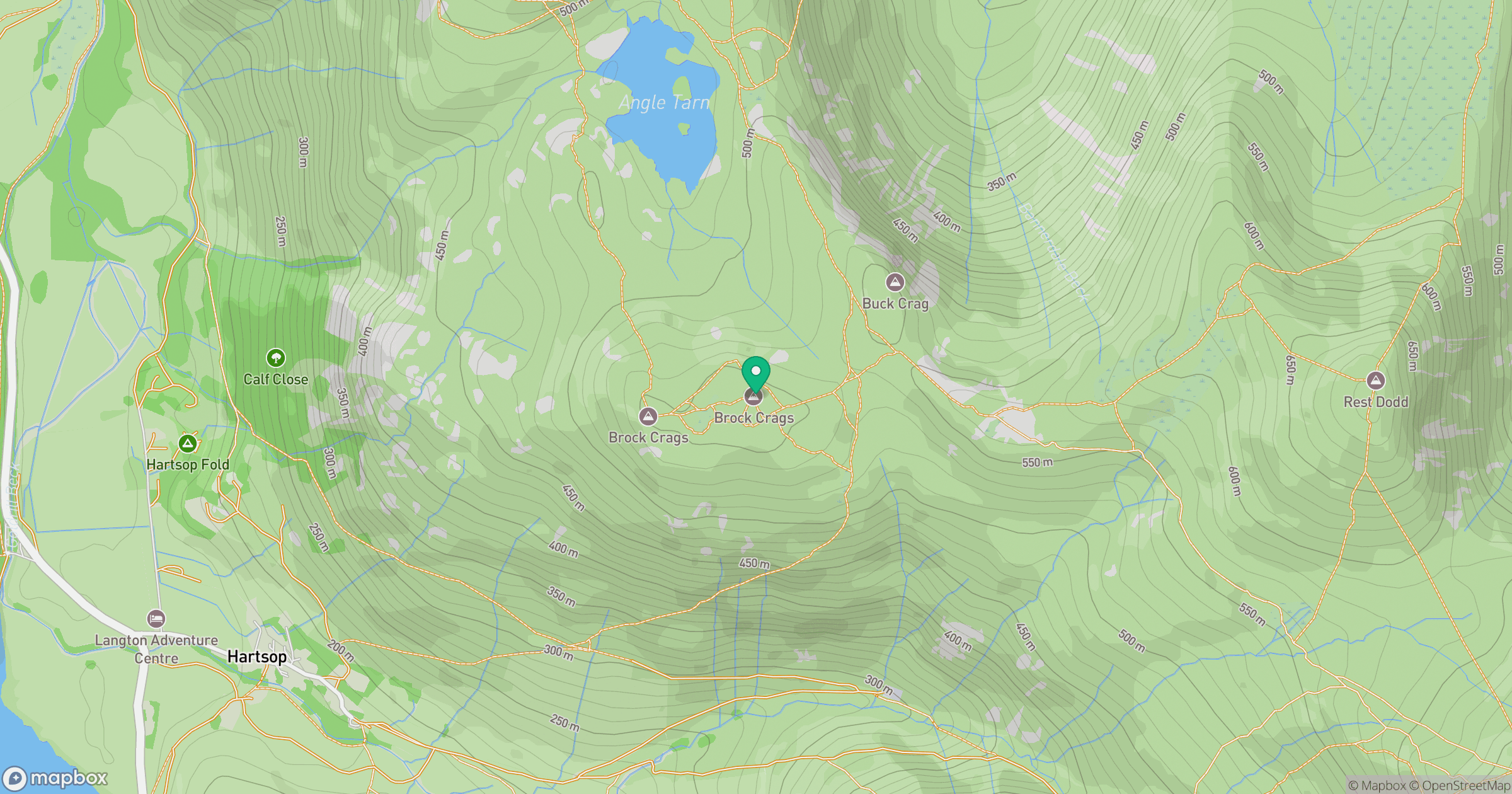
Grid reference: NY419137
View on OpenStreetMapOpens a map in a new tab, centred on the hill.

No comments yet. Be the first.