

Broad Heath
Good walks are even better shared.
Overview
Broad Heath: A Hidden Gem of the Shropshire Hills
Nestled within the picturesque Shropshire Hills, Broad Heath stands proudly at 151 meters, offering adventurers a delightful blend of natural beauty and moderate challenge. Whether you’re a seasoned hiker or just looking for a pleasant walk with fantastic views, Broad Heath won’t disappoint.
Geology
The geology of Broad Heath is primarily sandstone, resulting in a landscape that has been gently sculpted by both glacial action and the passing of rivers over millennia. This has created gentle slopes adorned with a tapestry of wildflowers and diverse fauna. It's truly a sight for sore eyes, especially after an ambitious breakfast!
Routes
One of the most popular routes is the Shropshire Hill Circuit. This 9.5-kilometre loop allows you to fully immerse yourself in the stunning scenery while enjoying an approximate hiking time of 3.5 hours. Expect moderate difficulty—perfect for a fun day out without needing a Sherpa!
Summit Features
At the summit, you'll be greeted by a quaint cairn. Come prepared to snap a few selfies, but try not to pose too dramatically; it’s not a Bollywood film set up here!
Terrain Type
Expect a mix of grassy meadows and rocky patches. Be sure to wear proper hiking boots to navigate these charming yet occasionally uneven trails and enjoy the breath of fresh air.
Views
From the top, the panoramic views are nothing short of breathtaking. To the north, the long undulating lines of the Long Mynd and the jagged peaks of the Stiperstones beckon for exploration. On exceptionally clear days, you might even spot the distant Welsh mountains—just think of it as nature’s own peek-a-boo.
The best seasons to visit are late spring and early autumn, when the landscape bursts with colour and the weather behaves itself—mostly!
Hazards
While hiking Broad Heath is generally safe, be aware of potentially undulating terrain and, of course, the unpredictable British weather that can shift faster than you can say "I forgot my raincoat!"
Nearby Summits
For those looking to extend their adventure, nearby summits such as Caer Caradoc (455 m) and The Lawley (474 m) cater to your mountain-loving spirit.
Access
Accessing Broad Heath is a breeze. The nearest parking is available at the Longmynd car park, just a stone's throw away from the footpaths leading to the summit. If you're relying on public transport, buses from Shrewsbury frequently make the short trip to Church Stretton, making it hassle-free for all hikers!
Facilities
After your hike, make a pit stop in Church Stretton for a well-deserved coffee or slice of cake (or both). You’ll find a delightful selection of cafes, pubs, and, yes, public toilets to help you freshen up after your day of adventure.
History
Etymologically, 'Broad Heath' comes from Old English, marrying the concepts of high ground with open land. Historically, this region once served as a vital crossroad for ancient trade routes and hosts archaeological sites of prehistoric significance—heck, even the ancients knew this place was worth a trek!
In conclusion, whether you’re seeking solitude or a chance to connect with nature, Broad Heath is a well-kept secret just waiting to be discovered. Lace up those hiking boots, grab your walking stick, and head out for a day filled with exploration and maybe a bit of cheeky fun!
Be safe, enjoy, and maybe, just maybe, plan to come back for round two.
Explore routes near Broad Heath
Public walks starting within 80 km of this hill. Nearby does not mean a route reaches the summit; check its map and access before setting out.
Brockhampton: damson orchards and Apple Core trail
View route
Cleobury Mortimer with Men Walking & Talking
View route
Berrington Hall: woodland, lake and Windmill Hill
View route
Stourport Walk with Men Walking & Talking
View route
Route planning notes
These notes describe possible approaches, not verified navigable routes or permission to cross land. Check current paths, local access rules and conditions before setting out.
The Shropshire Hill Circuit
A delightful loop showcasing Broad Heath and its neighbouring peaks, perfect for a full day's adventure.
Make a day of it, together
Find someone to share the walk with, or organise a day out along a route you like.
Photo Gallery
View all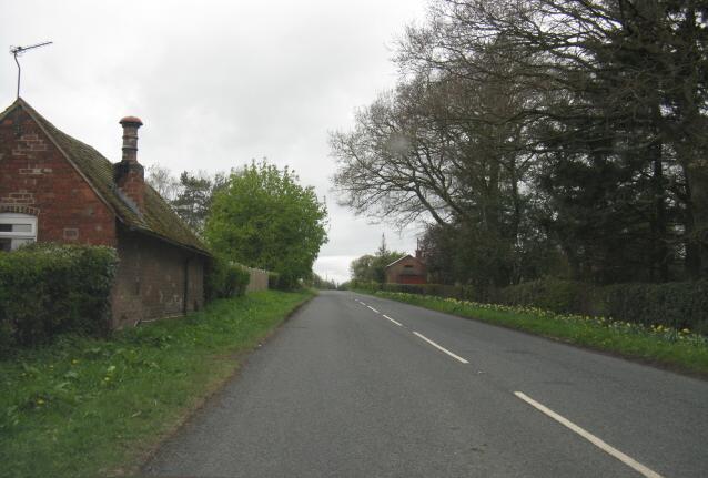 Photo could not load
SO6665 : B4204 at High House
Peter Whatley
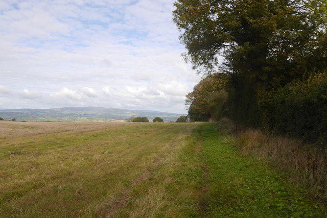 Photo could not load
SO6665 : Path, Broad Heath
Richard Webb
Hill facts and local notes
Classifications
Elevation
246m
806 ft
Prominence
104m
Coordinates
52.2869, -2.4936
SO664655
OS Map
138 149
Explorer: 203
At the Summit
The summit is marked by a modest cairn, where you can rest your weary legs and perhaps ponder if you left the oven on.
Terrain & Geology
Primarily composed of sandstone, Broad Heath presents a landscape shaped by glacial and fluvial processes, resulting in gentle slopes and rich biodiversity.
Views & Scenery
From the summit, behold the sweeping landscapes of the Shropshire Hills, with the Long Mynd and Stiperstones in the distance, and on a clear day, even a glimpse of the Welsh Mountains.
History & Heritage
Name Origin
The name 'Broad Heath' derives from the Old English 'heah', meaning high or hill, combined with 'heath', referring to open land.
Historical Significance
The area has historical significance as it was once a crossroad for ancient trade routes and boasts prehistoric archaeological sites.
Getting There & Facilities
Check current local access restrictions, parking rules and transport timetables before travelling. These notes do not confirm public access to the summit.
Parking
There is ample parking available at the Longmynd car park, which is just a short walk away from the starting paths to Broad Heath.
Public Transport
Regular bus services run from Shrewsbury to Church Stretton, the nearest urban centre.
Nearby Facilities
Shropshire’s gateway to adventure, Church Stretton offers a variety of cafes, pubs, and even a public loo for your convenience.
Safety Information
Known Hazards
- While generally safe, be cautious of uneven ground and sudden weather changes typical of the region.
General Safety Tips
- Check weather conditions before setting out
- Carry appropriate clothing and equipment
- Let someone know your planned route
- Take a map, compass, and GPS device
- Carry emergency supplies: food, water, first aid kit, torch
Hills
Some common questions about the hills answered
Are there group walks up Broad Heath?
Many walkers use Walkmates to join or organise walks with others. You can check for group walks around Broad Heath through the maps
Are there other walkers around Broad Heath?
Activity varies by location and time, but Walkmates lets you see whether others have shared walks or shown interest in this area. Find other people through the walking friends search walking friends for Broad Heath search or of course create your own walk for Broad Heath
Can I organise a walk to Broad Heath?
Yes. If there aren’t any walks listed already, you can create a walk and make it available for others to join.
If you're signed up to Walkmates, you can create a walk to Broad Heath.
How do I find a walk up this hill?
There are often multiple ways to walk this hill, depending on experience and route preference. Walkmates helps you explore walks and routes that others have shared.
Can I suggest a new route up Broad Heath?
Yes. You can suggest or create routes to share with others. Walkmates focuses on the social side of walking, so routes are used to help people organise walks and explore areas together, rather than as detailed navigation tools or route libraries.
Other uses really appreciate knowledgeable walkers sharing their routes. Share your favourite route to Broad Heath here
The is an error or something incorrect about this hill. How do I let you know?
We always strive to keep the information on Walkmates as accurate as possible. If you find an error, please let us know through the contact form and we'll aim to correct it as quickly as possible
Community Discussion
Comments
Location
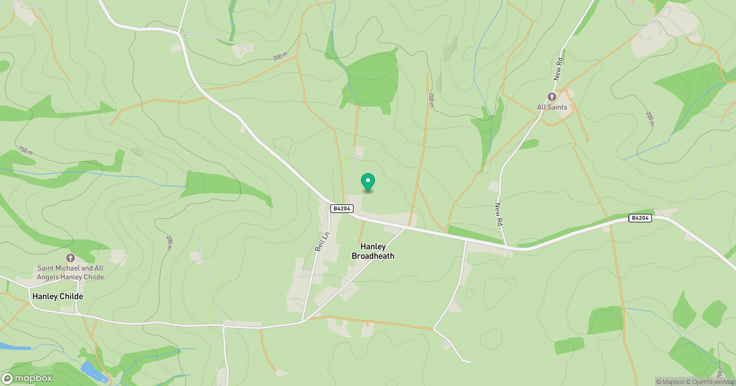
Grid reference: SO664655
View on OpenStreetMapOpens a map in a new tab, centred on the hill.
Hills within 30 km
Straight-line distance, not a walking route or confirmation of access.
Titterstone Clee Hill
533m
Worcestershire Beacon
425m
Abberley Hill
283m
Hegdon Hill
255m
Brown Clee Hill
540m
No comments yet. Be the first.