

Broad Crag
Good walks are even better shared.
Overview
Broad Crag
Location: Lake District, UK
Broad Crag, standing at 804 meters, may not be the tallest of its neighbours in the Lake District, but what it lacks in elevation, it more than makes up for with stunning views and a sense of adventure. The mountain is nestled amidst the scenic Southern Fells and offers hikers a delightful challenge with an opportunity to connect with one of the most beautiful landscapes in England.
Geology
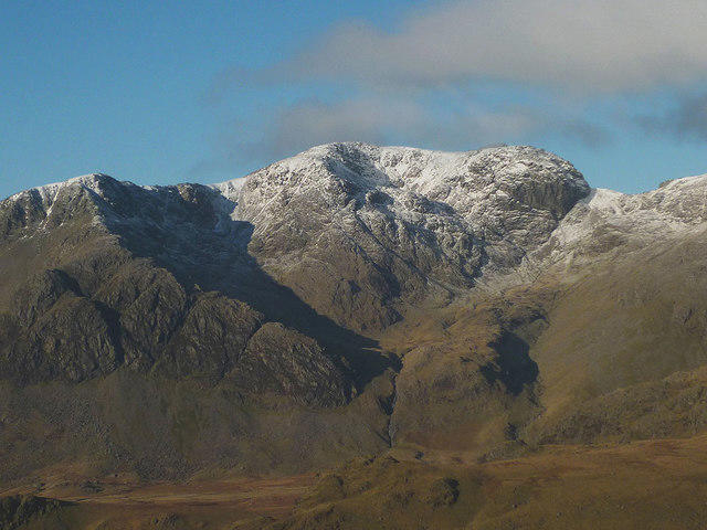
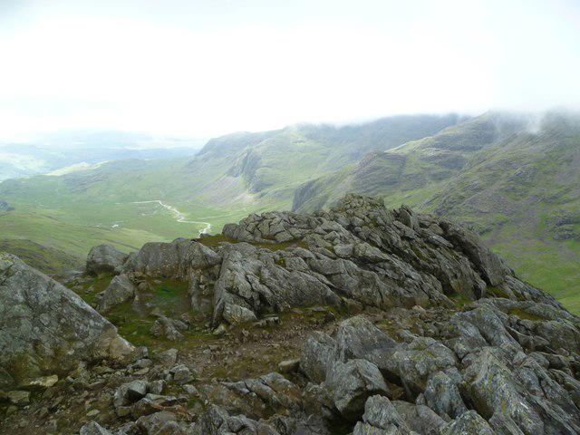
Broad Crag's geology is characterised by volcanic rock, remnants of ancient geological activity. Upon approach, you will notice the rugged terrain that tells the tale of Mother Nature's artistic flair in carving out these dramatic features over centuries.
Routes
Corridor Route from Scafell Pike
- Distance: 10 km
- Time: Approximately 4 hours
- Difficulty: Moderate
An accessible route connecting Broad Crag to Scafell Pike provides not just a workout but also panoramic views of the surrounding area—perfect for those who enjoy the great outdoors with views to match.
Mosedale from Wasdale Head
- Distance: 8 km
- Time: About 3.5 hours
- Difficulty: Challenging
This route is a bit of a hidden gem; it takes you through the enchanting valleys of Mosedale and offers a less trodden path to the summit.
Summit Features
Upon reaching the summit, you'll be greeted by a humble cairn, perfect for placing your rucksack while you take a breather and soak in the surrounding beauty.
Views
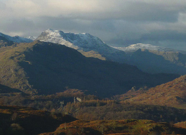
The views from Broad Crag are nothing short of spectacular. On a clear day, the dramatic peaks of Scafell Pike rise majestically to the east, while the shimmering waters of Wast Water stretch out below. To the west, catch a glimpse of the Irish Sea, especially during a bright spring afternoon.
Hazards
Though generally safe for hikers with good footwear and care, be cautious of loose rocks when navigating the slopes. And remember, the weather here can be as changeable as a cat on a hot tin roof, so always check conditions before adventuring out.
Access
Nearest Parking: The Wasdale Head National Trust car park provides a suitable starting point for your journey with a modest fee—ideal for grabbing a quick cuppa before you embark!
Public Transport: Services are sparse, so it's best to check for updates to bus routes leading nearby.
Nearest Town: The charming village of Wasdale Head is your best bet for amenities and a starting point for your hikes.
Facilities
At Wasdale, you’ll find a café serving tasty snacks and drinks. Facilities are simple but sufficient for a quick pit stop.
History
The name ‘Broad Crag’ reflects its broad summit profile, standing proud among the jagged peaks. With a rich history linked to the great hiking tradition of the Lake District, Broad Crag continues to attract outdoor seekers year after year.
In summary, Broad Crag is an exhilarating destination for hikers of various skill levels, offering views, camaraderie, and a taste of the wild. Prepare yourself for an adventure that’s both challenging and rewarding, and who knows? You might just fall in love with the Lake District’s beauty along the way.
Explore routes near Broad Crag
Walks starting near this hill. Open a route to check its map, distance and full itinerary.
Scafell Pike via Brown Tongue and Hollow Stones
View route
Scafell Pike from Seathwaite via the Corridor Route
View route
Bow Fell from Langdale
View route
Great Carrs Halifax Wreckage from Wrynose Pass
View route
Route planning notes
These notes describe possible approaches. Check a route's map and access information when planning your walk.
Corridor Route from Scafell Pike
A popular approach trail linking Broad Crag with the ascent to Scafell Pike, offering stunning views and a bit of a leg stretch.
Mosedale from Wasdale Head
Starting from Wasdale Head, this route takes you through picturesque valleys and up to Broad Crag with less traffic than the Corridor Route.
Make a day of it, together
Find someone to share the walk with, or organise a day out along a route you like.
Photo Gallery
View all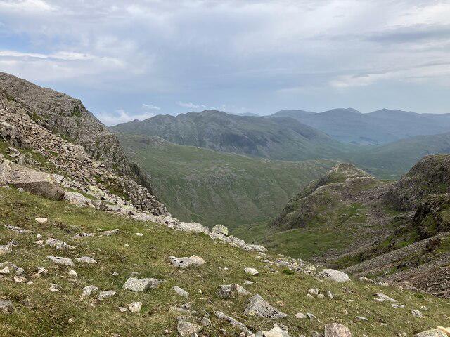 Photo could not load
NY2107 : Broad Crag Col
Anthony Foster
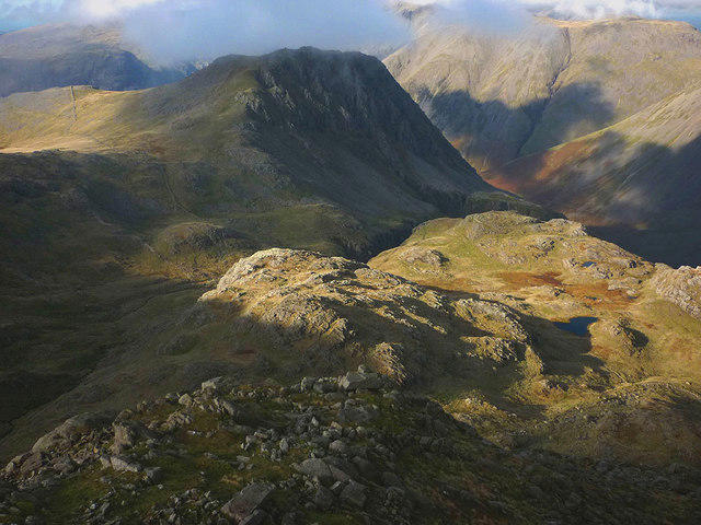 Photo could not load
NY2107 : The north west shoulder of Broad Crag
Karl and Ali
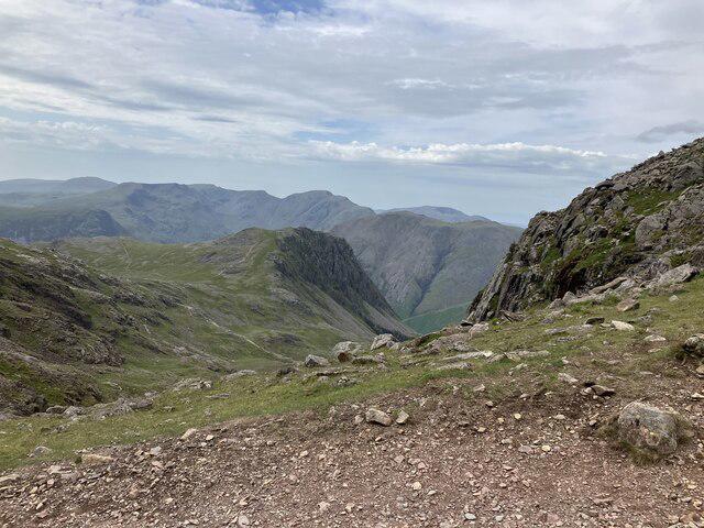 Photo could not load
NY2107 : Broad Crag Col
Anthony Foster
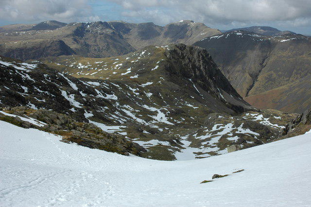 Photo could not load
NY2107 : Lingmell viewed from Broad Col
Philip Halling
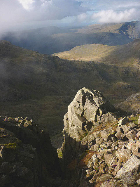 Photo could not load
NY2107 : Gully on Broad Crag
Karl and Ali
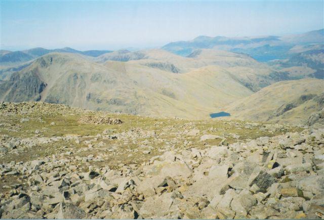 Photo could not load
NY2107 : Scafell Pike summit view
Peter S
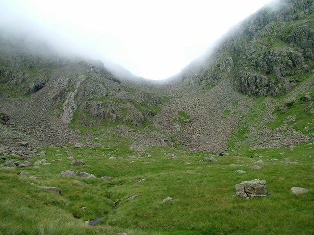 Photo could not load
NY2107 : Misty col between Broad Crag and Scafell Pike
David Brown
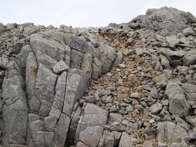 Photo could not load
NY2107 : Shattered rocks on Broad Crag
Peter S
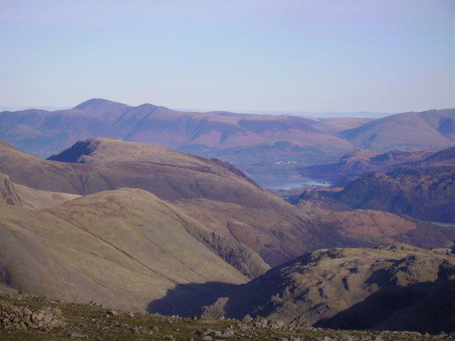 Photo could not load
NY2107 : Keswick from Scafell Pike
Michael Graham
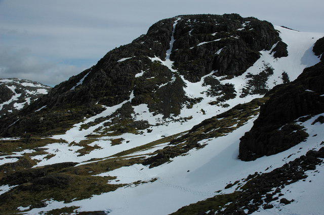
NY2107 : Broad Crag
Philip Halling
Hill facts and local notes
Classifications
Elevation
935m
3,069 ft
Prominence
58m
Coordinates
54.4574, -3.2069
NY218075
OS Map
89 90
Explorer: OL6N
At the Summit
The summit of Broad Crag boasts a modest cairn, providing a great spot for a cheeky selfie or a well-deserved breather after the climb.
Terrain & Geology
Broad Crag is primarily composed of volcanic rock, representing the remnants of ancient volcanic activity that shaped the Lake District landscape. Its rugged features and steep inclines are a testament to the geological processes that have occurred over millennia.
Views & Scenery
From the summit, you can see the grandeur of Scafell Pike to the east and the picturesque valleys and lakes below, including Wast Water and a glimpse of the Irish Sea on a clear day.
History & Heritage
Name Origin
The name 'Broad Crag' aptly describes its broad summit ridge, contrasting with the sharper peaks surrounding it.
Historical Significance
Broad Crag is known for its association with the Southern Fells of the Lake District and remains a beloved destination for hikers seeking to conquer the area following the adjoining Scafell Pike.
Getting There & Facilities
Parking
Wasdale Head National Trust car park is the nearest, with ample spaces and a small charge, especially on busy weekends.
Public Transport
Limited public transport available; the nearest bus services to Wasdale depart from nearby towns, but it’s advisable to check schedules beforehand.
Nearby Facilities
There are basic facilities at Wasdale Head, including a small cafe and toilets, but make sure to stock up on provisions before heading out.
Safety Information
Known Hazards
- Loose scree and rocky outcrops can pose a risk to less experienced hikers. Additionally, unpredictable weather can change conditions rapidly, so always come prepared.
General Safety Tips
- Check weather conditions before setting out
- Carry appropriate clothing and equipment
- Let someone know your planned route
- Take a map, compass, and GPS device
- Carry emergency supplies: food, water, first aid kit, torch
Hills
Some common questions about the hills answered
Are there group walks up Broad Crag?
Many walkers use Walkmates to join or organise walks with others. You can check for group walks around Broad Crag through the maps
Are there other walkers around Broad Crag?
Activity varies by location and time, but Walkmates lets you see whether others have shared walks or shown interest in this area. Find other people through the walking friends search walking friends for Broad Crag search or of course create your own walk for Broad Crag
Can I organise a walk to Broad Crag?
Yes. If there aren’t any walks listed already, you can create a walk and make it available for others to join.
If you're signed up to Walkmates, you can create a walk to Broad Crag.
How do I find a walk up this hill?
There are often multiple ways to walk this hill, depending on experience and route preference. Walkmates helps you explore walks and routes that others have shared.
Can I suggest a new route up Broad Crag?
Yes. You can suggest or create routes to share with others. Walkmates focuses on the social side of walking, so routes are used to help people organise walks and explore areas together, rather than as detailed navigation tools or route libraries.
Other uses really appreciate knowledgeable walkers sharing their routes. Share your favourite route to Broad Crag here
The is an error or something incorrect about this hill. How do I let you know?
We always strive to keep the information on Walkmates as accurate as possible. If you find an error, please let us know through the contact form and we'll aim to correct it as quickly as possible
Community Discussion
Comments
Location
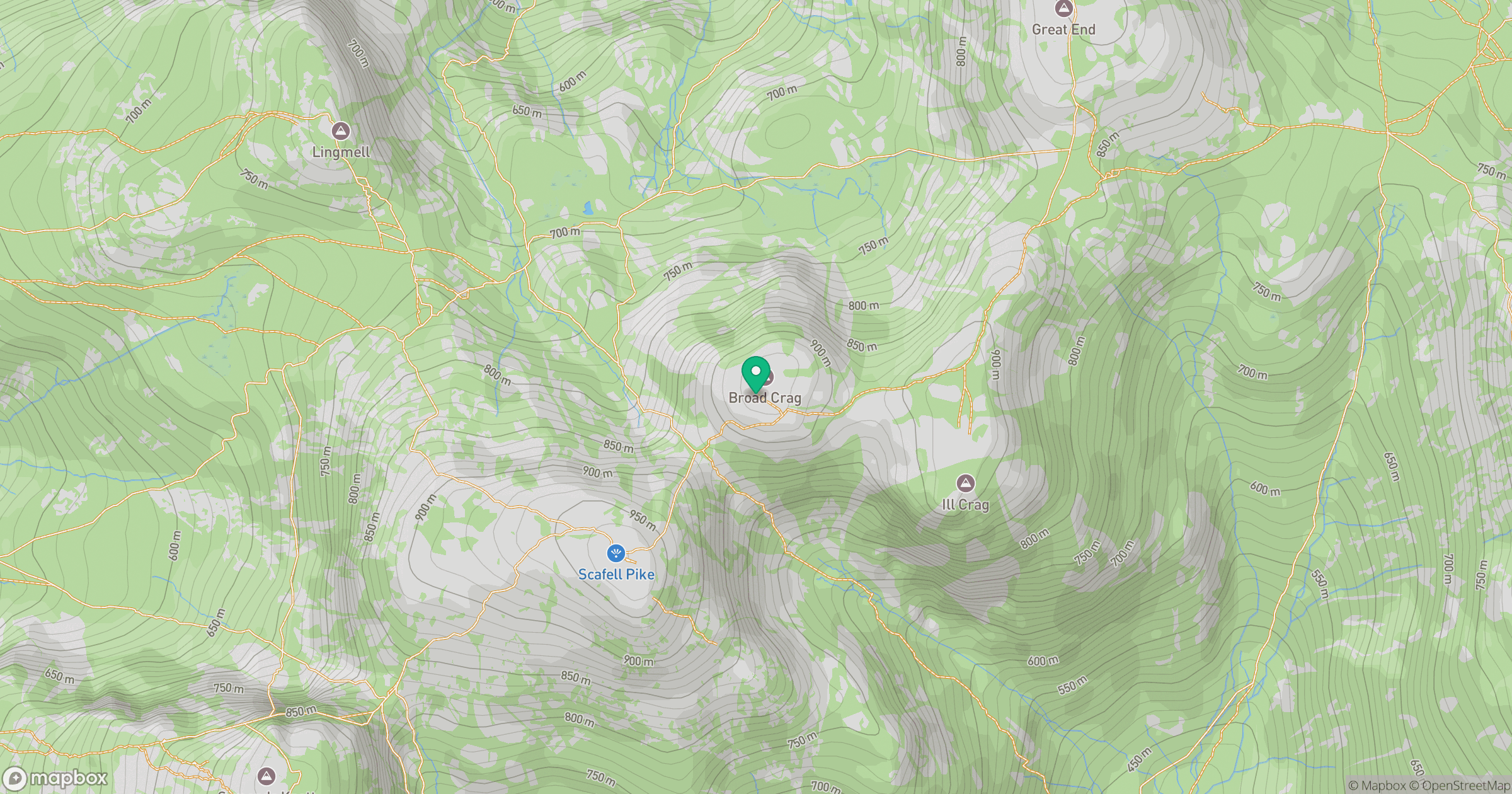
Grid reference: NY218075
View on OpenStreetMapOpens a map in a new tab, centred on the hill.

No comments yet. Be the first.