

Bowscale Fell
Good walks are even better shared.
NY3330 : Leaving Bowscale Fell
Karl and Ali Photo source
Overview
Bowscale Fell
Bowscale Fell stands majestically at 703 meters, a hidden gem in the heart of the Lake District. Known for its striking volcanic rock formations, this mountain offers both adventure and beautiful views. Whether you're a seasoned climber or a casual walker, Bowscale Fell has something for everyone.
Geology
Bowscale Fell's intriguing geology primarily consists of rocks from the Borrowdale Volcanic Group. These ancient, volcanic formations create a dramatic landscape that's sure to pique the interest of geology enthusiasts. Scramble your way up through scree slopes and craggy outcrops, and you might just feel like a modern-day explorer!
Routes
There are several pathways to conquer Bowscale Fell. The Bowscale Fell Circular (10.5 km, 3.5 hours) starts from Mungrisdale, giving you a lovely loop around the fell with incredible views. Alternatively, the Direct Ascent via Bowscale Tarn offers a more challenging trek, perfect for those with a taste for adventure who fancy a more direct approach.
Summit Features
Upon reaching the summit, hikers are greeted by a sturdy cairn that stands as a testament to the many walkers who have come before. Take a moment to soak in the panoramic views – you might even see a few sheep staring back at you!
Terrain Type
Expect a mixed terrain with rocky paths, rolling grassy hills, and some squishy bogs. Be sure to wear sturdy footwear to tackle whatever Mother Nature throws at you!
Views
The summit offers breathtaking views of the Helvellyn range, majestic Blencathra, and the serene Thirlmere. For the best scenery, consider hiking in late spring or early autumn when the heather blooms gloriously across the landscape.
Hazards
As with many fells, watch your step! Loose rocks can be hazardous, especially in wet weather. Some areas may be boggy, so waterproof boots are strongly recommended – your feet will thank you later.
Access
The nearest parking area is located in Mungrisdale. It’s a small but convenient spot for those looking to start their hike. If you're relying on public transport, check the bus schedules from Keswick to Mungrisdale, though services may be a bit sparse.
Facilities
While there are no facilities directly at the fell, the charming village of Mungrisdale has a welcoming pub for post-hike refreshments. For a wider selection of cafes and shops, Keswick is just a short drive away.
History
The name 'Bowscale' comes from Old Norse, likely referring to the unique shape of the mountain and its close partnership with the surrounding tarn. This fell has long been a cherished destination for hikers and nature lovers alike, steeped in the rich natural and cultural history of the Lake District.
Last Thoughts
Bowscale Fell may not be the highest, but its charm and allure are undeniable. A great choice for a day out, come prepared for an adventure and perhaps a few sheep witnesses while you soak in the marvellous views!
Explore routes near Bowscale Fell
Walks starting near this hill. Open a route to check its map, distance and full itinerary.
Mungrisdale Common and Bowscale Fell from Mosedale Valley Wainwright
View route
Bannerdale Crags from Mungrisdale Wainwright
View route
Brae Fell from Longlands Wainwright
View route
Derwentwater Walk: full lakeside circuit from Keswick
View route
Route planning notes
These notes describe possible approaches. Check a route's map and access information when planning your walk.
Bowscale Fell Circular
A scenic loop starting from the village of Mungrisdale, this route takes you around the base of Bowscale Fell, providing breathtaking views along the way.
Direct Ascent via Bowscale Tarn
This route ascends directly from Bowscale Tarn, offering a more challenging climb with stunning vistas.
Make a day of it, together
Find someone to share the walk with, or organise a day out along a route you like.
Photo Gallery
View all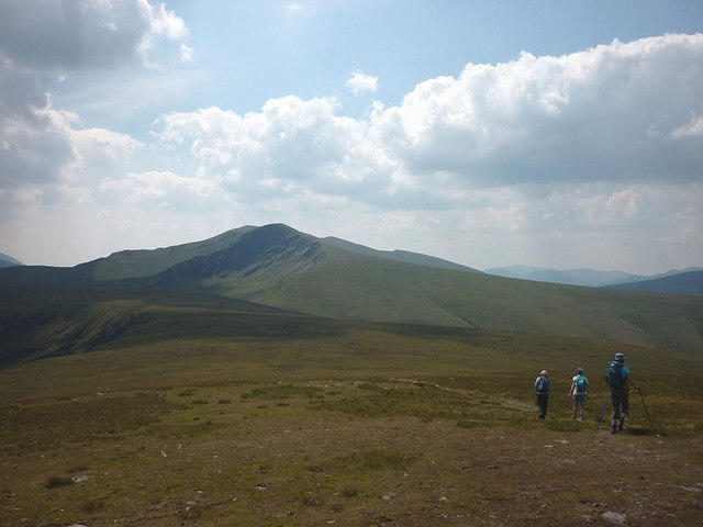 Photo could not load
NY3330 : Leaving Bowscale Fell
Karl and Ali
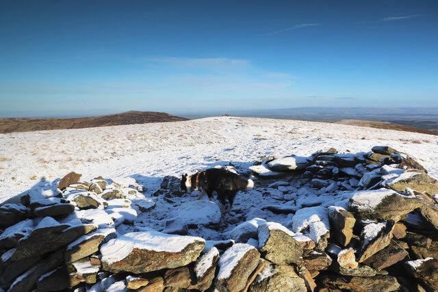 Photo could not load
NY3330 : Summit shelter
Andy Waddington
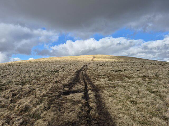 Photo could not load
NY3330 : Path on Bowscale Fell
Steven Brown
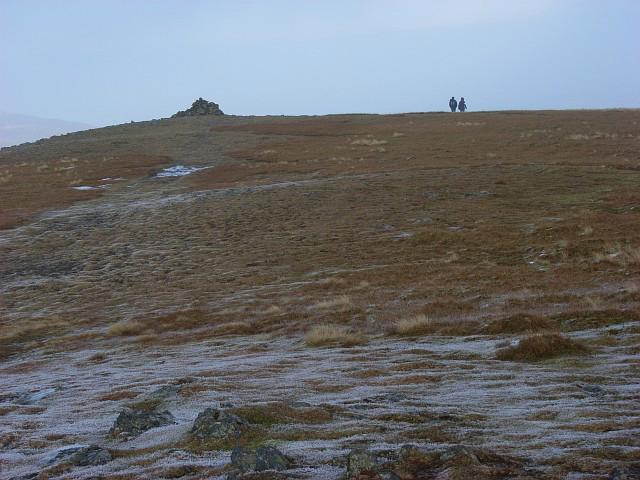 Photo could not load
NY3330 : Bowscale Fell
Andrew Smith
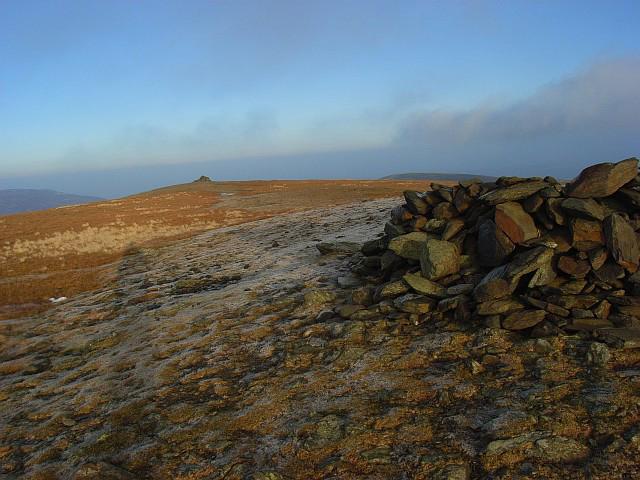 Photo could not load
NY3330 : Bowscale Fell
Andrew Smith
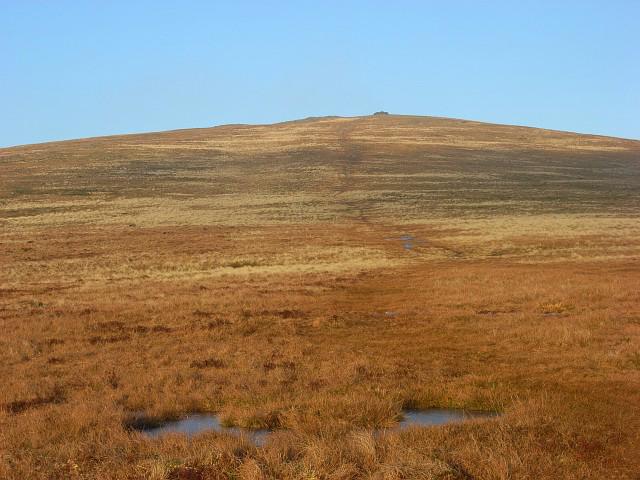 Photo could not load
NY3330 : Bowscale Fell
Andrew Smith
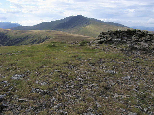 Photo could not load
NY3330 : Bowscale Fell Summit
Shaun Ferguson
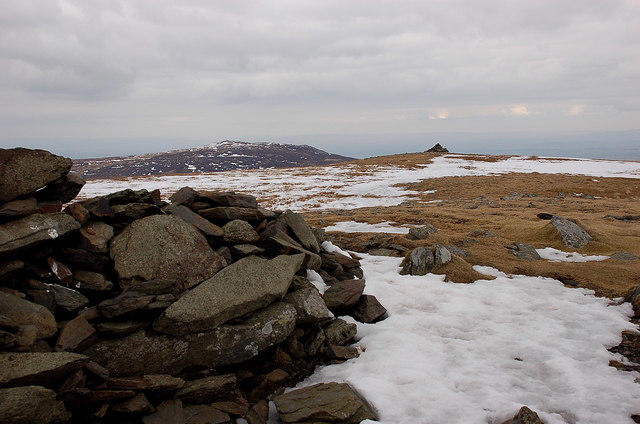 Photo could not load
NY3330 : Summit shelter and cairn, Bowscale Fell
Jim Barton
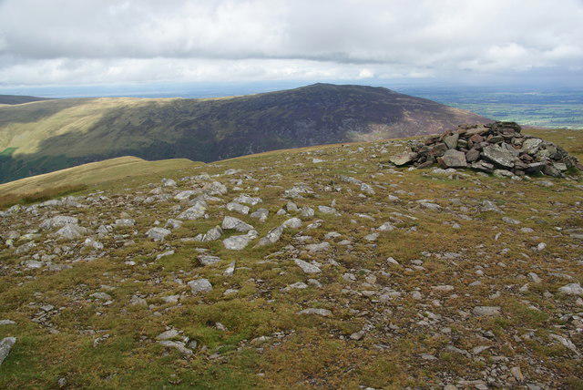 Photo could not load
NY3330 : Cairn at the top of Bowscale Fell
Bill Boaden
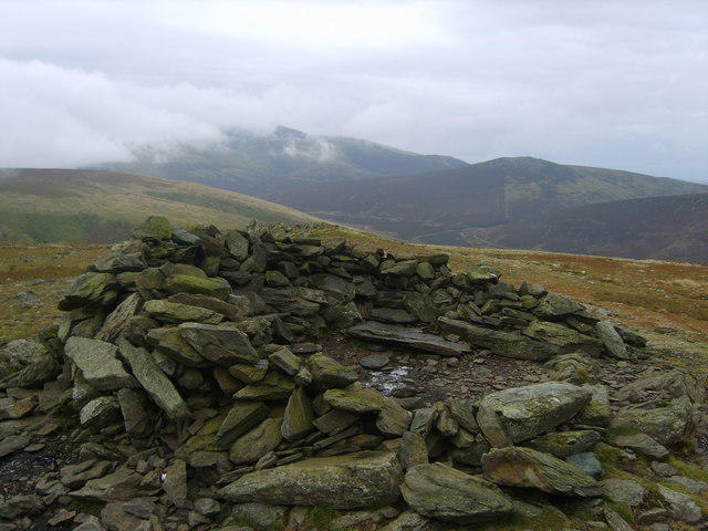
NY3330 : Wind Shelter Bowscale Fell
Michael Graham
Hill facts and local notes
Classifications
Elevation
702m
2,303 ft
Prominence
87m
Coordinates
54.6655, -3.0350
NY333305
OS Map
90
Explorer: OL5N OL5S
At the Summit
The summit is marked by a prominent cairn and offers stunning panoramic views of the surrounding fells and the nearby Bowscale Tarn.
Terrain & Geology
Bowscale Fell is primarily composed of volcanic rocks from the Borrowdale Volcanic Group, lending the mountain its rugged charm. The summit features scree slopes and craggy outcrops, a playground for geology enthusiasts.
Views & Scenery
From the summit, hikers can enjoy views of the Helvellyn range, Blencathra, and the sprawling Thirlmere.
History & Heritage
Name Origin
The name 'Bowscale' is derived from Old Norse, likely referring to the shape of the mountain and its close association with the surrounding tarn.
Historical Significance
Bowscale Fell offers a glimpse into the Lake District's natural history and has been a cherished hiking destination for locals and visitors alike.
Getting There & Facilities
Parking
There is a small parking area adjacent to the village of Mungrisdale, which serves as a good starting point for several routes.
Public Transport
Buses run from Keswick to Mungrisdale, though service is limited; it's best to check the local timetable.
Nearby Facilities
There are no facilities directly at Bowscale Fell, but the nearby village of Mungrisdale has a pub, and Keswick offers various cafes and shops.
Safety Information
Known Hazards
- Beware of loose rocks on the ascent, particularly in wet conditions. Some areas can be boggy, so waterproof boots are advised.
General Safety Tips
- Check weather conditions before setting out
- Carry appropriate clothing and equipment
- Let someone know your planned route
- Take a map, compass, and GPS device
- Carry emergency supplies: food, water, first aid kit, torch
Hills
Some common questions about the hills answered
Are there group walks up Bowscale Fell?
Many walkers use Walkmates to join or organise walks with others. You can check for group walks around Bowscale Fell through the maps
Are there other walkers around Bowscale Fell?
Activity varies by location and time, but Walkmates lets you see whether others have shared walks or shown interest in this area. Find other people through the walking friends search walking friends for Bowscale Fell search or of course create your own walk for Bowscale Fell
Can I organise a walk to Bowscale Fell?
Yes. If there aren’t any walks listed already, you can create a walk and make it available for others to join.
If you're signed up to Walkmates, you can create a walk to Bowscale Fell.
How do I find a walk up this hill?
There are often multiple ways to walk this hill, depending on experience and route preference. Walkmates helps you explore walks and routes that others have shared.
Can I suggest a new route up Bowscale Fell?
Yes. You can suggest or create routes to share with others. Walkmates focuses on the social side of walking, so routes are used to help people organise walks and explore areas together, rather than as detailed navigation tools or route libraries.
Other uses really appreciate knowledgeable walkers sharing their routes. Share your favourite route to Bowscale Fell here
The is an error or something incorrect about this hill. How do I let you know?
We always strive to keep the information on Walkmates as accurate as possible. If you find an error, please let us know through the contact form and we'll aim to correct it as quickly as possible
Community Discussion
Comments
Location
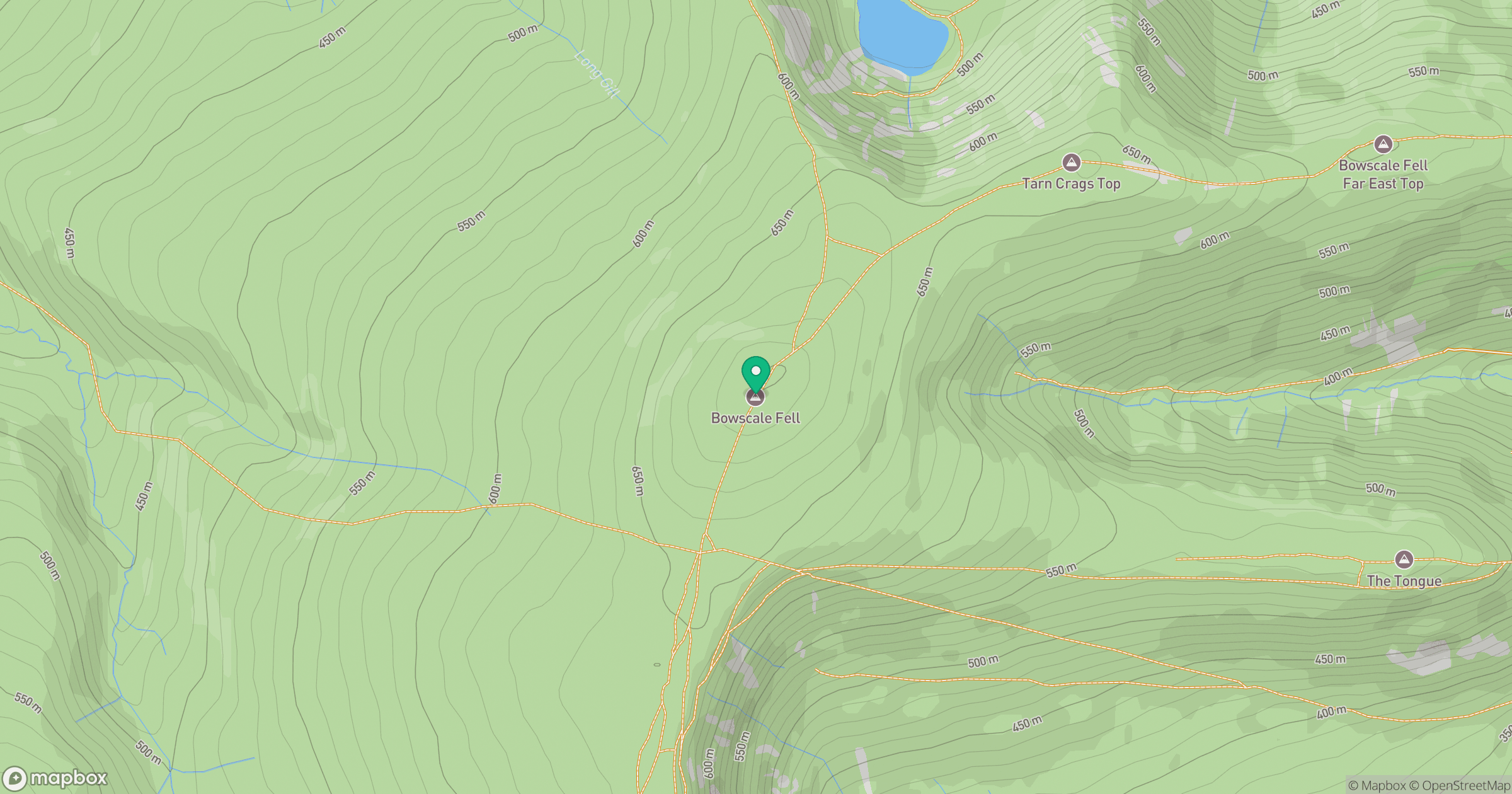
Grid reference: NY333305
View on OpenStreetMapOpens a map in a new tab, centred on the hill.


No comments yet. Be the first.