
Bowden Hill
Good walks are even better shared.
Overview
Bowden Hill
Nestled in the picturesque Cotswolds near Bath, Bowden Hill may not be the tallest peak, but it certainly has its charm. Standing at an elevation of 125 meters, it offers a friendly incline for those looking to stretch their legs.
Geology
Bowden Hill is primarily made of limestone, showcasing the classic rugged elements of the Cotswolds. The rocky outcrops and grassy patches provide not just visual interest but also a variety of habitats for local wildlife.
Routes
One of the most popular hikes is the Bowden Hill Circular Walk, a pleasant 5.5 km trek starting from Box. This moderate walk is perfect for families and beginner hikers. Alternatively, if you're feeling a bit more adventurous, the Direct Ascent from Bath leads straight up from the city and covers about 3 km. It's a challenging route that’ll have your heart racing, and the views will be well worth the effort!
Summit Features
At the summit, you’ll find a small limestone outcrop, perfect for a leisurely picnic or just soaking up the stunning vistas. Be sure to pack your favourite sandwich—nothing like a bit of sustenance after a good hike!
Terrain
The terrain is mostly grassy with some rocky areas, but be prepared for mud after a rain. Good walking boots are a must unless you're keen on giving your shoes a mud bath!
Views
From the top, you can savour magnificent views of Bath and the surrounding hills. Spring and autumn are the ideal seasons for stunning scenery, so keep your camera at the ready!
Hazards
While Bowden Hill is generally safe, do watch out for slippery conditions post-rain, and keep an eye out for the local wildlife—rabbits can be quite cheeky!
Access
The nearest parking is conveniently located on the A367, just outside Bath. Public transport options are available, with buses frequently running from Bath to Box, making accessibility a breeze.
Facilities
Once you've worked up an appetite, head into Box for a variety of cafés and pubs to refuel.
History
The name Bowden translates to 'hill in a valley,' a nod to its geographical setting. Historically, the area has been a part of ancient routes used long ago, adding a layer of historical intrigue to your hike.
Whether you're a seasoned hiker or just out for a leisurely stroll, Bowden Hill offers an engaging outdoor experience with a splash of Cotswold charm. Grab your boots, plan your visit, and remember—whatever you do, don't forget your snacks!
Explore routes near Bowden Hill
Walks starting near this hill. Open a route to check its map, distance and full itinerary.
Chippenham Walk with Men Walking & Talking
View route
Devizes Wharf and Caen Hill Lock Flight Towpath Walk
View route
The Ridgeway: Overton Hill to Ogbourne St George
View route
Bath Skyline hills and Rainbow Wood from central Bath
View route
Route planning notes
These notes describe possible approaches. Check a route's map and access information when planning your walk.
Bowden Hill Circular Walk
This delightful circular walk begins at the village of Box and meanders around Bowden Hill, offering lush countryside and sweeping views.
Direct Ascent from Bath
A more challenging route that leads directly up the hill from the city of Bath, rewarding hikers with beautiful views of the surrounding area.
Make a day of it, together
Find someone to share the walk with, or organise a day out along a route you like.
Hill facts and local notes
Classifications
Elevation
181m
593 ft
Prominence
90m
Coordinates
51.4166, -2.0830
ST943686
OS Map
173
Explorer: 156
At the Summit
The summit boasts a small limestone outcrop and a few rocky ledges, providing an excellent perch for a picnic or simply taking in the views.
Terrain & Geology
The hill is primarily composed of limestone, giving it a rugged yet charming character typical of the Cotswolds.
Views & Scenery
From the summit, remarkable views of Bath, the River Avon, and the rolling Cotswold hills are visible.
History & Heritage
Name Origin
Bowden is derived from 'Bod' meaning hill or mound, and 'den', a reference to a small valley.
Historical Significance
The area has historical significance, with nearby ancient transport routes and remnants of prehistoric habitation.
Getting There & Facilities
Parking
There is a small car park at the bottom of Bowden Hill, located on the A367, just outside of Bath.
Public Transport
Buses run regularly from Bath city centre to Box, with a short walk to the starting point of several trails.
Nearby Facilities
There are no facilities directly on Bowden Hill; however, Box offers several pubs and cafés for refreshments.
Safety Information
Known Hazards
- Watch out for slippery conditions after rain; also, be mindful of potential wildlife, including rabbits and other small mammals.
General Safety Tips
- Check weather conditions before setting out
- Carry appropriate clothing and equipment
- Let someone know your planned route
- Take a map, compass, and GPS device
- Carry emergency supplies: food, water, first aid kit, torch
Hills
Some common questions about the hills answered
Are there group walks up Bowden Hill?
Many walkers use Walkmates to join or organise walks with others. You can check for group walks around Bowden Hill through the maps
Are there other walkers around Bowden Hill?
Activity varies by location and time, but Walkmates lets you see whether others have shared walks or shown interest in this area. Find other people through the walking friends search walking friends for Bowden Hill search or of course create your own walk for Bowden Hill
Can I organise a walk to Bowden Hill?
Yes. If there aren’t any walks listed already, you can create a walk and make it available for others to join.
If you're signed up to Walkmates, you can create a walk to Bowden Hill.
How do I find a walk up this hill?
There are often multiple ways to walk this hill, depending on experience and route preference. Walkmates helps you explore walks and routes that others have shared.
Can I suggest a new route up Bowden Hill?
Yes. You can suggest or create routes to share with others. Walkmates focuses on the social side of walking, so routes are used to help people organise walks and explore areas together, rather than as detailed navigation tools or route libraries.
Other uses really appreciate knowledgeable walkers sharing their routes. Share your favourite route to Bowden Hill here
The is an error or something incorrect about this hill. How do I let you know?
We always strive to keep the information on Walkmates as accurate as possible. If you find an error, please let us know through the contact form and we'll aim to correct it as quickly as possible
Community Discussion
Comments
Location
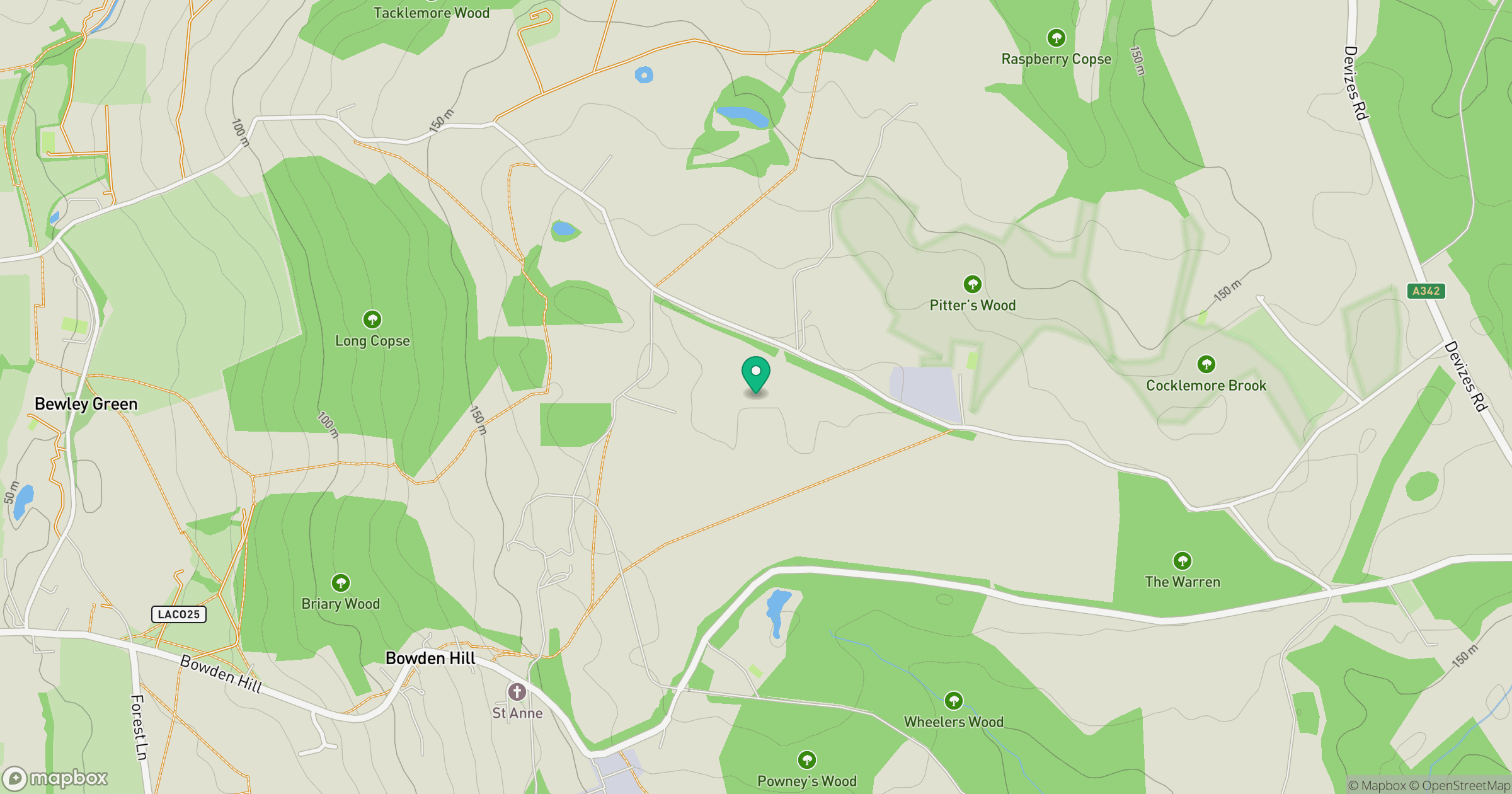
Grid reference: ST943686
View on OpenStreetMapOpens a map in a new tab, centred on the hill.
Nearby Hills
Glastonbury Tor
158m
Worcestershire Beacon
425m
Titterstone Clee Hill
533m

The Wrekin
407m
Long Mynd - Pole Bank
517m
No comments yet. Be the first.