
Bouleevin
Good walks are even better shared.
Overview
Bouleevin: A Munro Worth Climbing
Introduction
Bouleevin stands proudly in the heart of the Scottish Highlands, beckoning hikers with its charming slopes and awe-inspiring views. With an elevation of 686 meters, it's a favourite for those keen to bag another Munro without the initial feeling of being a broken kite!
Geology
This majestic mountain displays granite rock formations that have weathered beautifully through time. The rocky terrain interspersed with verdant patches creates a vibrant landscape that is as good on the eye as a well-picked bouquet.
Routes
There are several routes that lead to Bouleevin’s summit. The Bouleevin Loop takes you through the picturesque Glen Fyne, perfect for those looking to combine a bit of exercise with a tad of scenery. Meanwhile, the Direct Ascent from Kilmichael Glen is for the brave-hearted – it’s shorter but quite steep.
Summit Features
The summit features a cairn, which is a favourite spot for taking selfies. Its rocky top offers panoramic views that will leave you gaping like a trout out of water!
Terrain
Hiking varies from rocky paths to grassy meadows, with some boggy areas to keep you on your toes, particularly after rain. Leggings and sturdy boots recommended!
Views
On a clear day, the views from Bouleevin are nothing short of breathtaking, with the Crinan Canal winding its way towards the shimmering sea, and hills galore stretching far into the horizon. If you are lucky, the setting sun casts a golden glow over the landscape, painting everything in hues that would make an artist weep with joy.
Hazards
As you make your way, be wary of loose rocks which love to play a game of skittles with unsuspecting hikers' feet. And always be conscious of the ever-changing Scottish weather—one moment it’s sunny, and the next you might find yourself in a game of hide and seek with raindrops.
Access
Getting there is a cinch! You’ll find parking at Glen Fyne, just off the main road. If public transport is more your style, double-check the bus timings, as they can be as unpredictable as a Scottish summer!
Facilities
Inveraray is just a hop away with all the necessary amenities, so fuel up on snacks and enjoy local cafes where the cakes are as big as your ambitions.
History
The name Bouleevin celebrates the history of pastoral life in this region, harking back to a time when the gentler slopes were filled with flocks. Today, it remains a sought-after destination for those wishing to embrace Scotland’s wild beauty.
Conclusion
Bouleevin isn’t just a hill; it’s an experience waiting to unfold. So grab your gear, pack your sense of humour, and head out to explore the trails – you might just find the adventure of a lifetime!
Explore routes near Bouleevin
Public walks starting within 80 km of this hill. Nearby does not mean a route reaches the summit; check its map and access before setting out.
No public routes are currently listed within 80 km of Bouleevin on Walkmates. This does not mean there are no paths here. Explore the map and check local access information before planning a walk.
Route planning notes
These notes describe possible approaches, not verified navigable routes or permission to cross land. Check current paths, local access rules and conditions before setting out.
Bouleevin Loop
A scenic loop starting from the nearby Glen Fyne, offering diverse terrain and stunning valley views.
Direct Ascent from Kilmichael Glen
A straightforward ascent directly up the mountainside, challenging but rewarding for those with a bit of grit.
Make a day of it, together
Find someone to share the walk with, or organise a day out along a route you like.
Hill facts and local notes
Classifications
Elevation
222m
728 ft
Prominence
124m
Coordinates
53.0648, -8.9882
M338020
OS Map
52
At the Summit
The summit is marked by a small stone cairn, a perfect place to catch your breath and take in the splendid surroundings.
Terrain & Geology
Bouleevin is predominantly composed of granite, providing a sturdy foundation that contributes to its rugged beauty. The exposure of metamorphic rocks adds variety to the landscape, making the geology here a topic of interest for enthusiasts.
Views & Scenery
From the summit, you can see the Crinan Canal snaking towards the coast, the peaks of the surrounding hills, and, on a clear day, even the distant Isle of Jura.
History & Heritage
Name Origin
The name 'Bouleevin' derives from the Gaelic 'Buaile Bheinn', meaning 'Mountain of the Fold', which refers to the livestock pastures once found in the surrounding areas.
Historical Significance
Bouleevin is a favourite among Munro-baggers due to its accessibility and picturesque routes, making it a cherished part of Scottish mountaineering culture.
Getting There & Facilities
Check current local access restrictions, parking rules and transport timetables before travelling. These notes do not confirm public access to the summit.
Parking
Parking is available at the base of Glen Fyne, just off the A83. Be sure to respect local parking regulations.
Public Transport
Buses run infrequently from Inveraray to Kilmichael Glen, so it's best to check schedules in advance.
Nearby Facilities
Inveraray offers various facilities, including cafes and public toilets. However, don’t expect a five-star restaurant in the hills!
Safety Information
Known Hazards
- Loose rocks may cause a slip if you're not paying attention. Sudden changes in weather can occur, so come prepared with a rain jacket and a heart full of adventure!
General Safety Tips
- Check weather conditions before setting out
- Carry appropriate clothing and equipment
- Let someone know your planned route
- Take a map, compass, and GPS device
- Carry emergency supplies: food, water, first aid kit, torch
Hills
Some common questions about the hills answered
Are there group walks up Bouleevin?
Many walkers use Walkmates to join or organise walks with others. You can check for group walks around Bouleevin through the maps
Are there other walkers around Bouleevin?
Activity varies by location and time, but Walkmates lets you see whether others have shared walks or shown interest in this area. Find other people through the walking friends search walking friends for Bouleevin search or of course create your own walk for Bouleevin
Can I organise a walk to Bouleevin?
Yes. If there aren’t any walks listed already, you can create a walk and make it available for others to join.
If you're signed up to Walkmates, you can create a walk to Bouleevin.
How do I find a walk up this hill?
There are often multiple ways to walk this hill, depending on experience and route preference. Walkmates helps you explore walks and routes that others have shared.
Can I suggest a new route up Bouleevin?
Yes. You can suggest or create routes to share with others. Walkmates focuses on the social side of walking, so routes are used to help people organise walks and explore areas together, rather than as detailed navigation tools or route libraries.
Other uses really appreciate knowledgeable walkers sharing their routes. Share your favourite route to Bouleevin here
The is an error or something incorrect about this hill. How do I let you know?
We always strive to keep the information on Walkmates as accurate as possible. If you find an error, please let us know through the contact form and we'll aim to correct it as quickly as possible
Community Discussion
Comments
Location
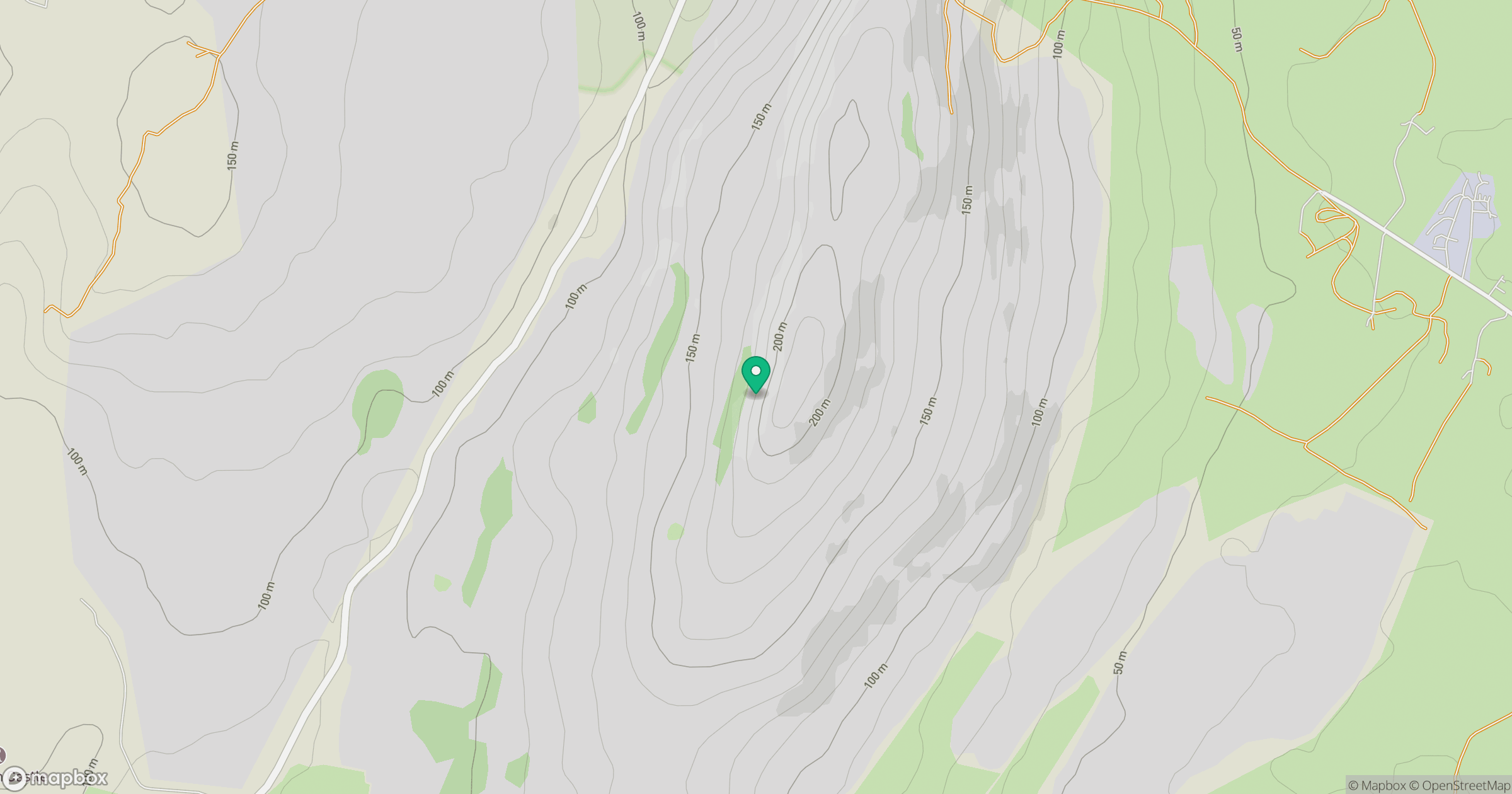
Grid reference: M338020
View on OpenStreetMapOpens a map in a new tab, centred on the hill.
Hills within 30 km
Straight-line distance, not a walking route or confirmation of access.
Slievecarran [Sliabh Cairn]
326m
Knockanes
205m
Abbey Hill [Cnoc na Mainistreach]
240m
Aillwee
304m
Cloontohil
190m
No comments yet. Be the first.