
Gleninagh Mountain
Good walks are even better shared.
Overview
Gleninagh Mountain
Introduction
Nestled in the heart of Connemara, Gleninagh Mountain stands gracefully at 468 meters, offering ramblers and hikers alike a taste of the wild Irish landscape. Just a stone’s throw from Clifden, it’s a friendly giant with a perfect blend of challenge and beauty.
Geology
Gleninagh’s substrate is primarily limestone, characteristic of the region, giving adventurers a peek into remarkable geological formations. The impact of glaciers has carved out the area, creating a patchwork of rocky outcrops and strange sinkholes that could easily swallow your lunch if you’re not careful!
Routes
The Gleninagh Cliffs Route is the most popular path, a moderate hike of approximately 7.3 km which can be enjoyed in about 2.5 hours. This route takes you alongside breathtaking cliffs with the Atlantic pounding below, as well as spots of lush greenery that are quintessentially Irish.
Summit Features
At the summit, you’ll be greeted by a welcoming cairn, along with stunning panoramic views that make the uphill trek worthwhile. Just don’t forget to take that obligatory summit selfie—after all, if you didn’t post it on social media, did you really go?
Terrain Type
Expect a mixture of rocky sections and grassy pathways. Be mindful of some boggy patches, especially after a rainstorm. Sturdy footwear is recommended, as the Irish weather can be as capricious as a cat in a room full of rocking chairs!
Views
From the top, you’ll be rewarded with views of the Twelve Bens and the sprawling Atlantic coastline. Late spring and summer reveal the clearest vistas, while autumn enchants with a tapestry of colours.
Hazards
While the hike isn’t overly treacherous, do keep an eye out for loose rocks and slippery areas, especially if the weather’s been wet. It’s not a race, so take your time!
Nearby Summits
If you’re feeling adventurous, consider tackling nearby peaks such as Benbaun (711 m) and Mam Trasna (703 m), both offering their unique charm and challenge.
Access
Parking is readily available at the start of the Gleninagh Cliffs Route, although it can fill quickly during peak seasons. The nearest town, Clifden, has a wealth of amenities like cafes and pints of Guinness, which are perfect for replenishment after your trek. Public transport options are limited, but bus services to Clifden run periodically.
Facilities
Once you’re back from your hike, make a beeline for one of Clifden’s cafes. Whether you fancy a cup of tea or a hearty meal, you'll find plenty of options to satisfy your after-hike appetite.
Conclusion
Gleninagh Mountain is a treasure in Connemara, perfect for families, individuals or anyone looking to reconnect with nature. Just remember to bring along good shoes, a camera, and your sense of adventure!
Explore routes near Gleninagh Mountain
Public walks starting within 80 km of this hill. Nearby does not mean a route reaches the summit; check its map and access before setting out.
No public routes are currently listed within 80 km of Gleninagh Mountain on Walkmates. This does not mean there are no paths here. Explore the map and check local access information before planning a walk.
Route planning notes
These notes describe possible approaches, not verified navigable routes or permission to cross land. Check current paths, local access rules and conditions before setting out.
Gleninagh Cliffs Route
This route starts from the parking area near the Gleninagh Cliffs and takes in stunning coastal views as you ascend towards the summit.
Make a day of it, together
Find someone to share the walk with, or organise a day out along a route you like.
Hill facts and local notes
Classifications
Elevation
316m
1,037 ft
Prominence
132m
Coordinates
53.1298, -9.2277
M178094
OS Map
51
At the Summit
The summit features a prominent rocky outcrop with a small cairn, offering ample space for a well-deserved rest and snack while enjoying the views.
Terrain & Geology
Gleninagh Mountain is composed primarily of limestone, which gives rise to interesting karstic features including sinkholes and rocky outcrops. The area is shaped by glacial activity, leading to its rugged terrain.
Views & Scenery
From the summit, enjoy sweeping views of the Twelve Bens mountain range and the rugged coastline of Connemara, with the Atlantic Ocean stretching as far as the eye can see.
History & Heritage
Name Origin
The name 'Gleninagh' derives from the Irish 'Gleann Iongh', meaning 'glen of the yew trees'.
Historical Significance
Local folklore speaks of the mountain's rugged beauty, often being featured in tales of old that highlight the connection between the people and their landscape.
Getting There & Facilities
Check current local access restrictions, parking rules and transport timetables before travelling. These notes do not confirm public access to the summit.
Parking
There is a small parking area at the start of the Gleninagh Cliffs Route, suitable for a few cars.
Public Transport
The nearest public transport can be accessed via bus services running through nearby towns like Clifden.
Nearby Facilities
In Clifden, you can find several cafes, restaurants, and public toilets. Make sure to fill your boots—or rather, your stomach—before heading up!
Safety Information
Known Hazards
- Watch out for loose rocks, particularly on the steeper sections. The terrain can become slippery when wet.
General Safety Tips
- Check weather conditions before setting out
- Carry appropriate clothing and equipment
- Let someone know your planned route
- Take a map, compass, and GPS device
- Carry emergency supplies: food, water, first aid kit, torch
Hills
Some common questions about the hills answered
Are there group walks up Gleninagh Mountain?
Many walkers use Walkmates to join or organise walks with others. You can check for group walks around Gleninagh Mountain through the maps
Are there other walkers around Gleninagh Mountain?
Activity varies by location and time, but Walkmates lets you see whether others have shared walks or shown interest in this area. Find other people through the walking friends search walking friends for Gleninagh Mountain search or of course create your own walk for Gleninagh Mountain
Can I organise a walk to Gleninagh Mountain?
Yes. If there aren’t any walks listed already, you can create a walk and make it available for others to join.
If you're signed up to Walkmates, you can create a walk to Gleninagh Mountain.
How do I find a walk up this hill?
There are often multiple ways to walk this hill, depending on experience and route preference. Walkmates helps you explore walks and routes that others have shared.
Can I suggest a new route up Gleninagh Mountain?
Yes. You can suggest or create routes to share with others. Walkmates focuses on the social side of walking, so routes are used to help people organise walks and explore areas together, rather than as detailed navigation tools or route libraries.
Other uses really appreciate knowledgeable walkers sharing their routes. Share your favourite route to Gleninagh Mountain here
The is an error or something incorrect about this hill. How do I let you know?
We always strive to keep the information on Walkmates as accurate as possible. If you find an error, please let us know through the contact form and we'll aim to correct it as quickly as possible
Community Discussion
Comments
Location
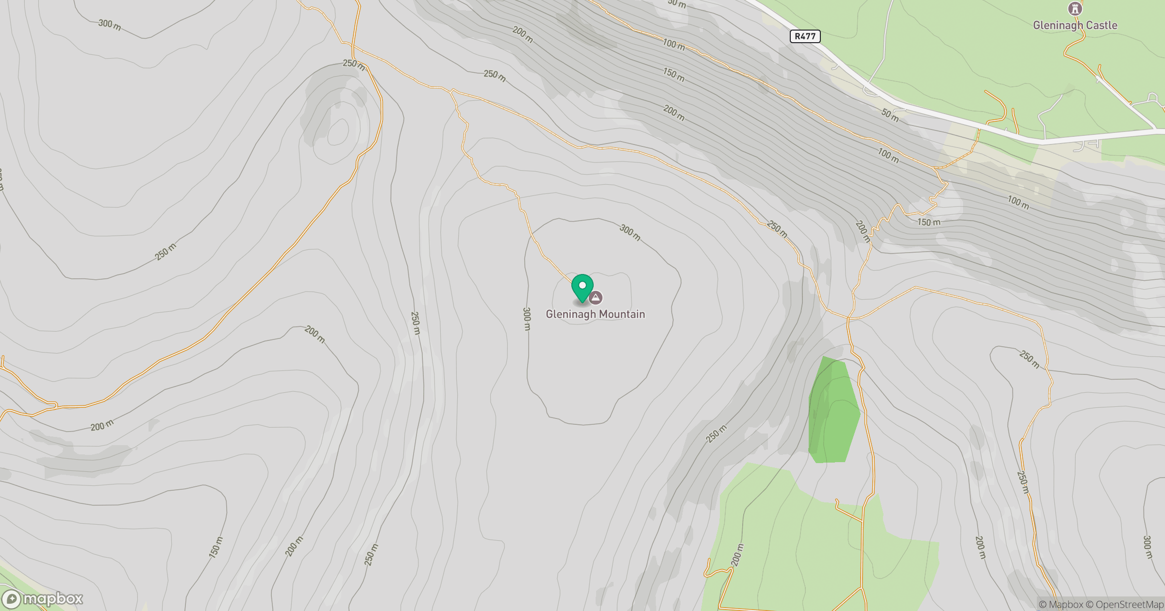
Grid reference: M178094
View on OpenStreetMapOpens a map in a new tab, centred on the hill.
Hills within 30 km
Straight-line distance, not a walking route or confirmation of access.
Slieve Elva [Sliabh Eilbhe]
344m
Aillwee
304m
Abbey Hill [Cnoc na Mainistreach]
240m
Knocknalarabana
204m
Slievecarran [Sliabh Cairn]
326m
No comments yet. Be the first.