

Knocknalarabana
Good walks are even better shared.
Overview
Knocknalarabana: A Hidden Gem of Connemara
Knocknalarabana is a Marilyn peak sitting proudly within the breathtaking landscapes of Connemara, Ireland. With an elevation of 556 meters, this mountain is not just a hill; it’s a bucket-list destination for those who wish to bask in the beauty of nature while getting a little exercise.
Geology
The mountain is primarily composed of granite and schist, showcasing the incredible geological history that has shaped the Irish landscape. Erosion has sculpted the rugged cliffs, giving them a character that can make you feel as if you’re trekking through a natural art exhibit.
Routes
Start at the Maam Valley
This moderately challenging route, approximately 5.5 km in length, begins at the picturesque Maam Valley. The path weaves through enchanting bogland before leading to the western slopes of the mountain. Get your cameras ready, for the views as you ascend are simply breathtaking!
Summit Features
At the summit, you’ll find a small yet weathered cairn. The panoramic views from this vantage point are enough to make anyone’s heart sing, showcasing the stunning Twelve Bens and the shimmering Lough Corrib.
Terrain Type
Prepare for a bit of a mixed bag! The terrain is generally grassy and rocky, interspersed with some notoriously squishy bog patches. Make sure your hiking boots are up to the challenge, or be prepared for a good laugh if you find yourself in a bit of a muddle!
Views
The summit presents truly spectacular vistas, with highlights including the rugged Twelve Bens and coastal vistas of Connemara. The best time to take in these views is during late spring or early autumn when nature puts on its finest attire.
Hazards
While the hike is rewarding, be mindful of sudden weather changes typical of Irish hills. And watch your step on those boggy areas; they can be a wee bit unpredictable!
Nearby Summits
In the vicinity, you’ll find other charming peaks such as Benbo and Mullach Fada. If you enjoy Knocknalarabana, these summits might just tickle your fancy as well!
Access
Nearest Parking
Park at the behg t-Maam Valley trailhead, where you’ll find plenty of roadside spots. Just remember to park responsibly!
Public Transport
Buses are available from Galway to Clifden, with connections to nearby villages. Plan your trip ahead, particularly on slower days when services may fade away like a puff of mist.
Nearest Town
Clifden, about 15 km away, is your go-to spot for refreshments post-hike. It’s a vibrant town boasting pubs, shops, and a friendly atmosphere.
Facilities
While you won’t find facilities on the mountain itself, Clifden offers everything from hearty meals to necessary public toilets. Don’t miss out!
History
The name Knocknalarabana serves as a nod to local lore, meaning 'hill of the white books.' With connections to ancient manuscripts, this mountain sits steeped in history and culture.
In conclusion, Knocknalarabana is more than just another peak to climb; it’s an invitation to explore, revel, and make memories in the rugged charm of Connemara. So lace up your boots, pack a proper sandwich, and prepare for a day of adventure!
Happy hiking!
Explore routes near Knocknalarabana
Public walks starting within 80 km of this hill. Nearby does not mean a route reaches the summit; check its map and access before setting out.
No public routes are currently listed within 80 km of Knocknalarabana on Walkmates. This does not mean there are no paths here. Explore the map and check local access information before planning a walk.
Route planning notes
These notes describe possible approaches, not verified navigable routes or permission to cross land. Check current paths, local access rules and conditions before setting out.
Start at the Maam Valley
This route leads you through enchanting bogland before ascending the western slopes of Knocknalarabana, rewarding you with stunning views of surrounding peaks.
Make a day of it, together
Find someone to share the walk with, or organise a day out along a route you like.
Photo Gallery
View all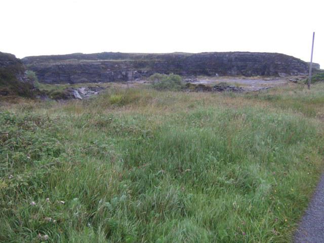 Photo could not load
R0894 : Doonagoore quarry
John M
Hill facts and local notes
Classifications
Elevation
204m
669 ft
Prominence
116m
Coordinates
52.9927, -9.3708
R080944
OS Map
51
At the Summit
The summit is crowned with a small, weathered cairn and offers a stunning panoramic view of the rolling hills and distant lakes, perfect for Instagramming your moment of glory.
Terrain & Geology
Composed largely of granite and schist, Knocknalarabana showcases the rugged geological history of the region. With its striking cliffs and weathered rock formations, the mountain offers a fantastic display of natural erosion.
Views & Scenery
From the summit, you can see the Twelve Bens range to the north, the expansive Lough Corrib, and the stunning coastal scenery of Connemara.
History & Heritage
Name Origin
The name Knocknalarabana is derived from the Irish 'Cnoc na Leabhar Bán', meaning 'hill of the white books', possibly referencing ancient manuscripts.
Historical Significance
This area holds cultural significance in Irish folklore, often associated with local legends and the ancient way of life.
Getting There & Facilities
Check current local access restrictions, parking rules and transport timetables before travelling. These notes do not confirm public access to the summit.
Parking
Ample roadside parking is available at the Maam Valley trailhead. Be sure to park responsibly and avoid blocking any farm entrances.
Public Transport
Buses run from Galway to Clifden, with connections to nearby villages. Check local schedules as services can be sparse on off-peak days.
Nearby Facilities
While there are no facilities directly on the mountain, Clifden offers a range of pubs, restaurants, and public toilets to suit your pre- or post-hike needs.
Safety Information
Known Hazards
- Watch for sudden weather changes and be cautious of the boggy patches, which can be ankle-deep if you're not careful. Stick to the paths!
General Safety Tips
- Check weather conditions before setting out
- Carry appropriate clothing and equipment
- Let someone know your planned route
- Take a map, compass, and GPS device
- Carry emergency supplies: food, water, first aid kit, torch
Hills
Some common questions about the hills answered
Are there group walks up Knocknalarabana?
Many walkers use Walkmates to join or organise walks with others. You can check for group walks around Knocknalarabana through the maps
Are there other walkers around Knocknalarabana?
Activity varies by location and time, but Walkmates lets you see whether others have shared walks or shown interest in this area. Find other people through the walking friends search walking friends for Knocknalarabana search or of course create your own walk for Knocknalarabana
Can I organise a walk to Knocknalarabana?
Yes. If there aren’t any walks listed already, you can create a walk and make it available for others to join.
If you're signed up to Walkmates, you can create a walk to Knocknalarabana.
How do I find a walk up this hill?
There are often multiple ways to walk this hill, depending on experience and route preference. Walkmates helps you explore walks and routes that others have shared.
Can I suggest a new route up Knocknalarabana?
Yes. You can suggest or create routes to share with others. Walkmates focuses on the social side of walking, so routes are used to help people organise walks and explore areas together, rather than as detailed navigation tools or route libraries.
Other uses really appreciate knowledgeable walkers sharing their routes. Share your favourite route to Knocknalarabana here
The is an error or something incorrect about this hill. How do I let you know?
We always strive to keep the information on Walkmates as accurate as possible. If you find an error, please let us know through the contact form and we'll aim to correct it as quickly as possible
Community Discussion
Comments
Location
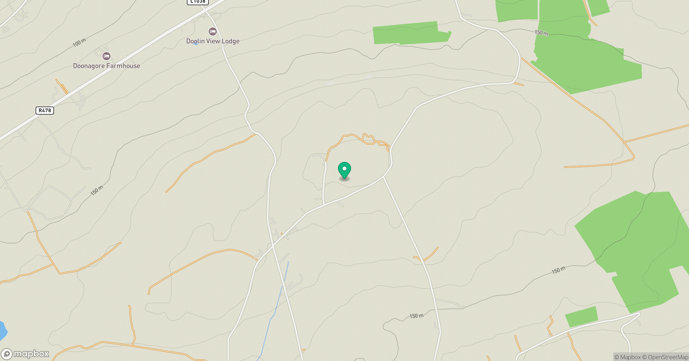
Grid reference: R080944
View on OpenStreetMapOpens a map in a new tab, centred on the hill.
Hills within 30 km
Straight-line distance, not a walking route or confirmation of access.
No comments yet. Be the first.