

Knockanes
Good walks are even better shared.
Overview
Knockanes: A Hidden Gem of County Kerry
Nestled in the rolling hills of County Kerry, Knockanes is a charming peak that offers both adventure and serenity. Standing at a respectable elevation of 279 meters, this hewitt might not be the highest around, but it certainly hosts some spectacular views that will stop you in your tracks.
Geology
The geology of Knockanes is a fascinating mix of limestone and sandstone. Its weathered faces tell stories of ancient seas and shifting landscapes. As you traverse the rocky outcrops, keep an eye out for unique karst formations that dot the hillsides, adding to the allure of this serene landscape.
Routes
The Knockanes Loop Trail is a popular choice among hikers, spanning approximately 6.5 km. Taking about 2.5 hours to complete, it's rated as moderate. You'll enjoy the scenic variety as the trail meanders through grassy slopes, rocky stretches, and even some boggy bits that remind you why hiking boots were invented in the first place!
Summit Features
At the summit, you'll find a quaint stone cairn, perfect for a leisurely break. It's the ideal spot to relish the peaceful vistas and perhaps ponder why you thought climbing a hill on a sunny day was a brilliant idea!
Terrain Type
Expect a variety of terrains on your journey, ranging from rocky outcrops to soft grassy patches. Be prepared for the occasional squelchy bog, especially after a good rain—this trail loves to keep you on your toes!
Views
The views from the top are nothing short of stunning. You’ll be treated to a sweeping panorama of nearby peaks, particularly the MacGillycuddy's Reeks, as well as Lough Leane sparkling in the distance. For the best view, try visiting in late spring or early autumn when the skies are clearer and the air is crisp.
Hazards
Like many hikes in this region, be mindful of changing weather conditions. A sunny day can swiftly turn into a soggy affair. Our advice? Always check the forecast and bring a waterproof jacket just in case.
Access
Getting to Knockanes is a cinch! There’s a small parking area available at the trailhead (R328974), but it fills up quickly on weekends. If you’re relying on public transport, bear in mind the nearest bus stop is in Killorglin, about 6 km away, so plan accordingly.
Facilities
While you won’t find any facilities at the trailhead, Killorglin, just a short drive away, boasts a variety of cafes where you can fuel up before your adventure. Don't skip that cup of coffee; you'll need it!
History
The name Knockanes originates from the Irish 'Cnocán', meaning 'little hill'. This peak has its own share of tales tied to ancient settlers and local folklore, enhancing the hiking experience with a touch of history.
In conclusion, Knockanes offers a delightful retreat for hikers of all levels. Whether you’re craving solitude or seeking to share the views with friends, this peak is well worth the trek. Happy hiking!
Explore routes near Knockanes
Public walks starting within 80 km of this hill. Nearby does not mean a route reaches the summit; check its map and access before setting out.
No public routes are currently listed within 80 km of Knockanes on Walkmates. This does not mean there are no paths here. Explore the map and check local access information before planning a walk.
Route planning notes
These notes describe possible approaches, not verified navigable routes or permission to cross land. Check current paths, local access rules and conditions before setting out.
Knockanes Loop Trail
A circular route that begins at the base and navigates through stunning scenery, taking you around the foot of Knockanes before ascending to the summit.
Make a day of it, together
Find someone to share the walk with, or organise a day out along a route you like.
Photo Gallery
View all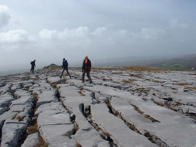 Photo could not load
R3297 : Limestone Pavement on Knockanes
Robert Bone
Hill facts and local notes
Classifications
Elevation
205m
673 ft
Prominence
120m
Coordinates
53.0234, -9.0022
R328974
OS Map
52
At the Summit
The summit boasts a modest stone cairn, providing a perfect spot to catch your breath and contemplate life’s great mysteries—or just to enjoy the view, really.
Terrain & Geology
Knockanes is primarily composed of limestone and sandstone, offering a rich narrative of geological history from its rippled strata to the weathered facets. The landscape is dotted with karst formations, typical of the area’s rich geological diversity.
Views & Scenery
From the summit, hikers can see a panoramic vista including the MacGillycuddy's Reeks and the shimmering waters of Lough Leane.
History & Heritage
Name Origin
The name 'Knockanes' likely derives from the Irish 'Cnocán', which translates to 'little hill'.
Historical Significance
The mountain holds cultural significance in local folklore, often associated with tales of the area's ancient settlers.
Getting There & Facilities
Check current local access restrictions, parking rules and transport timetables before travelling. These notes do not confirm public access to the summit.
Parking
There is a small parking area at the trailhead near R328974, accommodating around 6 vehicles.
Public Transport
Public transport options are limited; the nearest bus stop is in the village of Beaufort, approximately 6 km away.
Nearby Facilities
While there are no facilities directly at the trailhead, Killorglin has various cafes and shops where you can stock up on snacks and refreshments.
Safety Information
Known Hazards
- Be wary of sudden weather changes, especially in early spring or late autumn. Slippery rocks and unexpected bogs can keep you on your toes—literally!
General Safety Tips
- Check weather conditions before setting out
- Carry appropriate clothing and equipment
- Let someone know your planned route
- Take a map, compass, and GPS device
- Carry emergency supplies: food, water, first aid kit, torch
Hills
Some common questions about the hills answered
Are there group walks up Knockanes?
Many walkers use Walkmates to join or organise walks with others. You can check for group walks around Knockanes through the maps
Are there other walkers around Knockanes?
Activity varies by location and time, but Walkmates lets you see whether others have shared walks or shown interest in this area. Find other people through the walking friends search walking friends for Knockanes search or of course create your own walk for Knockanes
Can I organise a walk to Knockanes?
Yes. If there aren’t any walks listed already, you can create a walk and make it available for others to join.
If you're signed up to Walkmates, you can create a walk to Knockanes.
How do I find a walk up this hill?
There are often multiple ways to walk this hill, depending on experience and route preference. Walkmates helps you explore walks and routes that others have shared.
Can I suggest a new route up Knockanes?
Yes. You can suggest or create routes to share with others. Walkmates focuses on the social side of walking, so routes are used to help people organise walks and explore areas together, rather than as detailed navigation tools or route libraries.
Other uses really appreciate knowledgeable walkers sharing their routes. Share your favourite route to Knockanes here
The is an error or something incorrect about this hill. How do I let you know?
We always strive to keep the information on Walkmates as accurate as possible. If you find an error, please let us know through the contact form and we'll aim to correct it as quickly as possible
Community Discussion
Comments
Location
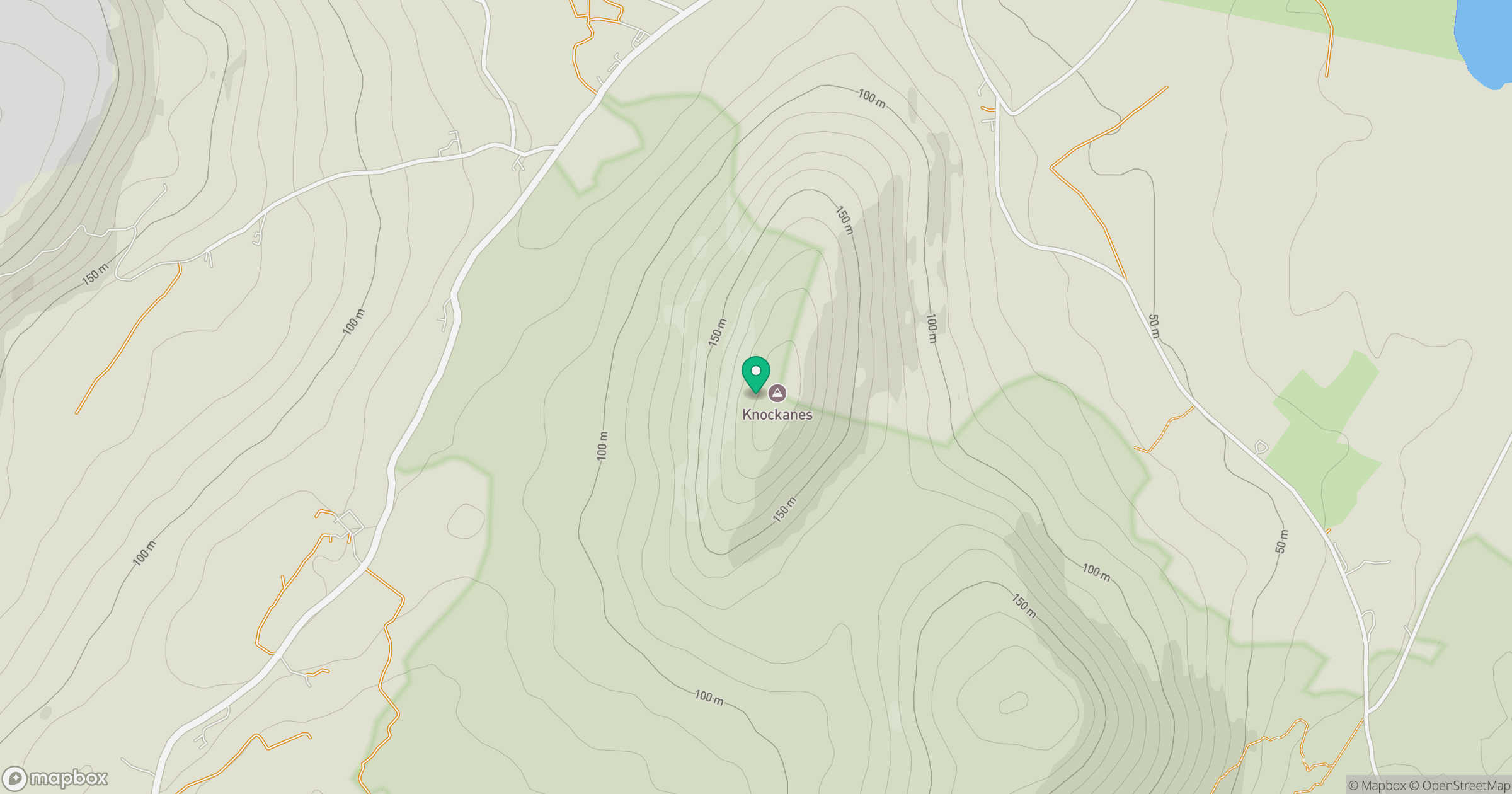
Grid reference: R328974
View on OpenStreetMapOpens a map in a new tab, centred on the hill.
Hills within 30 km
Straight-line distance, not a walking route or confirmation of access.
Slievecarran [Sliabh Cairn]
326m
Abbey Hill [Cnoc na Mainistreach]
240m
Aillwee
304m
Cloontohil
190m
Gleninagh Mountain
316m
No comments yet. Be the first.