
Clifden Hill
Good walks are even better shared.
Overview
Clifden Hill: A Hiker's Delight
Nestled in the heart of Connemara, Clifden Hill offers an idyllic escape for outdoor enthusiasts. Standing tall at 514 meters, this hill is no giant like the iconic mountains of Ireland, but what it lacks in stature, it more than makes up for in charm.
Geology
Clifden Hill is characterized by its sandstone formations that have withstood the test of time, revealing stunning rocks and boulders that beg to be photographed. You'll find that the erosion patterns create an attractive ruggedness, perfect for explorers eager to marvel at nature's craftsmanship.
Routes
There are several routes to choose from, depending on your fitness level and preference. The Coastal Road Route is particularly popular, offering remarkable sea views, while the Lough Nafooey Trail is perfect for a relaxing, family-friendly hike. Each path brings its own story and adventure.
Example Routes
- Coastal Road Route: 8.0 km, 3 hours, Moderate
- Lough Nafooey Trail: 6.5 km, 2.5 hours, Easy
Summit Features
Reaching the summit, hikers are greeted by a sturdy stone cairn and a vista that feels like a reward from the great outdoors. It’s the perfect spot for a selfie, especially for those who insist that proof is necessary!
Terrain
The hill offers an array of terrains from grassy paths catching sunbeams to rocky outcrops eager for a climber’s touch. Make sure to wear shoes that handle all terrain well – after all, a true hiker is prepared for anything!
Views
Highlights
Views from Clifden Hill are nothing short of spectacular, especially on clear days when you can gaze out at the shimmering Clifden Bay and the majestic Twelve Bens mountains.
Best Seasons
The best seasons are spring and summer, particularly in the mornings when the sunrise paints the sky and landscape with golden hues.
Hazards
As with any hike, be aware of potential hazards. Rocks can be slippery after rain, and sudden changes in weather can leave unsuspecting hikers shivering. Pack wisely and stay alert!
Nearby Summits
For those seeking further adventure, nearby summits such as Mullaghderg Mountain and Benbaun offer excellent additional hiking opportunities.
Access
Accessing Clifden Hill is quite easy. The nearest parking area can be found along the R341 road, about 3 km from Clifden. Local public transport connects Clifden to Galway, but always check the schedule, as you wouldn't want to sit around waiting!
Facilities
After an invigorating hike, pop into one of the local cafes in Clifden for a bite to eat or to answer nature's call – toilets are readily available.
History
The name Clifden translates to 'little cliff', a fitting name given the ruggedland surrounding it. The town has a rich history and has been a focal point in tourist development since the 19th century.
With all this in mind, Clifden Hill is not just a hike; it's an experience packed with beauty, history, and just the right dose of adventure! Get your boots on and enjoy the journey!
Explore routes near Clifden Hill
Public walks starting within 80 km of this hill. Nearby does not mean a route reaches the summit; check its map and access before setting out.
No public routes are currently listed within 80 km of Clifden Hill on Walkmates. This does not mean there are no paths here. Explore the map and check local access information before planning a walk.
Route planning notes
These notes describe possible approaches, not verified navigable routes or permission to cross land. Check current paths, local access rules and conditions before setting out.
Coastal Road Route
A scenic route starting from the coastal road, offering breathtaking views of Clifden Bay and the surrounding landscape.
Lough Nafooey Trail
This trail meanders along the shores of Lough Nafooey, providing a peaceful hike with lush greenery and potential wildlife spotting.
Make a day of it, together
Find someone to share the walk with, or organise a day out along a route you like.
Hill facts and local notes
Classifications
Elevation
189m
620 ft
Prominence
102m
Coordinates
52.9517, -9.1126
R252895
OS Map
57
At the Summit
The summit features a distinctive stone cairn that stands as a marker for hikers. On clear days, you'll often find fellow enthusiasts sharing stories of their adventures - just try not to start a mountain-top debate on whether biscuits or cake is better!
Terrain & Geology
Clifden Hill primarily consists of sandstone formations, which are well to be appreciated for their rugged beauty. The erosion patterns are particularly interesting, giving rise to unique rock formations and stunning panoramic views away from the 'cliff edge' - though I guarantee it’s not a cliffhanger!
Views & Scenery
From the summit, one can observe the Connemara coastline, the Twelve Bens range to the north, and the picturesque Clifden town below.
History & Heritage
Name Origin
The name Clifden is derived from the Irish 'Cloifín', meaning 'little cliff'. It’s a nod to the stunning coastal cliffs that grace this beautiful area.
Historical Significance
Historically significant as the capital of Connemara, Clifden was founded in the 19th century and is known for its role in the development of Irish tourism.
Getting There & Facilities
Check current local access restrictions, parking rules and transport timetables before travelling. These notes do not confirm public access to the summit.
Parking
There is a small parking area at the starting point along the R341 road, approximately 3 km from Clifden.
Public Transport
Clifden is served by local buses from Galway City. However, check schedules to avoid getting stuck – not that we encourage hitchhiking, unless you fancy a new adventure!
Nearby Facilities
In Clifden, you'll find various cafes, restaurants, and toilets - perfect for a pint or a bite after a long walk!
Safety Information
Known Hazards
- Slippery rocks, particularly after rain. Watch your step! Also, be cautious of sudden weather changes typical to the region.
General Safety Tips
- Check weather conditions before setting out
- Carry appropriate clothing and equipment
- Let someone know your planned route
- Take a map, compass, and GPS device
- Carry emergency supplies: food, water, first aid kit, torch
Hills
Some common questions about the hills answered
Are there group walks up Clifden Hill?
Many walkers use Walkmates to join or organise walks with others. You can check for group walks around Clifden Hill through the maps
Are there other walkers around Clifden Hill?
Activity varies by location and time, but Walkmates lets you see whether others have shared walks or shown interest in this area. Find other people through the walking friends search walking friends for Clifden Hill search or of course create your own walk for Clifden Hill
Can I organise a walk to Clifden Hill?
Yes. If there aren’t any walks listed already, you can create a walk and make it available for others to join.
If you're signed up to Walkmates, you can create a walk to Clifden Hill.
How do I find a walk up this hill?
There are often multiple ways to walk this hill, depending on experience and route preference. Walkmates helps you explore walks and routes that others have shared.
Can I suggest a new route up Clifden Hill?
Yes. You can suggest or create routes to share with others. Walkmates focuses on the social side of walking, so routes are used to help people organise walks and explore areas together, rather than as detailed navigation tools or route libraries.
Other uses really appreciate knowledgeable walkers sharing their routes. Share your favourite route to Clifden Hill here
The is an error or something incorrect about this hill. How do I let you know?
We always strive to keep the information on Walkmates as accurate as possible. If you find an error, please let us know through the contact form and we'll aim to correct it as quickly as possible
Community Discussion
Comments
Location
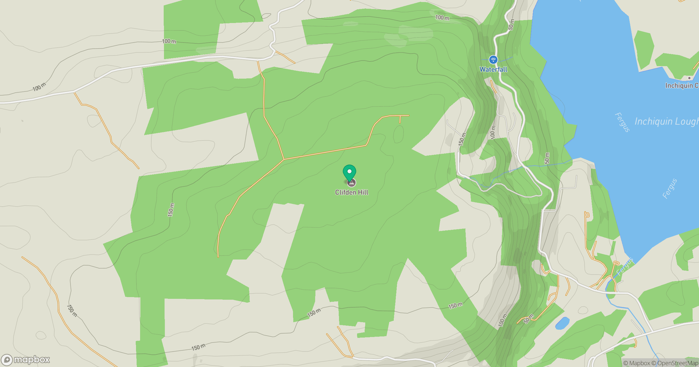
Grid reference: R252895
View on OpenStreetMapOpens a map in a new tab, centred on the hill.
Hills within 30 km
Straight-line distance, not a walking route or confirmation of access.
No comments yet. Be the first.