

Blawith Knott
Good walks are even better shared.
SD2588 : Trail bike damage, Blawith Knott
Karl and Ali Photo source
Overview
Blawith Knott: A Hidden Gem in the Lake District
Blawith Knott may not be the highest peak in the Lake District, but it sure packs a punch in terms of beauty and charm!
Geology
Comprising mainly volcanic basalt, this Marilyn is not just another hill; it's a geological marvel that unveils ancient earth processes. The rocky outcrops present a fascinating glimpse into the past and are a joy for geology enthusiasts.
Routes
The most popular route leading to Blawith Knott starts from the south, where hikers can wander through picturesque fields. This moderately challenging route offers an enjoyable climb with a few steep sections that may get the heart racing, but fret not; the summit is worth every bit of effort!
Summit Features
At the summit, you'll find a humble cairn that provides a sense of achievement akin to adding a feather to your cap. The views from up here are truly splendid, with the glistening expanse of Coniston Water providing a breathtaking backdrop.
Terrain
The terrain is a delightful mix of grassy knolls and rocky patches. Be sure to watch your step; this isn’t a stroll in the park, even if it feels like one sometimes!
Views
From the top, you’re treated to a stunning panorama that includes views of Coniston Water and nearby peaks. The best times to enjoy these vistas are during spring and autumn, when nature showcases its best colours.
Access
Parking is available along the A5084, close to the hill. However, it fills up faster than a kettle on the boil, so aim for early arrival. Bouth is the nearest public transport stop, situated a pleasant 2 km stroll away.
Facilities
Head into Ulverston for refreshments or a quick pit stop before or after your hike. Café options abound, and let’s face it, walking is a great way to justify that slice of cake!
History
The name 'Blawith' has its roots in Old Norse, associating it with the beautiful flora that once covered its slopes. Historically, this little hill has been a cherished spot for locals, providing a perfect escape for both adventurers and families alike.
Blawith Knott may be small, but it’s a big deal for anyone looking for a beautiful, manageable hike in the Lake District. So lace up your boots, bring some snacks and enjoy!
Explore routes near Blawith Knott
Walks starting near this hill. Open a route to check its map, distance and full itinerary.
Coniston to Tarn Hows: Monk Coniston Gardens and Woodland Circuit
View route
Tarn Hows Fast Route
View route
Great Carrs Halifax Wreckage from Wrynose Pass
View route
Bow Fell from Langdale
View route
Route planning notes
These notes describe possible approaches. Check a route's map and access information when planning your walk.
Blawith Knott from the South End
A well-trodden path starting from the south, meandering through scenic fields and ascending to provide a lovely view of the surrounding landscape.
Make a day of it, together
Find someone to share the walk with, or organise a day out along a route you like.
Photo Gallery
View all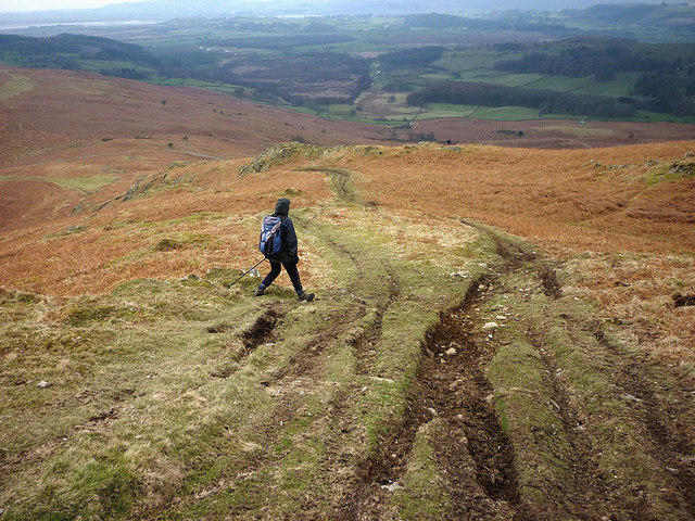 Photo could not load
SD2588 : Trail bike damage, Blawith Knott
Karl and Ali
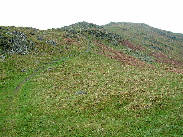 Photo could not load
SD2588 : Path up Blawith Knott
David Brown
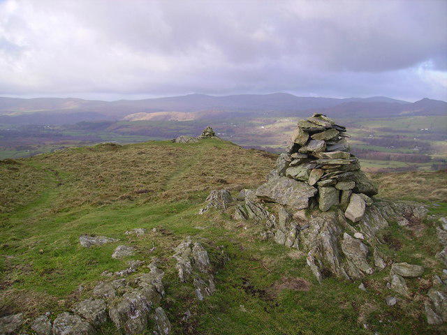 Photo could not load
SD2688 : Blawith Knott
Michael Graham
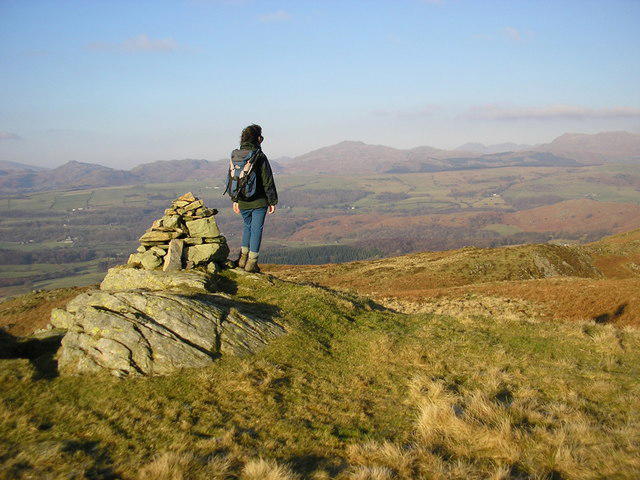 Photo could not load
SD2688 : The top of Blawith Knott (248m)
Karl and Ali
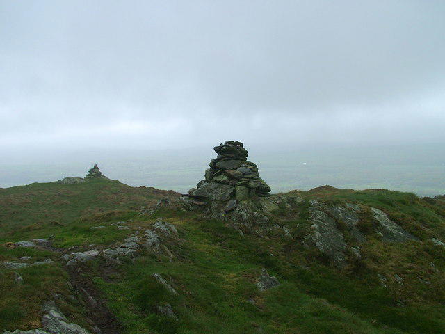 Photo could not load
SD2688 : Cairns on Blawith Knott
David Brown
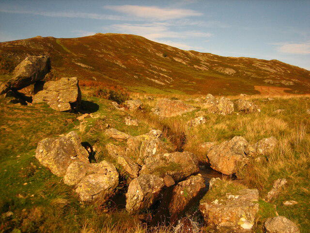 Photo could not load
SD2688 : Blawith Knott seen from Giant's Grave
Pete Walker
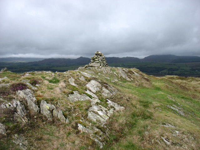 Photo could not load
SD2688 : Summit cairn on Blawith Knott
David Purchase
Hill facts and local notes
Classifications
Elevation
248m
814 ft
Prominence
89m
Coordinates
54.2858, -3.1371
SD260883
OS Map
96 97
Explorer: OL6S
At the Summit
The summit is marked by a small cairn and offers a 360-degree panoramic view, perfect for that Instagram shot (or just a nice view, if that’s your style).
Terrain & Geology
Blawith Knott is predominantly composed of volcanic rock, specifically basalt, and features rocky outcrops that tell a tale of ancient geological activity.
Views & Scenery
From the summit, you can see Coniston Water and the surrounding fells, including the peaks of Beacon Fell and the western Lake District.
History & Heritage
Name Origin
The name 'Blawith' is believed to come from Old Norse, meaning 'blue moss', hinting at the vibrant flora that may have once adorned its slopes.
Historical Significance
Blawith Knott is popular among local hikers and provides a great introduction to the Lake District’s charms, drawing both seasoned adventurers and families.
Getting There & Facilities
Parking
There is a small parking area on the A5084 near the south end of the hill, but it can fill up quickly, so arrive early!
Public Transport
Stagecoach buses serve nearby villages, with the nearest bus stop at Bouth, roughly 2 km away.
Nearby Facilities
Ulverston offers various cafes and toilets; however, amenities near the hill are limited, so plan accordingly.
Safety Information
Known Hazards
- Uneven terrain may cause slips or trips; be wary of sudden weather changes typical in the Lake District.
General Safety Tips
- Check weather conditions before setting out
- Carry appropriate clothing and equipment
- Let someone know your planned route
- Take a map, compass, and GPS device
- Carry emergency supplies: food, water, first aid kit, torch
Hills
Some common questions about the hills answered
Are there group walks up Blawith Knott?
Many walkers use Walkmates to join or organise walks with others. You can check for group walks around Blawith Knott through the maps
Are there other walkers around Blawith Knott?
Activity varies by location and time, but Walkmates lets you see whether others have shared walks or shown interest in this area. Find other people through the walking friends search walking friends for Blawith Knott search or of course create your own walk for Blawith Knott
Can I organise a walk to Blawith Knott?
Yes. If there aren’t any walks listed already, you can create a walk and make it available for others to join.
If you're signed up to Walkmates, you can create a walk to Blawith Knott.
How do I find a walk up this hill?
There are often multiple ways to walk this hill, depending on experience and route preference. Walkmates helps you explore walks and routes that others have shared.
Can I suggest a new route up Blawith Knott?
Yes. You can suggest or create routes to share with others. Walkmates focuses on the social side of walking, so routes are used to help people organise walks and explore areas together, rather than as detailed navigation tools or route libraries.
Other uses really appreciate knowledgeable walkers sharing their routes. Share your favourite route to Blawith Knott here
The is an error or something incorrect about this hill. How do I let you know?
We always strive to keep the information on Walkmates as accurate as possible. If you find an error, please let us know through the contact form and we'll aim to correct it as quickly as possible
Community Discussion
Comments
Location
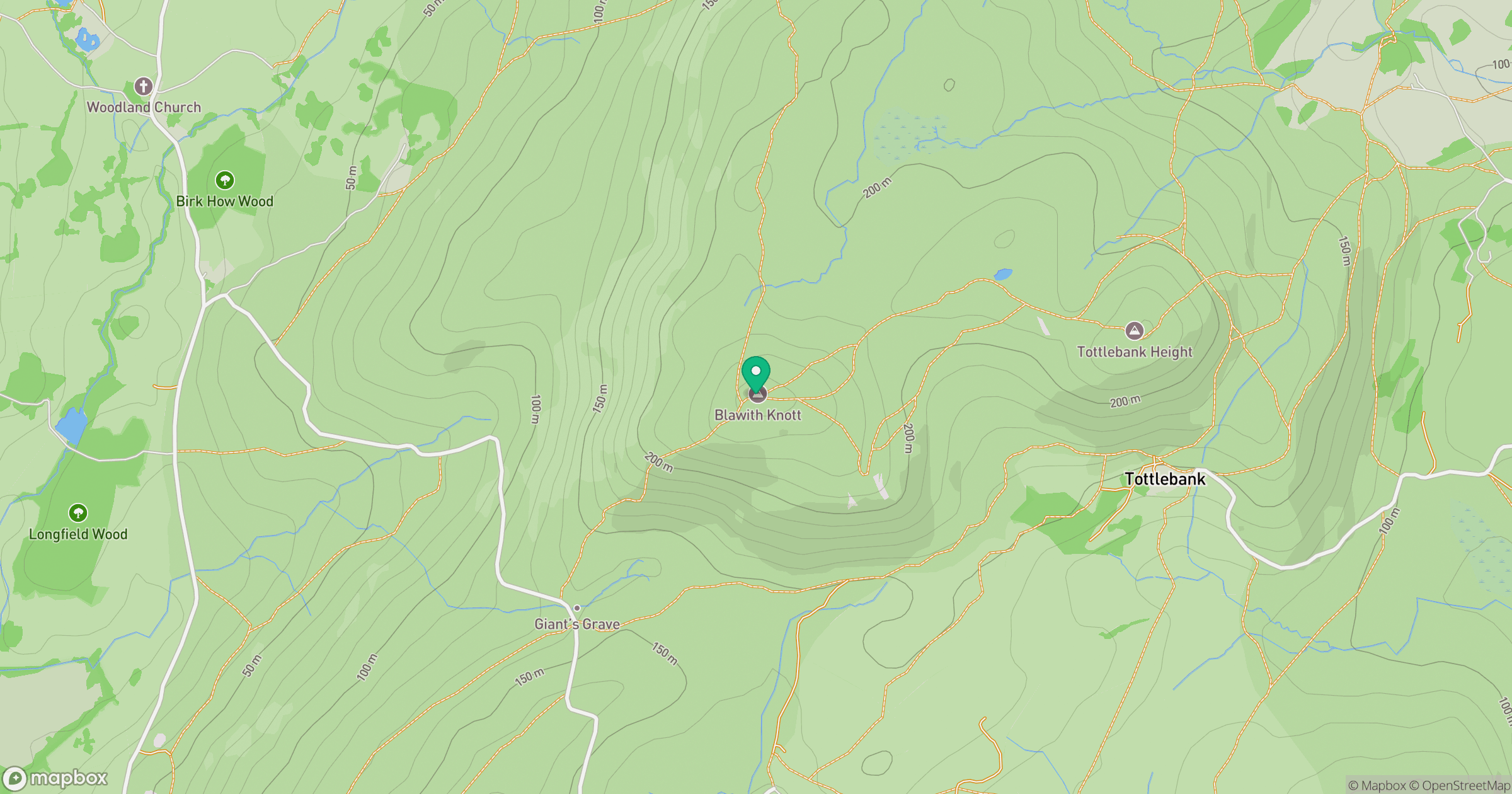
Grid reference: SD260883
View on OpenStreetMapOpens a map in a new tab, centred on the hill.
Nearby Hills
Dow Crag
778m
![The Old Man of Coniston [Coniston Old Man]](https://cdn.walkmates.com/gallery-images/0c140e91269b49abbee339fc41828d25.jpg)
The Old Man of Coniston [Coniston Old Man]
802m
Wetherlam
763m
Hard Knott
550m
Pike of Blisco
703m
No comments yet. Be the first.