

Blacklorg Hill
Good walks are even better shared.
Overview
Blacklorg Hill
Nestled in the Southern Uplands of Scotland, Blacklorg Hill stands proudly at 422 meters, offering outdoor enthusiasts a delightful escape. With a prominence of just 16 meters, this Marilyn provides a moderate challenge and fantastic views that are worth the trek.
Geology
Blacklorg Hill's geology speaks to the ancient forces that shaped the Scottish landscape. Primarily composed of sedimentary rock with some volcanic elements, this area is a textbook example of Scotland’s geological evolution. It’s a moorland paradise, with heather and grass, punctuated by rocky outcrops, making it as interesting underfoot as it is eyeful in the distance.
Routes
The most popular route is the Blacklorg Hill Trail, which begins in the village of Leadhills. It's approximately 6.5 km round trip and typically takes about 2.5 hours to complete, with moderate difficulty that suits well-prepared hikers. As you ascend, you’ll meander through lush meadows, inhaling the crisp, fresh air and perhaps a few sheep bleats for company.
Summit Features
At the summit, you’ll find a modest knob surrounded by resilient shrubs and scattered rocky formations. It might not have the grandeur of some Highland peaks, but it has charm aplenty!
Terrain Type
Expect moorland with a mixture of grassy patches and rocky outcrops. The terrain can vary from soft heather beds to slightly more rugged rocks, so good footwear is essential.
Views
The views from the summit are truly spectacular! You’ll be treated to majestic panoramas of the Southern Uplands, including the nearby Lowther Hills, as well as the Clyde Valley seen far below. Spring and summer are the best times for the most breathtaking vistas, especially when the heather blooms.
Hazards
Keep in mind that the moorland can get slippery, particularly when wet. Mist can roll in quickly, so a sense of direction and a good map are your trusty companions on this trip.
Nearby Summits
If you're feeling adventurous, consider tackling nearby peaks such as Black Hill (393 m) and Crawick Hill (352 m) to make a proper hillwalking day out of it!
Access
For those driving, parking is available just outside Leadhills, near the village hall. Use caution to avoid blocking any neighbours' drives. As for public transport, options are limited, so plan ahead if you rely on buses.
Facilities
While Blacklorg Hill itself is a pristine natural setting, Leadhills offers a cozy pub and a small shop for essential supplies. Perfect for a celebratory pint after your hike!
History
The intriguing name 'Blacklorg' reflects its Scottish Gaelic roots, suggesting the local cultural history intertwined with the land. Furthermore, this area was once bustling with lead mining, adding a layer of rich historical significance to your adventure.
So whether you’re a seasoned hiker or just looking to stretch your legs, Blacklorg Hill presents itself as a splendid destination. Lace up those boots and hit the trails!
Conclusion
In conclusion, Blacklorg Hill is a gem in Scotland's outdoor crown, waiting to be explored by hikers from all walks of life. Don’t forget your camera, as the views promise to be Instagram-worthy!
Happy hiking!
Explore routes near Blacklorg Hill
Public walks starting within 80 km of this hill. Nearby does not mean a route reaches the summit; check its map and access before setting out.
Carrick Forest Drive: Stinchar Bridge to Loch Doon
View route
Forest of Ae Water of Ae Riverside Trail
View route
Loch Trool: Full Loch and Oak Woodland Circuit
View route
Glentrool Water of Trool and Spout Head Trail
View route
Route planning notes
These notes describe possible approaches, not verified navigable routes or permission to cross land. Check current paths, local access rules and conditions before setting out.
Blacklorg Hill Trail
A scenic ascent starting from the village of Leadhills, winding through lush meadows and heather-clad slopes.
Make a day of it, together
Find someone to share the walk with, or organise a day out along a route you like.
Photo Gallery
View all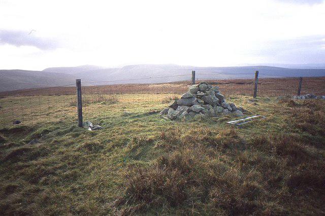 Photo could not load
NS6504 : Summit cairn, Blacklorg Hill
Richard Webb
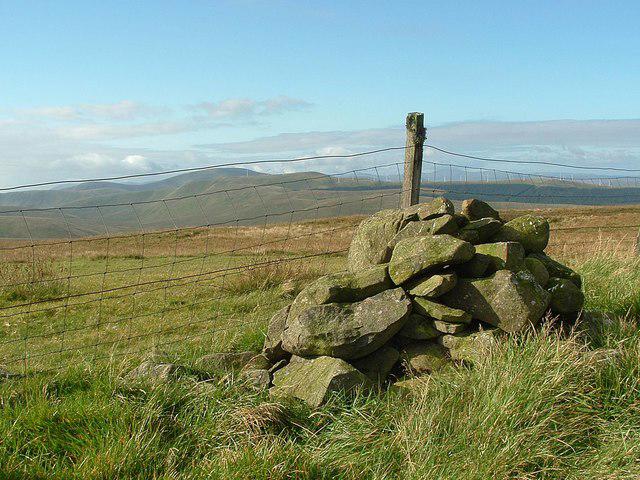 Photo could not load
NS6504 : Blacklorg Hill (summit cairn)
Raibeart MacAoidh
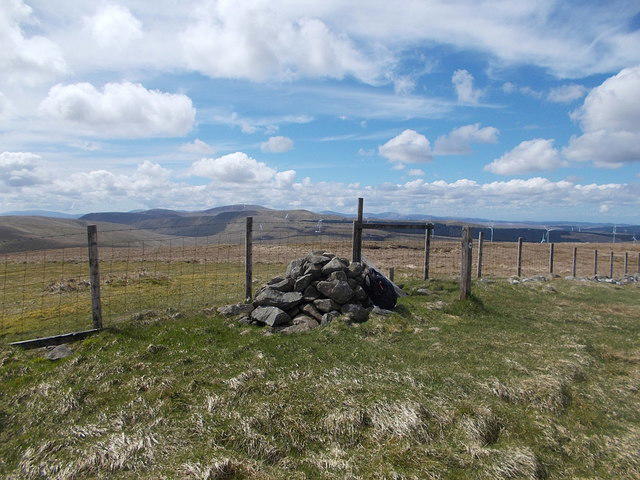 Photo could not load
NS6504 : Summit of Blacklorg Hill
Iain Russell
Hill facts and local notes
Classifications
Elevation
681m
2,234 ft
Prominence
148m
Coordinates
55.3138, -4.1226
NS653042
OS Map
77
Explorer: 328S
At the Summit
The summit is crowned with a modest leafy knob, surrounded by a small number of rocky outcrops and a few resilient shrubs that have taken root in the harsh conditions.
Terrain & Geology
Predominantly composed of sedimentary rock, with some areas exhibiting volcanic intrusion, Blacklorg Hill offers insights into the geological history of the region, characterized by rolling hills and moorland.
Views & Scenery
From the top, one can enjoy sweeping vistas of the Southern Uplands, the nearby hills of the Lowther Hills, and a glimpse of the picturesque Clyde Valley.
History & Heritage
Name Origin
The name 'Blacklorg' is believed to derive from the Scottish Gaelic 'black' (dubh) and 'lorg', meaning 'trace' or 'track'.
Historical Significance
Historically significant as part of the mining district, Leadhills was known for its lead mining in the 18th and 19th centuries.
Getting There & Facilities
Check current local access restrictions, parking rules and transport timetables before travelling. These notes do not confirm public access to the summit.
Parking
Parking is available at the outskirts of Leadhills, near the village hall. Be respectful and avoid blocking private drives.
Public Transport
Limited public transport options; the nearest bus service operates from Biggar to Leadhills. Check local schedules.
Nearby Facilities
There are no facilities directly on the hill, but Leadhills offers a quaint pub and a small shop for essentials.
Safety Information
Known Hazards
- Moorland conditions can lead to tricky footing, especially when wet. Pay attention to changing weather, as fog can roll in quickly.
General Safety Tips
- Check weather conditions before setting out
- Carry appropriate clothing and equipment
- Let someone know your planned route
- Take a map, compass, and GPS device
- Carry emergency supplies: food, water, first aid kit, torch
Hills
Some common questions about the hills answered
Are there group walks up Blacklorg Hill?
Many walkers use Walkmates to join or organise walks with others. You can check for group walks around Blacklorg Hill through the maps
Are there other walkers around Blacklorg Hill?
Activity varies by location and time, but Walkmates lets you see whether others have shared walks or shown interest in this area. Find other people through the walking friends search walking friends for Blacklorg Hill search or of course create your own walk for Blacklorg Hill
Can I organise a walk to Blacklorg Hill?
Yes. If there aren’t any walks listed already, you can create a walk and make it available for others to join.
If you're signed up to Walkmates, you can create a walk to Blacklorg Hill.
How do I find a walk up this hill?
There are often multiple ways to walk this hill, depending on experience and route preference. Walkmates helps you explore walks and routes that others have shared.
Can I suggest a new route up Blacklorg Hill?
Yes. You can suggest or create routes to share with others. Walkmates focuses on the social side of walking, so routes are used to help people organise walks and explore areas together, rather than as detailed navigation tools or route libraries.
Other uses really appreciate knowledgeable walkers sharing their routes. Share your favourite route to Blacklorg Hill here
The is an error or something incorrect about this hill. How do I let you know?
We always strive to keep the information on Walkmates as accurate as possible. If you find an error, please let us know through the contact form and we'll aim to correct it as quickly as possible
Community Discussion
Comments
Location
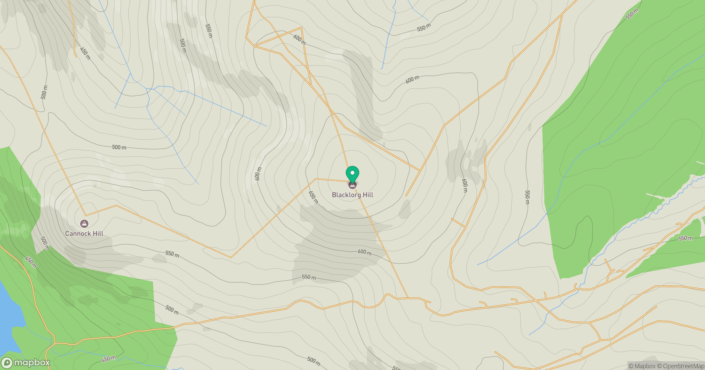
Grid reference: NS653042
View on OpenStreetMapOpens a map in a new tab, centred on the hill.
Hills within 30 km
Straight-line distance, not a walking route or confirmation of access.
No comments yet. Be the first.