

Cocker Hill
Good walks are even better shared.
Overview
Cocker Hill
Overview
Cocker Hill, rising gracefully to 325 meters, is not the highest but certainly one of the most delightful Marilyns in the Cumbrian Mountains. Nestled conveniently near Sedbergh, it offers an accessible escape for walkers of all abilities.
Geology
The hill is primarily made up of layers of sandstone and shale, a reminder of the time when these lands were likely seafloors. Not only is it beautiful, but it’s also a stunning example of the region's ever-changing geological narrative.
Hiking Routes
The popular Cocker Hill Circuit presents a moderate challenge, with a round trip of approximately 7.5 km. You’ll find the journey quite manageable, even bringing a sense of satisfaction as you hit that summit. The initial parts of the walk guide you through lush meadows where a medley of flora and possibly some sheep can be observed.
Summit Features
Reaching the summit, you'll encounter a classic cairn, a perfect photo op or spot to have a picnic—after all, nothing says ‘summit success’ like munching on sandwiches with a view!
Terrain
Expect a combination of grassy fields and some rocky sections, adding a bit of character to the hike. Footwear with a decent grip is advised, especially if you're bringing friends who's more suited for the pub than peak-bagging!
Views
From the top, the vistas are stunning. On clear days, you can behold the Howgill Fells and the impressive peaks of the Lake District. Don’t forget your camera; memories and photographs last longer than most hikes! The best time to capture these sights is during late spring, when the landscape is alive with colours.
Hazards
It’s friendly territory mostly, but do keep an eye out for the occasional sheep and slippery pathways, especially after a good rain. They might not have a 5-star rating on their navigation skills!
Nearby Summits
If you're feeling ambitious, nearby summits like Calder High and Winder await your adventurous spirit.
Access
Sedbergh serves as the best base for your adventures—ample parking facilities are available, and the town itself boasts charming little cafes to fill up on energy.
Facilities
Post-hike, you can refresh in one of the local cafes or use public toilets found in town.
History
The name 'Cocker' resonates with local history tied to the natural world, giving a nod to the local rivers or avian inhabitants.
In conclusion, Cocker Hill is a fantastic destination that won’t require you to climb Everest to feel accomplished! So, grab your hiking boots, maybe a snack (or two), and enjoy your time in this beautiful part of the Cumbrian landscape.
Explore routes near Cocker Hill
Public walks starting within 80 km of this hill. Nearby does not mean a route reaches the summit; check its map and access before setting out.
Forest of Ae Water of Ae Riverside Trail
View route
Moffat Gallow Hill Woodland and Viewpoint Circuit
View route
Carrick Forest Drive: Stinchar Bridge to Loch Doon
View route
Motherwell: Strathclyde Loch full shoreline circuit
View route
Route planning notes
These notes describe possible approaches, not verified navigable routes or permission to cross land. Check current paths, local access rules and conditions before setting out.
Cocker Hill Circuit
A scenic loop starting from the quaint village of Sedbergh, taking you through lush fields and gentle inclines before reaching the summit.
Make a day of it, together
Find someone to share the walk with, or organise a day out along a route you like.
Photo Gallery
View all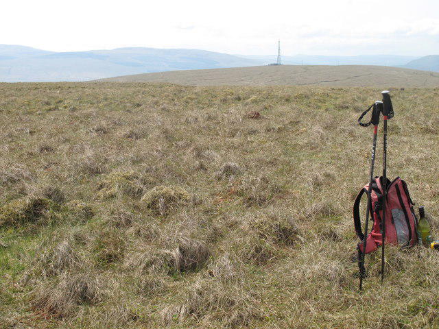 Photo could not load
NS7515 : Cocker Hill
Rude Health
Hill facts and local notes
Classifications
Elevation
503m
1,650 ft
Prominence
118m
Coordinates
55.4167, -3.9639
NS757153
OS Map
71 78
Explorer: 328N
At the Summit
The summit features a modest cairn, which can be a perfect spot for a well-deserved breather, possibly while contemplating why we thought hiking was a good idea!
Terrain & Geology
Primarily composed of sandstone and shale, Cocker Hill showcases the fascinating geological history of the region, with layers that have been shaped by time and weather.
Views & Scenery
On a clear day, you can see the sprawling Howgill Fells to the south, as well as the distant peaks of the Lake District, including the infamous Scafell Pike.
History & Heritage
Name Origin
The name 'Cocker' is believed to derive from an old term for a local river or the word for a male bird; it's related to the vibrant wildlife that inhabits the region.
Historical Significance
Cocker Hill has historical importance as a point of interest for hikers and local tourists, contributing to the overall charm of Sedbergh and surrounding areas.
Getting There & Facilities
Check current local access restrictions, parking rules and transport timetables before travelling. These notes do not confirm public access to the summit.
Parking
There is parking available near Sedbergh, a lovely little town with ample spots, perfect for staging your jaunt up Cocker Hill.
Public Transport
Sedbergh is serviced by a few local bus routes; however, it's best to check the schedules ahead of time for availability.
Nearby Facilities
In Sedbergh, you can find cafes for a pre- or post-hike treat, and public toilets to freshen up before heading out on the trails.
Safety Information
Known Hazards
- Watch out for the occasional sheep – they’re not shy and can be quite the roadblock! Slippery paths in wet conditions can also pose a challenge.
General Safety Tips
- Check weather conditions before setting out
- Carry appropriate clothing and equipment
- Let someone know your planned route
- Take a map, compass, and GPS device
- Carry emergency supplies: food, water, first aid kit, torch
Hills
Some common questions about the hills answered
Are there group walks up Cocker Hill?
Many walkers use Walkmates to join or organise walks with others. You can check for group walks around Cocker Hill through the maps
Are there other walkers around Cocker Hill?
Activity varies by location and time, but Walkmates lets you see whether others have shared walks or shown interest in this area. Find other people through the walking friends search walking friends for Cocker Hill search or of course create your own walk for Cocker Hill
Can I organise a walk to Cocker Hill?
Yes. If there aren’t any walks listed already, you can create a walk and make it available for others to join.
If you're signed up to Walkmates, you can create a walk to Cocker Hill.
How do I find a walk up this hill?
There are often multiple ways to walk this hill, depending on experience and route preference. Walkmates helps you explore walks and routes that others have shared.
Can I suggest a new route up Cocker Hill?
Yes. You can suggest or create routes to share with others. Walkmates focuses on the social side of walking, so routes are used to help people organise walks and explore areas together, rather than as detailed navigation tools or route libraries.
Other uses really appreciate knowledgeable walkers sharing their routes. Share your favourite route to Cocker Hill here
The is an error or something incorrect about this hill. How do I let you know?
We always strive to keep the information on Walkmates as accurate as possible. If you find an error, please let us know through the contact form and we'll aim to correct it as quickly as possible
Community Discussion
Comments
Location
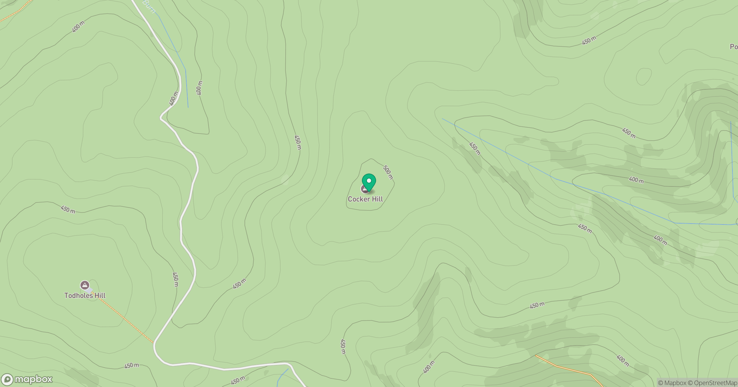
Grid reference: NS757153
View on OpenStreetMapOpens a map in a new tab, centred on the hill.
Hills within 30 km
Straight-line distance, not a walking route or confirmation of access.

No comments yet. Be the first.