

Benachally
Good walks are even better shared.
Overview
Benachally: A Walk on the Wild Side
Introduction
Benachally is a charming Marilyn located in Central Scotland, reaching an impressive height of 344 meters. This mountain, while not the tallest, offers a delightful day out for hikers seeking a breath of fresh air and stunning vistas.
Geology
Primarily composed of volcanic rock, Benachally showcases a fascinating blend of basalt and andesite. As you hike, you might find yourself intrigued by the rugged cliffs and the smooth slopes shaped by the elements over millennia.
Routes
The Benachally Trail is the most popular route and is characterised by its well-maintained pathway. Starting from the parking area, the journey meanders through picturesque woodlands before ascending to the summit. Spanning approximately 4.5 km, expect a moderate challenge that can be pleasantly tackled in about 1.5 hours.
Summit Features
As you crest the top, you'll be greeted by a modest but sturdy stone cairn that beckons you to rest a while. Sitting back and soaking in the 360-degree views of the lush landscape is a must—after all, you’ve earned it!
Terrain
The terrain is a delightful mix of soft grass interspersed with rocky patches, topped off with vibrant heather in bloom. Just a word of caution: the path can be slippery after rain, so tread with care to avoid a comical tumble.
Views
The vista from Benachally is nothing short of spectacular. You can catch sight of the River Tay sparkling in the distance and the rolling hills of the Grampians beyond. Springtime means blossoms, while Autumn treats you to a tapestry of colours—perfect for capturing Instagram-worthy snaps!
Hazards
While not overly dangerous, navigating Benachally requires some awareness, especially in foggy conditions where paths can disappear like your motivation at 6 AM. Be cautious of mud after rain, as it can be quite deceptive.
Nearby Summits
Benachally isn’t alone in its majesty; nearby are Moncreiffe Hill (221 meters) and Kinnoull Hill (235 meters). If you’re feeling adventurous, why not tick them all off in one glorious hike?
Access
Parking at NO060490 is limited but nearby facilities in Perth offer a plethora of options for food and toilet breaks before and after your adventure. Public transport lovers can catch a bus to areas close by, followed by a short walk.
Conclusion
Benachally is a gem waiting to be discovered by hikers of all skill levels. Whether you are in it for the views, the fresh air, or the enjoyment of nature, this mountain offers a delightful escape from the hustle and bustle of everyday life. So lace up those boots and get going—adventure awaits!
Explore routes near Benachally
Public walks starting within 80 km of this hill. Nearby does not mean a route reaches the summit; check its map and access before setting out.
Unled club outing: Glenesk (coach departure)
View route
Unled club outing: Xmas Walk - Bankfoot - Dunkeld (coach departure)
View route
Unled club outing: Angus coastal walk (coach departure)
View route
Unled club outing: Glen Moy/Glenogil (shared-car departure)
View route
Route planning notes
These notes describe possible approaches, not verified navigable routes or permission to cross land. Check current paths, local access rules and conditions before setting out.
Benachally Trail
A well-defined path leading from the initial car park winding through woodlands before tackling the upper slopes.
Make a day of it, together
Find someone to share the walk with, or organise a day out along a route you like.
Photo Gallery
View all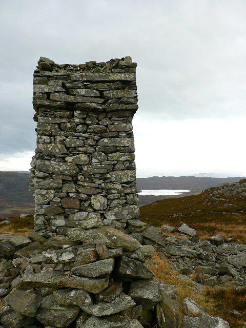 Photo could not load
NO0648 : Benachally Monument
Rob Burke
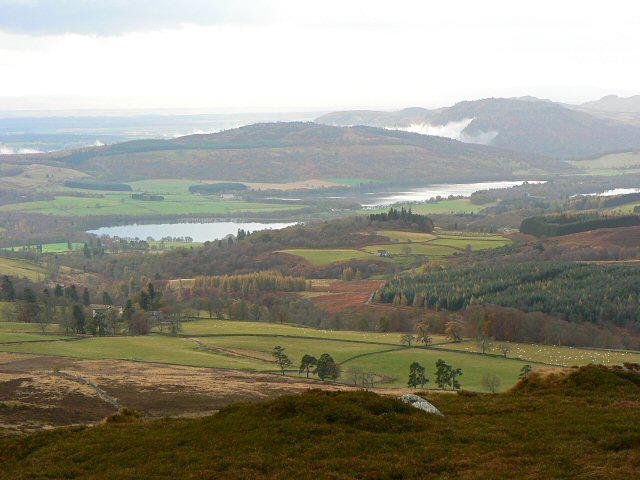 Photo could not load
NO0648 : View from Benachally Monument
Rob Burke
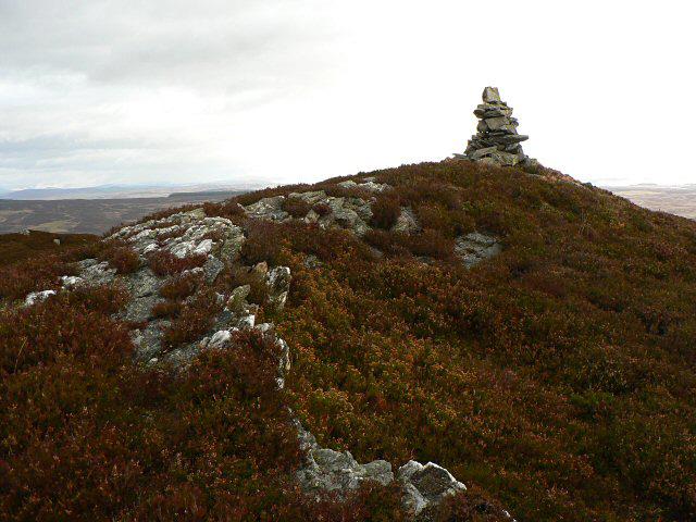 Photo could not load
NO0649 : Cairn on Benachally
Rob Burke
Hill facts and local notes
Classifications
Elevation
487m
1,598 ft
Prominence
117m
Coordinates
56.6250, -3.5241
NO065491
OS Map
52 53
Explorer: 379E
At the Summit
The summit boasts a small stone cairn and a stunning panoramic view of the surrounding forestry and hills, making it a perfect spot for a scenic pit stop.
Terrain & Geology
Benachally is primarily composed of volcanic rock, featuring a mix of basalt and andesite. The mountain's rugged terrain has eroded into distinct cliffs and slopes, providing an interesting study for geology enthusiasts.
Views & Scenery
From the summit, climbers can enjoy breathtaking views of the River Tay, Perth, and the distant hills of the Grampians.
History & Heritage
Name Origin
The name 'Benachally' derives from the Gaelic 'Beinn a' Challa', meaning 'mountain of the stone'.
Historical Significance
The mountain has been a favourite for local walkers for centuries, serving as both a training ground for climbers and a peaceful retreat for nature lovers.
Getting There & Facilities
Check current local access restrictions, parking rules and transport timetables before travelling. These notes do not confirm public access to the summit.
Parking
There is a small car park located at NO060490, which accommodates about 10 vehicles. It's best to arrive early during weekends.
Public Transport
Regular bus services operate from Perth to nearby locations, with a short walk required to reach the start of the trail.
Nearby Facilities
The nearest facilities are located in Perth, where you can find numerous cafes and public toilets.
Safety Information
Known Hazards
- Careful navigation is needed in misty conditions as paths can become indistinct; be wary of muddy areas after rainfall.
General Safety Tips
- Check weather conditions before setting out
- Carry appropriate clothing and equipment
- Let someone know your planned route
- Take a map, compass, and GPS device
- Carry emergency supplies: food, water, first aid kit, torch
Hills
Some common questions about the hills answered
Are there group walks up Benachally?
Many walkers use Walkmates to join or organise walks with others. You can check for group walks around Benachally through the maps
Are there other walkers around Benachally?
Activity varies by location and time, but Walkmates lets you see whether others have shared walks or shown interest in this area. Find other people through the walking friends search walking friends for Benachally search or of course create your own walk for Benachally
Can I organise a walk to Benachally?
Yes. If there aren’t any walks listed already, you can create a walk and make it available for others to join.
If you're signed up to Walkmates, you can create a walk to Benachally.
How do I find a walk up this hill?
There are often multiple ways to walk this hill, depending on experience and route preference. Walkmates helps you explore walks and routes that others have shared.
Can I suggest a new route up Benachally?
Yes. You can suggest or create routes to share with others. Walkmates focuses on the social side of walking, so routes are used to help people organise walks and explore areas together, rather than as detailed navigation tools or route libraries.
Other uses really appreciate knowledgeable walkers sharing their routes. Share your favourite route to Benachally here
The is an error or something incorrect about this hill. How do I let you know?
We always strive to keep the information on Walkmates as accurate as possible. If you find an error, please let us know through the contact form and we'll aim to correct it as quickly as possible
Community Discussion
Comments
Location
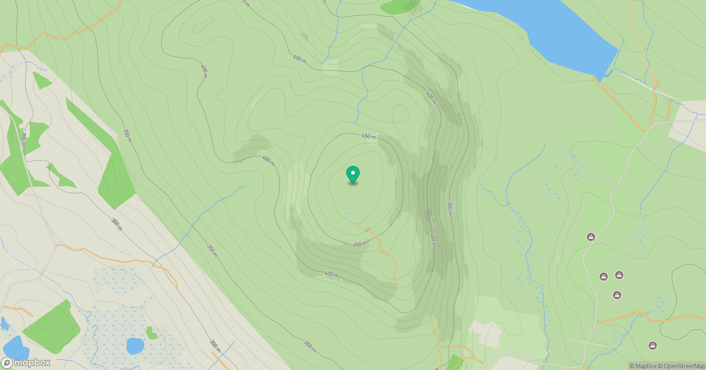
Grid reference: NO065491
View on OpenStreetMapOpens a map in a new tab, centred on the hill.
Hills within 30 km
Straight-line distance, not a walking route or confirmation of access.
Beinn a' Ghlo - Carn nan Gabhar
1,122m
Beinn a' Ghlo - Carn Liath
976m
Beinn a' Ghlo - Braigh Coire Chruinn-bhalgain
1,070m
Deuchary Hill
511m
Creag nam Mial
562m
No comments yet. Be the first.