

Deuchary Hill
Good walks are even better shared.
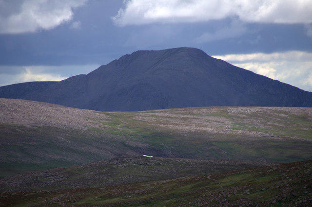
NO0348 : Deuchary Hill from the summit of Garlet
Gordon Brown Photo source
Overview
Deuchary Hill
Deuchary Hill, standing proudly at an elevation of 586 meters, is a Marilyn located in the heart of Central Scotland. With its stunning vistas and rich geological features, it is a favourite among walkers and nature enthusiasts alike.
Geology
This hill is primarily composed of sandstone and conglomerate, which date back to ancient geological eras. Explorers can marvel at the colourful rock formations and perhaps even stumble upon fossilised remains from a time when Scotland was a hotbed of biodiversity.
Routes
Old Military Road Route
For those seeking a moderate hike, the Old Military Road Route offers about 5.6 km of delightful scenery, ideal for those looking to stretch their legs and enjoy the great outdoors. Expect to take around 2.5 hours to reach the summit, with stunning views along the way.
Glen Turret Route
Families and casual walkers may prefer the Glen Turret Route, which is approximately 4.2 km and takes roughly 2 hours. This leisurely path gently winds up through serene landscapes, making it accessible for all ages.
Summit Features
As you reach the summit of Deuchary Hill, you'll be greeted by a sturdy trig point perfect for photos and a delightful stone cairn. It’s a prime spot for soaking in the breathtaking surroundings.
Terrain
The terrain varies between grassy fields and rocky outcrops, with the occasional boggy area for added adventure. Be sure to wear sturdy hiking boots to keep those feet happy!
Views
The views from the top are nothing short of spectacular. With a 360-degree panorama, you’ll see the charming Perthshire landscape stretching out beneath you, alongside distant hills like Ben Vorlich. Spring and early summer are the best times to experience these breathtaking views, as the landscape comes alive with colours.
Hazards
Keep an eye out for uneven ground and boggy sections, especially after a rain shower. Weather can be fickle in Scotland, so always be prepared!
Nearby Summits
If you're feeling inspired for more adventures, nearby summits like Ben Chonzie and Monadhliath offer additional climbing opportunities!
Access and Facilities
Parking is available at a small area along the A85 road near the start of the Old Military Road. Crieff, the nearest town, provides all the amenities you might need before or after your hike, including cafes and public toilets.
History
The name Deuchary Hill refers to ancient Gaelic roots, indicating its historical significance as a landmark for local populations.
In summary, Deuchary Hill offers an excellent hiking experience complete with natural beauty, fascinating geology, and a bit of local history. Lace up your boots, pack your gear, and get ready for an adventure that’s bound to create lasting memories!
Explore routes near Deuchary Hill
Walks starting near this hill. Open a route to check its map, distance and full itinerary.
Unled club outing: West Drumochter/Beinn Udlamain (coach departure)
View route
Unled club outing: Glenesk (coach departure)
View route
Unled club outing: Xmas Walk - Bankfoot - Dunkeld (coach departure)
View route
Unled club outing: Angus coastal walk (coach departure)
View route
Route planning notes
These notes describe possible approaches. Check a route's map and access information when planning your walk.
Old Military Road Route
A scenic path starting from the Old Military Road that winds its way up through heather-clad slopes to the summit.
Glen Turret Route
This route follows the Glen Turret for a leisurely approach, with gentle climbs leading to the summit, perfect for families.
Make a day of it, together
Find someone to share the walk with, or organise a day out along a route you like.
Photo Gallery
View all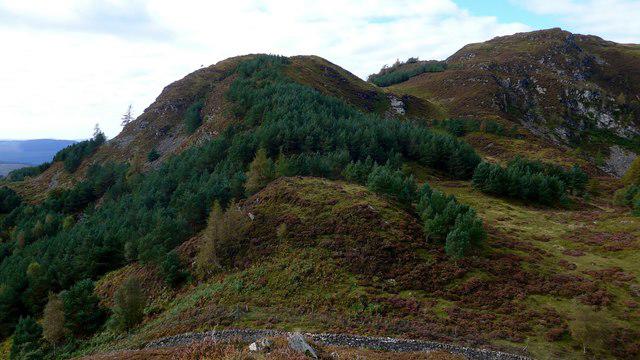 Photo could not load
NO0348 : Deuchary Hill from the summit of Garlet
Gordon Brown
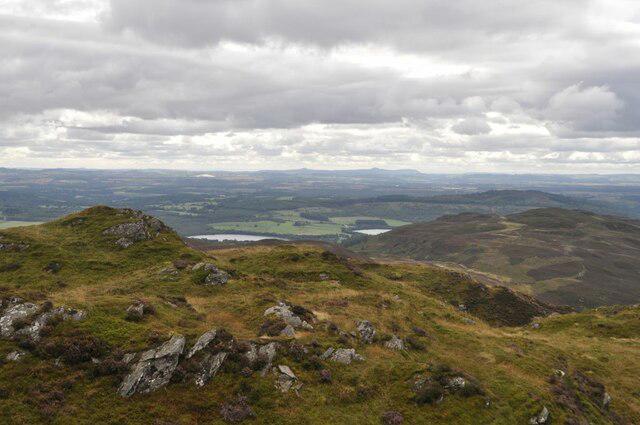 Photo could not load
NO0348 : Deuchary Hill Summit
Robert Struthers
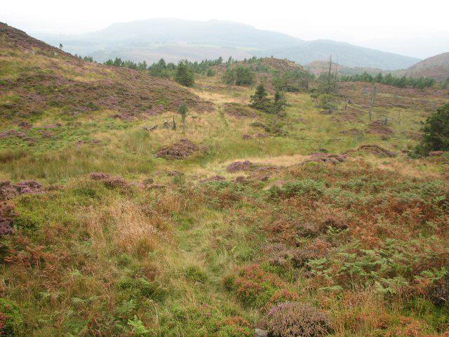 Photo could not load
NO0348 : Deuchary Hill
Callum Black
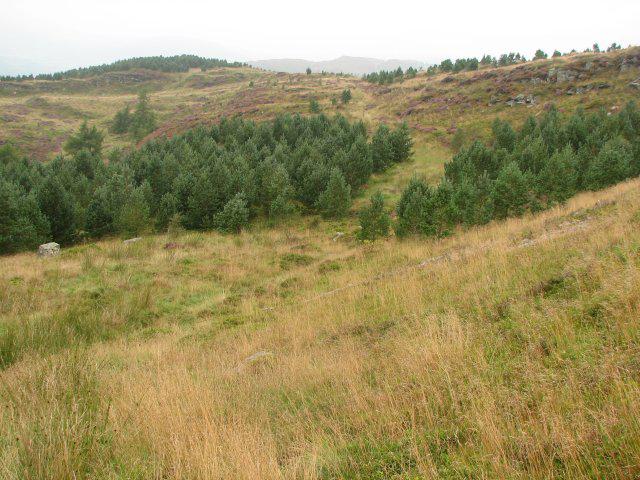 Photo could not load
NO0348 : Deuchary Hill
Callum Black
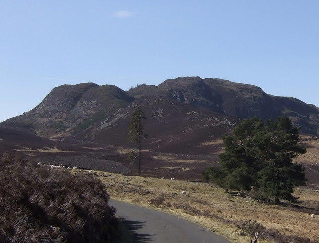 Photo could not load
NO0348 : Deuchary Hill
John McMillan
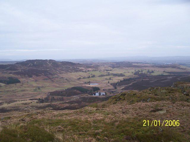 Photo could not load
NO0348 : View towards Dubh Loch
Karl Peet
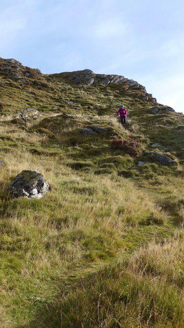 Photo could not load
NO0348 : Path on the west side of Deuchary Hill
Gordon Brown
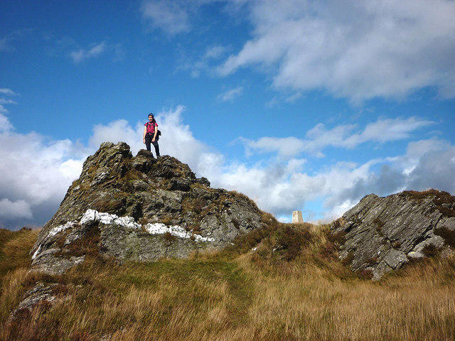 Photo could not load
NO0348 : Summit rocks, Deuchary Hill
Karl and Ali
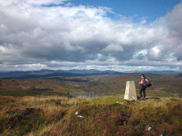 Photo could not load
NO0348 : North from Deuchary Hill (510m)
Karl and Ali
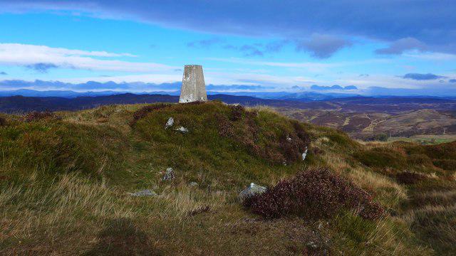
NO0348 : The trig on Deuchary Hill
Gordon Brown
Hill facts and local notes
Classifications
Elevation
511m
1,677 ft
Prominence
220m
Coordinates
56.6186, -3.5703
NO037485
OS Map
52 53
Explorer: 379E
At the Summit
The summit features a prominent trig point which offers a perfect backdrop for those all-important summit selfies and a small stone cairn marking the peak.
Terrain & Geology
Deuchary Hill is predominantly composed of sandstone and conglomerate, part of the Old Red Sandstone formations which are known for their vibrant colours and fossil-rich layers. The rocky outcrops provide a glimpse into geological history dating back to the Devonian period.
Views & Scenery
From the summit, you can enjoy panoramic views over the stunning Perthshire countryside, with Crieff and the Highland hills as are your companions. On a clear day, you may catch a glimpse of Ben Vorlich in the distance.
History & Heritage
Name Origin
The name 'Deuchary' is derived from the Gaelic 'Deoch an Ria', meaning 'drink of the river', possibly referring to the nearby water bodies.
Historical Significance
Deuchary Hill is significant in local history, providing a vital point of orientation for ancient travellers in the region.
Getting There & Facilities
Parking
There is a small parking area along the A85 road near the Old Military Road. It can accommodate about 5-6 cars, so arrive early to secure a spot.
Public Transport
The nearest bus service runs from Crieff. Check local schedules for the 'Crieff to Perth' route.
Nearby Facilities
While no facilities are directly on Deuchary Hill, Crieff offers lovely cafes, pubs, and public toilets.
Safety Information
Known Hazards
- Beware of uneven terrain and occasional boggy patches. Weather can change rapidly; be prepared for all seasons.
General Safety Tips
- Check weather conditions before setting out
- Carry appropriate clothing and equipment
- Let someone know your planned route
- Take a map, compass, and GPS device
- Carry emergency supplies: food, water, first aid kit, torch
Hills
Some common questions about the hills answered
Are there group walks up Deuchary Hill?
Many walkers use Walkmates to join or organise walks with others. You can check for group walks around Deuchary Hill through the maps
Are there other walkers around Deuchary Hill?
Activity varies by location and time, but Walkmates lets you see whether others have shared walks or shown interest in this area. Find other people through the walking friends search walking friends for Deuchary Hill search or of course create your own walk for Deuchary Hill
Can I organise a walk to Deuchary Hill?
Yes. If there aren’t any walks listed already, you can create a walk and make it available for others to join.
If you're signed up to Walkmates, you can create a walk to Deuchary Hill.
How do I find a walk up this hill?
There are often multiple ways to walk this hill, depending on experience and route preference. Walkmates helps you explore walks and routes that others have shared.
Can I suggest a new route up Deuchary Hill?
Yes. You can suggest or create routes to share with others. Walkmates focuses on the social side of walking, so routes are used to help people organise walks and explore areas together, rather than as detailed navigation tools or route libraries.
Other uses really appreciate knowledgeable walkers sharing their routes. Share your favourite route to Deuchary Hill here
The is an error or something incorrect about this hill. How do I let you know?
We always strive to keep the information on Walkmates as accurate as possible. If you find an error, please let us know through the contact form and we'll aim to correct it as quickly as possible
Community Discussion
Comments
Location
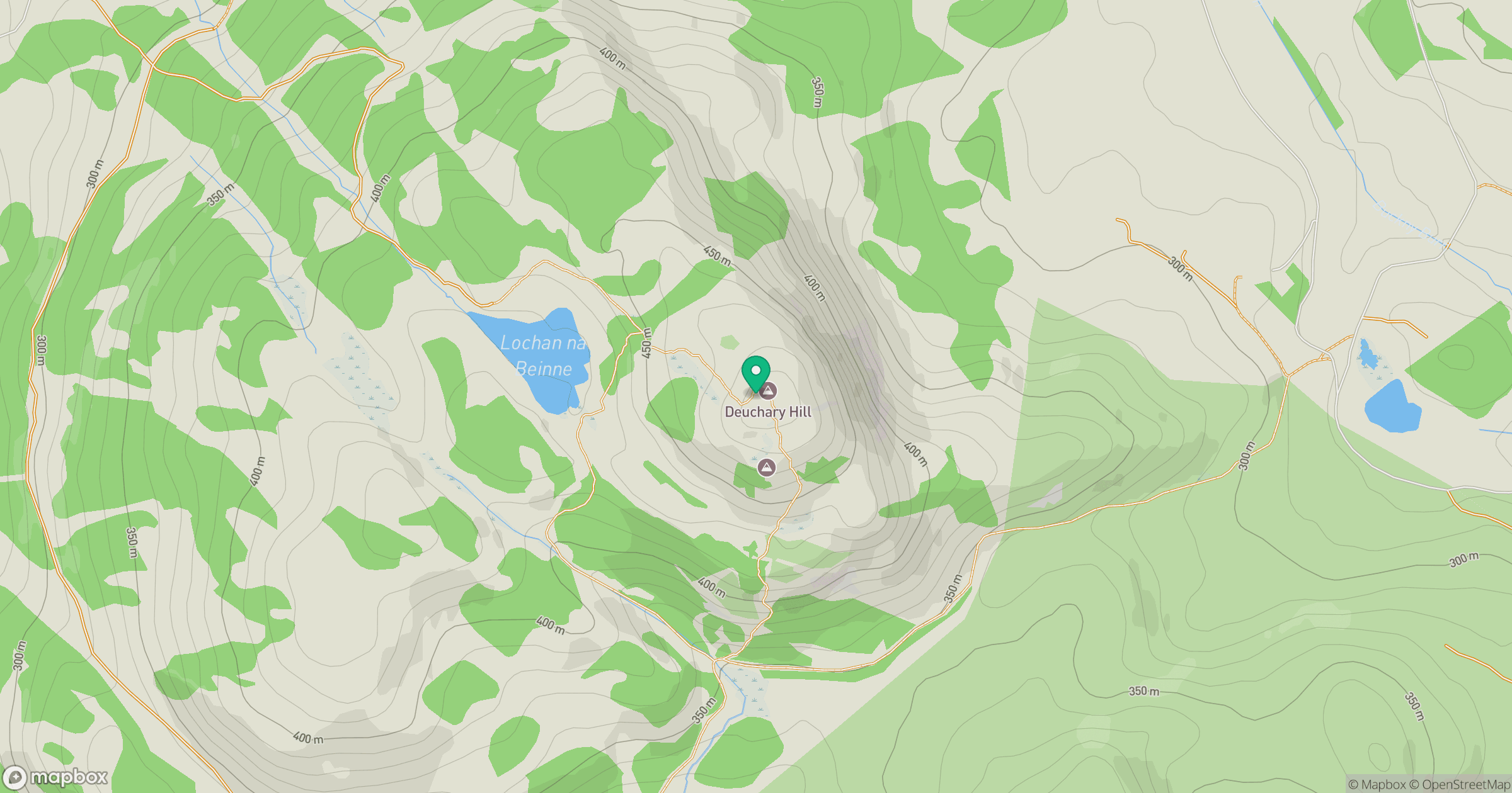
Grid reference: NO037485
View on OpenStreetMapOpens a map in a new tab, centred on the hill.
No comments yet. Be the first.