

Creag nam Brataichean
Good walks are even better shared.
Overview
Creag nam Brataichean
Nestled in the picturesque Scottish Highlands, Creag nam Brataichean is a delightful Corbett that offers both challenge and beauty. Standing at 652 meters, it might not be the highest of peaks, but it’s certainly one that rewards hikers with outstanding views and a fulfilling experience.
Geology
As you trek up, take a moment to appreciate the fascinating geology. The predominant Old Red Sandstone gives a lovely reddish tint to the rocky outcrops. Imagine the ancient rivers flowing through this landscape millions of years ago, gathering tales of the past.
Routes
The most popular route begins in Glen Dochart. This scenic pathway meanders through Scottish heather and rocky terrain, perfect for a moderate hike. At approximately 10 km round trip, it generally takes about 4 hours to complete, depending on how often you stop to snap pictures or catch your breath. Remember to leave no trace, so future hikers can enjoy the same wonders!
Summit Features
Upon reaching the summit, you’ll be greeted by a simple stone cairn, a testament to the many adventurous souls who’ve stood in admiration of the majestic views. Watching the clouds dance over the peaks is a balm for the soul!
Terrain Type
Prepare for a mix of rocky and grassy terrain, with a few boggy patches to test your traction. Good footwear is your best friend here!
Views
The panoramic vistas from the top are nothing short of spectacular. You'll be able to see notable landmarks such as Ben More and the shimmering Loch Ichar. Autumn particularly brings splendid hues to the hills—don’t forget your camera! The best season for hiking is from late spring to early autumn, although holing up for a sunrise can yield breathtaking views.
Hazards
A word of caution: the terrain can be tricky, with loose rocks ready to make you test your balance. Be aware of the quickly-changing weather; it can go from sunny to foggy faster than one can say 'Scottish mist.'
Nearby Summits
Nearby, the prominent Ben More and the charming Stobinian beckon more adventurous spirits. If you’re feeling extra ambitious, why not attempt them in one epic day?
Access
Accessing Creag nam Brataichean is straightforward. Parking can be found near Crianlarich, a quaint village that offers the essentials. If you’re relying on public transport, regular bus routes run to this charming spot.
Facilities
For those planning to refresh post-hike, Crianlarich has a lovely cafe alongside a shop for a quick snack. Public toilets are also available near the village for your convenience.
History
In local folklore, 'Creag nam Brataichean' signifies a place rich in pastoral heritage. Its story is woven with the journeys of shepherds throughout the ages, making it a site of cultural significance.
In conclusion, Creag nam Brataichean is a treasure of the Highlands. Whether you’re an experienced climber or a casual hiker, the trails and views are bound to captivate and inspire—just be sure to appreciate the journey as much as the destination!
Explore routes near Creag nam Brataichean
Public walks starting within 80 km of this hill. Nearby does not mean a route reaches the summit; check its map and access before setting out.
Unled club outing: Glenesk (coach departure)
View route
Unled club outing: Xmas Walk - Bankfoot - Dunkeld (coach departure)
View route
Unled club outing: Angus coastal walk (coach departure)
View route
Unled club outing: Glen Moy/Glenogil (shared-car departure)
View route
Route planning notes
These notes describe possible approaches, not verified navigable routes or permission to cross land. Check current paths, local access rules and conditions before setting out.
Glen Dochart Route
A popular approach starting from the stunning Glen Dochart, winding through scenic landscapes with stunning views.
Make a day of it, together
Find someone to share the walk with, or organise a day out along a route you like.
Photo Gallery
View all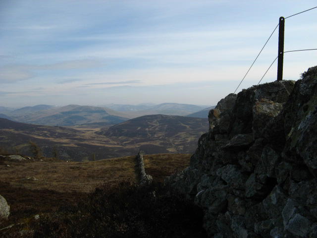 Photo could not load
NO1161 : Boundary wall
Steve woodward
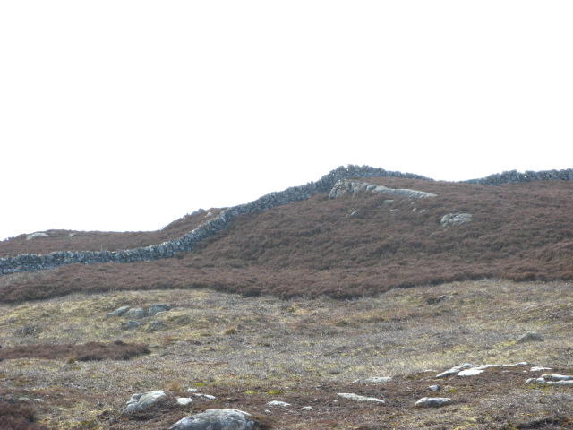 Photo could not load
NO1161 : Boundary Wall
Steve woodward
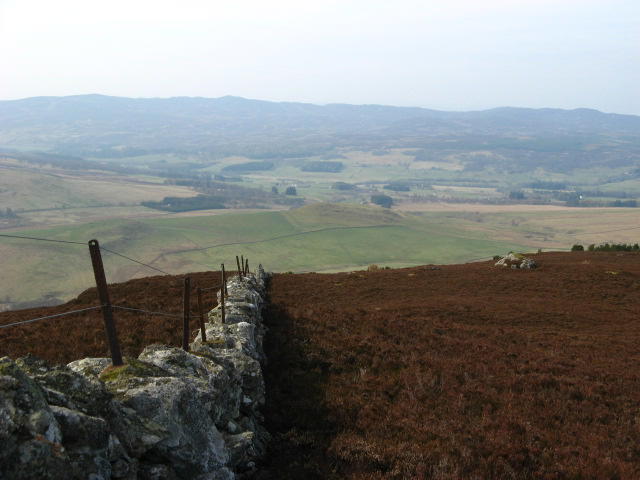 Photo could not load
NO1161 : Boundary wall
Steve woodward
Hill facts and local notes
Classifications
Elevation
537m
1,761 ft
Prominence
139m
Coordinates
56.7352, -3.4500
NO113613
OS Map
43
Explorer: OL52S 387S
At the Summit
The summit features a small stone cairn which serves as a humble marker for the intrepid hikers who have made their way up. There’s also a glorious view of the surrounding peaks.
Terrain & Geology
Creag nam Brataichean is primarily composed of Old Red Sandstone, which is known for its reddish hue and sedimentary characteristics. The fascinating layers tell tales of ancient river systems and habitats that once existed here.
Views & Scenery
From the summit, hikers can enjoy views of Ben More and the stunning Loch Ichar, making the effort truly worthwhile. On clear days, the expanse of the Highlands stretches out like a checkerboard of beauty.
History & Heritage
Name Origin
The name 'Creag nam Brataichean' translates to 'rock of the flocks,' hinting at the mountain's pastoral heritage.
Historical Significance
This mountain has roots in local lore and has been a gathering point for shepherds and outdoor enthusiasts alike for generations.
Getting There & Facilities
Check current local access restrictions, parking rules and transport timetables before travelling. These notes do not confirm public access to the summit.
Parking
There is a designated parking area near the village of Crianlarich, approximately a 10-minute drive from the trailhead.
Public Transport
Regular bus services run to Crianlarich from larger centres like Glasgow, making it accessible for those relying on public transport.
Nearby Facilities
Crianlarich offers basic facilities including a small cafe, a shop for snacks, and public toilets.
Safety Information
Known Hazards
- Loose rocks on the ascent can pose a risk. Be mindful of changing weather conditions that can make the terrain slippery.
General Safety Tips
- Check weather conditions before setting out
- Carry appropriate clothing and equipment
- Let someone know your planned route
- Take a map, compass, and GPS device
- Carry emergency supplies: food, water, first aid kit, torch
Hills
Some common questions about the hills answered
Are there group walks up Creag nam Brataichean?
Many walkers use Walkmates to join or organise walks with others. You can check for group walks around Creag nam Brataichean through the maps
Are there other walkers around Creag nam Brataichean?
Activity varies by location and time, but Walkmates lets you see whether others have shared walks or shown interest in this area. Find other people through the walking friends search walking friends for Creag nam Brataichean search or of course create your own walk for Creag nam Brataichean
Can I organise a walk to Creag nam Brataichean?
Yes. If there aren’t any walks listed already, you can create a walk and make it available for others to join.
If you're signed up to Walkmates, you can create a walk to Creag nam Brataichean.
How do I find a walk up this hill?
There are often multiple ways to walk this hill, depending on experience and route preference. Walkmates helps you explore walks and routes that others have shared.
Can I suggest a new route up Creag nam Brataichean?
Yes. You can suggest or create routes to share with others. Walkmates focuses on the social side of walking, so routes are used to help people organise walks and explore areas together, rather than as detailed navigation tools or route libraries.
Other uses really appreciate knowledgeable walkers sharing their routes. Share your favourite route to Creag nam Brataichean here
The is an error or something incorrect about this hill. How do I let you know?
We always strive to keep the information on Walkmates as accurate as possible. If you find an error, please let us know through the contact form and we'll aim to correct it as quickly as possible
Community Discussion
Comments
Location
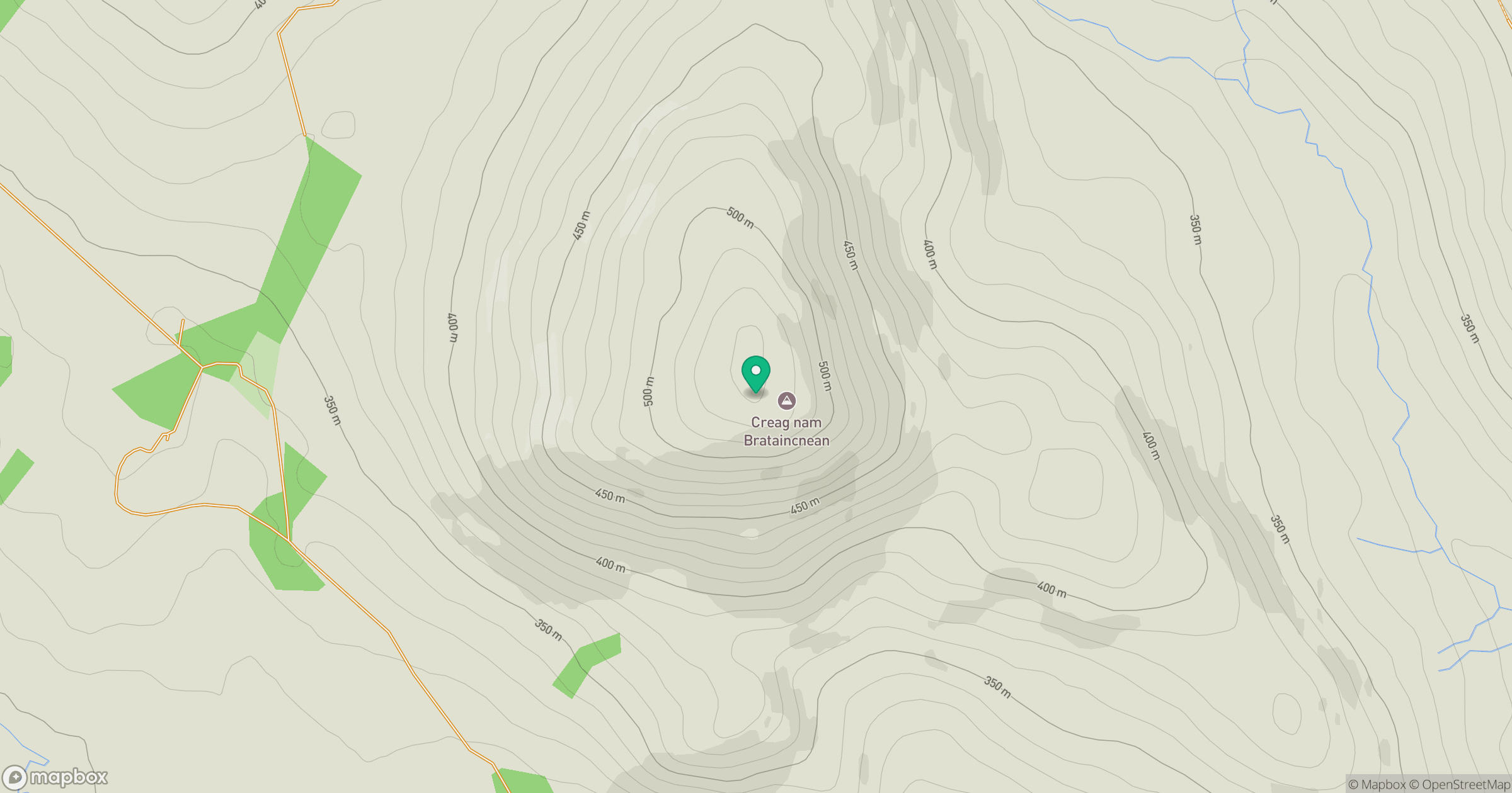
Grid reference: NO113613
View on OpenStreetMapOpens a map in a new tab, centred on the hill.
Hills within 30 km
Straight-line distance, not a walking route or confirmation of access.
Beinn a' Ghlo - Carn nan Gabhar
1,122m
Driesh
948m
Beinn a' Ghlo - Braigh Coire Chruinn-bhalgain
1,070m
Beinn a' Ghlo - Carn Liath
976m
Lochnagar - Cac Carn Beag
1,156m
No comments yet. Be the first.