
Beinn Bhreac
Good walks are even better shared.
Overview
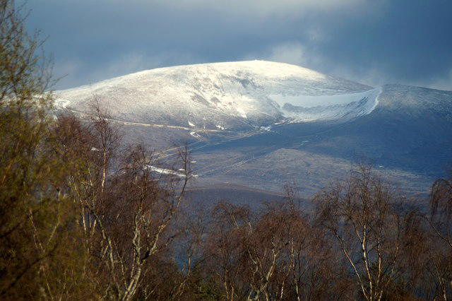
Beinn Bhreac
Nestled in the heart of the Scottish Highlands, Beinn Bhreac stands proudly with an elevation of 877 meters.
Geology
This majestic Munro features granite that has been sculpted by the relentless forces of nature, with some areas displaying schist. The diverse geology provides an engaging experience for those who appreciate the intricate natural world around us.
Parking and Access
For those planning an adventure, the Feshiebridge car park serves as the primary starting point for hikes. The nearby village of Aviemore offers all the services you might need from cafes to shops, ensuring you're well-prepared.
The Route
One of the most popular routes is the Glen Feshie Circuit, covering approximately 14.5 km, and requiring about six hours to complete. Expect a challenging trek with stretches of rocky and grassy terrain. Be sure to wear sturdy boots, as certain sections can be slippery after rainfall.
Summit Features
Reaching the summit is half the fun! Here, a modest cairn stands sentinel amidst breathtaking panoramas. It’s the perfect spot to kick back and relish your hard-earned snacks while soaking in the views.
Views
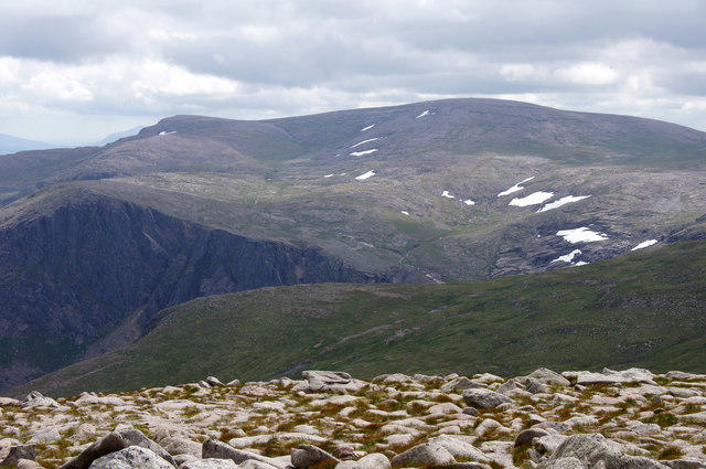
The vistas from the top are nothing short of spectacular. Surrounding peaks like Braeriach and Cairn Toul loom majestically, creating a photo opportunity that would make even the most seasoned Instagrammer swoon. The best seasons for clear views are late spring and early autumn.
Hazards
As with any outdoors adventure, caution is paramount. Sudden weather shifts are common, so layer up and be prepared. The rocky terrain can present challenges, so tread carefully to avoid any unwelcome slips.
Nearby Summits
While conquering Beinn Bhreac, consider extending your trip to nearby peaks like Braeriach and Cairn Toul, adding to the adventure.
In conclusion, Beinn Bhreac offers not just a hike, but an experience filled with natural beauty, history, and the kind of memories that last a lifetime. So lace up those boots and set forth into the wild!
Explore routes near Beinn Bhreac
Walks starting near this hill. Open a route to check its map, distance and full itinerary.
Rothiemurchus: Beaver Trail and Lochan Mor
View route
Aviemore: Loch an Eilein and the Croft Track from Rothiemurchus
View route
Cairngorms night walk and stargazing (event meeting)
View route
Cairngorms night walk and stargazing (event meeting)
View route
Route planning notes
These notes describe possible approaches. Check a route's map and access information when planning your walk.
Glen Feshie Circuit
A popular route starting from Glen Feshie that offers a delightful walk through the glen before ascending the slopes of Beinn Bhreac.
Make a day of it, together
Find someone to share the walk with, or organise a day out along a route you like.
Hill facts and local notes
Classifications
Elevation
930m
3,052 ft
Prominence
81m
Coordinates
57.0551, -3.5535
NO058970
OS Map
36 43
Explorer: OL57S OL58S 403S 404S
At the Summit
The summit boasts a modest cairn and a stunning panoramic view, creating a perfect backdrop for a selfie or a contemplative moment while munching on your packed lunch.
Terrain & Geology
Beinn Bhreac is primarily composed of granite, which provides a sturdy base and excellent rock scrambling opportunities for the adventurous. The area also features some schist, giving the mountain a varied and interesting geology that has been shaped by glacial action.
Views & Scenery
From the summit, you'll be treated to breathtaking views of the Cairngorms and the surrounding valleys, with peaks such as Braeriach and Cairn Toul visible on a good day.
History & Heritage
Name Origin
The name Beinn Bhreac means 'speckled mountain' in Gaelic, likely referring to its rocky and varied terrain.
Historical Significance
The mountain is popular among hikers and mountaineers and is part of the larger Cairngorms National Park, which is rich in flora, fauna, and history.
Getting There & Facilities
Parking
Parking is available at the Feshiebridge car park, which is just a short walk from the trailhead.
Public Transport
The nearest bus services operate from Aviemore, which regularly connects to several locations in the Highlands. Check local schedules for up-to-date information.
Nearby Facilities
Aviemore has a variety of facilities, including cafes, restaurants, and public toilets. The local shops are also stocked with essentials for your hike.
Safety Information
Known Hazards
- Be wary of sudden weather changes, as they can turn a sunny day into a stormy one in the blink of an eye. Also, watch your step on rocky sections, as they can be slippery, especially after rain.
General Safety Tips
- Check weather conditions before setting out
- Carry appropriate clothing and equipment
- Let someone know your planned route
- Take a map, compass, and GPS device
- Carry emergency supplies: food, water, first aid kit, torch
Hills
Some common questions about the hills answered
Are there group walks up Beinn Bhreac?
Many walkers use Walkmates to join or organise walks with others. You can check for group walks around Beinn Bhreac through the maps
Are there other walkers around Beinn Bhreac?
Activity varies by location and time, but Walkmates lets you see whether others have shared walks or shown interest in this area. Find other people through the walking friends search walking friends for Beinn Bhreac search or of course create your own walk for Beinn Bhreac
Can I organise a walk to Beinn Bhreac?
Yes. If there aren’t any walks listed already, you can create a walk and make it available for others to join.
If you're signed up to Walkmates, you can create a walk to Beinn Bhreac.
How do I find a walk up this hill?
There are often multiple ways to walk this hill, depending on experience and route preference. Walkmates helps you explore walks and routes that others have shared.
Can I suggest a new route up Beinn Bhreac?
Yes. You can suggest or create routes to share with others. Walkmates focuses on the social side of walking, so routes are used to help people organise walks and explore areas together, rather than as detailed navigation tools or route libraries.
Other uses really appreciate knowledgeable walkers sharing their routes. Share your favourite route to Beinn Bhreac here
The is an error or something incorrect about this hill. How do I let you know?
We always strive to keep the information on Walkmates as accurate as possible. If you find an error, please let us know through the contact form and we'll aim to correct it as quickly as possible
Community Discussion
Comments
Location
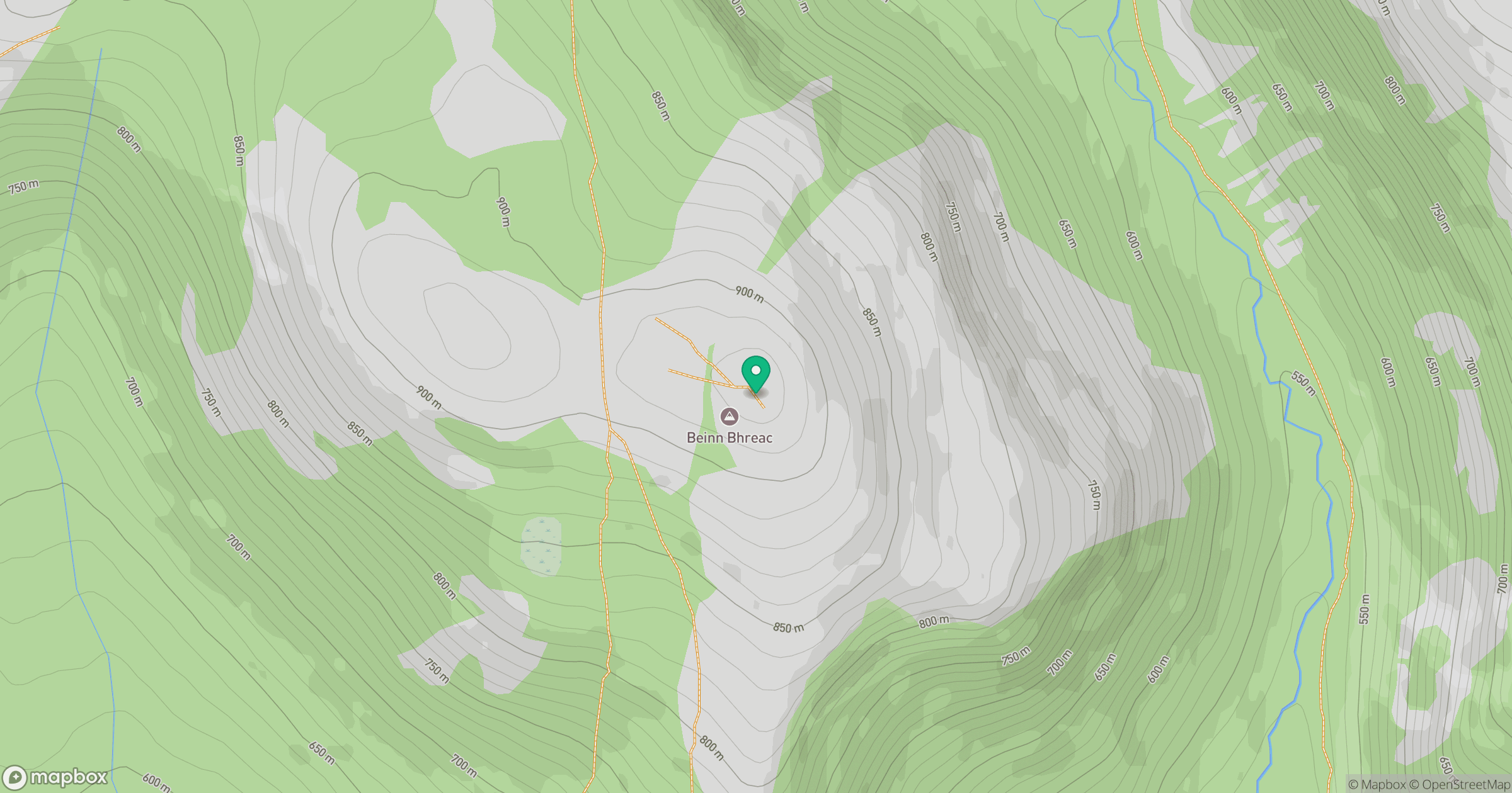
Grid reference: NO058970
View on OpenStreetMapOpens a map in a new tab, centred on the hill.
No comments yet. Be the first.