

Beacon Fell
Good walks are even better shared.
SD2790 : Beacon Fell summit cairn
Peter S Photo source
Overview
Beacon Fell
Situated within the picturesque Forest of Bowland, Beacon Fell rises to a height of 266 meters, offering visitors splendid views and ample opportunity for outdoor adventure. Not just a pretty face, it’s a Marilyn, known for its prominent yet inviting summit, a magnet for walkers and nature lovers alike.
Geology
Beacon Fell is a delightful mix of sandstone that showcases the power of glacial action—those rock outcrops did not appear out of nowhere! Geological formations tell the story of the land, and Beacon Fell is no exception, providing an excellent case study for those looking to explore the Earth’s history.
Routes
There are multiple routes available for adventurers:
- Beacon Fell Circular Walk - A treat for the senses, this 4.5 km circular route begins and ends at the visitor centre. It winds through lush woodlands, crosses open moorland, and leads you straight to its glorious summit. Expect to take about 1.5 hours, with moderate difficulty making this route perfect for families and seasoned walkers alike.
- Summit Ascent from Visitor Centre - Less adventurous? No worries! This straightforward ascent is 1.2 km and takes about half an hour, perfect for those who wish to enjoy the summit without a rigorous workout.
Summit Features
Reaching the top, one can find a sturdy trig point, standing proudly as a reminder of the country’s surveying past. The stone shelter nearby is perfect for resting those weary legs—just try not to fall asleep; you wouldn’t want to miss the view!
Terrain Type
The terrain is invitingly mixed, with grassy slopes and rocky outcrops. Paths are generally well-defined, providing an enjoyable walking experience without the fear of disappearing into the wilderness.
Views
From the summit, the views extend far and wide. On a clear day, it’s truly a sight to behold, with the Yorkshire Dales to the east and the North Pennines lurking in the distance. Spring and early autumn offer the most spectacular views, while winter’s chill brings a serene, frosty magic to the landscape.
Hazards
As always, safety first! Slippery paths can be a challenge post-rain, and rolling fog can ambush the unsuspecting hiker. Always keep your map and wits about you!
Access
Access to Beacon Fell is straightforward, with plenty of parking available at the visitor centre. For those relying on public transport, you may find access limited, so having your own transport will serve you well. The nearest town, Garstang, lies about 10 miles south—an excellent pit stop for snacks and supplies.
Facilities
To complement your visit, the nearby visitor centre boasts toilets and a charming little café, perfect for refuelling before or after your hike.
History
The name 'Beacon' is derived from the historic practice of lighting fires on hilltops as warning signals, while 'Fell' is reminiscent of the bucolic highlands of the area. Rich in history, Beacon Fell and its forested surrounds have long been a cherished retreat for locals and visitors.
In conclusion, whether you’re an experienced hiker or a casual walker, Beacon Fell should not be missed. With a delightful mix of geology, picturesque views, and fantastic walking routes, it’s an outing sure to refresh the soul!
Buckle up those hiking boots, pack up a picnic, and make your way to Beacon Fell. You won’t regret it!
Explore routes near Beacon Fell
Walks starting near this hill. Open a route to check its map, distance and full itinerary.
Coniston to Tarn Hows: Monk Coniston Gardens and Woodland Circuit
View route
Tarn Hows Fast Route
View route
Great Carrs Halifax Wreckage from Wrynose Pass
View route
Bow Fell from Langdale
View route
Route planning notes
These notes describe possible approaches. Check a route's map and access information when planning your walk.
Beacon Fell Circular Walk
A popular circular route that begins and ends at the visitor centre, taking you through woodlands and open moorland, with stunning views from the summit.
Summit Ascent from Visitor Centre
A straightforward ascent from the visitor centre that leads directly to the summit, suitable for families and less experienced walkers.
Make a day of it, together
Find someone to share the walk with, or organise a day out along a route you like.
Photo Gallery
View all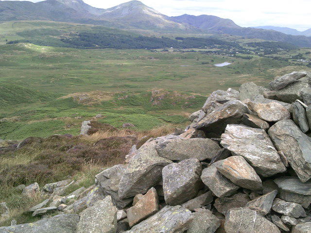 Photo could not load
SD2790 : Beacon Fell summit cairn
Peter S
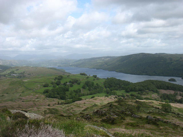 Photo could not load
SD2790 : Looking down to Coniston Water from Beacon Fell
David Purchase
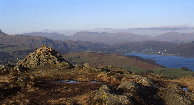 Photo could not load
SD2790 : Cairn above Beacon Tarn, Blawith Fells
Tom Richardson
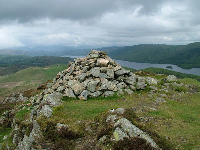 Photo could not load
SD2790 : Beacon Fell top
David Brown
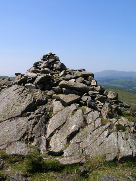 Photo could not load
SD2790 : Cairn on Blawith Fells
mauldy
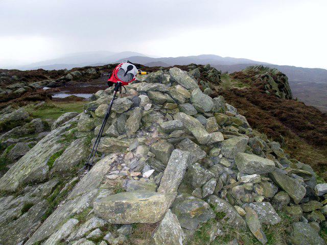 Photo could not load
SD2790 : Beacon Fell
Rude Health
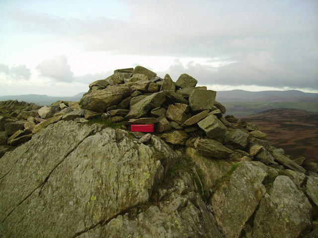 Photo could not load
SD2790 : Cairn, Blawith Beacon
Michael Graham
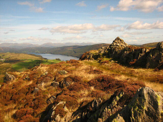 Photo could not load
SD2790 : View NE from the cairn on Blawith Fells
Pete Walker
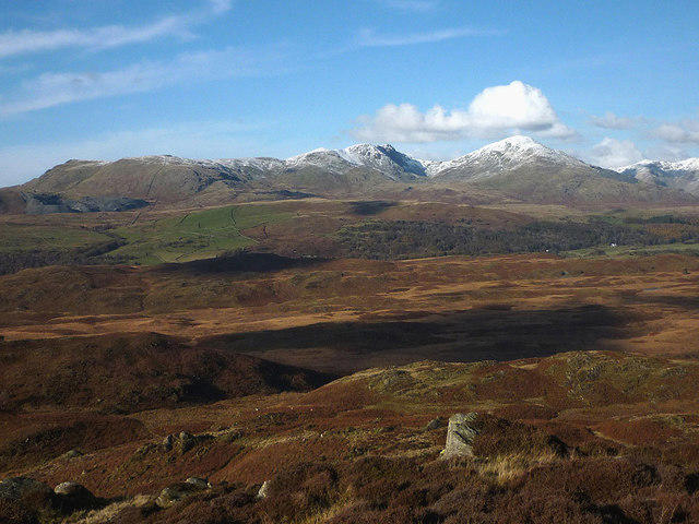 Photo could not load
SD2790 : Looking north from Beacon Fell (255m)
Karl and Ali
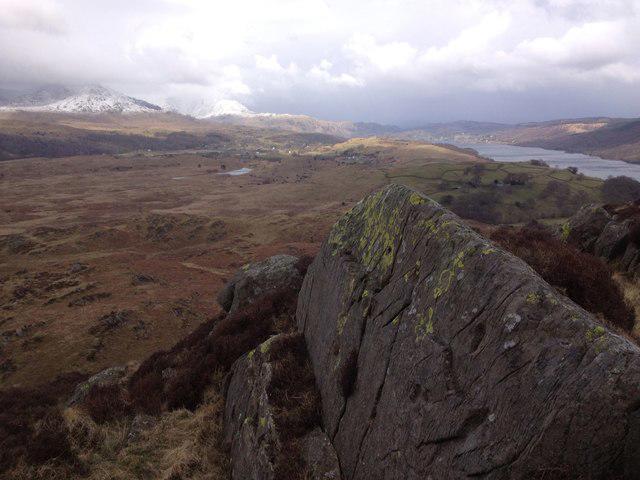
SD2790 : Lichen covered rocks on Blawith Fell
Tom Cubbon
Hill facts and local notes
Classifications
Elevation
255m
837 ft
Prominence
129m
Coordinates
54.3069, -3.1110
SD278907
OS Map
96 97
Explorer: OL6N OL6S
At the Summit
The summit features a prominent trig point with panoramic views, accompanied by a stone built shelter for those wishing to take a breather and enjoy the scenery.
Terrain & Geology
Beacon Fell is primarily composed of sandstone, with the distinctive feature of the rocky outcrops making up its summit area. The surrounding landscape showcases the remnants of glacial erosion, providing interesting geological insights for enthusiasts.
Views & Scenery
On a clear day, you can see the Yorkshire Dales to the east, the Forest of Bowland stretching below, and even the North Pennines in the distance. The views truly make the trek worth it!
History & Heritage
Name Origin
The name 'Beacon' is attributed to the ancient practice of using hilltop fires as signals, while 'Fell' refers to the highland terrain common in the region.
Historical Significance
Beacon Fell is part of the ancient Forest of Bowland area, holding cultural significance for local communities and is cherished for its natural beauty.
Getting There & Facilities
Parking
There is ample parking available at the Beacon Fell Country Park visitor centre, with signage directing you to the trails.
Public Transport
Limited bus services operate to the nearby village of Greate Harwood; however, having a vehicle is recommended for the best access.
Nearby Facilities
The visitor centre offers toilets and has a small café serving hot and cold drinks and snacks.
Safety Information
Known Hazards
- Watch out for slippery paths, especially after rainfall. Fog can roll in unexpectedly, so keep your map handy!
General Safety Tips
- Check weather conditions before setting out
- Carry appropriate clothing and equipment
- Let someone know your planned route
- Take a map, compass, and GPS device
- Carry emergency supplies: food, water, first aid kit, torch
Hills
Some common questions about the hills answered
Are there group walks up Beacon Fell?
Many walkers use Walkmates to join or organise walks with others. You can check for group walks around Beacon Fell through the maps
Are there other walkers around Beacon Fell?
Activity varies by location and time, but Walkmates lets you see whether others have shared walks or shown interest in this area. Find other people through the walking friends search walking friends for Beacon Fell search or of course create your own walk for Beacon Fell
Can I organise a walk to Beacon Fell?
Yes. If there aren’t any walks listed already, you can create a walk and make it available for others to join.
If you're signed up to Walkmates, you can create a walk to Beacon Fell.
How do I find a walk up this hill?
There are often multiple ways to walk this hill, depending on experience and route preference. Walkmates helps you explore walks and routes that others have shared.
Can I suggest a new route up Beacon Fell?
Yes. You can suggest or create routes to share with others. Walkmates focuses on the social side of walking, so routes are used to help people organise walks and explore areas together, rather than as detailed navigation tools or route libraries.
Other uses really appreciate knowledgeable walkers sharing their routes. Share your favourite route to Beacon Fell here
The is an error or something incorrect about this hill. How do I let you know?
We always strive to keep the information on Walkmates as accurate as possible. If you find an error, please let us know through the contact form and we'll aim to correct it as quickly as possible
Community Discussion
Comments
Location
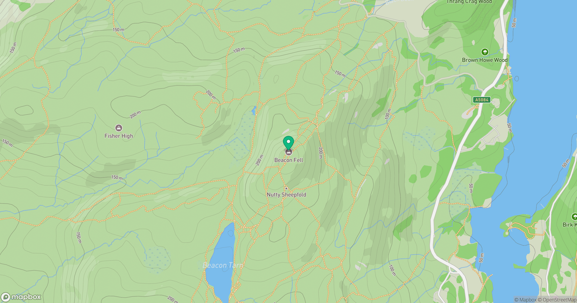
Grid reference: SD278907
View on OpenStreetMapOpens a map in a new tab, centred on the hill.

No comments yet. Be the first.