
Barrow
Good walks are even better shared.
Overview
Exploring Barrow
Barrow is a Marilyn situated in the heart of the Lake District, standing tall at an elevation of 596 meters. Known for its stunning views and unique geological features, it's a must-visit for outdoor enthusiasts.
Geology
Barrow's ground is an amazing testament to geological history, formed from volcanic rocks like andesite and basalt. This rugged terrain not only provides lovely scenery but also supportive environments for diverse flora and fauna.
The Routes
There are several ways to reach the peak, each offering its unique charm:
- Route from Derwentwater: This 8 km trail offers a moderate challenge, transitioning from scenic woods to breathtaking lake views as you ascend.
- Route via Catbells: For the more adventurous, connecting the summits of Barrow and Catbells offers a challenging yet rewarding 9.5 km loop.
Summit Features
At the summit, be sure to visit the cairn and trig point - they're practically begging for a photo op! This elevated view is a favourite among climbers for capturing the surrounding beauty.
Terrain
Expect a mix of rocky paths and grassy slopes - a fantastic trifecta for hiking! Do watch your step, especially in wetter months when the ground can become a bit squelchy.
Views
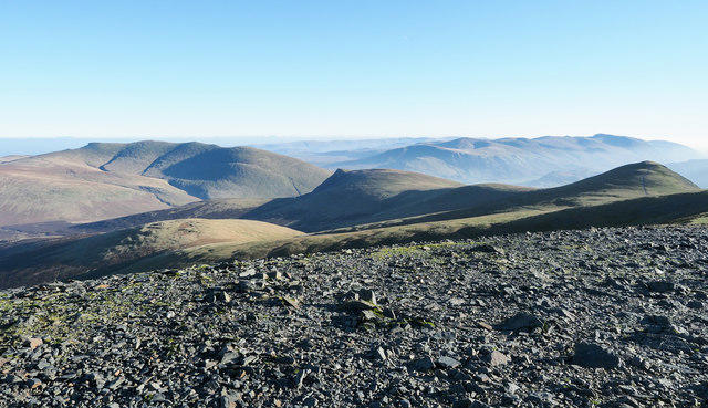
Once at the top, the effort is richly rewarded. Gaze at the picturesque Derwentwater and take in the spectrum of mountains that make this region renowned worldwide. The scenery is particularly striking in spring and autumn, so plan your venture accordingly.
Hazards
Keep in mind that Barrow can be slippery, especially on loose rock when the going gets tough. Weather can turn on you in the blink of an eye, so pack those waterproofs!
Nearby Summits
If you're keen on expanding your horizons, nearby summits like Catbells (451 m) and the towering Skiddaw (931 m) beckon for further exploration.
Access
Access is a breeze with ample parking at Keswick, followed by a short but scenic walk to the trailhead. Public transport also regularly stops nearby, so you're never too far from the next adventure.
Facilities
After your hike, Keswick is a thriving hub of activity with cafes, shops, and restrooms, perfect for refueling or sharing tales of your adventure with fellow hikers.
History
The name 'Barrow' relates to the Old Norse term for burial mounds, whispering tales of ancient history in its name. This beautiful mountain isn’t just a feast for the eyes, but also a part of the rich tapestry of the Lake District's culture.
In conclusion, Barrow remains a cherished gem in the Lake District and an ideal escape for anyone looking to connect with the great outdoors. Bring your sense of adventure and a camera - well, you may just find a few new Instagram followers at the top!
Happy hiking!
Explore routes near Barrow
Walks starting near this hill. Open a route to check its map, distance and full itinerary.
Whinlatter dark skies walk
View route
Whinlatter dark skies walk
View route
Scafell Pike from Seathwaite via the Corridor Route
View route
Binsey from Binsey Lodge Direct Out and Back Wainwright
View route
Route planning notes
These notes describe possible approaches. Check a route's map and access information when planning your walk.
Barrow from the shores of Derwentwater
Starting from the beautiful shores of Derwentwater, this route meanders through scenic woodland before the real ascent begins. The trail zigzags up the slopes with stunning views back over the lake.
Barrow from the Catbells
This trail starts at the popular hiking trail of Catbells and offers a scenic loop to Barrow, providing the opportunity to conquer two summits in one go.
Make a day of it, together
Find someone to share the walk with, or organise a day out along a route you like.
Hill facts and local notes
Classifications
Elevation
455m
1,493 ft
Prominence
70m
Coordinates
54.5857, -3.1975
NY227218
OS Map
89 90
Explorer: OL4S
At the Summit
The summit features a prominent cairn and a trig point, making it a perfect spot for a duo of selfies - one with the views and another for bragging rights on social media.
Terrain & Geology
Barrow's geology is predominantly composed of volcanic rock, primarily andesite and basalt, which can be traced back to the volcanic activity that formed this region millions of years ago. The rugged cliffs and scree slopes provide a unique ecological habitat.
Views & Scenery
From the summit, enjoy panoramic views of Derwentwater, Skiddaw, and the surrounding peaks of the Lake District. On a clear day, you can see as far as the Solway Firth.
History & Heritage
Name Origin
The name 'Barrow' derives from the Old Norse word 'barrow', meaning a burial mound, hinting at the potential historical significance of the area.
Historical Significance
This mountain has long been a favourite with hikers, not just for its beauty, but also as part of the cultural landscape of the Lake District, celebrated in poetry and literature.
Getting There & Facilities
Parking
The nearest parking is at the Keswick Car Park near Derwentwater, which is approximately a 15-minute walk to the trailhead.
Public Transport
Regular bus services operate from nearby towns, with stops close to the trailhead at Derwentwater.
Nearby Facilities
Facilities include several cafes in Keswick, public toilets near Derwentwater, and numerous shops for supplies.
Safety Information
Known Hazards
- Loose rocks on the ascent may cause slips; beware of changing weather conditions, especially in autumn and winter.
General Safety Tips
- Check weather conditions before setting out
- Carry appropriate clothing and equipment
- Let someone know your planned route
- Take a map, compass, and GPS device
- Carry emergency supplies: food, water, first aid kit, torch
Hills
Some common questions about the hills answered
Are there group walks up Barrow?
Many walkers use Walkmates to join or organise walks with others. You can check for group walks around Barrow through the maps
Are there other walkers around Barrow?
Activity varies by location and time, but Walkmates lets you see whether others have shared walks or shown interest in this area. Find other people through the walking friends search walking friends for Barrow search or of course create your own walk for Barrow
Can I organise a walk to Barrow?
Yes. If there aren’t any walks listed already, you can create a walk and make it available for others to join.
If you're signed up to Walkmates, you can create a walk to Barrow.
How do I find a walk up this hill?
There are often multiple ways to walk this hill, depending on experience and route preference. Walkmates helps you explore walks and routes that others have shared.
Can I suggest a new route up Barrow?
Yes. You can suggest or create routes to share with others. Walkmates focuses on the social side of walking, so routes are used to help people organise walks and explore areas together, rather than as detailed navigation tools or route libraries.
Other uses really appreciate knowledgeable walkers sharing their routes. Share your favourite route to Barrow here
The is an error or something incorrect about this hill. How do I let you know?
We always strive to keep the information on Walkmates as accurate as possible. If you find an error, please let us know through the contact form and we'll aim to correct it as quickly as possible
Community Discussion
Comments
Location
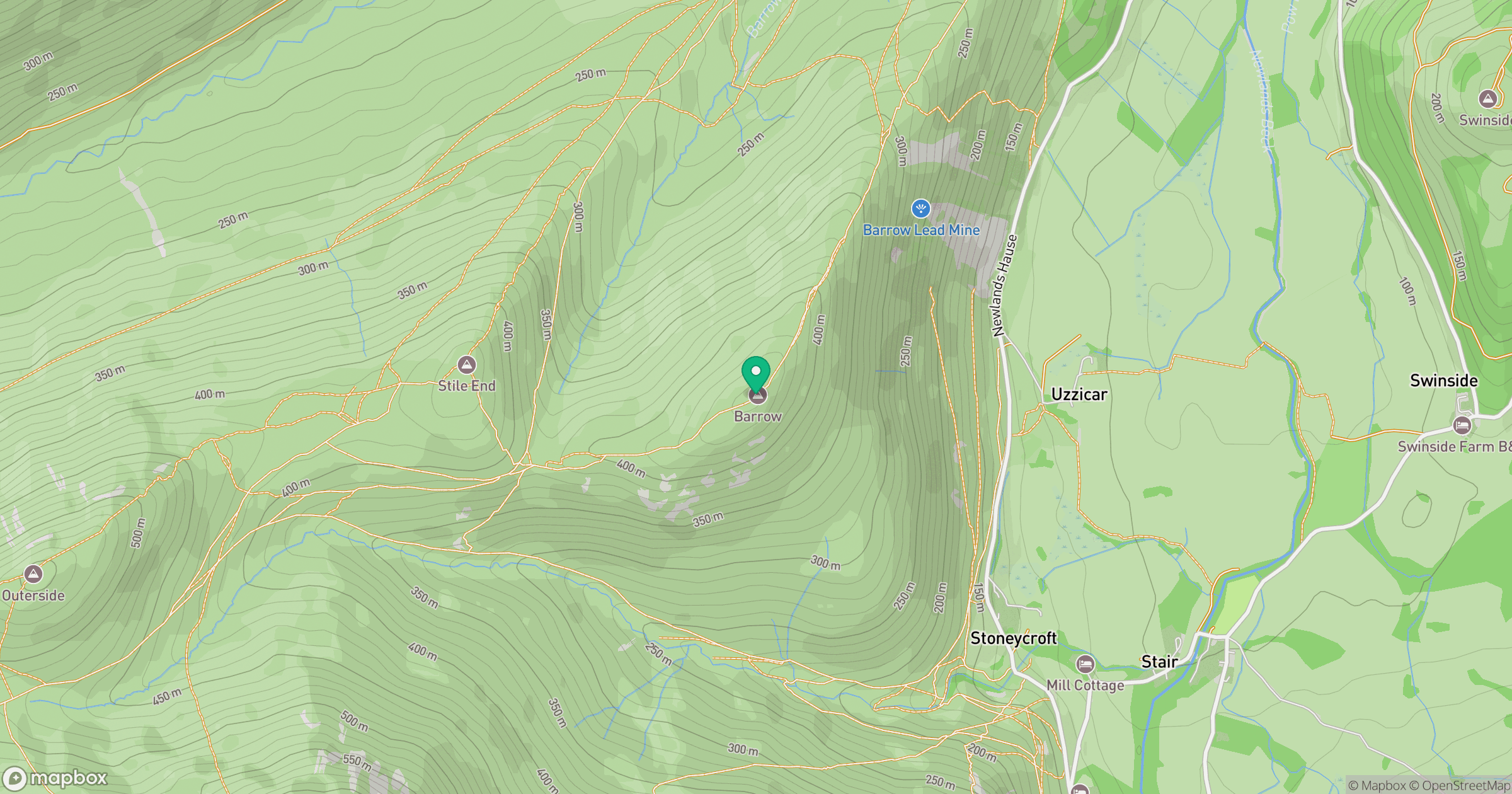
Grid reference: NY227218
View on OpenStreetMapOpens a map in a new tab, centred on the hill.
No comments yet. Be the first.