
Banks
Good walks are even better shared.
Overview
Banks Mountain
Nestled in the heart of the North Pennines, Banks stands at 612 meters, offering adventurers a delightful romp into the rolling hills. Not just a Marilyn, but a Marilyn with charm!
Geology
The mountain is a geological gem, predominantly made up of sandstone and limestone sediment that highlights the grandeur of the Carboniferous era. As you wander, take a moment to appreciate the ancient rocks that have weathered countless storms and are now the silent witnesses of time past.
Routes
Two recommended routes cater to various abilities. For the keen hikers, the Widdy Bank to Banks Summit trail is approximately 4.5 km, requiring roughly two hours to conquer. It's a moderate hike that rewards you with stunning vistas. If you're pinched for time or looking for an easy stroll, the B6277 to Banks Trig Point is about 2.0 km and accessible in an hour. The trig point itself is a fine place to mark your achievement.
Summit Features
Upon reaching the summit, you’ll be greeted by a trusty trig point. It’s a popular spot—consider it the mountain’s own social media influencer, always perched and ready for a photo-op. The surrounding grasses make it ideal for a well-earned break, perhaps with a sandwich or two.
Terrain
The terrain is a delightful mix of grassy hills with the occasional rocky outcrop. Just be on the lookout for boggy areas—nobody wants to inadvertently acquire a pair of muddy boots!
Views
The rewards of your effort? Sweeping views of the North Pennines and, on a clear day, the distant splendour of the Lake District and Yorkshire Dales. Best season for these incredible vistas? Spring is the way to go!
Hazards
Do keep an eye out for slippery paths, particularly after a drenching rain. In winter, snowy conditions can turn a pleasant walk into a rather challenging venture.
Access
Parking can be found along the B6277, just a hop away from the trailhead. Alston is the nearest town, chock-full of hospitable cafés and pubs to rest your weary legs.
History
The name 'Banks' cleverly reflects the hill's attributes, derived from Old English. Historically, the region is steeped in lead mining heritage, a reflection of the industrious folks who called this rugged land home.
So pack your boots, grab some snacks, and head out for a day of British countryside enjoyment, but do remember—while the views are simply stunning, a bit of local weather can keep you on your toes!
Explore routes near Banks
Walks starting near this hill. Open a route to check its map, distance and full itinerary.
Coniston to Tarn Hows: Monk Coniston Gardens and Woodland Circuit
View route
Tarn Hows Fast Route
View route
Great Carrs Halifax Wreckage from Wrynose Pass
View route
Bow Fell from Langdale
View route
Route planning notes
These notes describe possible approaches. Check a route's map and access information when planning your walk.
Widdy Bank to Banks Summit
A well-trodden path beginning at Widdy Bank that winds its way up to the summit. The route offers stunning views and is relatively easy to follow.
B6277 to Banks Trig Point
A straightforward ascent from the B6277 road leads directly to the trig point located at the summit. Suitable for those looking for a quick hike.
Make a day of it, together
Find someone to share the walk with, or organise a day out along a route you like.
Hill facts and local notes
Classifications
Elevation
311m
1,020 ft
Prominence
66m
Coordinates
54.3361, -3.1283
SD267939
OS Map
96 97
Explorer: OL6N
At the Summit
The summit features a stone trig point, which stands proudly as a testament to the UK's mapping history. There's also a grassy area perfect for a picnic—or an impromptu nap if you're feeling a bit peckish.
Terrain & Geology
The mountain is primarily composed of sandstone and limestone, offering a rich geological history that dates back to the Carboniferous period. The landscapes feature classic Pennine gritstone outcrops.
Views & Scenery
From the summit, one can see the rolling hills of the North Pennines, the distant peaks of the Lake District, and on a clear day, views stretching to the Yorkshire Dales.
History & Heritage
Name Origin
The name 'Banks' is thought to derive from the Old English word 'banc,' meaning a hill or bank, reflecting the geographical features of the area.
Historical Significance
The area has a rich mining heritage, with remnants of lead mining evident in the surrounding landscape.
Getting There & Facilities
Parking
There is ample parking along the B6277, with space for several vehicles right by the trailhead.
Public Transport
The nearest bus stop is in the village of Alston, approximately 8 miles away. A bit of a trek, but there’s nothing like a bit of legwork to warm up for a hike.
Nearby Facilities
There are no facilities directly on the mountain, but Alston offers pubs, cafés, and toilet facilities for those looking to recharge after a day in the hills.
Safety Information
Known Hazards
- Beware of muddied paths after rain, which can become slippery. In winter, snow and ice can make the terrain treacherous.
General Safety Tips
- Check weather conditions before setting out
- Carry appropriate clothing and equipment
- Let someone know your planned route
- Take a map, compass, and GPS device
- Carry emergency supplies: food, water, first aid kit, torch
Hills
Some common questions about the hills answered
Are there group walks up Banks?
Many walkers use Walkmates to join or organise walks with others. You can check for group walks around Banks through the maps
Are there other walkers around Banks?
Activity varies by location and time, but Walkmates lets you see whether others have shared walks or shown interest in this area. Find other people through the walking friends search walking friends for Banks search or of course create your own walk for Banks
Can I organise a walk to Banks?
Yes. If there aren’t any walks listed already, you can create a walk and make it available for others to join.
If you're signed up to Walkmates, you can create a walk to Banks.
How do I find a walk up this hill?
There are often multiple ways to walk this hill, depending on experience and route preference. Walkmates helps you explore walks and routes that others have shared.
Can I suggest a new route up Banks?
Yes. You can suggest or create routes to share with others. Walkmates focuses on the social side of walking, so routes are used to help people organise walks and explore areas together, rather than as detailed navigation tools or route libraries.
Other uses really appreciate knowledgeable walkers sharing their routes. Share your favourite route to Banks here
The is an error or something incorrect about this hill. How do I let you know?
We always strive to keep the information on Walkmates as accurate as possible. If you find an error, please let us know through the contact form and we'll aim to correct it as quickly as possible
Community Discussion
Comments
Location
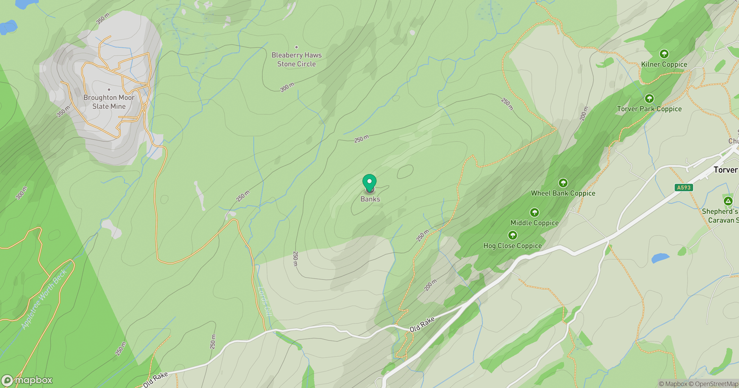
Grid reference: SD267939
View on OpenStreetMapOpens a map in a new tab, centred on the hill.
Nearby Hills
Dow Crag
778m
![The Old Man of Coniston [Coniston Old Man]](https://cdn.walkmates.com/gallery-images/0c140e91269b49abbee339fc41828d25.jpg)
The Old Man of Coniston [Coniston Old Man]
802m
Wetherlam
763m
Pike of Blisco
703m
Hard Knott
550m
No comments yet. Be the first.