
Ballyguile Hill
Good walks are even better shared.
Overview
Ballyguile Hill
Ballyguile Hill, standing at 214 meters, is part of the picturesque Blackstairs Mountains in Ireland. This modest peak may not be the tallest in the region, but it offers a delightful mix of scenery, wildlife, and accessibility that makes it a favourite among local hikers.
Geology
The hill’s geology is primarily Old Red Sandstone, characterised by its distinctive rocky outcrops. It exemplifies a stunning display of sedimentary rock formations. Don’t be surprised if you find a few geological enthusiasts peering at the rocks rather than the views!
Routes
One of the most popular hiking routes is the Ballyguile Hill Circular Walk. This 5.5 km circular route usually takes about 2.5 hours to complete and is considered moderate in difficulty. You’ll meander around the lower slopes before heading to the summit. Perfect for burning off last night’s dinner!
Summit Features
At the summit, you'll be greeted by a charming stone cairn—a fine spot to catch your breath and snap a photo or two. The panoramic vistas from here can make anyone feel on top of the world (provided the clouds haven’t decided otherwise).
Terrain Type
The terrain is a delightful blend of grassy slopes and rocky outcrops, with some boggy sections—bring sturdy boots or risk a soggy sock catastrophe!
Views
From the top, you're treated to spectacular views of the surrounding Blackstairs Mountains and possibly even the Wicklow Mountains on a clear day. The late spring and early autumn are especially serene, showcasing nature's stunning palette.
Hazards
As with any mountain excursion, there are risks to be aware of. Be particularly cautious of rocky and uneven ground, and watch out for those sneaky boggy areas that appear unexpectedly! Always check the weather before heading out—mountain weather can change faster than you can say 'tea and biscuits.'
Access
For your convenience, parking can be found at T320929, just a short walk from the trailhead. If you prefer public transport, you can catch a bus from Carlow to Ferns and then take a short taxi ride to the hill. The nearest town, Bagenalstown, is just a hop away, boasting cafes to refuel post-adventure.
Facilities
There are no facilities at the mountain itself, but Bagenalstown comes to the rescue with cafés and public toilets. Ideal for a hearty fry-up to celebrate your conquest of the hill!
History
The etymology of 'Ballyguile' is intriguing, possibly translating to 'town of brightness.' Its historical significance is tied to the broader heritage of the Blackstairs Mountains, which have inspired legends and stories throughout the ages.
In summary, Ballyguile Hill may not be the giant on the block, but its charm, accessibility, and breathtaking views make it a must-visit for anyone looking to escape into the beauty of the Irish countryside. Happy hiking!
Explore routes near Ballyguile Hill
Public walks starting within 80 km of this hill. Nearby does not mean a route reaches the summit; check its map and access before setting out.
No public routes are currently listed within 80 km of Ballyguile Hill on Walkmates. This does not mean there are no paths here. Explore the map and check local access information before planning a walk.
Route planning notes
These notes describe possible approaches, not verified navigable routes or permission to cross land. Check current paths, local access rules and conditions before setting out.
Ballyguile Hill Circular Walk
A circular route that takes you around the base of the hill before ascending to the summit, offering varied scenery along the way.
Make a day of it, together
Find someone to share the walk with, or organise a day out along a route you like.
Hill facts and local notes
Classifications
Elevation
186m
610 ft
Prominence
110m
Coordinates
52.9675, -6.0450
T314925
OS Map
56
At the Summit
The summit boasts a small stone cairn which serves as a perfect photo opportunity. Expect panoramic views, weather permitting.
Terrain & Geology
Ballyguile Hill is primarily composed of Old Red Sandstone, resulting in a rocky yet accessible terrain. The hill's geology showcases classic features of sedimentary rock formations, with various hues that change throughout the day.
Views & Scenery
From the summit, one can enjoy sweeping views of the surrounding Blackstairs Mountains, the River Barrow, and on a clear day, even the Wicklow Mountains.
History & Heritage
Name Origin
The name Ballyguile may derive from 'Baile' (town) and 'Geal' (bright) indicating a 'town of brightness', reflecting the hill's scenic beauty.
Historical Significance
The Blackstairs Mountains have historically been a significant site for early settlers and are mentioned in various historical texts, often associated with folklore and local legends.
Getting There & Facilities
Check current local access restrictions, parking rules and transport timetables before travelling. These notes do not confirm public access to the summit.
Parking
Parking is available at the trailhead located at T320929, with space for several cars.
Public Transport
The nearest bus service runs from Carlow to Ferns, with a short taxi or walk needed to reach the hill.
Nearby Facilities
While there are no facilities on the hill itself, the nearby Bagenalstown offers cafes and public toilets. Perfect for a post-hike coffee.
Safety Information
Known Hazards
- Be wary of the rugged terrain and potential for boggy areas, especially after rainfall. Weather conditions can change rapidly in the mountains, so be prepared.
General Safety Tips
- Check weather conditions before setting out
- Carry appropriate clothing and equipment
- Let someone know your planned route
- Take a map, compass, and GPS device
- Carry emergency supplies: food, water, first aid kit, torch
Hills
Some common questions about the hills answered
Are there group walks up Ballyguile Hill?
Many walkers use Walkmates to join or organise walks with others. You can check for group walks around Ballyguile Hill through the maps
Are there other walkers around Ballyguile Hill?
Activity varies by location and time, but Walkmates lets you see whether others have shared walks or shown interest in this area. Find other people through the walking friends search walking friends for Ballyguile Hill search or of course create your own walk for Ballyguile Hill
Can I organise a walk to Ballyguile Hill?
Yes. If there aren’t any walks listed already, you can create a walk and make it available for others to join.
If you're signed up to Walkmates, you can create a walk to Ballyguile Hill.
How do I find a walk up this hill?
There are often multiple ways to walk this hill, depending on experience and route preference. Walkmates helps you explore walks and routes that others have shared.
Can I suggest a new route up Ballyguile Hill?
Yes. You can suggest or create routes to share with others. Walkmates focuses on the social side of walking, so routes are used to help people organise walks and explore areas together, rather than as detailed navigation tools or route libraries.
Other uses really appreciate knowledgeable walkers sharing their routes. Share your favourite route to Ballyguile Hill here
The is an error or something incorrect about this hill. How do I let you know?
We always strive to keep the information on Walkmates as accurate as possible. If you find an error, please let us know through the contact form and we'll aim to correct it as quickly as possible
Community Discussion
Comments
Location
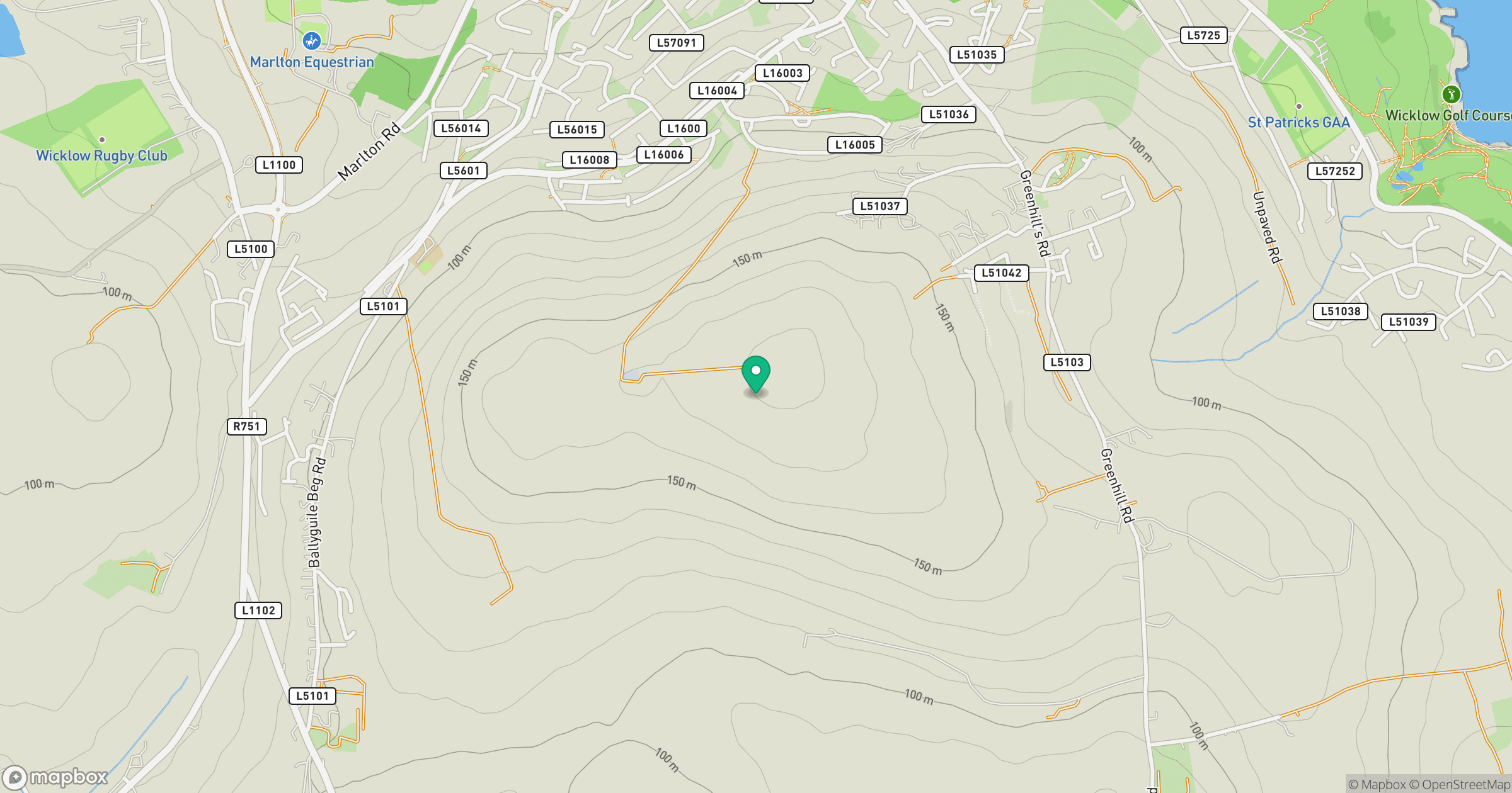
Grid reference: T314925
View on OpenStreetMapOpens a map in a new tab, centred on the hill.
Hills within 30 km
Straight-line distance, not a walking route or confirmation of access.
Mullaghcleevaun
847m
Lugnaquilla [Log na Coille]
925m
Collon Hill [Castletimon Hill]
239m
Carrick Mountain
381m
Westaston Hill
270m
No comments yet. Be the first.