
Westaston Hill
Good walks are even better shared.
Overview
Westaston Hill
Overview
Westaston Hill, standing at 307 meters, is a delightful hill located in the charming South West of England, just a stone's throw from the cathedral city of Wells. This not-so-towering giant is perfect for a brisk day walk, offering an escape from the hustle and bustle, yet not requiring mountaineering boots and ice axes!
Geology
Formed primarily of limestone, Westaston Hill is not just a pretty face; it sports intriguing geological features. The rocky outcrops and the craggy terrain will keep the geologist in you engaged. Keep an eye out for interesting fossils in the limestone, if that's your cup of tea.
Routes
Westaston Circular
This moderate circular route is the most popular among walkers. Spanning approximately 5.5 km, it meanders gently up the hill and back, allowing you to soak in the splendid views without breaking too much of a sweat. Just be wary of slippery spots after rain—a bit of a mud dance could be on the cards!
Summit Features
At the summit, you’ll find a small stone cairn that seems to be surveying the landscape with quite the air of authority. The panoramic views from up here are simply marvellous—much like a good cup of tea, best enjoyed while sitting down!
Terrain Type
The terrain here is predominantly grassy, peppered with rocky outcrops. You may want to avoid wearing your Sunday best—this isn't a catwalk.
Views
From the hill, gaze down upon the endlessly rolling Mendip Hills to the south. Spring and early autumn are your friends here, when the landscape is painted with vibrant colours and the skies are clear. Don’t forget your camera; selfie sticks optional but recommended!
Hazards
As always, there are potential hazards to keep in mind. Slippery rocks can catch you off guard, and muddy paths may offer a surprise slip or two. Stay on your toes!
Nearby Summits
If you're feeling adventurous, consider heading over to the Mendip Hills for a bit of a workout. They may not give you a medal, but the views will surely earn you bragging rights!
Access
Starting your adventure is easy. You can park at a quaint little car park in Wookey, just around 1 km from the main trailhead. Regular bus services from Wells—where you can grab a coffee before you set off—provide an eco-friendly option as well.
Facilities
After conquering Westaston Hill, treat yourself with a meal at the local café in Wookey, where you can discuss your triumphs or recover from your 'exertion' with a slice of homemade cake.
History
The name 'Westaston' hints at its historical roots. It’s believed to mean 'western estate', nestled nicely in the lush landscapes of the area. Locals can regale you with tales of ancient paths that crisscross this hill, giving it a rich cultural significance.
So pack your boots, don your favourite hat, and get ready to enjoy the great outdoors on Westaston Hill. Happy hiking!
Explore routes near Westaston Hill
Public walks starting within 80 km of this hill. Nearby does not mean a route reaches the summit; check its map and access before setting out.
No public routes are currently listed within 80 km of Westaston Hill on Walkmates. This does not mean there are no paths here. Explore the map and check local access information before planning a walk.
Route planning notes
These notes describe possible approaches, not verified navigable routes or permission to cross land. Check current paths, local access rules and conditions before setting out.
Westaston Circular
A scenic circular route starting from the nearby village, taking in the picturesque surroundings and gentle slopes of Westaston Hill.
Make a day of it, together
Find someone to share the walk with, or organise a day out along a route you like.
Hill facts and local notes
Classifications
Elevation
270m
886 ft
Prominence
122m
Coordinates
52.9208, -6.1631
T236871
OS Map
62
At the Summit
The summit features a small stone cairn with a stunning panoramic view across the surrounding countryside.
Terrain & Geology
Westaston Hill is primarily composed of limestone, offering interesting geological formations including exposed rock faces and small limestone crags. The area's rich history of quarrying is evident in some parts of the hill.
Views & Scenery
From the summit, you can see the rolling hills of the Mendip Hills to the south and the expansive fields of the Somerset Levels.
History & Heritage
Name Origin
The name 'Westaston' is believed to derive from its position as a western settlement ('aston' meaning 'east town').
Historical Significance
The hill has historical significance due to its location near ancient paths and remnants of old settlements.
Getting There & Facilities
Check current local access restrictions, parking rules and transport timetables before travelling. These notes do not confirm public access to the summit.
Parking
There is a small car park at the foot of the hill in the village of Wookey, approximately 1 km from the starting point.
Public Transport
Regular bus services run to Wookey from Wells and surrounding towns.
Nearby Facilities
The nearest facilities, including a café and public toilets, are available in Wookey, making it convenient for a quick refreshment stop.
Safety Information
Known Hazards
- Beware of slippery rocks and muddy paths, especially after rain. Some sections of the route may be steep.
General Safety Tips
- Check weather conditions before setting out
- Carry appropriate clothing and equipment
- Let someone know your planned route
- Take a map, compass, and GPS device
- Carry emergency supplies: food, water, first aid kit, torch
Hills
Some common questions about the hills answered
Are there group walks up Westaston Hill?
Many walkers use Walkmates to join or organise walks with others. You can check for group walks around Westaston Hill through the maps
Are there other walkers around Westaston Hill?
Activity varies by location and time, but Walkmates lets you see whether others have shared walks or shown interest in this area. Find other people through the walking friends search walking friends for Westaston Hill search or of course create your own walk for Westaston Hill
Can I organise a walk to Westaston Hill?
Yes. If there aren’t any walks listed already, you can create a walk and make it available for others to join.
If you're signed up to Walkmates, you can create a walk to Westaston Hill.
How do I find a walk up this hill?
There are often multiple ways to walk this hill, depending on experience and route preference. Walkmates helps you explore walks and routes that others have shared.
Can I suggest a new route up Westaston Hill?
Yes. You can suggest or create routes to share with others. Walkmates focuses on the social side of walking, so routes are used to help people organise walks and explore areas together, rather than as detailed navigation tools or route libraries.
Other uses really appreciate knowledgeable walkers sharing their routes. Share your favourite route to Westaston Hill here
The is an error or something incorrect about this hill. How do I let you know?
We always strive to keep the information on Walkmates as accurate as possible. If you find an error, please let us know through the contact form and we'll aim to correct it as quickly as possible
Community Discussion
Comments
Location
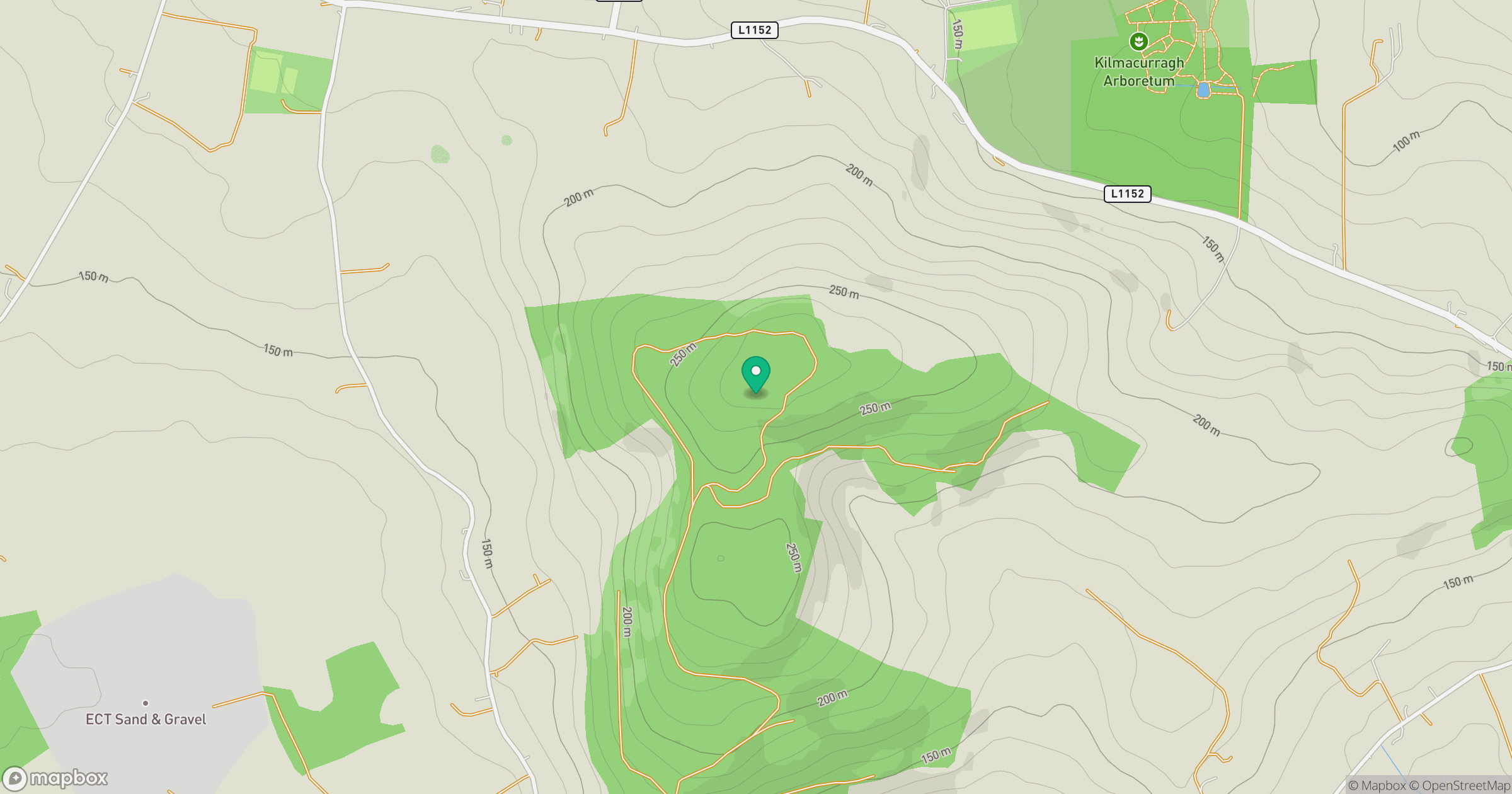
Grid reference: T236871
View on OpenStreetMapOpens a map in a new tab, centred on the hill.
Hills within 30 km
Straight-line distance, not a walking route or confirmation of access.
Mullaghcleevaun
847m
Lugnaquilla [Log na Coille]
925m
Carrick Mountain
381m
Collon Hill [Castletimon Hill]
239m
Trooperstown Hill [Maoilin]
430m
No comments yet. Be the first.