
Ballyhook Hill
Good walks are even better shared.
Overview
Ballyhook Hill
Nestled in the serene landscape of County Carlow, Ballyhook Hill rises to an elevation of 425 meters, making it a modest yet delightful trek for hikers of varying experience levels. Its prominence of 60 meters means while it might not be the tallest of hills, the panoramic views are worth every step.
Geology
Composed of sandstone and shale, the geology of Ballyhook Hill tells a story of ancient landscapes and climatic changes. The rocky outcrops you encounter are beautiful remnants of erosion, showcasing the rugged charm that makes this area so appealing to nature lovers.
Routes
The primary route, The Ballyhook Circuit, begins in Glynn village. This scenic loop covers 8.5 km and typically takes about 3.5 hours to complete. The route is moderately challenging, winding through charming woodlands and ascending the eastern face of the hill. Prepare to have your breath taken away – both from the exertion and the views!
Summit Features
At the summit, a sturdy stone cairn greets you, alongside a quaint wooden cross that symbolizes the local heritage and adds a spiritual touch. You'll feel on top of the world, with nature's beauty surrounding you.
Terrain
Ballyhook Hill boasts a mix of grassy slopes and rocky outcrops, providing a varied experience for those who love a bit of adventure underfoot. Just a warning: it can get slippery when wet!
Views
From the top, the vistas are simply stunning. You can catch sight of the Blackstairs Mountains, with their distinct peaks, and the fertile fields of Carlow. A clear day can even reward you with views of the distant Irish Sea. Spring and autumn are particularly splendid, transforming the land into a patchwork of colours.
Hazards
Although it's a delightful hike, don't underestimate the weather. Conditions can change rapidly, and the terrain can get slick, so good hiking boots and awareness are crucial.
Nearby Summits
Ballyhook's close companions include:
- Mount Leinster (795m): A notable peak nearby and a popular choice for serious hikers.
- Blackstairs Mountains (735m): Together, they create a stunning backdrop for your hiking adventures.
Access
The nearest parking is conveniently located near Glynn village, just off the R114 road. Spaces can fill quickly, especially during weekends or holidays. If you prefer public transport, be aware that bus services from Carlow town to Glynn are not very frequent – better to check the timetable and plan ahead! Glynn itself offers a charming slice of rural life, perfect for resting after your trek.
Facilities
While the hill has no facilities directly on-site, Glynn village hosts a quaint café where you can enjoy a well-earned coffee and perhaps a slice of cake after conquering the hill. There are also public toilets available for your convenience.
History
The etymology of Ballyhook is fascinating, with its roots tracing back to the Irish 'Baile an Chaoch', translating to 'the town of the blind'. The hill has also been a gathering point for hikers, appreciated not only for its natural beauty but also for its cultural significance.
So lace up your boots, gather your pals, and make your way to Ballyhook Hill – who knows, you might just stumble upon the best-kept secret in County Carlow!
Explore routes near Ballyhook Hill
Public walks starting within 80 km of this hill. Nearby does not mean a route reaches the summit; check its map and access before setting out.
No public routes are currently listed within 80 km of Ballyhook Hill on Walkmates. This does not mean there are no paths here. Explore the map and check local access information before planning a walk.
Route planning notes
These notes describe possible approaches, not verified navigable routes or permission to cross land. Check current paths, local access rules and conditions before setting out.
The Ballyhook Circuit
A scenic loop starting from the small village of Glynn, taking you through lush woodlands and up the eastern face of the hill.
Make a day of it, together
Find someone to share the walk with, or organise a day out along a route you like.
Hill facts and local notes
Classifications
Elevation
288m
945 ft
Prominence
121m
Coordinates
52.9952, -6.6872
S882946
OS Map
55
At the Summit
The summit features a stone cairn, which serves as a handy landmark. Additionally, there is a small wooden cross that adds a touch of local spirituality to your walk.
Terrain & Geology
Ballyhook Hill is primarily composed of sandstone and shale, offering a glimpse into the sedimentary processes that shaped this area over millions of years. The rocky outcrops at its summit are evidence of the erosion that has carved out its rugged beauty.
Views & Scenery
From the summit, one can see the sweeping vistas of the Blackstairs Mountains, the lush fields of Carlow, and on clear days, even the distant Irish Sea.
History & Heritage
Name Origin
The name 'Ballyhook' is derived from the Irish 'Baile an Chaoch', meaning 'the town of the blind' – a nod to the local lore!
Historical Significance
Ballyhook Hill has been a meeting point for local hiking groups and is appreciated for its tranquil beauty, often referred to in local folklore.
Getting There & Facilities
Check current local access restrictions, parking rules and transport timetables before travelling. These notes do not confirm public access to the summit.
Parking
There is a small parking area off the R114 road near Glynn village. It's advisable to arrive early as spaces can be limited during peak hiking times.
Public Transport
Bus services from Carlow town run to Glynn though they may not be frequent. Check local schedules in advance.
Nearby Facilities
There are no facilities directly on the hill, but Glynn village has a charming café, perfect for a post-hike coffee, and there are public toilets available.
Safety Information
Known Hazards
- The terrain can be slippery in wet conditions, so good hiking boots are a must. Watch out for sudden changes in weather typical of Irish hills.
General Safety Tips
- Check weather conditions before setting out
- Carry appropriate clothing and equipment
- Let someone know your planned route
- Take a map, compass, and GPS device
- Carry emergency supplies: food, water, first aid kit, torch
Hills
Some common questions about the hills answered
Are there group walks up Ballyhook Hill?
Many walkers use Walkmates to join or organise walks with others. You can check for group walks around Ballyhook Hill through the maps
Are there other walkers around Ballyhook Hill?
Activity varies by location and time, but Walkmates lets you see whether others have shared walks or shown interest in this area. Find other people through the walking friends search walking friends for Ballyhook Hill search or of course create your own walk for Ballyhook Hill
Can I organise a walk to Ballyhook Hill?
Yes. If there aren’t any walks listed already, you can create a walk and make it available for others to join.
If you're signed up to Walkmates, you can create a walk to Ballyhook Hill.
How do I find a walk up this hill?
There are often multiple ways to walk this hill, depending on experience and route preference. Walkmates helps you explore walks and routes that others have shared.
Can I suggest a new route up Ballyhook Hill?
Yes. You can suggest or create routes to share with others. Walkmates focuses on the social side of walking, so routes are used to help people organise walks and explore areas together, rather than as detailed navigation tools or route libraries.
Other uses really appreciate knowledgeable walkers sharing their routes. Share your favourite route to Ballyhook Hill here
The is an error or something incorrect about this hill. How do I let you know?
We always strive to keep the information on Walkmates as accurate as possible. If you find an error, please let us know through the contact form and we'll aim to correct it as quickly as possible
Community Discussion
Comments
Location
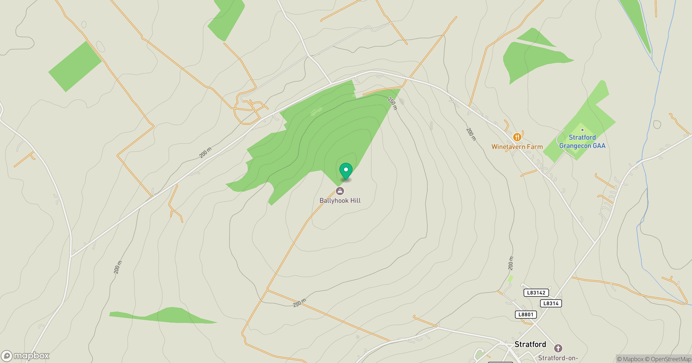
Grid reference: S882946
View on OpenStreetMapOpens a map in a new tab, centred on the hill.
Hills within 30 km
Straight-line distance, not a walking route or confirmation of access.
Lugnaquilla [Log na Coille]
925m
Mullaghcleevaun
847m
Baltinglass Hill [Pinnacle]
382m
Spinans Hill [Eadestown Hill] [Cnoc na Spionan]
408m
Cloghnagaune
380m
No comments yet. Be the first.