

Hawkstone Hill
Good walks are even better shared.
SJ5729 : Looking north from the monument
Chris Gunns Photo source
Overview
Hawkstone Hill
Overview
Hawkstone Hill is a charming peak located in the Shropshire Hills, standing at 225 meters high with a prominence of 12 meters. Nestled within the stunning Hawkstone Park, it offers a delightful escape for hikers and outdoor enthusiasts. The area is renowned for its unique geological features and breathtaking views.
Geology
The geology of Hawkstone Hill is primarily limestone, characterised by fascinating karst formations. These geological wonders contribute to a vibrant ecosystem, making it a hotspot for both geologists and nature lovers. If you're lucky, you might even stumble upon some local fossilised treasures!
Routes
The recommended route is the Hawkstone Park Circular Route, a moderate 5 km loop that takes you through some of the park's most scenic spots. You can expect to spend about 2 hours exploring the area while soaking in the historical significance that the surroundings offer.
Summit Features
At the summit, hikers can find a simple yet meaningful stone cairn and a viewpoint that provides stunning prospects over the landscape. Make sure to snap a photo; it’ll be the envy of your social circle!
Terrain Type
The terrain consists mostly of grassy trails, interspersed with rocky sections. After a drizzle, be ready for a bit of mud; keep those hiking boots handy!
Views
From the summit, sightseers can marvel at the striking views, with the iconic Wrekin prominently on display. Best seasons for views include spring and autumn, where you'll see incredible vistas as well as a riot of colours.
Hazards
While the route is accessible, be cautious of slippery surfaces, particularly after rain. Weather can change quicker than a British summer, so be prepared!
Nearby Summits
If you fancy extending your exploration, nearby summits include:
- The Wrekin (407 m)
- Caer Caradoc (465 m)
Access
Getting to Hawkstone Hill is a breeze:
- Nearest parking: Hawkstone Park offers great parking facilities on the B5063.
- Public transport: Regular buses run from Shrewsbury to the park.
- Nearest town: Shrewsbury is about 12 km away, perfect for a post-hike pint.
Facilities
After your hike, treat yourself to a lovely bite at the park's café, and don't worry about the facilities; they've got you covered with restrooms aplenty.
History
The name 'Hawkstone' reflects its rocky character and its historical connections to bird hunting. The area boasts a rich history, notably as a site of strategic importance during the English Civil War. So, you're not just conquering a hill; you’re walking through history!
In summary, Hawkstone Hill is a delightful destination for hikers of all levels. So pack your boots, grab a friend, and discover the beauty that awaits on this remarkable hill!
Explore routes near Hawkstone Hill
Walks starting near this hill. Open a route to check its map, distance and full itinerary.
Whitchurch Walk with Men Walking & Talking
View route
Colemere and Blakemere Canal Walk
View route
Haughmond Hill: Henry’s Hike
View route
Apley Pool and Landscaped Woods
View route
Route planning notes
These notes describe possible approaches. Check a route's map and access information when planning your walk.
Hawkstone Park Circular Route
A scenic loop that takes you through Hawkstone Park, passing various historical features and offering delightful views at every turn.
Make a day of it, together
Find someone to share the walk with, or organise a day out along a route you like.
Photo Gallery
View all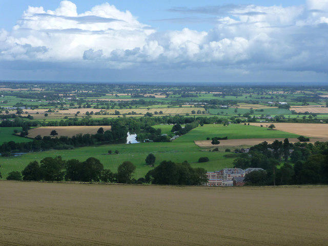 Photo could not load
SJ5729 : Looking north from the monument
Chris Gunns
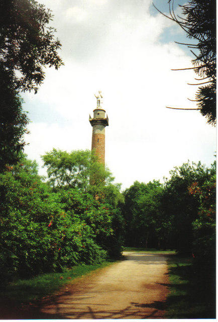 Photo could not load
SJ5729 : Hawkstone Park, near Weston, Shropshire
Carol Walker
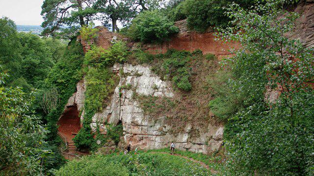 Photo could not load
SJ5729 : Hawkstone Park Cliffs
Kevin Waterhouse
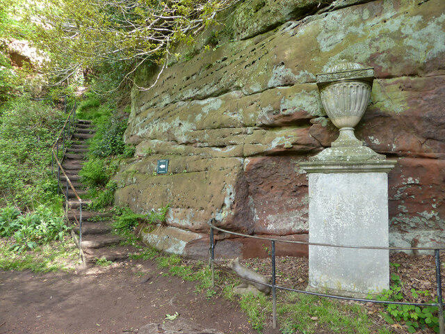 Photo could not load
SJ5729 : Hawkstone Park - The Urn
Chris Allen
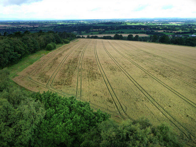 Photo could not load
SJ5729 : Looking northwest from the monument
Chris Gunns
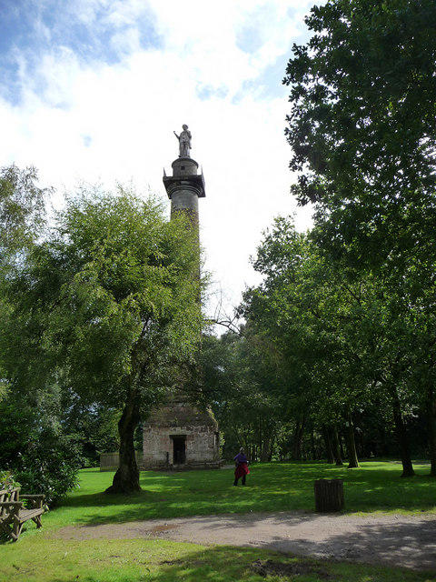 Photo could not load
SJ5729 : Rowland Hill Monument, Hawkstone Park
Chris Gunns
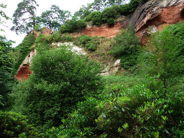 Photo could not load
SJ5729 : Hawkstone Park
Chris Gunns
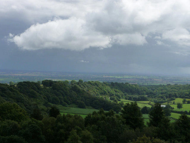 Photo could not load
SJ5729 : Looking east from the monument
Chris Gunns
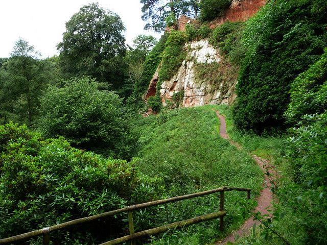 Photo could not load
SJ5729 : Hawkstone Park
Chris Gunns
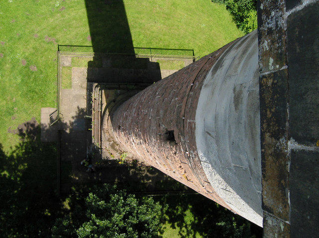
SJ5729 : View down from the top!
Dave Croker
Hill facts and local notes
Classifications
Elevation
208m
682 ft
Prominence
126m
Coordinates
52.8587, -2.6272
SJ578292
OS Map
126
Explorer: 241N
At the Summit
The summit features a small stone cairn and a viewpoint offering expansive vistas over the surrounding countryside.
Terrain & Geology
The hill is primarily composed of limestone with interesting karst formations that attract both geology enthusiasts and casual hikers alike. The unique geology contributes to the rich biodiversity of the surrounding area.
Views & Scenery
On a clear day, the views extend to the Wrekin and beyond, with a picturesque landscape of rolling hills and valleys.
History & Heritage
Name Origin
The name 'Hawkstone' derives from 'hawk' and 'stone', suggesting a rocky outcrop associated with bird hunting or nesting.
Historical Significance
The area is historically significant due to its role in various battles during the English Civil War and its rich archaeological sites.
Getting There & Facilities
Parking
Hawkstone Park offers an excellent parking facility with ample space, located just off the B5063.
Public Transport
The nearest bus service operates from Shrewsbury to Hawkstone Park with regular timings.
Nearby Facilities
Hawkstone Park has a café and visitor centre, providing refreshments and restrooms for hikers.
Safety Information
Known Hazards
- Slippery surfaces in wet weather, potential for sudden changes in weather conditions.
General Safety Tips
- Check weather conditions before setting out
- Carry appropriate clothing and equipment
- Let someone know your planned route
- Take a map, compass, and GPS device
- Carry emergency supplies: food, water, first aid kit, torch
Hills
Some common questions about the hills answered
Are there group walks up Hawkstone Hill?
Many walkers use Walkmates to join or organise walks with others. You can check for group walks around Hawkstone Hill through the maps
Are there other walkers around Hawkstone Hill?
Activity varies by location and time, but Walkmates lets you see whether others have shared walks or shown interest in this area. Find other people through the walking friends search walking friends for Hawkstone Hill search or of course create your own walk for Hawkstone Hill
Can I organise a walk to Hawkstone Hill?
Yes. If there aren’t any walks listed already, you can create a walk and make it available for others to join.
If you're signed up to Walkmates, you can create a walk to Hawkstone Hill.
How do I find a walk up this hill?
There are often multiple ways to walk this hill, depending on experience and route preference. Walkmates helps you explore walks and routes that others have shared.
Can I suggest a new route up Hawkstone Hill?
Yes. You can suggest or create routes to share with others. Walkmates focuses on the social side of walking, so routes are used to help people organise walks and explore areas together, rather than as detailed navigation tools or route libraries.
Other uses really appreciate knowledgeable walkers sharing their routes. Share your favourite route to Hawkstone Hill here
The is an error or something incorrect about this hill. How do I let you know?
We always strive to keep the information on Walkmates as accurate as possible. If you find an error, please let us know through the contact form and we'll aim to correct it as quickly as possible
Community Discussion
Comments
Location
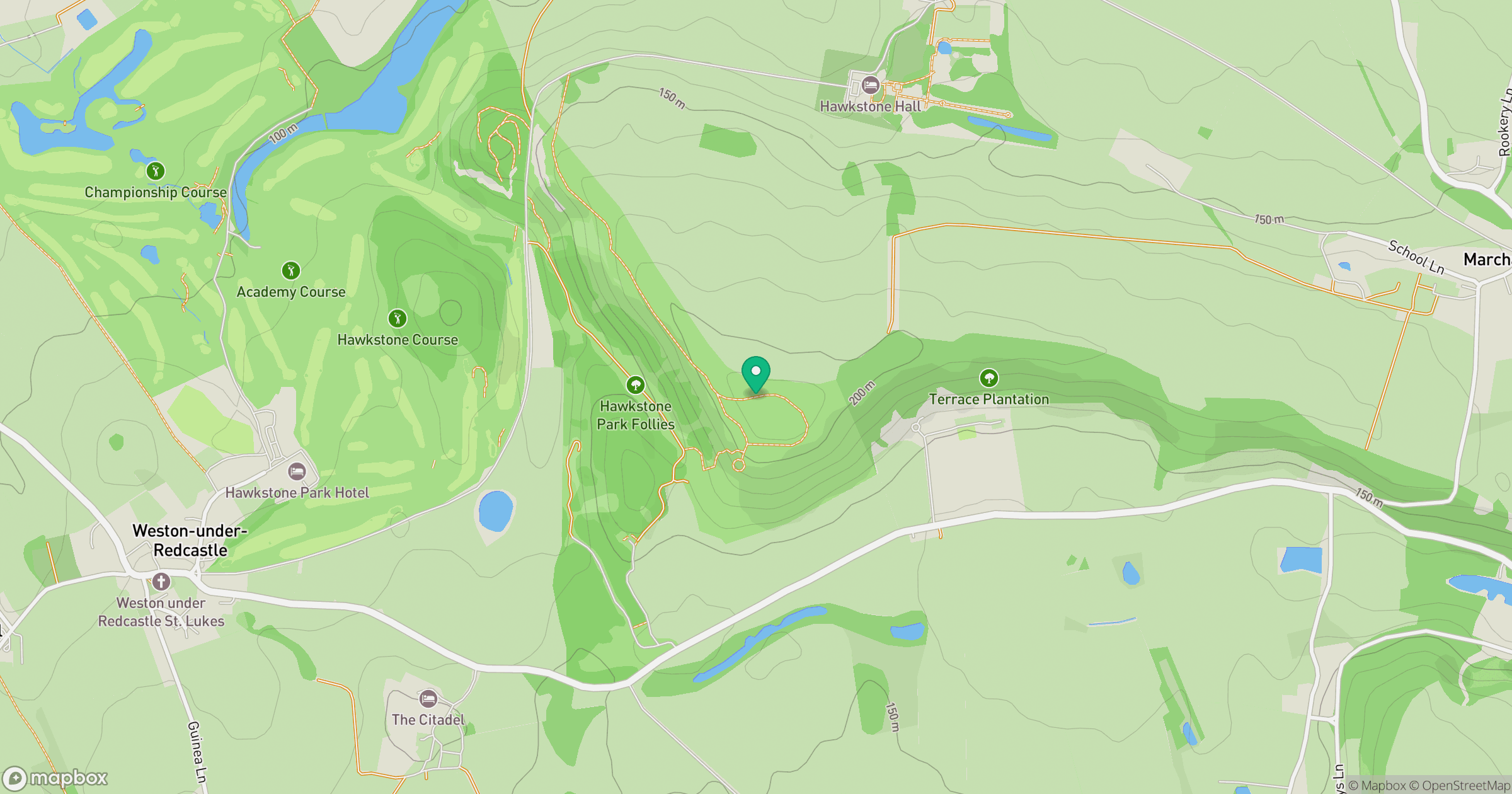
Grid reference: SJ578292
View on OpenStreetMapOpens a map in a new tab, centred on the hill.
Nearby Hills

The Wrekin
407m
Long Mynd - Pole Bank
517m
Stiperstones
537m
Titterstone Clee Hill
533m
Moel Famau
555m
No comments yet. Be the first.