
An Socach
Good walks are even better shared.
Overview
An Socach: A Munro for All Seasons
Overview
An Socach, standing tall at 946 meters, is a prominent Munro that offers the thrill of the Scottish Highlands without requiring you to be part mountain goat.
Geography and Geology
Situated at the coordinates of 56.9493 latitude and -4.7973 longitude, An Socach's ancient granite formations provide a sturdy heart for this mountain. As you ascend, be prepared for a mix of rocky outcrops and soft grass that may hide the occasional bog!
Routes
The most popular route to the summit is via the East Ridge. Spanning 8 km and taking around 4.5 hours, this moderate walk will leave even seasoned hikers feeling refreshed but not overly worn out (unless you’ve skipped breakfast, of course).
Summit Features
At the peak, you’ll find a sizeable cairn that acts as a cheeky reminder of your achievement. Don’t forget to snap a selfie—your friends need proof you’ve been somewhere cooler than the sofa!
Terrain
The terrain is varied, featuring rocky sections which can be slippery when wet, so keep your wits about you, especially on foggy days when the sheep seem to enjoy playing hide and seek.
Scenic Views
Once you reach the summit, the views are nothing short of spectacular! You can gaze across the vast landscapes of the Cairngorms, with Loch Morlich shimmering below like a thousand diamonds.
Hazards
As with any mountain, An Socach does present its fair share of hazards. Be aware of rapidly changing weather and take care on wet and slippery paths.
Access and Nearby Facilities
The journey begins at Glen Tilt car park, which can be quite busy in the summer months. Blairgowrie is the nearest town, full of friendly faces and places to grab a bite to eat after your hike.
History
The name 'An Socach' reflects a bit of Scottish whimsy and brings a smile to the lips of those familiar with its tales.
In summary, An Socach is not just a hike; it’s an adventure filled with stunning scenery, delightful company (if you're with friends), and a touch of Scottish spirit you won't soon forget. So, lace up those boots, grab your walking pole, and hit the trail!
Explore routes near An Socach
Walks starting near this hill. Open a route to check its map, distance and full itinerary.
Cairngorms night walk and stargazing (event meeting)
View route
Cairngorms night walk and stargazing (event meeting)
View route
Cairngorms night walk and stargazing (event meeting)
View route
Cairngorms night walk and stargazing (event meeting)
View route
Route planning notes
These notes describe possible approaches. Check a route's map and access information when planning your walk.
East Ridge Route
This popular route begins at the foot of the East Ridge and leads climbers directly to the summit, offering stunning views along the ascent.
Make a day of it, together
Find someone to share the walk with, or organise a day out along a route you like.
Hill facts and local notes
Classifications
Elevation
943m
3,093 ft
Prominence
187m
Coordinates
56.9020, -3.5124
NO079799
OS Map
43
Explorer: OL52N 387N
At the Summit
The summit boasts a prominent cairn, which serves as both a navigational aid and a great photo spot for all eager hikers. Look out for the occasional wandering sheep, who seem to think they own the place!
Terrain & Geology
The area is primarily composed of ancient granitic rock, providing a robust foundation for the mountain's rugged terrain. The granite outcrops contribute to the striking vistas seen from the summit.
Views & Scenery
From the summit, you can enjoy panoramic views of the surrounding hills, including the sprawling expanse of the Cairngorms and the nearby Loch Morlich sparkling in the sunlight.
History & Heritage
Name Origin
An Socach means 'the Sock' in Scots Gaelic, perhaps named for its distinct shape resembling a sock being hung out to dry.
Historical Significance
The mountain has played a role in local folklore, often being referenced in stories told around campfires about brave souls who ventured into its mists.
Getting There & Facilities
Parking
The nearest parking area is located at the Glen Tilt car park, approximately 6 km from the route starting point. It offers ample space but can fill up quickly during peak season.
Public Transport
Regular bus services operate from Blairgowrie to the nearest village, Bridge of Tilt. From there, it’s about a 40-minute walk to the trailhead.
Nearby Facilities
There are no facilities on the mountain itself, but Blairgowrie has a range of cafes, restaurants, and public toilets available.
Safety Information
Known Hazards
- Be cautious of changing weather conditions; they can turn on a dime. Additionally, slippery rocks and uneven terrain can be tricky, especially in wet weather.
General Safety Tips
- Check weather conditions before setting out
- Carry appropriate clothing and equipment
- Let someone know your planned route
- Take a map, compass, and GPS device
- Carry emergency supplies: food, water, first aid kit, torch
Hills
Some common questions about the hills answered
Are there group walks up An Socach?
Many walkers use Walkmates to join or organise walks with others. You can check for group walks around An Socach through the maps
Are there other walkers around An Socach?
Activity varies by location and time, but Walkmates lets you see whether others have shared walks or shown interest in this area. Find other people through the walking friends search walking friends for An Socach search or of course create your own walk for An Socach
Can I organise a walk to An Socach?
Yes. If there aren’t any walks listed already, you can create a walk and make it available for others to join.
If you're signed up to Walkmates, you can create a walk to An Socach.
How do I find a walk up this hill?
There are often multiple ways to walk this hill, depending on experience and route preference. Walkmates helps you explore walks and routes that others have shared.
Can I suggest a new route up An Socach?
Yes. You can suggest or create routes to share with others. Walkmates focuses on the social side of walking, so routes are used to help people organise walks and explore areas together, rather than as detailed navigation tools or route libraries.
Other uses really appreciate knowledgeable walkers sharing their routes. Share your favourite route to An Socach here
The is an error or something incorrect about this hill. How do I let you know?
We always strive to keep the information on Walkmates as accurate as possible. If you find an error, please let us know through the contact form and we'll aim to correct it as quickly as possible
Community Discussion
Comments
Location
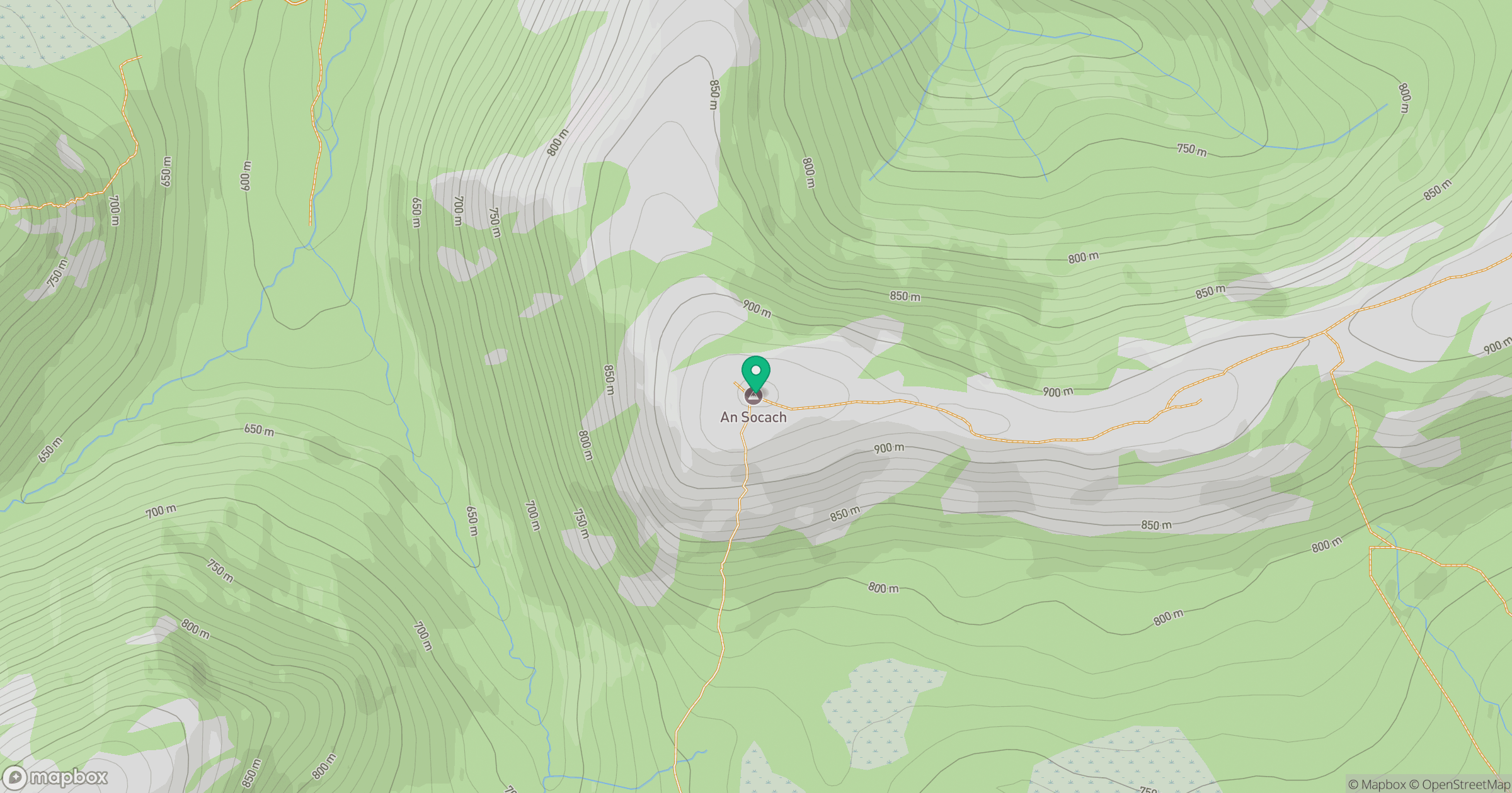
Grid reference: NO079799
View on OpenStreetMapOpens a map in a new tab, centred on the hill.
![Ben Macdui [Beinn Macduibh]](https://cdn.walkmates.com/gallery-images/e60cf32aeb394c3282fcdd14a63368f0.jpg)
No comments yet. Be the first.