

Wrotham Hill
Good walks are even better shared.
TQ5960 : M20, Cooper's Wood
David Dixon Photo source
Overview
Wrotham Hill: A Hiker's Delight
Overview
Nestled in the scenic North Downs of Kent, Wrotham Hill is a charming Marilyn that stands proudly at an elevation of 263 meters, offering stunning views and a delightful hiking experience for both seasoned hikers and beginners alike.
Geology
The hill showcases classic chalk geology, typical of the region. Flints embedded within the chalk provide a distinct feature and are remnants of the ancient marine life that once thrived here. It’s a geological wonder with stories that date back to when dinosaurs roamed the Earth — no, seriously, well, not right here specifically!
Routes
One popular route is the Wrotham Hill Circular that meanders through picturesque woodlands and past captivating views. Clocking in at about 7.5 km, it takes approximately 2.5 hours to complete, depending on how often you stop to take in the views or snap a few selfies!
Summit Features
As you reach the top, you’re greeted by a trig point that stands as a silent witness to all the hikers that have come before you. Take a moment to revel in the feeling of being on top of the world — well, at least the highest point of the hill.
Terrain
The slopes of Wrotham Hill invite you with a mix of grassy land and woodland paths that can get a bit rocky near the summit. Make sure to wear comfy shoes and a smile!
Views
From the summit, expect views that will leave you breathless — and not just because you've climbed! You might catch sight of the Medway Valley stretching out below and, on crystal-clear days, the rooftops of London may even peek through the horizon. Spring and autumn are the prime seasons for optimal vistas, as the landscape bursts with colour.
Hazards
Be mindful of the slippery sections, particularly if there’s been rain. Also, keep an eye out for wildlife; it can be a bit too friendly if you're carrying snacks!
Nearby Summits
Not too far from Wrotham Hill, you can find Istead Rise and the Sevenoaks Ridge to extend your hiking adventures.
Access
For those driving, you can easily park in laybys on the approach to Wrotham or use on-street parking within the village. Public transport options include buses, and the nearest train station is Borough Green. Wrotham itself is your go-to nearest settlement, offering a warm Kentish welcome.
Facilities
After your hike, Wrotham is a delightful place to unwind with a couple of pubs and cafes — perfect spots to enjoy a hearty meal or a warm cuppa. Public toilets are also conveniently available.
History
The origin of the name Wrotham gives you a glimpse into its historical roots — it means 'the settlement on the wzra stream'. This hill has held significance since ancient times, acting as a place of burial in the past.
So pack your backpack, lace up your boots, and set off on an adventure to Wrotham Hill. You'll find ample opportunities for thrilling hikes, beautiful views, and a touch of history!
Explore routes near Wrotham Hill
Walks starting near this hill. Open a route to check its map, distance and full itinerary.
Trosley Country Park: Woodland Walk and Weald views
View route
Ightham Mote, Scathes Wood and Wilmot Hill Circuit
View route
Lullingstone Country Park: Beechen Wood and valley views
View route
Knole Park Broad Walk and Chestnut Walk Circuit
View route
Route planning notes
These notes describe possible approaches. Check a route's map and access information when planning your walk.
Wrotham Hill Circular
A popular circular walk starting from the village of Wrotham, leading up through woodlands and open fields.
Make a day of it, together
Find someone to share the walk with, or organise a day out along a route you like.
Photo Gallery
View all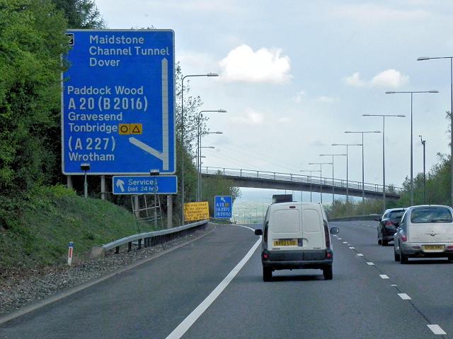 Photo could not load
TQ5960 : M20, Cooper's Wood
David Dixon
Hill facts and local notes
Classifications
Elevation
235m
771 ft
Prominence
129m
Coordinates
51.3171, 0.2851
TQ593600
OS Map
177 188
Explorer: 147
At the Summit
The summit features a prominent trig point, which adds to the hill's charm. There's also a small rock outcrop that provides a perfect spot to rest and take in the views.
Terrain & Geology
Wrotham Hill is primarily composed of chalk, characteristic of the North Downs, interspersed with flint nodules. The surrounding area has fascinating landforms shaped by glacial activity during the last Ice Age.
Views & Scenery
From the summit, one can enjoy sweeping views over the Medway Valley and across to the North Downs, with the historic town of Wrotham, and on clear days, even the skyscrapers of London in the distance.
History & Heritage
Name Origin
The name 'Wrotham' is believed to derive from Old English, meaning 'the settlement on the wzra stream'.
Historical Significance
Wrotham Hill holds historical significance as it has been a site for various settlements since the prehistoric era. The hill is also closely associated with ancient burial mounds.
Getting There & Facilities
Parking
There are several laybys along the road to Wrotham where you can park for free. Alternatively, the village of Wrotham offers some on-street parking.
Public Transport
Wrotham is accessible via bus services from nearby towns, with the closest railway station being Borough Green, approximately 3 km away.
Nearby Facilities
The village of Wrotham has a couple of pubs and cafes where you can grab a bite to eat or a cup of tea after your hike. Public toilets are also available in the village.
Safety Information
Known Hazards
- Keep an eye out for slippery areas on the woodland paths, especially after rain. Also, be cautious of the wildlife, particularly during early morning or late evening.
General Safety Tips
- Check weather conditions before setting out
- Carry appropriate clothing and equipment
- Let someone know your planned route
- Take a map, compass, and GPS device
- Carry emergency supplies: food, water, first aid kit, torch
Hills
Some common questions about the hills answered
Are there group walks up Wrotham Hill?
Many walkers use Walkmates to join or organise walks with others. You can check for group walks around Wrotham Hill through the maps
Are there other walkers around Wrotham Hill?
Activity varies by location and time, but Walkmates lets you see whether others have shared walks or shown interest in this area. Find other people through the walking friends search walking friends for Wrotham Hill search or of course create your own walk for Wrotham Hill
Can I organise a walk to Wrotham Hill?
Yes. If there aren’t any walks listed already, you can create a walk and make it available for others to join.
If you're signed up to Walkmates, you can create a walk to Wrotham Hill.
How do I find a walk up this hill?
There are often multiple ways to walk this hill, depending on experience and route preference. Walkmates helps you explore walks and routes that others have shared.
Can I suggest a new route up Wrotham Hill?
Yes. You can suggest or create routes to share with others. Walkmates focuses on the social side of walking, so routes are used to help people organise walks and explore areas together, rather than as detailed navigation tools or route libraries.
Other uses really appreciate knowledgeable walkers sharing their routes. Share your favourite route to Wrotham Hill here
The is an error or something incorrect about this hill. How do I let you know?
We always strive to keep the information on Walkmates as accurate as possible. If you find an error, please let us know through the contact form and we'll aim to correct it as quickly as possible
Community Discussion
Comments
Location
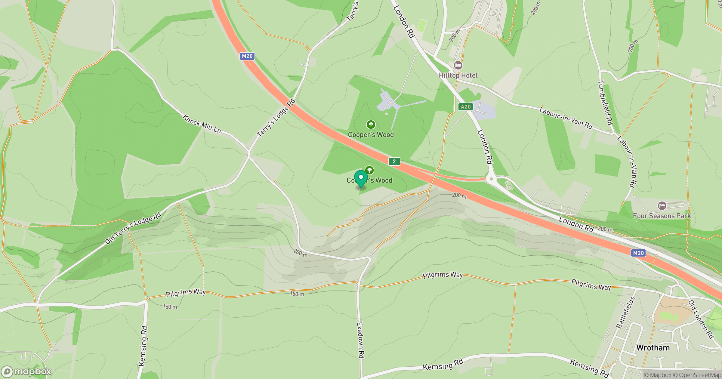
Grid reference: TQ593600
View on OpenStreetMapOpens a map in a new tab, centred on the hill.
No comments yet. Be the first.