

Carn na Bruar
Good walks are even better shared.
Overview
Carn na Bruar
Overview
Carn na Bruar, standing at an impressive 978 meters, is one of the jewels of the Scottish Highlands. This Munro is not just a hill, but a scenic treasure trove, offering breathtaking views and a bit of Scottish mystique.
Geology
The mountain showcases granite and schist formations, a testimony to the glacial past of this rugged landscape. The rocks tell tales of time and resilience, making every step you take feel like a walk through history.
Routes
The most popular route up Carn na Bruar is the Bruar Water Circuit. It kicks off from the Bruar Water, gently climbing through enchanting woodlands before engaging in a more serious ascent. This route spans 12.5 kilometers and usually takes around 4.5 hours, providing a rewarding yet moderate challenge for hikers.
Summit Features
At the summit, you are greeted by a splendid cairn and a trig point both of which welcome weary trekkers and provide that perfect backdrop for a 'victory' photo.
Terrain
Expect a delightful mix of terrain. The lower sections can be a bit boggy, so be sure to wear appropriate footwear, while the upper reaches offer rocky paths that reward your effort with stunning vistas.
Views
The view from Carn na Bruar will take your breath away—assuming the wind hasn’t already done that! On a clear day, notable landmarks such as Ben Alder and the picturesque Strath Tarn can be spied from the top. Make sure to visit in spring for the wildflowers or autumn to marvel at the vibrant foliage.
Hazards
Though not particularly hazardous, the quick-changing weather can surprise the unwary. Watch out for slippery rocks and boggy holes, especially after a good dose of Scottish rain. Remember: Fools rush in, but wise hikers take heed!
Nearby Summits
Nearby you’ll find a pair of delightful walking companions: Mullach Clach a' Bhlair standing proudly at 957 meters and Ben Vrackie at 841 meters, both of which are worth exploring.
Access
Conveniently, a car park is available at Bruar Falls, near the A9, to kick off your adventure. If you're relying on public transport, bus services to Blair Atholl will get you fairly close, allowing a pleasant walk to the trailhead.
Facilities
After your hike, treat yourself to a well-deserved coffee or a spot of lunch at one of the cafes in Blair Atholl. The car park also offers essential toilet facilities to refresh before you set off.
Conclusion
In summary, Carn na Bruar is not just another Munro; it’s an experience waiting to be had. With its stunning views, accessible routes, and a sprinkle of Scottish charm, it’s a must-visit for any hiking enthusiast. Don’t forget your camera—though in Scotland, the scenery may often leave you speechless!
Happy hiking!
Explore routes near Carn na Bruar
Public walks starting within 80 km of this hill. Nearby does not mean a route reaches the summit; check its map and access before setting out.
Aberlour to Carron Bridge: Speyside Way riverside return
View route
Craigellachie to Aberlour: Speyside Railway Path Return
View route
Loch Kinord: Muir of Dinnet Woodland Circuit
View route
Cairngorms night walk and stargazing (event meeting)
View route
Route planning notes
These notes describe possible approaches, not verified navigable routes or permission to cross land. Check current paths, local access rules and conditions before setting out.
Bruar Water Circuit
This popular walking route starts from the Bruar Water and winds through scenic woodlands before ascending to the summit.
Make a day of it, together
Find someone to share the walk with, or organise a day out along a route you like.
Photo Gallery
View all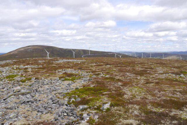 Photo could not load
NJ2925 : Summit plateau, Carn na Bruar
Richard Webb
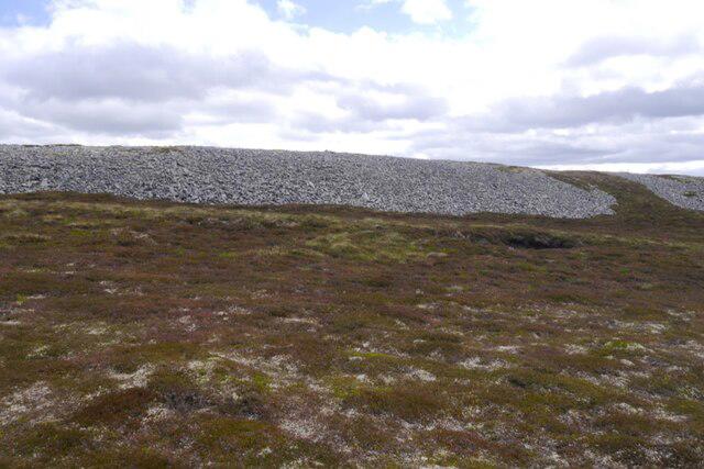 Photo could not load
NJ2925 : Scree on Carn na Bruar
Richard Webb
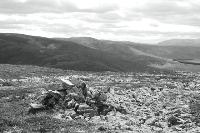 Photo could not load
NJ2925 : Cairn, Carn na Bruar
Richard Webb
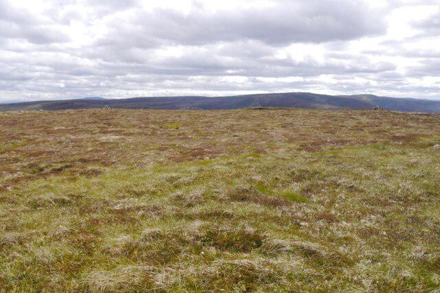 Photo could not load
NJ2925 : Summit, Carn na Bruar
Richard Webb
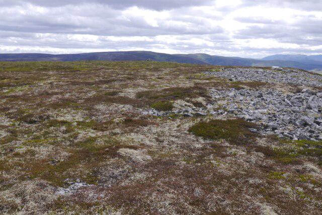 Photo could not load
NJ2925 : Summit plateau, Carn na Bruar
Richard Webb
Hill facts and local notes
Classifications
Elevation
683m
2,241 ft
Prominence
102m
Coordinates
57.3161, -3.1794
NJ290256
OS Map
37
Explorer: OL62W 420W
At the Summit
The summit features a substantial cairn and a trig point, marking the highest point and serving as a perfect location for summit selfies.
Terrain & Geology
Carn na Bruar is primarily composed of granite, alongside some schist, offering rugged terrain and panoramic views. The geology reflects the typical composition of the central Scottish Highlands, shaped by glacial action.
Views & Scenery
From the summit, you can observe stunning views of the surrounding peaks, including Ben Alder and the visual spectacle of Strath Tarn.
History & Heritage
Name Origin
The name 'Carn na Bruar' translates roughly to 'Hill of the Bruar', highlighting its prominent location overlooking the Bruar Water.
Historical Significance
This area has cultural significance, historically featuring in Scottish writings and folklore, often associated with natural beauty and tranquility.
Getting There & Facilities
Check current local access restrictions, parking rules and transport timetables before travelling. These notes do not confirm public access to the summit.
Parking
There is a dedicated car park at Bruar Falls, located off the A9, making it easily accessible for parking.
Public Transport
Regular bus services run to nearby Blair Athol, from where you can walk to the car park area.
Nearby Facilities
There are toilet facilities at Bruar Falls car park and several cafes in Blair Atholl offering refreshments after your hike.
Safety Information
Known Hazards
- Variable weather conditions can lead to rapid changes in temperature and visibility. Be wary of slippery rocks and boggy areas, especially after rain.
General Safety Tips
- Check weather conditions before setting out
- Carry appropriate clothing and equipment
- Let someone know your planned route
- Take a map, compass, and GPS device
- Carry emergency supplies: food, water, first aid kit, torch
Hills
Some common questions about the hills answered
Are there group walks up Carn na Bruar?
Many walkers use Walkmates to join or organise walks with others. You can check for group walks around Carn na Bruar through the maps
Are there other walkers around Carn na Bruar?
Activity varies by location and time, but Walkmates lets you see whether others have shared walks or shown interest in this area. Find other people through the walking friends search walking friends for Carn na Bruar search or of course create your own walk for Carn na Bruar
Can I organise a walk to Carn na Bruar?
Yes. If there aren’t any walks listed already, you can create a walk and make it available for others to join.
If you're signed up to Walkmates, you can create a walk to Carn na Bruar.
How do I find a walk up this hill?
There are often multiple ways to walk this hill, depending on experience and route preference. Walkmates helps you explore walks and routes that others have shared.
Can I suggest a new route up Carn na Bruar?
Yes. You can suggest or create routes to share with others. Walkmates focuses on the social side of walking, so routes are used to help people organise walks and explore areas together, rather than as detailed navigation tools or route libraries.
Other uses really appreciate knowledgeable walkers sharing their routes. Share your favourite route to Carn na Bruar here
The is an error or something incorrect about this hill. How do I let you know?
We always strive to keep the information on Walkmates as accurate as possible. If you find an error, please let us know through the contact form and we'll aim to correct it as quickly as possible
Community Discussion
Comments
Location
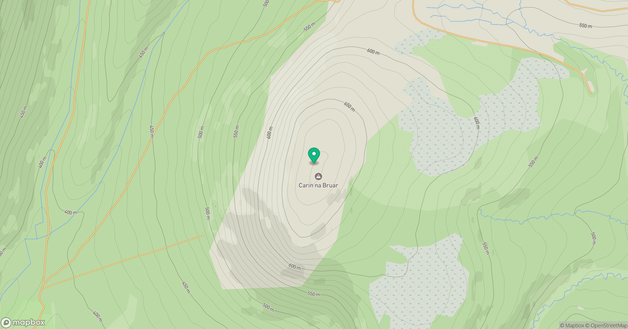
Grid reference: NJ290256
View on OpenStreetMapOpens a map in a new tab, centred on the hill.
Hills within 30 km
Straight-line distance, not a walking route or confirmation of access.
Ben Avon - Leabaidh an Daimh Bhuidhe
1,172m
Cook's Cairn
756m
Corryhabbie Hill
781m
Carn Mor
804m
The Bochel
491m
No comments yet. Be the first.