

Suidhe Chatain
Good walks are even better shared.
Overview
Suidhe Chatain
Introduction
Suidhe Chatain, standing majestically at 484 meters, is a charming Marilyn nestled in the Scottish Highlands. This mountain promises not just a hike, but an adventure filled with stunning landscapes and rich heritage.
Geology
With its roots in granite and schist, the geology of Suidhe Chatain is a testament to the effects of glacial activity. The rocky terrain not only makes for interesting hiking but also serves as a brilliant educational resource for geology enthusiasts.
Routes
The Suidhe Chatain Circular Route is ideal for both novices and experienced hikers. Covering approximately 8 km, this moderate trek takes around 3.5 hours to complete. Starting from Strathclyde, the route offers a steady ascent and plenty of opportunities to stop for breath-taking views or one of those bewildering moments of diminished physical stamina.
Summit Features
At the summit, hikers are greeted by a significant cairn—a rewarding sight after the climb. This sturdy monument stands as a silent witness to many a weary hiker's triumph.
Terrain Type
Expect a mix of rocky and grassy patches underfoot. Good footwear is essential to ensure you don't end up auditioning for a reality show about falling on your face in the great outdoors.
Views
The views from the top are simply breathtaking; look out for iconic landmarks such as Loch Awe, the formidable Ben Cruachan, and the expansive highland landscapes. The best seasons to enjoy these vistas are spring and early autumn, although sunsets at any time of year are a sight to behold!
Hazards
Be aware, the rocky paths can be a bit treacherous, so sturdy footwear is a must. The weather can change quicker than a cat on a hot tin roof, so make sure you're prepared. Cattle occasionally roam the trails, adding to both charm and a touch of unpredictability.
Nearby Summits
For those looking to extend their adventure, Beinn a' Chochuill and Ben Cruachan are splendid nearby summits, each offering unique challenges and views.
Access
You’ll find ample parking at the village hall in Strathclyde, just a short 10-minute walk from the trailhead. Public transport options from Oban make getting here a doddle.
Facilities
While the mountain itself is a wild adventure, don’t despair! Local facilities include a friendly café perfect for post-hike refuelling, as well as toilets at the village hall.
History
The name Suidhe Chatain itself carries weight, translating to 'Sit of the Chieftain' and highlighting the mountain's cultural significance within Scottish folklore.
Conclusion
Whether you're a seasoned mountaineer or just fancy a Sunday stroll with exceptional scenery, Suidhe Chatain offers a slice of the Scottish Highlands that should not be missed!
Explore routes near Suidhe Chatain
Public walks starting within 80 km of this hill. Nearby does not mean a route reaches the summit; check its map and access before setting out.
Goatfell from Cladach
View route
Greenock Cut: the full circuit from Cornalees
View route
Bishop’s Glen group walk
View route
West Bay walk and talk
View route
Route planning notes
These notes describe possible approaches, not verified navigable routes or permission to cross land. Check current paths, local access rules and conditions before setting out.
Suidhe Chatain Circular
A popular circular route starting from the village of Strathclyde, featuring a steady incline and stunning scenery throughout.
Make a day of it, together
Find someone to share the walk with, or organise a day out along a route you like.
Photo Gallery
View all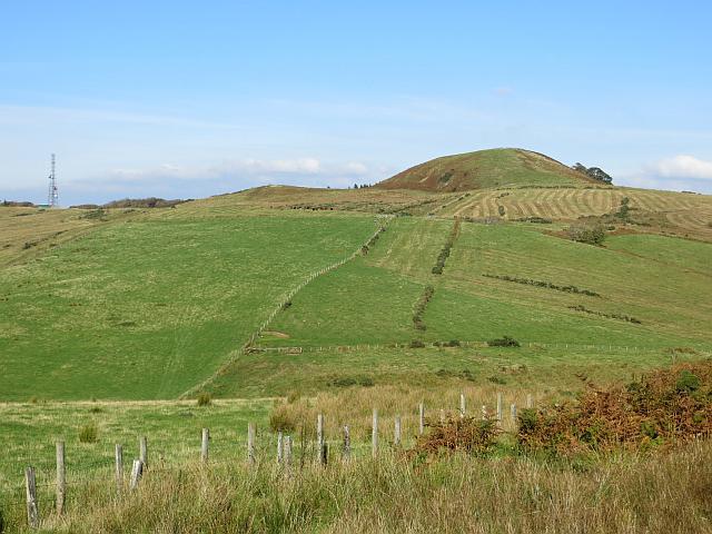 Photo could not load
NS0954 : Suidhe Chatain
Richard Webb
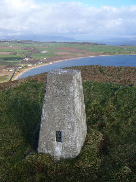 Photo could not load
NS0954 : Suidhe Chatain trig
Iain Macaulay
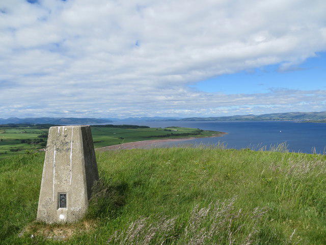 Photo could not load
NS0954 : Trig point on Suidhe Chatain
John Ferguson
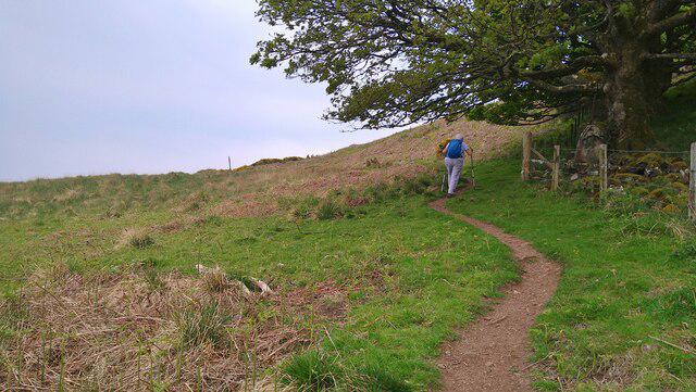 Photo could not load
NS0954 : The West Island Way path snakes up south of Suidhe Chatain
Gordon Brown
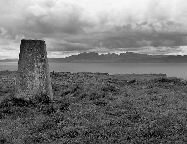 Photo could not load
NS0954 : Suidhe Chatain (trig point)
Raibeart MacAoidh
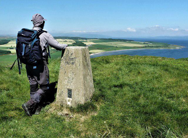 Photo could not load
NS0954 : Suidhe Chatain - Isle of Bute
Raibeart MacAoidh
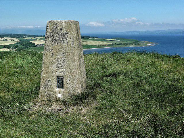 Photo could not load
NS0954 : Suidhe Chatain - Isle of Bute
Raibeart MacAoidh
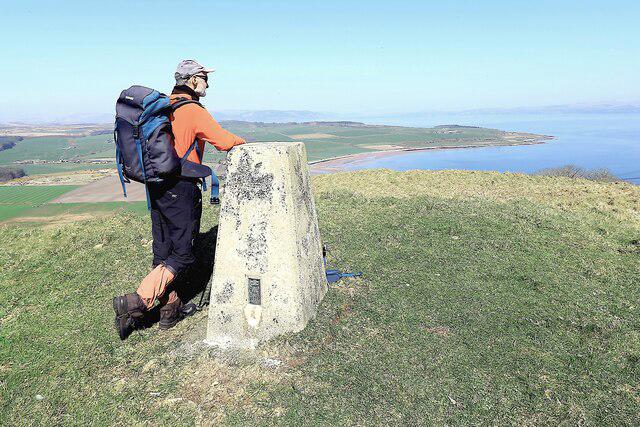 Photo could not load
NS0954 : Suidhe Chatain - Isle of Bute
Raibeart MacAoidh
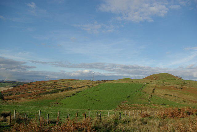 Photo could not load
NS0954 : Suidhe Chatain
Leslie Barrie
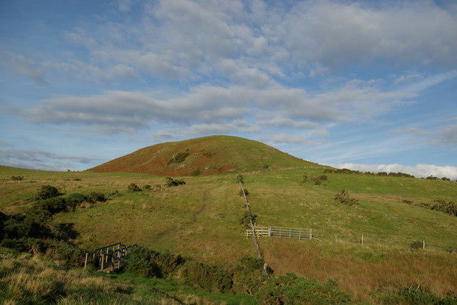
NS0954 : Suidhe Chatain
Leslie Barrie
Hill facts and local notes
Classifications
Elevation
157m
515 ft
Prominence
140m
Coordinates
55.7487, -5.0320
NS098547
OS Map
63
Explorer: 362S
At the Summit
The summit is marked by a large cairn, allowing hikers to feel a sense of accomplishment as they enjoy the panoramic views.
Terrain & Geology
The area is primarily composed of granite and schist, with fascinating geological formations resulting from glacial activity. The rocky landscape provides a mesmerizing showcase of natural history.
Views & Scenery
Breathtaking views of Loch Awe and the surrounding hills, including Ben Cruachan and the sweeping landscapes of the Highlands.
History & Heritage
Name Origin
The name 'Suidhe Chatain' translates as 'Sit of the Chieftain' in Gaelic, indicating its significance in local folklore.
Historical Significance
This area has been inhabited for centuries and is steeped in Scottish Gaelic history, offering insight into the region's past.
Getting There & Facilities
Check current local access restrictions, parking rules and transport timetables before travelling. These notes do not confirm public access to the summit.
Parking
Parking available at the village hall in Strathclyde, a brief 10-minute walk from the trailhead.
Public Transport
Regular bus services run from Oban to Strathclyde, providing a convenient option for hikers.
Nearby Facilities
A few campsites and a local café are situated within short driving distance in Strathclyde. Toilets are available at the nearby village hall.
Safety Information
Known Hazards
- Rocky terrain requiring sturdy footwear, sudden weather changes typical of the Highlands, and potential encounters with livestock.
General Safety Tips
- Check weather conditions before setting out
- Carry appropriate clothing and equipment
- Let someone know your planned route
- Take a map, compass, and GPS device
- Carry emergency supplies: food, water, first aid kit, torch
Hills
Some common questions about the hills answered
Are there group walks up Suidhe Chatain?
Many walkers use Walkmates to join or organise walks with others. You can check for group walks around Suidhe Chatain through the maps
Are there other walkers around Suidhe Chatain?
Activity varies by location and time, but Walkmates lets you see whether others have shared walks or shown interest in this area. Find other people through the walking friends search walking friends for Suidhe Chatain search or of course create your own walk for Suidhe Chatain
Can I organise a walk to Suidhe Chatain?
Yes. If there aren’t any walks listed already, you can create a walk and make it available for others to join.
If you're signed up to Walkmates, you can create a walk to Suidhe Chatain.
How do I find a walk up this hill?
There are often multiple ways to walk this hill, depending on experience and route preference. Walkmates helps you explore walks and routes that others have shared.
Can I suggest a new route up Suidhe Chatain?
Yes. You can suggest or create routes to share with others. Walkmates focuses on the social side of walking, so routes are used to help people organise walks and explore areas together, rather than as detailed navigation tools or route libraries.
Other uses really appreciate knowledgeable walkers sharing their routes. Share your favourite route to Suidhe Chatain here
The is an error or something incorrect about this hill. How do I let you know?
We always strive to keep the information on Walkmates as accurate as possible. If you find an error, please let us know through the contact form and we'll aim to correct it as quickly as possible
Community Discussion
Comments
Location
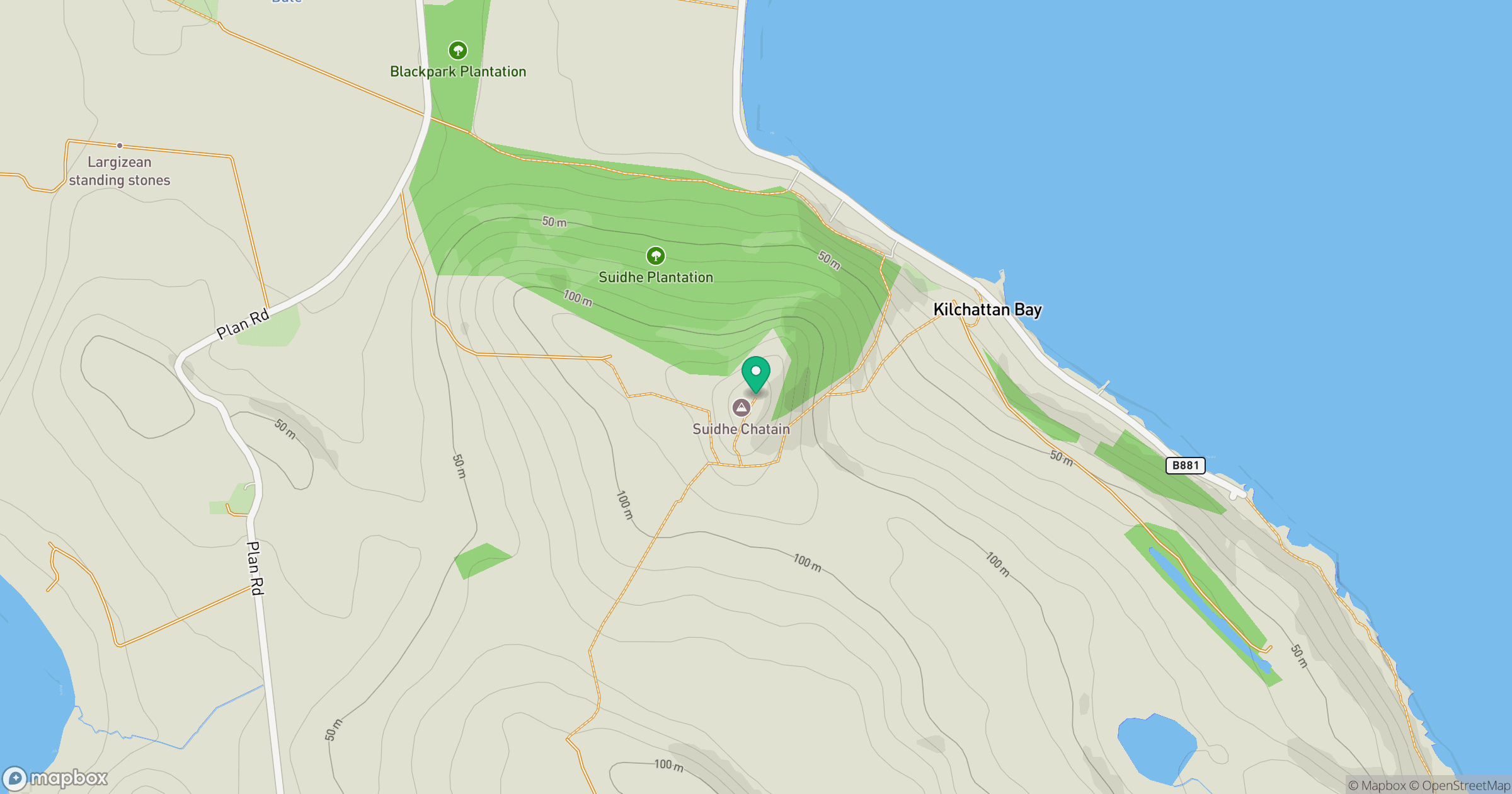
Grid reference: NS098547
View on OpenStreetMapOpens a map in a new tab, centred on the hill.
Hills within 30 km
Straight-line distance, not a walking route or confirmation of access.
Goatfell [Goat Fell]
875m
Cir Mhor
798m
Common Hill [Canada Hill]
132m
Barbay Hill
127m
Black Craig
522m
No comments yet. Be the first.