

Caisteal Abhail
Good walks are even better shared.
NR9644 : Summit camp on Caisteal Abhail
Raibeart MacAoidh Photo source
Overview
Caisteal Abhail
Caisteal Abhail, standing tall at 859 meters, is a worthy challenge for any keen hiker looking to soak in the enchanting beauty of the Scottish Highlands. Often recognized for its distinct granite formations, this Munro offers the perfect blend of steep ascents and breathtaking views.
Geology
The unique geology of Caisteal Abhail is characterized by its granite core. Shaped by ancient glacial movements, the terrain is rugged and offers delightful rocky outcrops that will challenge your hiking skills and perhaps your patience as you navigate the slightly slippery bits.
Routes
A popular route for enthusiasts is the Caisteal Abhail Circuit, which is roughly 8 km in length and typically takes around 4 hours to complete. This route not only introduces you to Caisteal Abhail but also offers an exciting journey around its neighboring peaks. For the more adventurous souls, the East Ridge Ascend presents a challenging option. Clocking in at 5 km and requiring about 3 hours, this route will have you scrambling, sweating, and silently cursing the steep climb, but it’s incredibly rewarding in terms of views.
Summit Features
At the summit, you'll be greeted by a well-constructed stone cairn, offering some shelter from the usually unpredictable Scottish weather. You may feel tempted to place a stone upon it – a tip of your hat to the mountain gods.
Terrain Type
Expect a rugged and rocky experience, occasionally interspersed with grassy areas. Be prepared for some muddy surprises too; after all, what’s a hike without a bit of squelchy fun?
Views
When you finally reach the summit, the views are nothing short of spectacular. You can see the Paps of Jura standing resolute nearby, and on those rare clear days, the vistas extend to the distant islands of the Outer Hebrides. Late spring to early autumn is the best time to enjoy this splendor, ideally with clear skies to truly appreciate the landscape.
Hazards
While the ascent is manageable, be aware of loosely consolidated rocks that can give way beneath your feet. Moreover, Scottish weather is notoriously fickle, so be prepared for anything from sunshine to sudden showers. Always carry a good waterproof jacket!
Access
The nearest parking area is conveniently located just off the A846 near Port Askaig, making it an accessible starting point for your adventure. Public transport options are available, with regular bus services connecting Bowmore to Port Askaig. If you find yourself in need of a coffee before or after your hike, several local cafes are ready to serve you.
History
The name Caisteal Abhail reflects the mountain’s heritage. It translates to ‘Castle of the Abhainn’, nodding to its relationship with the nearby river. Historically, this peak has served as a checkpoint for wanderers through the Scottish wilderness, adding a layer of intrigue to your hiking experience.
In conclusion, Caisteal Abhail stands as a testament to the allure of the Scottish Highlands. Whether you’re a seasoned hiker or a curious novice, getting lost in its rugged beauty will surely leave memories of adventure and perhaps a touch of humour.
Happy hiking! Keep your boots clean (if you can)!
Explore routes near Caisteal Abhail
Walks starting near this hill. Open a route to check its map, distance and full itinerary.
Goatfell from Cladach
View route
Bishop’s Glen group walk
View route
West Bay walk and talk
View route
West Bay walk and talk
View route
Route planning notes
These notes describe possible approaches. Check a route's map and access information when planning your walk.
Caisteal Abhail Circuit
A popular route that combines the ascent of Caisteal Abhail with the surrounding hills, offering stunning views and a bit of variety.
East Ridge Ascend
A direct ascent from the east ridge which includes some scrambling over rocky patches. A real leg-stretcher that rewards with spectacular panoramas.
Make a day of it, together
Find someone to share the walk with, or organise a day out along a route you like.
Photo Gallery
View all Photo could not load
NR9644 : Summit camp on Caisteal Abhail
Raibeart MacAoidh
 Photo could not load
NR9644 : Caisteal Abhail
Raibeart MacAoidh
 Photo could not load
NR9644 : Caisteal Abhail
Raibeart MacAoidh
 Photo could not load
NR9644 : Summit area, Caisteal Abhail
William Starkey
 Photo could not load
NR9644 : Caisteal Abhail
Leslie Barrie
 Photo could not load
NR9644 : Caisteal Abhail
Leslie Barrie
 Photo could not load
NR9644 : Caisteal Abhail
Leslie Barrie
 Photo could not load
NR9744 : Eastern ridge of Caisteal Abhail
Leslie Barrie
 Photo could not load
NR9644 : View Southwards from summit of Caisteal Abhail
ronnie leask

NR9644 : View from Caisteal Abhail
wfmillar
Hill facts and local notes
Classifications
Elevation
859m
2,818 ft
Prominence
427m
Coordinates
55.6499, -5.2293
NR969443
OS Map
62 69
Explorer: 361N
At the Summit
The summit boasts a prominent cairn and views that can easily turn a hiker into a poet (or at least give it a good try!).
Terrain & Geology
Caisteal Abhail is primarily composed of granite, which is characteristic of many peaks in the Scottish Highlands. The rugged terrain and steep cliffs were shaped by glacial activity, leaving stark contrasts in elevation and dramatic rock formations that can inspire both awe and trepidation.
Views & Scenery
Views of the surrounding Paps of Jura, and the expansive beauty of the Islay coast. On a clear day, you may spot the distant peaks of the Hebrides.
History & Heritage
Name Origin
Caisteal Abhail translates to 'Castle of the Abhainn', referring to the nearby river.
Historical Significance
This peak has been a landmark for generations, guiding both locals and adventurous souls through the wilderness.
Getting There & Facilities
Parking
There is a small parking area at the start of the trail just off the A846, near the village of Port Askaig.
Public Transport
Services from Bowmore to Port Askaig run regularly, making it a breeze to arrive by bus.
Nearby Facilities
Local cafes in Port Askaig offer refreshments, and public toilets are available near the harbour, though facilities can be sparse in more remote areas of the Highlands.
Safety Information
Known Hazards
- Loosely consolidated rocks can be found on the steeper sections; watch your footing. Summer can bring unexpected weather changes, so pack accordingly.
General Safety Tips
- Check weather conditions before setting out
- Carry appropriate clothing and equipment
- Let someone know your planned route
- Take a map, compass, and GPS device
- Carry emergency supplies: food, water, first aid kit, torch
Hills
Some common questions about the hills answered
Are there group walks up Caisteal Abhail?
Many walkers use Walkmates to join or organise walks with others. You can check for group walks around Caisteal Abhail through the maps
Are there other walkers around Caisteal Abhail?
Activity varies by location and time, but Walkmates lets you see whether others have shared walks or shown interest in this area. Find other people through the walking friends search walking friends for Caisteal Abhail search or of course create your own walk for Caisteal Abhail
Can I organise a walk to Caisteal Abhail?
Yes. If there aren’t any walks listed already, you can create a walk and make it available for others to join.
If you're signed up to Walkmates, you can create a walk to Caisteal Abhail.
How do I find a walk up this hill?
There are often multiple ways to walk this hill, depending on experience and route preference. Walkmates helps you explore walks and routes that others have shared.
Can I suggest a new route up Caisteal Abhail?
Yes. You can suggest or create routes to share with others. Walkmates focuses on the social side of walking, so routes are used to help people organise walks and explore areas together, rather than as detailed navigation tools or route libraries.
Other uses really appreciate knowledgeable walkers sharing their routes. Share your favourite route to Caisteal Abhail here
The is an error or something incorrect about this hill. How do I let you know?
We always strive to keep the information on Walkmates as accurate as possible. If you find an error, please let us know through the contact form and we'll aim to correct it as quickly as possible
Community Discussion
Comments
Location
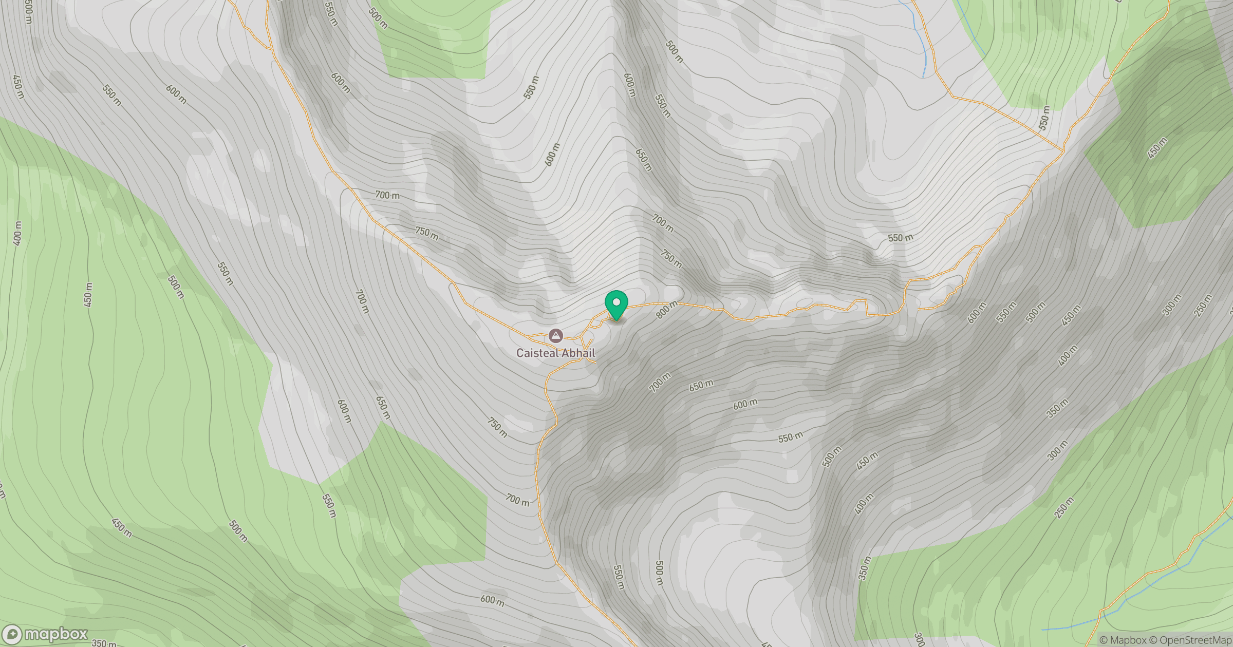
Grid reference: NR969443
View on OpenStreetMapOpens a map in a new tab, centred on the hill.
Nearby Hills
Cir Mhor
798m
Goatfell [Goat Fell]
875m
Ailsa Craig
339m
Beinn Ghlas
420m

The Cobbler [Ben Arthur]
887m
No comments yet. Be the first.