
St George's Hill
Good walks are even better shared.
Overview
St George's Hill
St George's Hill is a charming hill located in the Surrey Hills, classified as a Marilyn with an elevation of 142 meters. Not the highest of giants, but definitely a worthwhile climb for those seeking a breath of fresh air and lovely scenery.
Geology
St George's Hill is constructed of London Clay and the older Bagshot Formation, providing a unique sandy soil that nurtures heathland flora. The area's geology supports a mix of terrain types, from open grassy areas to shadowy woodlands, making it a haven for both hikers and wildlife alike.
Routes
St George's Hill Circular Route
This moderate 5-kilometre loop around the hill delivers stunning views and diverse ecosystems. Perfect for a morning amble or a leisurely afternoon stroll with friends or family.
Godstone to St George's Hill Path
For those looking for a straightforward approach, this easy 3-kilometre path directly connects Godstone and St George's Hill, suitable for a quick jaunt or an enjoyable day out with the dog.
Terrain
Expect a mixture of grassy paths and sandy tracks, occasionally interrupted by rocky outcrops. The terrain can be uneven— so keep an eye on where you're putting your feet!
Views
The summit treats you to magnificent vistas of the surrounding countryside, especially captivating during spring and autumn when the trees flaunt their colourful dresses. The nearby villager's rooftops create a rustic charm that is simply enchanting.
Hazards
Do watch your step—a few challenging slopes can pop up out of nowhere! And if it’s been a wet day, prepare for mud, because we all know how much an outdoor adventure loves to mix in a bit of splatter!
Nearby Summits
Nearby landmarks include Box Hill and Leith Hill, both of which offer their own unique views and trails, should you wish to extend your hiking experience.
Access
Parking is a tad limited near the base of the hill. The nearest public transport options can be found in Virginia Water, where local bus services can whisk you to the village entry points.
Facilities
Refuel after your hike at the lovely café in Virginia Water. They offer a range of refreshments along with toilet facilities, ensuring you’re ready for whatever the rest of your day holds.
History
The origins of St George’s Hill’s name, which may be linked to the patron saint of England, reveal a delightful mystery among local folklore. This area has historically been a recreational spot, giving it a cultural significance that invites you to partake.
Get your hiking boots on, gather some mates, and enjoy the charming St George’s Hill. Take your sense of adventure and maybe a cheeky bacon butty with you!
Explore routes near St George's Hill
Walks starting near this hill. Open a route to check its map, distance and full itinerary.
Painshill: Serpentine Lake, bridges and historic follies
View route
Bushy Park Ponds, Woodland Gardens and Diana Fountain
View route
Virginia Water Circular
View route
Virginia Water Lake, Cascade and Five-Arch Bridge Circuit
View route
Route planning notes
These notes describe possible approaches. Check a route's map and access information when planning your walk.
St George's Hill Circular Route
A scenic loop around St George's Hill encompassing various woodland paths and open heathland, offering a delightful hiking experience.
Godstone to St George's Hill Path
A straight shot from Godstone village through the countryside towards the summit, suitable for those looking for a direct approach.
Make a day of it, together
Find someone to share the walk with, or organise a day out along a route you like.
Hill facts and local notes
Classifications
Elevation
79m
260 ft
Prominence
54m
Coordinates
51.3478, -0.4401
TQ087621
OS Map
176 187
Explorer: 160
At the Summit
At the summit, you'll find a small exposed rocky outcrop and a few trees, providing a perfect perch for quiet reflection or an impromptu snack break.
Terrain & Geology
St George's Hill is predominantly composed of London Clay and Bagshot Formation, which forms the sandy soil seen in the area. The terrain here gives way to heathland and woodlands, providing a variety of ecosystems.
Views & Scenery
From the summit, enjoy sweeping views of the surrounding Surrey countryside, particularly the distant hills and the charming villages below.
History & Heritage
Name Origin
The name 'St George's Hill' is believed to reference St George, the patron saint of England, though the origins are somewhat murky, much like a good cup of tea!
Historical Significance
Historically, the hill has been used for various recreational activities and is part of the estate landscapes associated with the affluent neighbourhood surrounding it.
Getting There & Facilities
Parking
There is a small layby near the base of the hill on St George's Hill Road, but be sure to park considerately as spaces are limited.
Public Transport
The nearest train station is in Virginia Water, with a combination of local bus services connecting to nearby villages.
Nearby Facilities
A delightful café located in Virginia Water offers refreshments and toilet facilities, perfect for a before or after hike stop.
Safety Information
Known Hazards
- Uneven terrain can be encountered, so watch your step. In wet conditions, paths may become muddy and slippery.
General Safety Tips
- Check weather conditions before setting out
- Carry appropriate clothing and equipment
- Let someone know your planned route
- Take a map, compass, and GPS device
- Carry emergency supplies: food, water, first aid kit, torch
Hills
Some common questions about the hills answered
Are there group walks up St George's Hill?
Many walkers use Walkmates to join or organise walks with others. You can check for group walks around St George's Hill through the maps
Are there other walkers around St George's Hill?
Activity varies by location and time, but Walkmates lets you see whether others have shared walks or shown interest in this area. Find other people through the walking friends search walking friends for St George's Hill search or of course create your own walk for St George's Hill
Can I organise a walk to St George's Hill?
Yes. If there aren’t any walks listed already, you can create a walk and make it available for others to join.
If you're signed up to Walkmates, you can create a walk to St George's Hill.
How do I find a walk up this hill?
There are often multiple ways to walk this hill, depending on experience and route preference. Walkmates helps you explore walks and routes that others have shared.
Can I suggest a new route up St George's Hill?
Yes. You can suggest or create routes to share with others. Walkmates focuses on the social side of walking, so routes are used to help people organise walks and explore areas together, rather than as detailed navigation tools or route libraries.
Other uses really appreciate knowledgeable walkers sharing their routes. Share your favourite route to St George's Hill here
The is an error or something incorrect about this hill. How do I let you know?
We always strive to keep the information on Walkmates as accurate as possible. If you find an error, please let us know through the contact form and we'll aim to correct it as quickly as possible
Community Discussion
Comments
Location
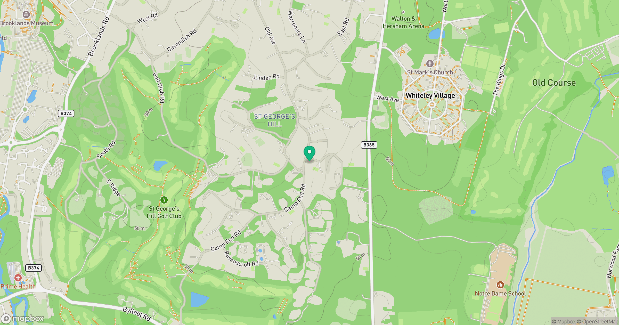
Grid reference: TQ087621
View on OpenStreetMapOpens a map in a new tab, centred on the hill.
Nearby Hills
Leith Hill
294m
Ditchling Beacon
248m
Worcestershire Beacon
425m
Glastonbury Tor
158m
The Roaches
505m
No comments yet. Be the first.