

St Catherine's Island
Good walks are even better shared.
SN1300 : St Catherine's Island, Tenby
Bill Jarvie Photo source
Overview
St Catherine's Island
Overview
St Catherine's Island, situated just off the picturesque coast of Tenby in Pembrokeshire, is a unique destination for hikers and history enthusiasts alike. While it's not towering in elevation, its historical significance and stunning coastal views are beyond compare.
Geology
This charming island is primarily composed of limestone and sandstone. The striking geology has created a rugged coastline, perfect for exploring and understanding coastal erosion. Perfect for geology buffs wanting to sink their teeth into some local history!
How to Get There
Access: The nearest parking can be found in Tenby, where spaces can be limited, especially in the height of summer, so arrive bright and early!
Public Transport
Tenby boasts a well-connected train station with regular services, alongside local buses. It’s well worth checking schedules to coordinate your day of adventure.
Hiking Routes
Circular Coastal Trail
- Distance: 2.5 km
- Estimated Time: 1.5 hours
- Difficulty: Easy
This circular route will guide you around the island, allowing you to take in the sights and sounds of the sparkling sea and dramatic cliffs. Perfect for a leisurely walk or as a family outing.
Summit Features
At the summit, adventurers will find a Victorian gun battery and a quaint chapel, remnants of the island's storied past. A perfect backdrop for your holiday snaps!
Terrain
Expect rocky outcrops and grassy patches. A great spot for a casual explore, just mind the path if the tide is high.
Views
From the summit, one can take in breathtaking views of Tenby's coastline, with Caldey Island peeking through the waves. Best Seasons: Spring and autumn offer lovely views thanks to clearer air and beautiful colours—all the better for your Instagram feed!
Hazards
Be aware of strong tides and slippery rocks—one moment you're grinning like a Cheshire cat, the next you're drenched! Always check tide times and avoid venturing too close to the water’s edge.
Nearby Facilities
The vibrant town of Tenby is just a stone's throw away, offering endless cafes and restaurants. Don't miss out on a slice of Welsh cake!
History
The name 'St Catherine' hails from the medieval era, reflecting the area's Christian heritage. Historically, the island has stood guard over the coastline, a silent witness to the passage of time.
Enjoy your walk on St Catherine's Island, where history and nature join hands to create a delightful experience!
Last Updated
2023-10-01
Explore routes near St Catherine's Island
Walks starting near this hill. Open a route to check its map, distance and full itinerary.
Neyland to Johnston: Brunel and Westfield Railway Trail
View route
Stackpole Estate: Bosherston Lily Ponds and Lodge Park Woodland Circuit
View route
Gower winter wildlife and birdwatching walk
View route
Llanelli North Dock to Machynys Point and Wetland Centre
View route
Route planning notes
These notes describe possible approaches. Check a route's map and access information when planning your walk.
Circular Coastal Trail
This scenic route takes you around the island, offering stunning views of the surrounding sea and coastline.
Make a day of it, together
Find someone to share the walk with, or organise a day out along a route you like.
Photo Gallery
View all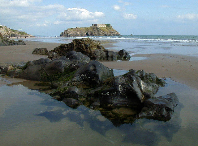 Photo could not load
SN1300 : St Catherine's Island, Tenby
Bill Jarvie
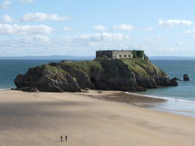 Photo could not load
SN1300 : Fort St Catherine, Tenby, South Wales
Michael W Beales BEM
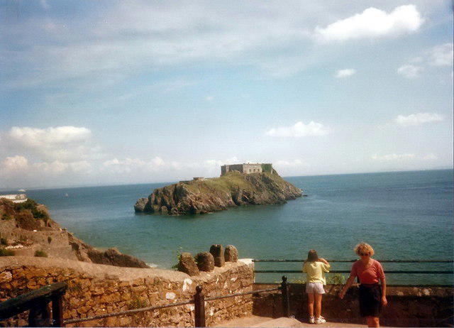 Photo could not load
SN1300 : St Catherine's Island
Alan Richards
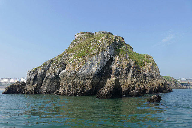 Photo could not load
SN1400 : St Catherine's Island, Tenby
Alan Hunt
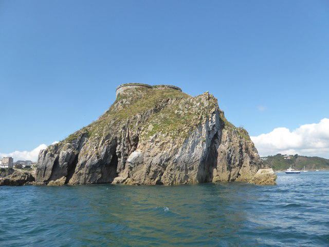 Photo could not load
SN1400 : St Catherine's Island as seen from the Caldey Ferry
Basher Eyre
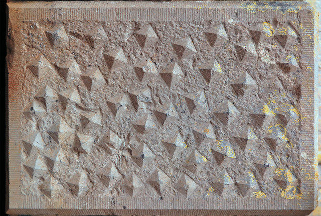 Photo could not load
SN1300 : Doorway building block: Fort St Catherine, Tenby
Dylan Moore
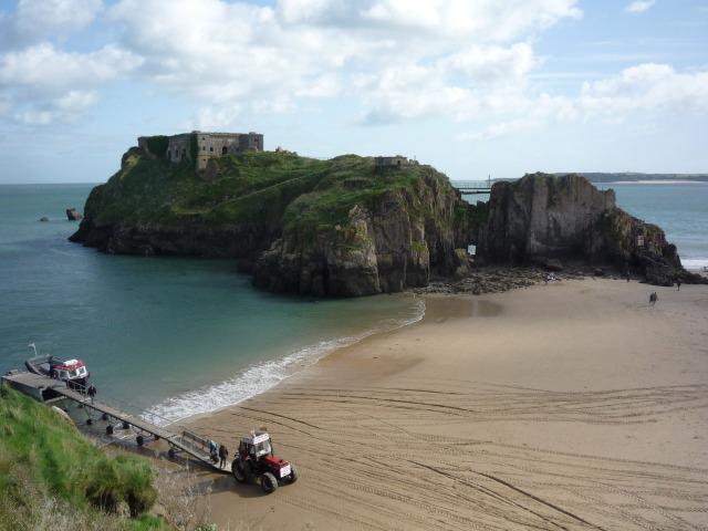 Photo could not load
SN1300 : Fort St. Catherine
DS Pugh
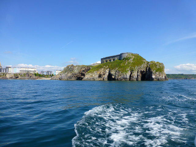 Photo could not load
SN1400 : St Catherine's Island
Raymond Knapman
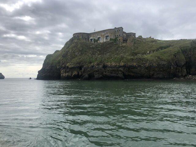 Photo could not load
SN1300 : Fort at the top of St Catherine's Island
Eirian Evans
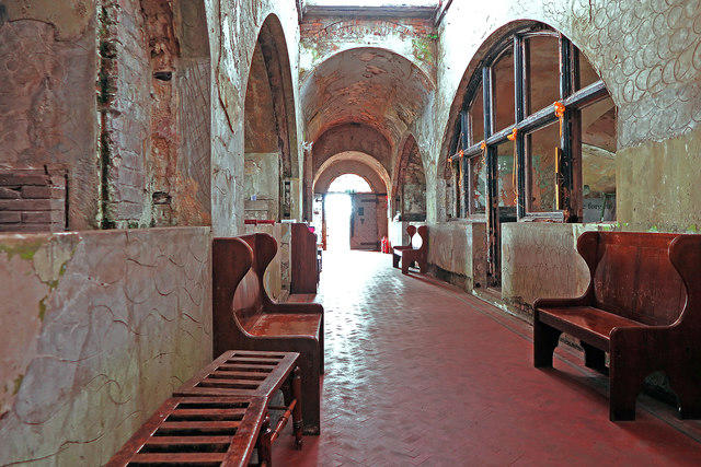
SN1300 : Fort St Catherine, Tenby: interior
Dylan Moore
Hill facts and local notes
Classifications
Elevation
30m
99 ft
Prominence
29m
Coordinates
51.6706, -4.6916
SN139002
OS Map
158
Explorer: OL36E
At the Summit
The island features a Victorian gun battery and a small chapel, both of which add historical significance to the summit experience.
Terrain & Geology
St Catherine's Island is primarily composed of limestone and sandstone, which shape the rugged coastlines and cliffs. The geological features provide a fascinating study of coastal erosion.
Views & Scenery
From the summit, you can see the beautiful coastline of Tenby, Caldey Island, and the crashing waves of the Bristol Channel.
History & Heritage
Name Origin
St Catherine's Island is named after St Catherine, a popular saints' name in medieval times, reflecting the Christian influence in the region.
Historical Significance
Historically, the island served as a defensive structure, playing a role in coastal protection during various conflicts.
Getting There & Facilities
Parking
There is limited parking available near Tenby, with Pay & Display options available.
Public Transport
Tenby is served by regular bus services and has a train station close by.
Nearby Facilities
Nearby Tenby offers numerous cafes, restaurants, and public toilets for your convenience.
Safety Information
Known Hazards
- Strong tides and slippery rocks can pose risks; caution is advised near the water.
General Safety Tips
- Check weather conditions before setting out
- Carry appropriate clothing and equipment
- Let someone know your planned route
- Take a map, compass, and GPS device
- Carry emergency supplies: food, water, first aid kit, torch
Hills
Some common questions about the hills answered
Are there group walks up St Catherine's Island?
Many walkers use Walkmates to join or organise walks with others. You can check for group walks around St Catherine's Island through the maps
Are there other walkers around St Catherine's Island?
Activity varies by location and time, but Walkmates lets you see whether others have shared walks or shown interest in this area. Find other people through the walking friends search walking friends for St Catherine's Island search or of course create your own walk for St Catherine's Island
Can I organise a walk to St Catherine's Island?
Yes. If there aren’t any walks listed already, you can create a walk and make it available for others to join.
If you're signed up to Walkmates, you can create a walk to St Catherine's Island.
How do I find a walk up this hill?
There are often multiple ways to walk this hill, depending on experience and route preference. Walkmates helps you explore walks and routes that others have shared.
Can I suggest a new route up St Catherine's Island?
Yes. You can suggest or create routes to share with others. Walkmates focuses on the social side of walking, so routes are used to help people organise walks and explore areas together, rather than as detailed navigation tools or route libraries.
Other uses really appreciate knowledgeable walkers sharing their routes. Share your favourite route to St Catherine's Island here
The is an error or something incorrect about this hill. How do I let you know?
We always strive to keep the information on Walkmates as accurate as possible. If you find an error, please let us know through the contact form and we'll aim to correct it as quickly as possible
Community Discussion
Comments
Location
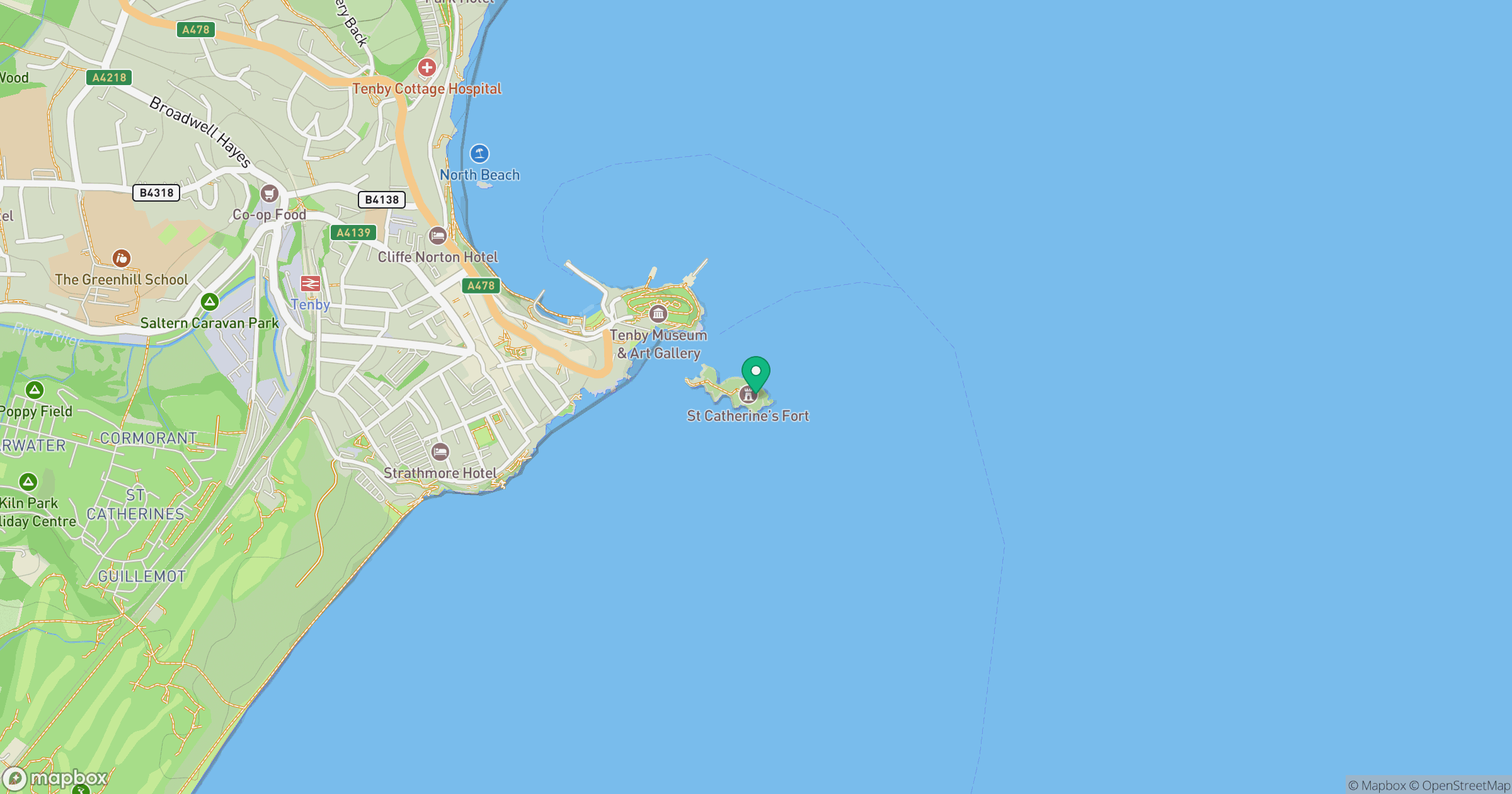
Grid reference: SN139002
View on OpenStreetMapOpens a map in a new tab, centred on the hill.

No comments yet. Be the first.