

St Catherine's Hill
Good walks are even better shared.
SU4827 : Tree felling on St. Catherine's Hill
Peter Facey Photo source
Overview
St Catherine’s Hill, Winchester
St Catherine’s Hill rises above the Itchen valley on Winchester’s southern edge. DoBIH records 97 m and a 20 m drop, with the exact high point on ground near a tree stump at SU 48428 27669. It is unclassified and was removed from the Tumps in December 2014. This is the Hampshire hill, not the 239 m Isle of Wight namesake.
A complete circular walk
Ordnance Survey describes a 3.6 km circuit from and back to Garnier Road car park, SU483280, allowing 1 hour 30 minutes. It follows the riverside approach, climbs the steps and circles the hilltop before a steep descent towards the Pilgrim’s Trail. The return uses the woodland track, a crossing into St Catherine’s Park and Ride and the cycle path back. Do not walk along narrow Bull Drove. Total ascent is not published.
The route visits the hilltop, with an optional detour into the chapel copse. It does not certify the exact stump-side summit point; an extra summit diversion changes its totals. The steep, muddy descent means the walk needs more care than its short distance suggests.
Landscape and history
BGS identifies Lewes Nodular Chalk at the summit and New Pit Chalk on surrounding slopes, within the Winchester anticline. The hilltop preserves Iron Age earthworks, the medieval chapel site and a nearby turf maze. Views overlook Winchester and the Itchen valley. Cheesefoot Head is a separate hill farther east, not part of this short circuit.
Access and facilities
Garnier Road parking is limited. St Catherine’s Park and Ride offers an alternative, toilets and a foot/cycle connection. Its bus serves Winchester station; the council says it does not operate on Sundays or bank holidays. Check timetables and parking notices. Handlebar Cafe on Garnier Road has refreshments and an accessible toilet during opening hours. Its loose-stoned, step-free approach is distinct from the steep hill walk.
Conditions and care
Keep dogs on leads around the grazing animals, watch for rabbit holes and take care on wet steps and chalk. At the 18 October 2026 check, the Wildlife Trust’s page displayed an ash-tree-work notice for the week commencing 19 October and temporary working-hours closures of some permissive paths. The notice does not give a year: check with the Trust before travelling and obey barriers rather than assuming this circuit remains available. Any diversion requires fresh route planning.
Explore routes near St Catherine's Hill
Walks starting near this hill. Open a route to check its map, distance and full itinerary.
Hinton Ampner: Dutton Estate Woodland and Downland Circuit
View route
Wilverley Inclosure Walk, New Forest
View route
Thatcham short birding stroll
View route
Thatcham short birding stroll
View route
Route planning notes
These notes describe possible approaches. Check a route's map and access information when planning your walk.
St Catherine’s Hill circuit from Garnier Road
Start and finish at the Garnier Road car park, SU483280. Follow the riverside approach, climb the steps, circuit the hilltop and descend the steep path towards the Pilgrim’s Trail. Continue by the motorway fence and woodland track; cross Bull Drove into the Park and Ride and use the cycle path back to the starting car park. Do not walk along the narrow, pavement-free Bull Drove. OS publishes 3.6 km and 1 hour 30 minutes for this whole circuit; total ascent is not given. The optional copse visit reaches the chapel area, but neither it nor the perimeter path certifies contact with the exact DoBIH ground near the stump at SU4842827669; any additional summit diversion changes the totals. Follow current reserve closures. https://osmaps.com/discover/adventures/st-catherines-hill-winchester/
Make a day of it, together
Find someone to share the walk with, or organise a day out along a route you like.
Photo Gallery
View all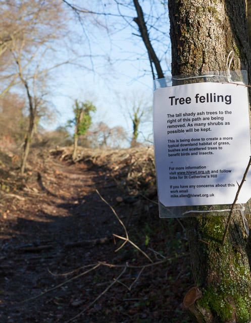 Photo could not load
SU4827 : Tree felling on St. Catherine's Hill
Peter Facey
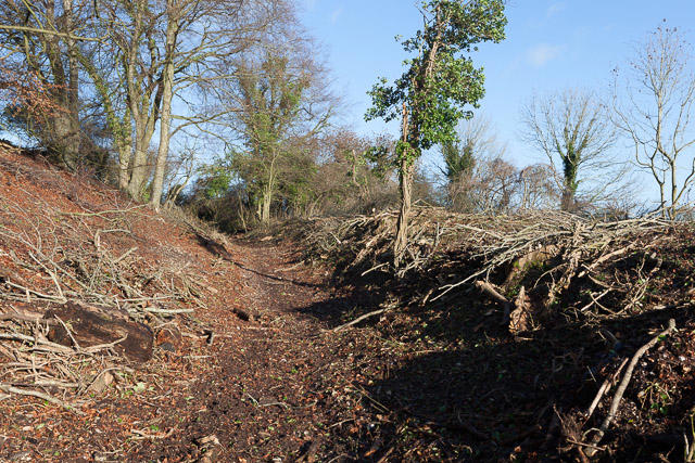 Photo could not load
SU4827 : Tree felling on St. Catherine's Hill
Peter Facey
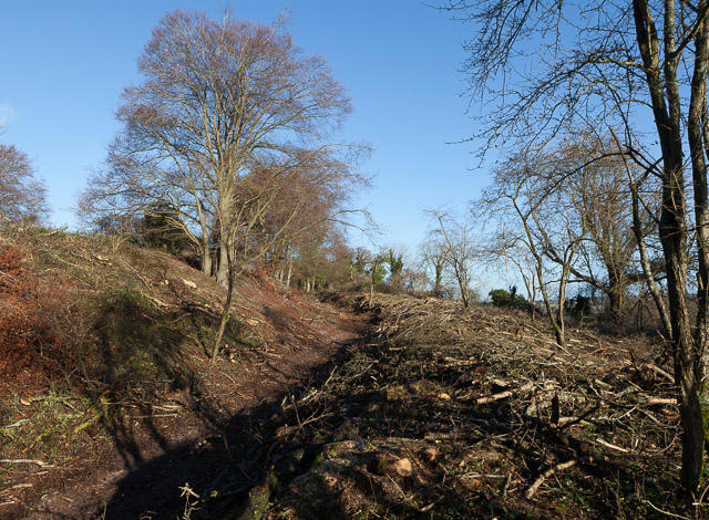 Photo could not load
SU4827 : Tree felling on St. Catherine's Hill
Peter Facey
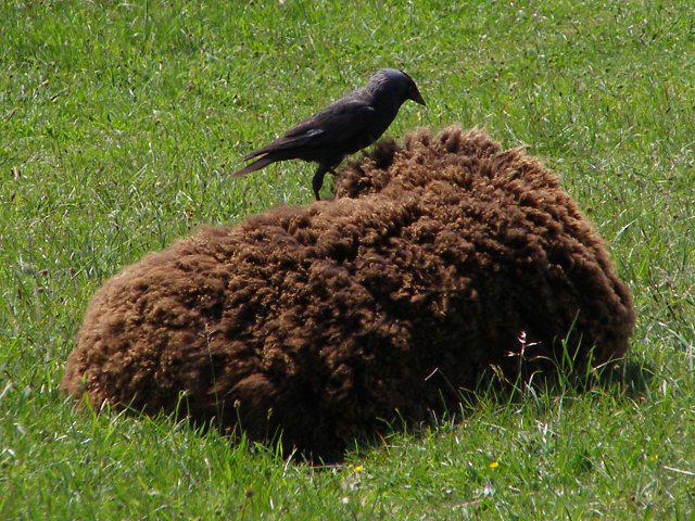 Photo could not load
SU4827 : Jackdaw on a Hebridean sheep, St Catherine's Hill
Jim Champion
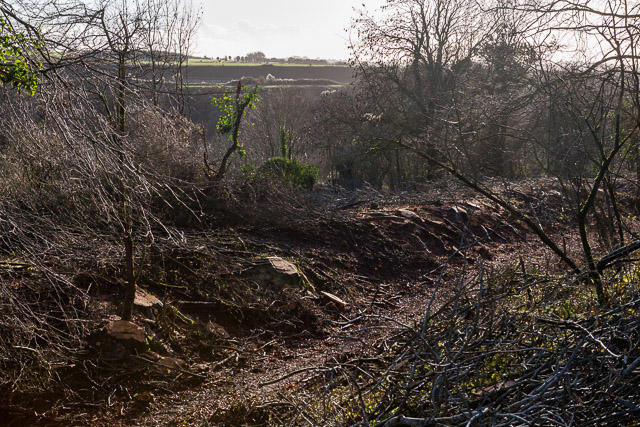 Photo could not load
SU4827 : Tree felling on St. Catherine's Hill
Peter Facey
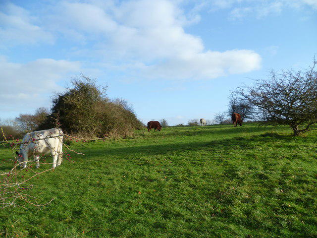 Photo could not load
SU4827 : Cattle grazing on St Catherine's Hill
Shazz
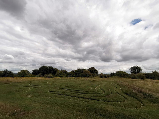 Photo could not load
SU4827 : Mizmaze on St Catherine's Hill, near Winchester
Phil Champion
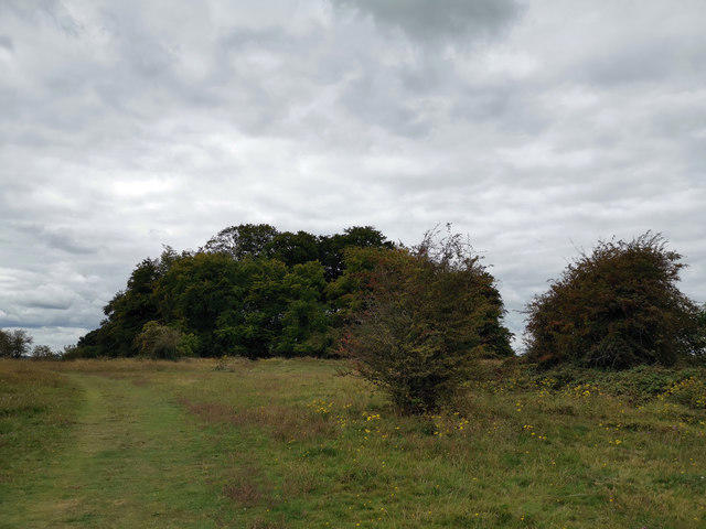 Photo could not load
SU4827 : On St Catherine's Hill
Phil Champion
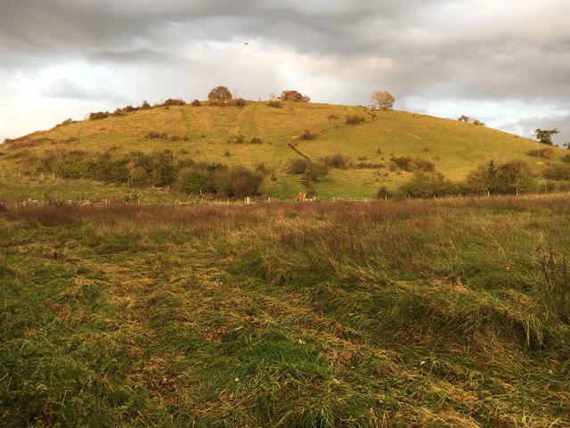 Photo could not load
SU4827 : St Catherine's Hill
Shaun Ferguson
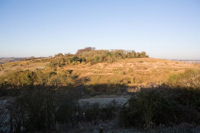
SU4827 : St Catherine's Hill
Peter Facey
Hill facts and local notes
Classifications
Elevation
97m
318 ft
Prominence
20m
Coordinates
51.0463, -1.3106
SU484276
OS Map
185
Explorer: OL32 132
At the Summit
DoBIH identifies the 97 m summit as ground near a tree stump at SU 48428 27669. The chapel site, beech copse, turf maze and hillfort ramparts are landmarks, not substitutes for this exact point.
Terrain & Geology
The hill is Upper Cretaceous chalk. BGS’s Winchester district description places Lewes Nodular Chalk at the summit, with New Pit Chalk around the slopes. The chalk succession is folded by the Winchester anticline.
Views & Scenery
Views take in Winchester, its cathedral and the Itchen valley, with surrounding downland. Visibility varies with weather and vegetation.
History & Heritage
Name Origin
The hill takes its name from the medieval chapel dedicated to St Catherine that stood on its summit.
Historical Significance
Iron Age hillfort earthworks enclose the hilltop. The summit also contains buried remains of the medieval chapel, while a turf maze survives nearby. These features form part of a protected archaeological landscape.
Getting There & Facilities
Parking
Use the Garnier Road car park beside the Itchen at SU483280 for the described OS circuit. Spaces are limited. East Winchester St Catherine’s Park and Ride, SO23 9NP, is an alternative with a foot/cycle connection; starting there changes the circuit’s start and distance. Check current restrictions and charges.
Public Transport
Winchester railway station connects with the Park and Ride bus serving St Catherine’s. Winchester City Council states there is no Park and Ride bus service on Sundays or bank holidays. Check the current timetable and allow for the walk from the car park to the reserve.
Nearby Facilities
Handlebar Cafe on Garnier Road has refreshments and an accessible toilet, subject to opening hours. St Catherine’s Park and Ride has toilets. The cafe’s step-free approach is loose-stoned; this does not make the steep hilltop route accessible.
Safety Information
Known Hazards
- Steep steps, wet chalk, muddy slopes and uneven ground need care; rabbit holes occur off the paths.
- Livestock graze the reserve. Keep dogs on a lead and follow signs.
- The OS circuit crosses Bull Drove; use the Park and Ride cycle-path connection rather than walking along its narrow carriageway.
- As checked on 18 October 2026, the Wildlife Trust page carries an ash-tree-work notice for the week commencing 19 October, with temporary working-hours closures on some permissive paths. The notice does not state a year. Check with the Trust and obey barriers; the circuit may need postponing or altering.
General Safety Tips
- Check weather conditions before setting out
- Carry appropriate clothing and equipment
- Let someone know your planned route
- Take a map, compass, and GPS device
- Carry emergency supplies: food, water, first aid kit, torch
Hills
Some common questions about the hills answered
Are there group walks up St Catherine's Hill?
Many walkers use Walkmates to join or organise walks with others. You can check for group walks around St Catherine's Hill through the maps
Are there other walkers around St Catherine's Hill?
Activity varies by location and time, but Walkmates lets you see whether others have shared walks or shown interest in this area. Find other people through the walking friends search walking friends for St Catherine's Hill search or of course create your own walk for St Catherine's Hill
Can I organise a walk to St Catherine's Hill?
Yes. If there aren’t any walks listed already, you can create a walk and make it available for others to join.
If you're signed up to Walkmates, you can create a walk to St Catherine's Hill.
How do I find a walk up this hill?
There are often multiple ways to walk this hill, depending on experience and route preference. Walkmates helps you explore walks and routes that others have shared.
Can I suggest a new route up St Catherine's Hill?
Yes. You can suggest or create routes to share with others. Walkmates focuses on the social side of walking, so routes are used to help people organise walks and explore areas together, rather than as detailed navigation tools or route libraries.
Other uses really appreciate knowledgeable walkers sharing their routes. Share your favourite route to St Catherine's Hill here
The is an error or something incorrect about this hill. How do I let you know?
We always strive to keep the information on Walkmates as accurate as possible. If you find an error, please let us know through the contact form and we'll aim to correct it as quickly as possible
Community Discussion
Comments
Location
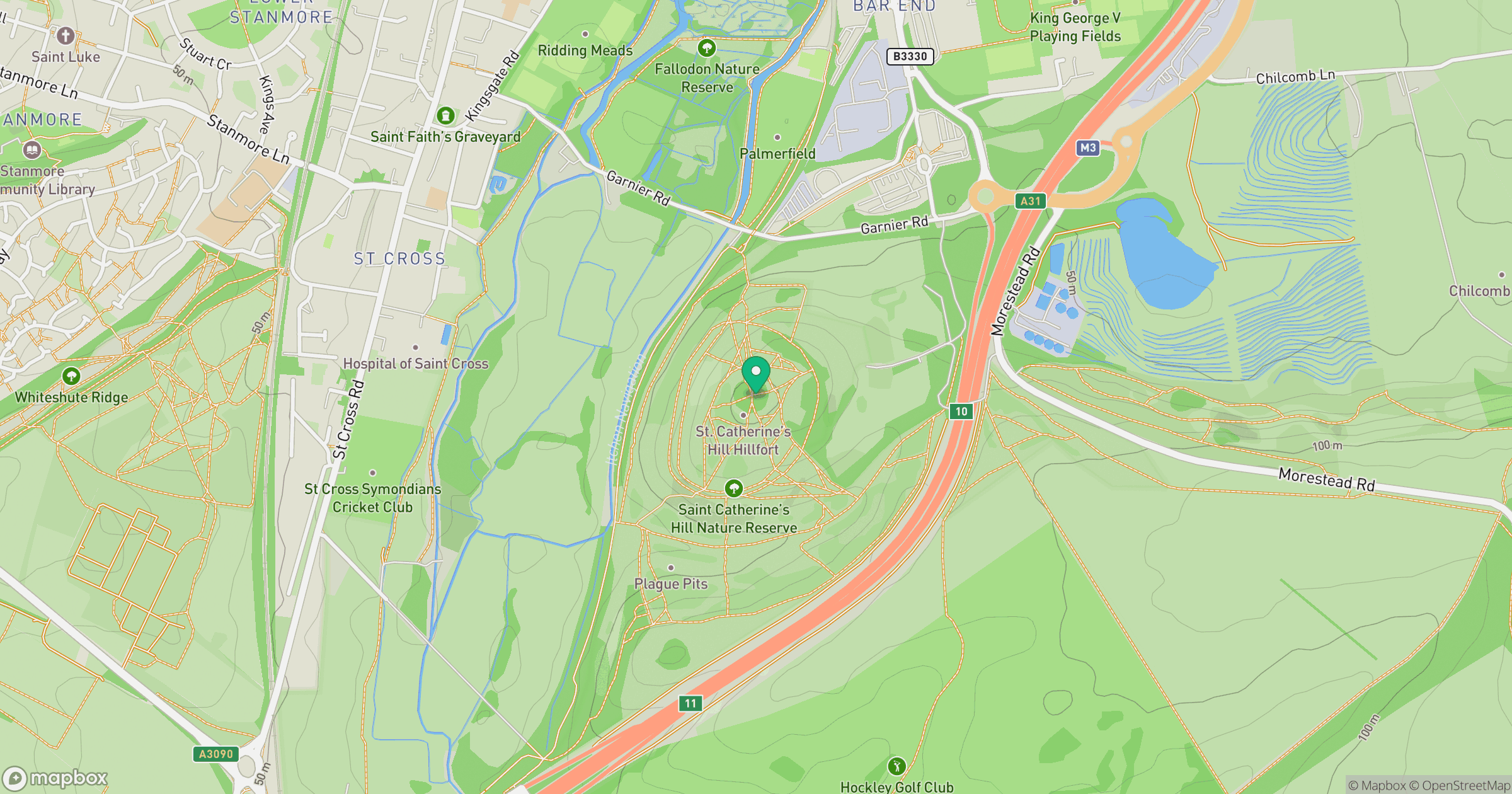
Grid reference: SU484276
View on OpenStreetMapOpens a map in a new tab, centred on the hill.
Nearby Hills
Leith Hill
294m
Ditchling Beacon
248m
Glastonbury Tor
158m
Worcestershire Beacon
425m
Titterstone Clee Hill
533m
No comments yet. Be the first.