
South Hill
Good walks are even better shared.
Overview
South Hill
Located in the picturesque Worcestershire region, South Hill stands at a respectable elevation of 253 meters. It's a welcoming hill for hikers seeking a gentler climb with rewarding views and a bit of history.
Geology
The geological makeup of South Hill showcases a tapestry of sedimentary rocks, including clays and limestones. This fascinating mixture makes it a great spot for geology enthusiasts who love to ponder the Earth's secrets while enjoying a light breeze.
Routes
The recommended route is the Worcestershire Way. It spans around 5 km and typically takes about 2 hours to complete. With a moderate difficulty rating, it offers lovely scenery and ample opportunity to meditate on the meaning of life—if only we had the answers!
Summit Features
The summit is crowned with a small rocky outcrop and a humble stone cairn, where many a hiker has paused to catch their breath and perhaps contemplate their next cup of tea. It’s the perfect spot for selfies or a serene moment immersed in nature.
Views
The views from South Hill are nothing short of delightful, with the Malvern Hills stretching proudly to the south and rolling green fields blanketing the landscape. Spring and autumn are ideal times to visit; the landscape bursts with colours, and the weather tends to be most obliging.
Hazards
While the hike is generally safe, be mindful of slippery mud following a downpour and watch your step on the rocks—better safe than sorry, right?
Nearby Summits
Adjacent to South Hill, Bredon Hill and the Malvern Hills beckon adventurous hikers with their own charms and challenges, so those looking for a more strenuous hike should not feel shy!
Access
Accessing South Hill is straightforward! There’s parking available along the Worcestershire Way, conveniently close to the trailhead. For those relying on public transport, a bus service from Upton-upon-Severn will get you within shouting distance of the trail.
Facilities
Once you’re back from conquering South Hill, treat yourself at the café in Upton-upon-Severn or make use of the local public toilets; we all know nature sometimes calls at the most unexpected moments!
History
The name 'South Hill' straightforwardly hints at its geographical location, but it has played a significant role in the area’s history. Rumour has it that it was a lookout point during past skirmishes. So, there's a good chance you'll be walking in the footsteps of history.
In conclusion, South Hill offers the perfect blend of natural beauty, accessibility, and a dash of historical intrigue, making it a worthy addition to your hiking adventures. Don’t forget to take your camera you won’t want to forget the memories you’ll create here!
Explore routes near South Hill
Public walks starting within 80 km of this hill. Nearby does not mean a route reaches the summit; check its map and access before setting out.
Bourton-on-the-Water and Wyck Rissington: Greystones and three rivers
View route
Winchcombe and Belas Knap: Cotswold Way and Sudeley Valley circuit
View route
Charlecote Park: riverside, Hill Park and lime avenue
View route
Warwick Walk with Men Walking & Talking
View route
Route planning notes
These notes describe possible approaches, not verified navigable routes or permission to cross land. Check current paths, local access rules and conditions before setting out.
Worcestershire Way
This scenic route meanders through the lovely countryside, providing views of surrounding hills and valleys.
Make a day of it, together
Find someone to share the walk with, or organise a day out along a route you like.
Hill facts and local notes
Classifications
Elevation
248m
814 ft
Prominence
119m
Coordinates
51.9722, -1.5935
SP280304
OS Map
151
Explorer: OL45N 191W
At the Summit
The summit is marked by a small, rocky outcrop with a delightful stone cairn to the north, where climbers often take a well-deserved breather and snap a few photos.
Terrain & Geology
South Hill predominantly features sedimentary rock formations, which include various types of clay and limestone, making it an interesting site for observing geological layering and erosion patterns.
Views & Scenery
From the summit, you can see the Malvern Hills to the south and beautiful pastoral landscapes stretching into the distance.
History & Heritage
Name Origin
The name 'South Hill' is straightforwardly derived from its position relative to surrounding landmarks, although it carries a poetic charm as 'the gentle slope to the south'.
Historical Significance
South Hill has been a local point of interest since the Middle Ages and is thought to have been a lookout point during various historical conflicts.
Getting There & Facilities
Check current local access restrictions, parking rules and transport timetables before travelling. These notes do not confirm public access to the summit.
Parking
Free parking is available at the base of the hill along the Worcestershire Way, with space for approximately 10 vehicles.
Public Transport
Bus services from the nearby town of Upton-upon-Severn provide access, with the closest stop located a short walk from the trailhead.
Nearby Facilities
There's a charming café in Upton-upon-Severn and public toilets near the car park, perfect for a post-hike snack or nature call.
Safety Information
Known Hazards
- Occasional slips on muddy sections after rainfall; take care on the rocky outcrops.
General Safety Tips
- Check weather conditions before setting out
- Carry appropriate clothing and equipment
- Let someone know your planned route
- Take a map, compass, and GPS device
- Carry emergency supplies: food, water, first aid kit, torch
Hills
Some common questions about the hills answered
Are there group walks up South Hill?
Many walkers use Walkmates to join or organise walks with others. You can check for group walks around South Hill through the maps
Are there other walkers around South Hill?
Activity varies by location and time, but Walkmates lets you see whether others have shared walks or shown interest in this area. Find other people through the walking friends search walking friends for South Hill search or of course create your own walk for South Hill
Can I organise a walk to South Hill?
Yes. If there aren’t any walks listed already, you can create a walk and make it available for others to join.
If you're signed up to Walkmates, you can create a walk to South Hill.
How do I find a walk up this hill?
There are often multiple ways to walk this hill, depending on experience and route preference. Walkmates helps you explore walks and routes that others have shared.
Can I suggest a new route up South Hill?
Yes. You can suggest or create routes to share with others. Walkmates focuses on the social side of walking, so routes are used to help people organise walks and explore areas together, rather than as detailed navigation tools or route libraries.
Other uses really appreciate knowledgeable walkers sharing their routes. Share your favourite route to South Hill here
The is an error or something incorrect about this hill. How do I let you know?
We always strive to keep the information on Walkmates as accurate as possible. If you find an error, please let us know through the contact form and we'll aim to correct it as quickly as possible
Community Discussion
Comments
Location
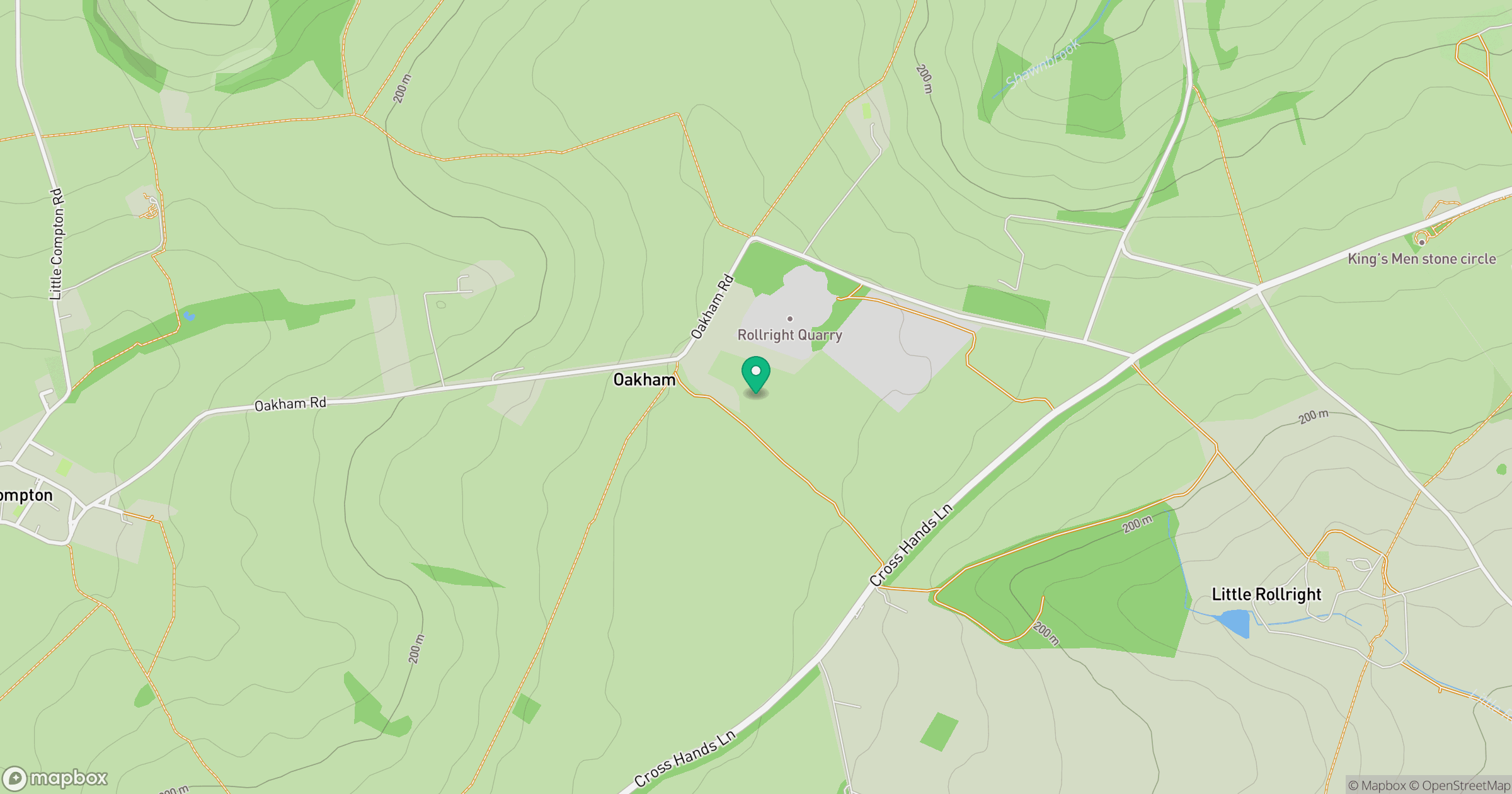
Grid reference: SP280304
View on OpenStreetMapOpens a map in a new tab, centred on the hill.
Hills within 30 km
Straight-line distance, not a walking route or confirmation of access.
No comments yet. Be the first.