
Slieveroe
Good walks are even better shared.
Overview
Welcome to Slieveroe
Slieveroe, affectionately known as the 'Red Mountain', rises majestically to 651 meters and is a prominent feature of the stunning County Down landscape. Whether you're a seasoned hiker or just someone who enjoys a good view and a bit of fresh air, there’s something for everyone here.
Geology
Slieveroe is a geological marvel, predominantly made up of granite. This resilient rock isn’t just difficult to cave into; it also provides the rocky outcrops that add character to the steep slopes and stunning vistas you'll encounter. The weathering of this granite has created unique formations that elevate the hiking experience effortlessly.
Routes
The most popular route is the Slieve Roe Circuit, a moderate 8.5 km loop that will take approximately 3.5 hours to complete. Expect to be enchanted by beautiful scenery and a few cheeky sheep along the way who might be more curious about you than you are of them.
Summit Features
When you finally reach the summit, don’t forget to take a selfie next to the charming stone cairn. It’s a great addition to your hiking portfolio, and the views won’t let you down! Enjoy breathtaking sights of the Mourne Mountains, Carlingford Lough, and the rolling hills of County Down.
Terrain Type
Prepare for a bit of everything! The terrain is varied with rocky paths that might test your toe balance, grassy slopes that feel like walking on a cloud, and some boggy bits that could very well be your own personal slip and slide.
Views
Highlights: At the summit, you will be rewarded with stunning panoramic views that are truly the icing on the cake. You’ll be able to see the majestic Mourne Mountains spread before you like nature’s own tapestry.
Best Seasons: The best times to visit are in the spring and early autumn. During these seasons, the views are especially vivid, and you won't need a magical filter to make your Instagrams pop.
Hazards
Although it sounds idyllic, Slieveroe isn’t without its concerns. Be aware of sheer drops, sudden weather changes, and don’t underestimate a slippery path, especially after a rainfall. Safety first, dear adventurers!
Nearby Summits
If you’re feeling ambitious, consider tackling Slieve Comedagh (765 m) or Slieve Donard (850 m) as part of your expedition. Each offers its own unique collection of beauty and challenges.
Access
- Nearest Parking: There’s a small parking area on the B7 road, perfect for starting your adventure.
- Public Transport: Buses operate from Newcastle, and while they get you close, a short stroll will lead you to the trailhead.
- Nearest Town: Newcastle is just 6 km away and has all the essentials you might need before or after your hike.
Facilities
After your hike, why not treat yourself? Newcastle boasts several cafés and pubs where you can replenish your energy with a warm drink or heartier fare. Plus, you can find public toilets near the beach for a quick pit stop.
History
- Name Meaning: The name 'Slieveroe' or 'Sliabh Rua' tells you a tale of its hue, with 'red mountain' giving a nod to the beautiful russet shades that adorn it.
- Significance: A jewel in the Mourne Mountains, Slieveroe has inspired generations with its breathtaking beauty and has deep roots in the cultural tapestry of Northern Ireland.
So lace up your hiking boots, grab your walking stick, and set forth on an adventure that promises to be both enjoyable and memorable. Just remember, what goes up must come down, and ideally, without too much mud on your backside. Happy hiking!
Explore routes near Slieveroe
Public walks starting within 80 km of this hill. Nearby does not mean a route reaches the summit; check its map and access before setting out.
No public routes are currently listed within 80 km of Slieveroe on Walkmates. This does not mean there are no paths here. Explore the map and check local access information before planning a walk.
Route planning notes
These notes describe possible approaches, not verified navigable routes or permission to cross land. Check current paths, local access rules and conditions before setting out.
Slieve Roe Circuit
A scenic loop that takes you around the slopes of Slieveroe, providing various panoramic viewpoints.
Make a day of it, together
Find someone to share the walk with, or organise a day out along a route you like.
Hill facts and local notes
Classifications
Elevation
330m
1,083 ft
Prominence
103m
Coordinates
53.1692, -6.5772
N952141
OS Map
56
At the Summit
The summit is marked by a stone cairn and offers a delightful view of the Mourne Mountains.
Terrain & Geology
Slieveroe is primarily composed of granite, with some sedimentary rock formations. The weathering of granite gives rise to stunning rocky outcrops and boulder fields.
Views & Scenery
From the summit, hikers can enjoy views of the Mourne Mountains, the rolling hills of County Down, and the coastline towards Carlingford Lough.
History & Heritage
Name Origin
The name 'Slieveroe' is derived from the Irish 'Sliabh Rua', meaning 'red mountain'.
Historical Significance
This mountain is part of the Mourne range, famed for its natural beauty and outdoor recreational opportunities. It has inspired poems and folklore in Northern Irish culture.
Getting There & Facilities
Check current local access restrictions, parking rules and transport timetables before travelling. These notes do not confirm public access to the summit.
Parking
There is a small parking area at the base of the Slieve Roe Circuit on the B7 road.
Public Transport
Buses from Newcastle and surrounding areas can get you close, but a short walk to the starting point is required.
Nearby Facilities
There are a few cafes and pubs in Newcastle, along with public toilets near the beach.
Safety Information
Known Hazards
- Sheer drops in places, changing weather conditions, and potential for slippery paths.
General Safety Tips
- Check weather conditions before setting out
- Carry appropriate clothing and equipment
- Let someone know your planned route
- Take a map, compass, and GPS device
- Carry emergency supplies: food, water, first aid kit, torch
Hills
Some common questions about the hills answered
Are there group walks up Slieveroe?
Many walkers use Walkmates to join or organise walks with others. You can check for group walks around Slieveroe through the maps
Are there other walkers around Slieveroe?
Activity varies by location and time, but Walkmates lets you see whether others have shared walks or shown interest in this area. Find other people through the walking friends search walking friends for Slieveroe search or of course create your own walk for Slieveroe
Can I organise a walk to Slieveroe?
Yes. If there aren’t any walks listed already, you can create a walk and make it available for others to join.
If you're signed up to Walkmates, you can create a walk to Slieveroe.
How do I find a walk up this hill?
There are often multiple ways to walk this hill, depending on experience and route preference. Walkmates helps you explore walks and routes that others have shared.
Can I suggest a new route up Slieveroe?
Yes. You can suggest or create routes to share with others. Walkmates focuses on the social side of walking, so routes are used to help people organise walks and explore areas together, rather than as detailed navigation tools or route libraries.
Other uses really appreciate knowledgeable walkers sharing their routes. Share your favourite route to Slieveroe here
The is an error or something incorrect about this hill. How do I let you know?
We always strive to keep the information on Walkmates as accurate as possible. If you find an error, please let us know through the contact form and we'll aim to correct it as quickly as possible
Community Discussion
Comments
Location
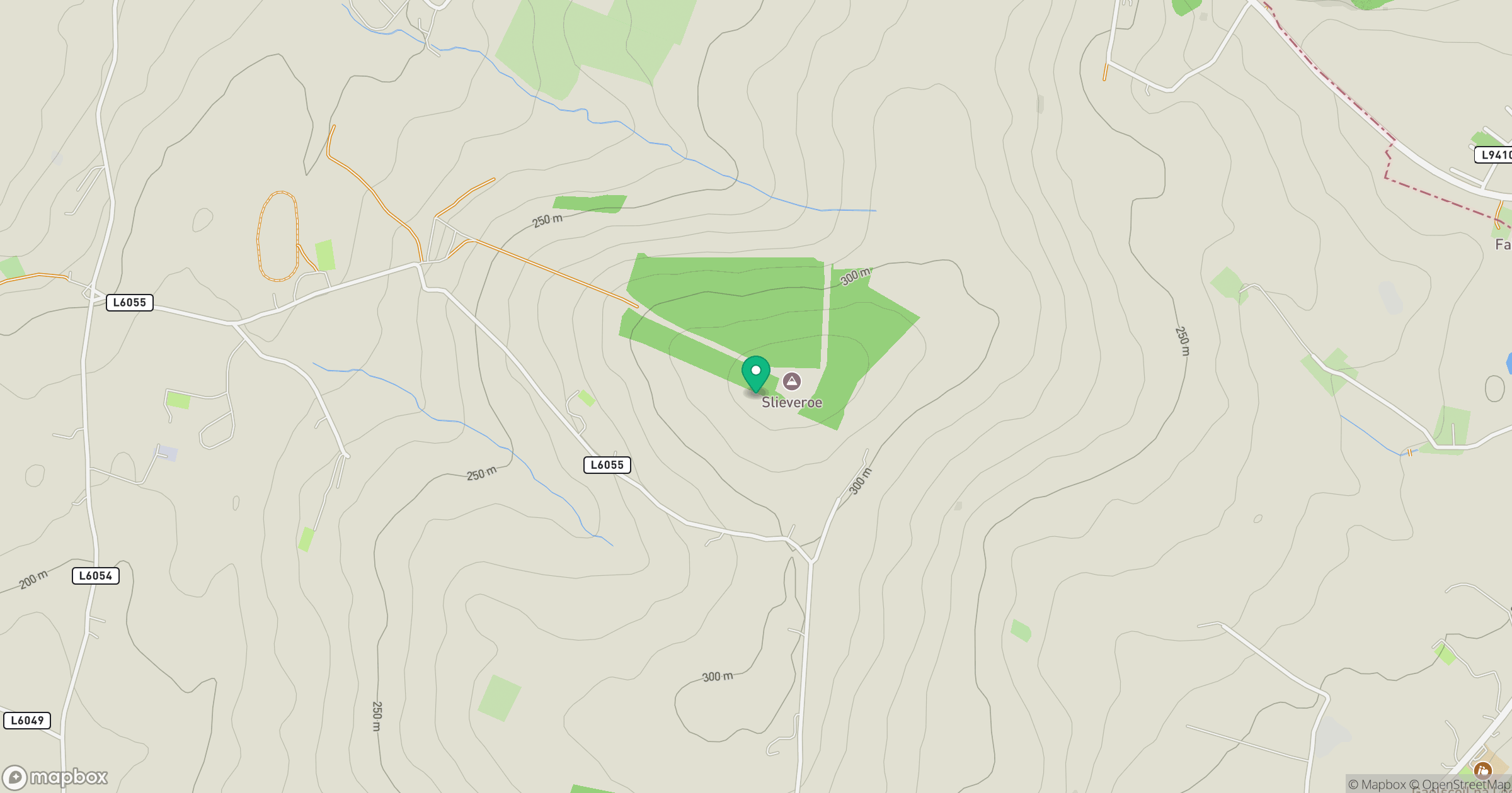
Grid reference: N952141
View on OpenStreetMapOpens a map in a new tab, centred on the hill.
Hills within 30 km
Straight-line distance, not a walking route or confirmation of access.
Mullaghcleevaun
847m
Lugnaquilla [Log na Coille]
925m
Slievecorragh [An Sliabh Corrach]
418m
Church Mountain
543m
Saggart Hill [Cnoc Theach Sagard]
397m
No comments yet. Be the first.