

Sorrel Hill
Good walks are even better shared.
Overview
Sorrel Hill: A Hidden Gem in the Pentlands
Nestled in the scenic Pentland Hills, Sorrel Hill is a marvellous Marilyn that stands at 490 metres elevation. While it may not be the tallest in the range, it certainly packs a punch in terms of opportunities for stunning views and a delightful walk.
Geology
Sorrel Hill is primarily made up of sedimentary rocks, consisting of sandstone and mudstone, which shapes its gentle slopes and grassy vistas. The geology contributes to the hill's rich ecosystem and the beautifully varied topography of the surrounding area.
Routes
There are a couple of routes to unleash your adventurous spirit:
- Cademuir Hill Approach: This easy 4.5 km trek provides a gentle ascent, perfect for families and beginners looking to stretch their legs while taking in the view.
- Bell's Hill Circuit: A moderate 7 km loop that combines the beauty of both Sorrel Hill and the nearby Bell's Hill, giving hikers a taste of the variety the Pentland Hills have to offer.
Summit Features
The summit is marked by a modest but sturdy cairn, a lovely spot to take a breather and enjoy the sights. Picture this: a panoramic view encompassing South Edinburgh and the Firth of Forth–on a clear day, you might even catch a glimpse of the Cheviots.
Terrain
Expect a generally grassy terrain punctuated by a few rocky outcrops; this should make for a pleasant hike. The terrain is friendly enough for families to navigate but do mind the occasionally boggy patches, particularly after rainfall.
Hazards
Be wary of the gusty winds at the summit and those sneaky bog patches lurking around after a shower; they can take your boots by surprise! Dress appropriately to keep snug and dry.
Access
Getting here is half the fun! Park at the small car park at Harlaw Reservoir, just a 3 km jaunt from the hill's trailhead.
For those relying on public transport, a bus service runs to Balerno from Edinburgh, with a short walk required to get to the trailhead.
Nearby Facilities
Pop into Balerno for some local cafés and necessary toilets before or after your hike. Try not to overindulge in the scones though—best to keep your energy for climbing!
History
The name 'Sorrel' reflects the lush plant life that flourishes around the area, and the hill carries significant historical relevance within the Pentland landscape, treasured by locals and outdoor enthusiasts alike.
So lace up your walking boots and unleash your inner explorer; Sorrel Hill awaits! It’s a wee wonder of the Pentlands that promises freshness in both air and perspective.
Happy hiking!
Explore routes near Sorrel Hill
Public walks starting within 80 km of this hill. Nearby does not mean a route reaches the summit; check its map and access before setting out.
No public routes are currently listed within 80 km of Sorrel Hill on Walkmates. This does not mean there are no paths here. Explore the map and check local access information before planning a walk.
Route planning notes
These notes describe possible approaches, not verified navigable routes or permission to cross land. Check current paths, local access rules and conditions before setting out.
Cademuir Hill Approach
A scenic route that offers views of the surrounding area, perfect for beginners and families.
Bell's Hill Circuit
This circular route takes you around Sorrel Hill and Bell's Hill, ideal for a varied trek.
Make a day of it, together
Find someone to share the walk with, or organise a day out along a route you like.
Photo Gallery
View all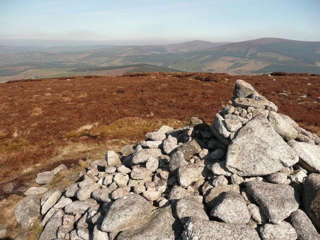 Photo could not load
O0411 : Cairn at Sorrel Hill
Robert Bone
Hill facts and local notes
Classifications
Elevation
600m
1,967 ft
Prominence
156m
Coordinates
53.1476, -6.4431
O042118
OS Map
56
At the Summit
The summit of Sorrel Hill features a modest cairn marking the highest point, alongside pleasing grassland and wildflowers that bloom in the summer.
Terrain & Geology
The underlying geology of Sorrel Hill is primarily composed of sedimentary rocks, including sandstone and mudstone, giving rise to the characteristic rolling hills and valleys found in the Pentland range.
Views & Scenery
From the summit, enjoy panoramic views of the South Edinburgh skyline, the Firth of Forth, and on a clear day, the distant hills of the Cheviots.
History & Heritage
Name Origin
The name 'Sorrel' is derived from the plant of the same name, reflecting the greenery and flora of the area.
Historical Significance
The hill captures the essence of the Pentlands, rich in natural beauty and part of the historic landscape enjoyed by locals and visitors alike.
Getting There & Facilities
Check current local access restrictions, parking rules and transport timetables before travelling. These notes do not confirm public access to the summit.
Parking
There is a small car park at the entrance to the Harlaw Reservoir, roughly 3 km from the summit trailhead.
Public Transport
Bus service to Balerno is available from Edinburgh, followed by a short walk to the trailhead.
Nearby Facilities
There are few facilities directly at the hill, but Balerno has cafes and toilets available.
Safety Information
Known Hazards
- Occasional boggy patches after heavy rainfall, and it can be windy at the summit, so wear appropriate clothing and footwear to stay dry and warm!
General Safety Tips
- Check weather conditions before setting out
- Carry appropriate clothing and equipment
- Let someone know your planned route
- Take a map, compass, and GPS device
- Carry emergency supplies: food, water, first aid kit, torch
Hills
Some common questions about the hills answered
Are there group walks up Sorrel Hill?
Many walkers use Walkmates to join or organise walks with others. You can check for group walks around Sorrel Hill through the maps
Are there other walkers around Sorrel Hill?
Activity varies by location and time, but Walkmates lets you see whether others have shared walks or shown interest in this area. Find other people through the walking friends search walking friends for Sorrel Hill search or of course create your own walk for Sorrel Hill
Can I organise a walk to Sorrel Hill?
Yes. If there aren’t any walks listed already, you can create a walk and make it available for others to join.
If you're signed up to Walkmates, you can create a walk to Sorrel Hill.
How do I find a walk up this hill?
There are often multiple ways to walk this hill, depending on experience and route preference. Walkmates helps you explore walks and routes that others have shared.
Can I suggest a new route up Sorrel Hill?
Yes. You can suggest or create routes to share with others. Walkmates focuses on the social side of walking, so routes are used to help people organise walks and explore areas together, rather than as detailed navigation tools or route libraries.
Other uses really appreciate knowledgeable walkers sharing their routes. Share your favourite route to Sorrel Hill here
The is an error or something incorrect about this hill. How do I let you know?
We always strive to keep the information on Walkmates as accurate as possible. If you find an error, please let us know through the contact form and we'll aim to correct it as quickly as possible
Community Discussion
Comments
Location
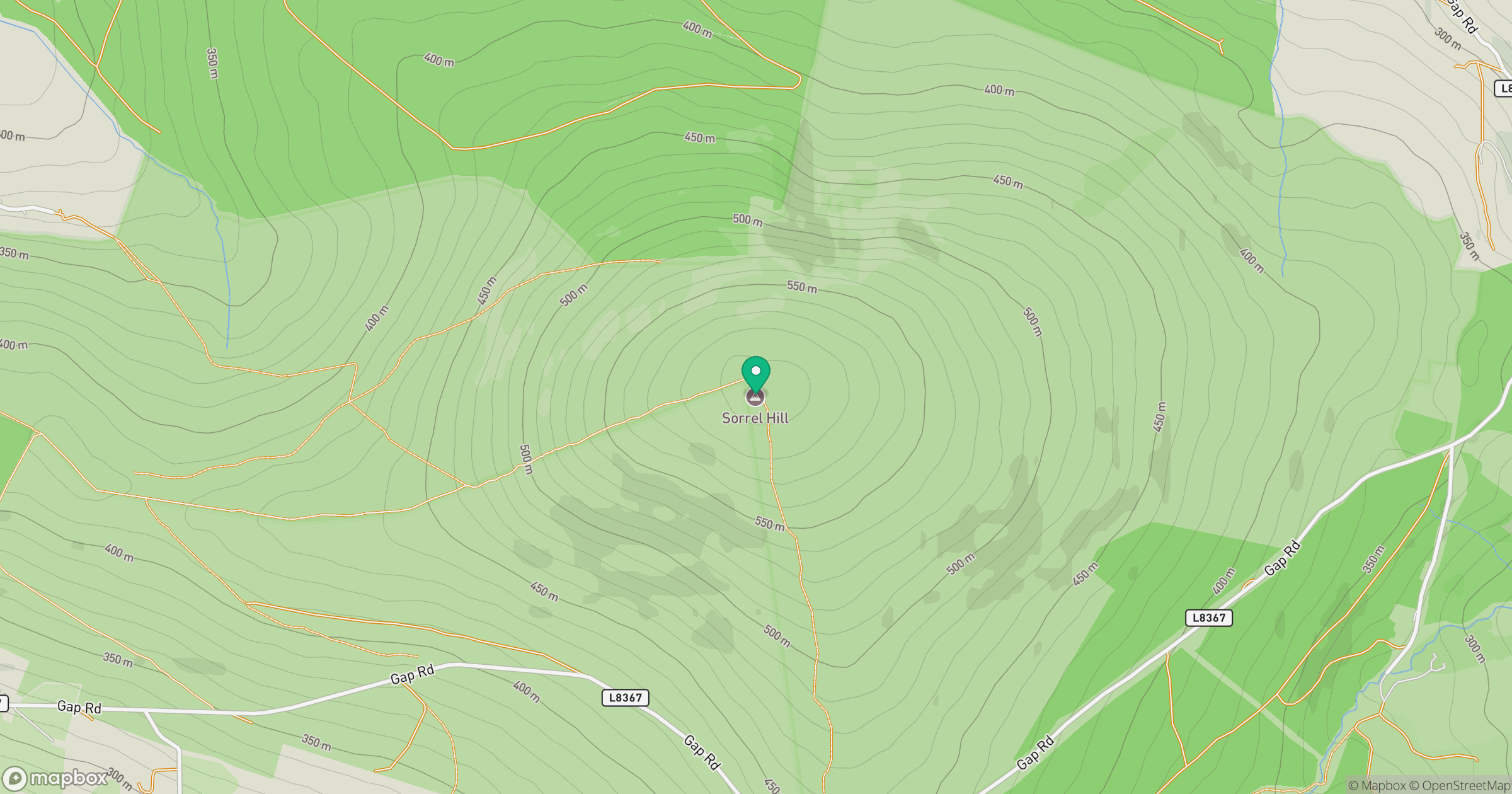
Grid reference: O042118
View on OpenStreetMapOpens a map in a new tab, centred on the hill.
Hills within 30 km
Straight-line distance, not a walking route or confirmation of access.
Mullaghcleevaun
847m
Lugnaquilla [Log na Coille]
925m
Moanbane [Moin Bhan]
703m
Seefingan [Sui Fingain]
723m
Saggart Hill [Cnoc Theach Sagard]
397m
No comments yet. Be the first.