
Knockannavea
Good walks are even better shared.
Overview
Knockannavea: The Hill of the Little Old Man
Nestled in the stunning Derryveagh Mountains, Knockannavea stands tall at an elevation of 547 meters. Known as a 'Marilyn', this mountain offers not only a rewarding hike but also panoramic views that will knock your socks off—if you’re wearing any that is!
Geology
Knockannavea showcases a splendid mixture of metamorphic rocks shaped by the relentless forces of nature over the ages. Hikers can not only enjoy breathtaking views but also marvel at the geology beneath their feet.
Getting There
Parking
The best starting point is the Ballybofey trailhead, where there is ample parking available. As always, be considerate and don’t block any farm gates.
Public Transport
Ballybofey is well-connected via local bus services, a fantastic way to save your legs for the hike ahead!
Nearest Town
Just a stone’s throw away, Ballybofey offers various amenities, making it perfect for a warm-up coffee or a hearty meal after your adventure.
Routes
Ballybofey Approach
This well-defined route is perfect for families and those looking for a moderate challenge. The 7.5 km path winds gently upwards, revealing delightful views at every turn. Expect to take around 3.5 hours to reach the summit, including photo ops.
Ardara to Knockannavea
For seasoned hikers craving a challenge, the Ardara route stretches 10 km with an estimated ascent time of 4.5 hours. Steep in parts, but your efforts will be rewarded with spectacular vistas and the satisfaction of conquering a true gem.
Summit Features
At the top, a grand cairn awaits, inviting you to sit for a moment and soak in the beauty surrounding you—the ultimate reward for your hard work.
Terrain
Prepare for a mix of grassy sections, rocky outcrops, and a few boggy patches that can make you feel like you’re moonwalking if you’re not careful! Boots with good grip are recommended.
Views
The summit offers stunning snapshots of Errigal Mountain and the surrounding valleys. Spring and autumn are particularly lovely, with refreshing air and vibrant landscapes.
Hazards
Watch your step, as rocks can be slippery after rain, and always be cautious of those boggy patches that can turn a hike into an unexpected aquatic adventure!
Nearby Summits
If you have time, the nearby peaks of Cnoc na Móna and Sliabh Sneacht are just begging to be explored.
Facilities
Once you return to Ballybofey, treat yourself to a bite at one of the charming local cafes or pop into a loo—you have earned it!
History
Knockannavea’s name gives a nod to local folklore, meaning 'The Hill of the Little Old Man'. This highlights the cultural ties the mountain has with the community.
In conclusion, whether you are an experienced hiker or a family looking for an adventure, Knockannavea promises an enjoyable day out etched in mountainside memories. So pack your boots, grab your walking stick, and get ready to discover this hidden treasure of Donegal!
Explore routes near Knockannavea
Public walks starting within 80 km of this hill. Nearby does not mean a route reaches the summit; check its map and access before setting out.
No public routes are currently listed within 80 km of Knockannavea on Walkmates. This does not mean there are no paths here. Explore the map and check local access information before planning a walk.
Route planning notes
These notes describe possible approaches, not verified navigable routes or permission to cross land. Check current paths, local access rules and conditions before setting out.
Ballybofey Approach
A well-defined route starting from Ballybofey that offers a gradual ascent and stunning views of the surrounding valleys.
Ardara to Knockannavea
A more challenging route for seasoned walkers, starting from Ardara and winding through heather-covered hills before climbing to the summit.
Make a day of it, together
Find someone to share the walk with, or organise a day out along a route you like.
Hill facts and local notes
Classifications
Elevation
401m
1,315 ft
Prominence
102m
Coordinates
53.2502, -6.4135
O059233
OS Map
50
At the Summit
The summit is marked by a substantial cairn, offering a perfect spot for a well-deserved breather and to admire the surrounding views.
Terrain & Geology
The summit of Knockannavea is predominantly composed of metamorphic rock, indicative of the area's geological history as it has undergone significant transformation over millions of years, creating the unique landscape seen today.
Views & Scenery
On a clear day, you can see the stunning Errigal Mountain to the north, as well as sweeping views of the surrounding valleys and lakes.
History & Heritage
Name Origin
Knockannavea translates to 'The Hill of the Little Old Man', a fitting name considering the folklore that surrounds the region.
Historical Significance
Historically, this region was significant for local communities and agricultural practices, with tales of ancient rituals and gatherings.
Getting There & Facilities
Check current local access restrictions, parking rules and transport timetables before travelling. These notes do not confirm public access to the summit.
Parking
Parking is available at the Ballybofey trailhead, which can accommodate several vehicles. Please respect local parking regulations.
Public Transport
The nearest bus route connects Ballybofey with major towns. Always check the latest public transport schedules.
Nearby Facilities
The nearest facilities include cafes and toilets in Ballybofey, perfect for a pre-hike coffee or post-hike treat.
Safety Information
Known Hazards
- Be aware of slippery rocks, especially during wet conditions. Also, some paths may be less defined and can become boggy.
General Safety Tips
- Check weather conditions before setting out
- Carry appropriate clothing and equipment
- Let someone know your planned route
- Take a map, compass, and GPS device
- Carry emergency supplies: food, water, first aid kit, torch
Hills
Some common questions about the hills answered
Are there group walks up Knockannavea?
Many walkers use Walkmates to join or organise walks with others. You can check for group walks around Knockannavea through the maps
Are there other walkers around Knockannavea?
Activity varies by location and time, but Walkmates lets you see whether others have shared walks or shown interest in this area. Find other people through the walking friends search walking friends for Knockannavea search or of course create your own walk for Knockannavea
Can I organise a walk to Knockannavea?
Yes. If there aren’t any walks listed already, you can create a walk and make it available for others to join.
If you're signed up to Walkmates, you can create a walk to Knockannavea.
How do I find a walk up this hill?
There are often multiple ways to walk this hill, depending on experience and route preference. Walkmates helps you explore walks and routes that others have shared.
Can I suggest a new route up Knockannavea?
Yes. You can suggest or create routes to share with others. Walkmates focuses on the social side of walking, so routes are used to help people organise walks and explore areas together, rather than as detailed navigation tools or route libraries.
Other uses really appreciate knowledgeable walkers sharing their routes. Share your favourite route to Knockannavea here
The is an error or something incorrect about this hill. How do I let you know?
We always strive to keep the information on Walkmates as accurate as possible. If you find an error, please let us know through the contact form and we'll aim to correct it as quickly as possible
Community Discussion
Comments
Location
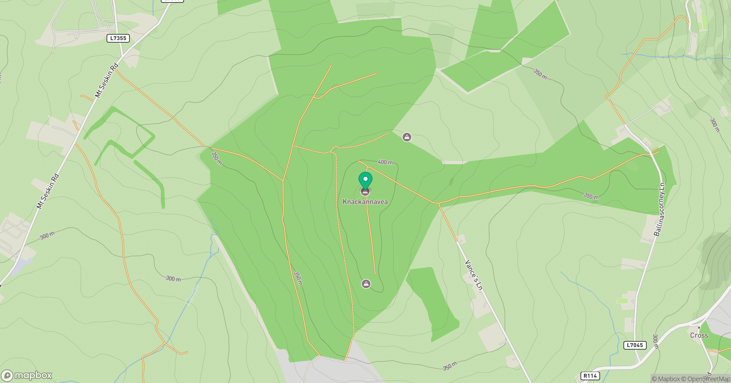
Grid reference: O059233
View on OpenStreetMapOpens a map in a new tab, centred on the hill.
Hills within 30 km
Straight-line distance, not a walking route or confirmation of access.
Mullaghcleevaun
847m
Saggart Hill [Cnoc Theach Sagard]
397m
Seefingan [Sui Fingain]
723m
Sorrel Hill
600m
Kippure [Cipiur]
757m
No comments yet. Be the first.