
Slievemore (Sherkin Island)
Good walks are even better shared.
Overview
Slievemore (Sherkin Island)
Nestled within the enchanting waters of County Cork, Slievemore stands as the crowning gem of Sherkin Island. Rising to a modest elevation of 49 meters, it may not be the highest peak in the world, but what it lacks in altitude, it certainly makes up for in views!
Geology
The geological structure of Slievemore is predominantly granite, which creates dramatic coastlines and interesting rock formations. The island's geology holds a treasure trove of stories and is a testament to the powerful forces of nature that shaped it.
Access and Facilities
Getting to Slievemore is a breeze; simply hop on a ferry from Baltimore, the nearby fishing village. Once you arrive at the picturesque Sherkin Pier, a short trek will lead you to the summits.
Limited parking exists at the pier, so be wise and arrive early to nab a spot during the high season. When you feel that rumble in your stomach after a good trudge, a couple of charming cafes await you on the island, offering local delicacies that are sure to soothe your weary spirit.
The Route
One of the most popular routes is the Coastal Loop from Sherkin Pier. This moderate trail of about 5.2 km offers not just exercise, but the kind of views that are wallpaper-worthy!
Summit Features and Views
Upon reaching the summit, you’ll be greeted by a modest cairn and undoubtedly breathtaking panoramas. Look out to the Atlantic, where you might even spot a seal or two basking on the rocks below. If you’re there at the right time, the sunset can turn the sky into a painter’s palette, full of oranges and purples.
Nearby Attractions
Don’t forget to check out nearby Cape Clear Island, a stone's throw away, which promises more adventure with its own heights and views.
Summary
While some may seek colossal mountains, Slievemore invites you to a gentle rise that unfolds like a beautifully illustrated storybook of nature. Remember, though, climbing may be easy, but once you reach the summit, maintaining your balance against a strong sea breeze might prove a little tricky!
Whether you take it as an afternoon jaunt or an extended stay, Slievemore is undoubtedly a place where the heart sings the praises of nature.
Conclusion
So lace up your hiking boots, grab some snacks, and set off on an adventure that’s not so much about scaling heights as it is about appreciating the beautiful, rugged landscapes Ireland has to offer.
Let’s make some memories—and maybe a couple of amusing slip-and-fall stories for the grandkids. Just don't forget the camera!
Explore routes near Slievemore (Sherkin Island)
Walks starting near this hill. Open a route to check its map, distance and full itinerary.
Route planning notes
These notes describe possible approaches. Check a route's map and access information when planning your walk.
Coastal Loop from Sherkin Pier
A scenic loop that takes you along coastal paths with panoramic views of the Atlantic, before circling back through lush terrain.
Make a day of it, together
Find someone to share the walk with, or organise a day out along a route you like.
Hill facts and local notes
Classifications
Elevation
101m
331 ft
Prominence
101m
Coordinates
51.4597, -9.4266
W009239
OS Map
88
At the Summit
The summit features a small cairn which serves as a great photo opportunity against the backdrop of the rugged coastline.
Terrain & Geology
The island is primarily composed of granite, giving rise to spectacular coastal cliffs and formations. The blanket bog in certain areas adds a unique ecosystem to the local geology.
Views & Scenery
From the summit, enjoy sweeping views of the Atlantic Ocean, surrounding islands like Cape Clear, and the scenic Mainland Cork.
History & Heritage
Name Origin
The name 'Slievemore' translates to 'big mountain' in Gaelic, reflecting its stature on the island.
Historical Significance
Sherkin Island has a rich history, noted for its monastic ruins and historical structures, showcasing a blend of early Irish Christian heritage and maritime history.
Getting There & Facilities
Parking
There is limited parking available at Sherkin Pier, which is the gateway to the island. Arrive early during peak seasons to secure a spot.
Public Transport
Ferry services run regularly from Baltimore on the mainland to Sherkin Island.
Nearby Facilities
There are several small cafes on Sherkin Island, offering refreshments and a rest stop for weary hikers. Public toilets are available near the pier.
Safety Information
Known Hazards
- Watch out for slippery rocks, particularly after rain. The terrain can be uneven, so sturdy footwear is recommended.
General Safety Tips
- Check weather conditions before setting out
- Carry appropriate clothing and equipment
- Let someone know your planned route
- Take a map, compass, and GPS device
- Carry emergency supplies: food, water, first aid kit, torch
Hills
Some common questions about the hills answered
Are there group walks up Slievemore (Sherkin Island)?
Many walkers use Walkmates to join or organise walks with others. You can check for group walks around Slievemore (Sherkin Island) through the maps
Are there other walkers around Slievemore (Sherkin Island)?
Activity varies by location and time, but Walkmates lets you see whether others have shared walks or shown interest in this area. Find other people through the walking friends search walking friends for Slievemore (Sherkin Island) search or of course create your own walk for Slievemore (Sherkin Island)
Can I organise a walk to Slievemore (Sherkin Island)?
Yes. If there aren’t any walks listed already, you can create a walk and make it available for others to join.
If you're signed up to Walkmates, you can create a walk to Slievemore (Sherkin Island).
How do I find a walk up this hill?
There are often multiple ways to walk this hill, depending on experience and route preference. Walkmates helps you explore walks and routes that others have shared.
Can I suggest a new route up Slievemore (Sherkin Island)?
Yes. You can suggest or create routes to share with others. Walkmates focuses on the social side of walking, so routes are used to help people organise walks and explore areas together, rather than as detailed navigation tools or route libraries.
Other uses really appreciate knowledgeable walkers sharing their routes. Share your favourite route to Slievemore (Sherkin Island) here
The is an error or something incorrect about this hill. How do I let you know?
We always strive to keep the information on Walkmates as accurate as possible. If you find an error, please let us know through the contact form and we'll aim to correct it as quickly as possible
Community Discussion
Comments
Location
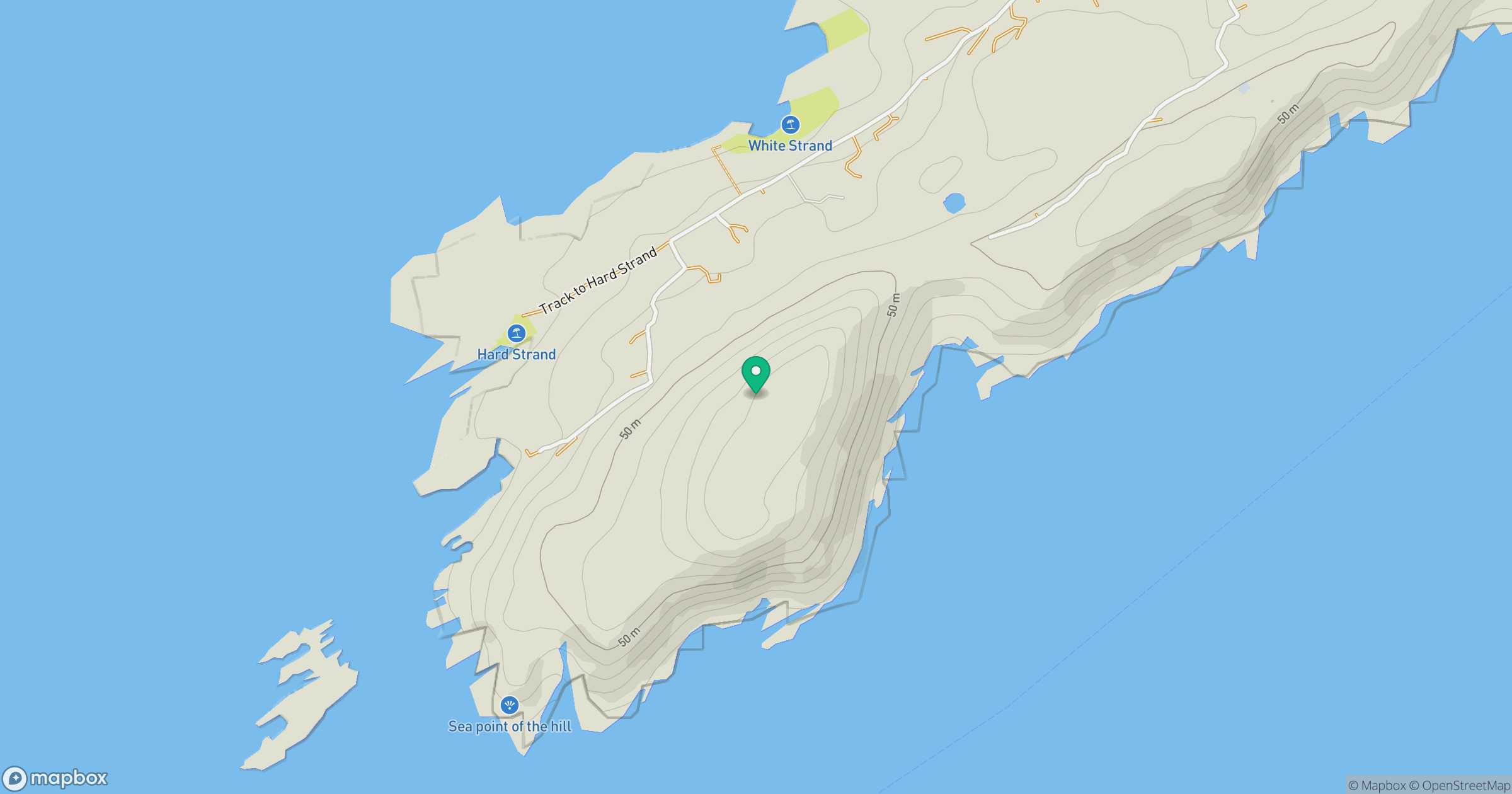
Grid reference: W009239
View on OpenStreetMapOpens a map in a new tab, centred on the hill.
No comments yet. Be the first.