

Selside Pike
Good walks are even better shared.
NY4811 : West from Selside Pike
Karl and Ali Photo source
Overview
Selside Pike: A Hidden Gem in the Lake District
Introduction
Selside Pike stands proudly at 657 meters, offering exquisite views and a chance to explore the magnificent Lake District. Not as popular as some of its better-known relatives, this mountain is a great choice for those seeking tranquility amidst stunning scenery.
Geology
Composed of volcanic rock, Selside Pike showcases the dramatic geological history of the Lake District. The area features a variety of rock types and compositions, making it a delightful spot for geology buffs and casual hikers alike.
Routes
The Ambleside to Selside Pike Loop is a fantastic choice for hikers looking to experience the beauty this region has to offer. Spanning approximately 12.5 km, this moderate trail offers a blend of gentle slopes and more challenging sections, perfect for a fulfilling day's adventure.
Summit Features
Reaching the summit rewards you with a modest cairn and unparalleled views that extend across the Lake District. Don’t forget to sign the visitors' register; it’s always nice to see who else has braved the trek.
Terrain
The terrain here is rugged and representative of Lake District hiking, with rocky paths intermingled with grassy sections and the occasional patch of heather. Good hiking boots are a must!
Views
From the top, you’ll be treated to stunning views over Windermere, the Kentmere Valley, and the majestic mountains surrounding the area. The best seasons for views are late spring and autumn, as the weather tends to be clearer, and trust me, the panoramas are worth it!
Hazards
Like all adventures, there are a few things to watch out for. Uneven terrain can be tricky, particularly in wet weather, and never underestimate the fickleness of Lake District weather. Keep an eye out for wandering sheep as they seem to believe they own every inch of the trail.
Access
Accessing Selside Pike is convenient, thanks to a plethora of options in Ambleside. With a mix of parking options available and regular bus services from Windermere, it is quite approachable.
Facilities
Ambleside is a treasure trove of facilities, including delightful cafes ready to serve you a hot drink and some delicious cake post-hike
Conclusion
In summary, Selside Pike is a marvellous destination for those looking to escape the crowds and immerse themselves in nature's wonders. It may not be the highest peak in the region, but its enchanting views and charming trails make it a worthy addition to any wanderer's bucket list. So, lace up your boots, grab your walking stick and head out for an unforgettable experience in this stunning corner of the Lake District!
Happy hiking!
Explore routes near Selside Pike
Walks starting near this hill. Open a route to check its map, distance and full itinerary.
Striding Edge, Helvellyn and Catstye Cam
View route
Helvellyn via Striding Edge
View route
Windermere west shore: Ash Landing to Wray and back
View route
Tarn Hows Fast Route
View route
Route planning notes
These notes describe possible approaches. Check a route's map and access information when planning your walk.
Ambleside to Selside Pike Loop
A stunning circular route starting from Ambleside, this trail takes you through lush valleys and across the slopes leading to the summit of Selside Pike.
Make a day of it, together
Find someone to share the walk with, or organise a day out along a route you like.
Photo Gallery
View all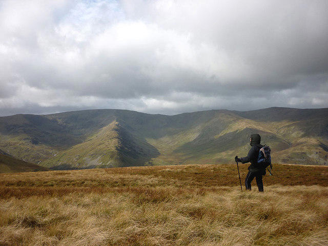 Photo could not load
NY4811 : West from Selside Pike
Karl and Ali
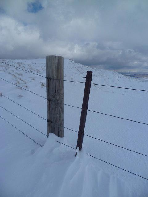 Photo could not load
NY4911 : Fence on Selside Pike
Michael Graham
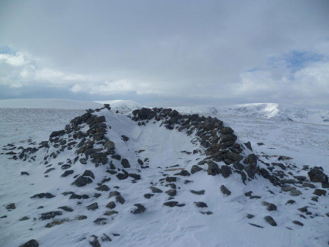 Photo could not load
NY4911 : Cairn on Selside Pike
Michael Graham
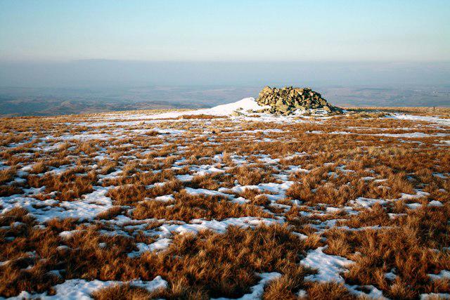 Photo could not load
NY4911 : Cairn on Selside Pike
Colin Kinnear
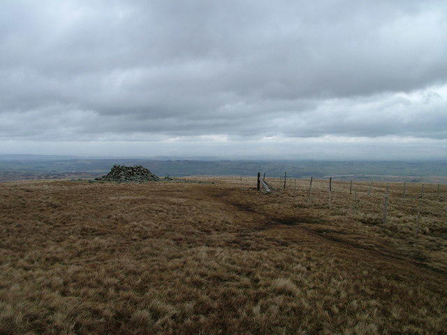 Photo could not load
NY4911 : Selside Pike
David Brown
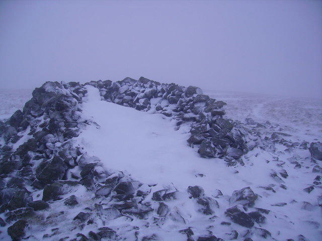 Photo could not load
NY4911 : Windshelter Selside Pike
Michael Graham
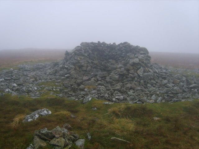 Photo could not load
NY4911 : Windshelter Selside Pike
Michael Graham
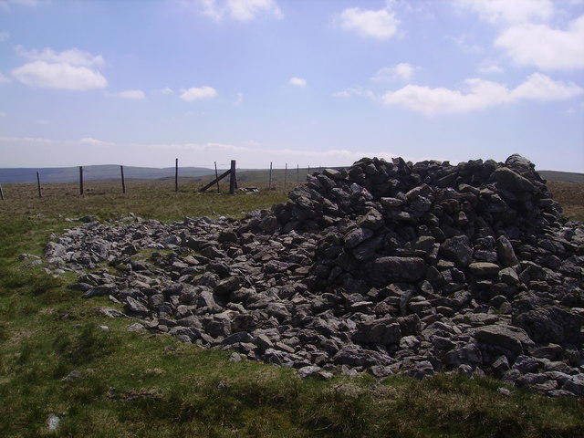 Photo could not load
NY4911 : Windshelter, Selside Pike
Michael Graham
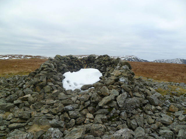 Photo could not load
NY4911 : Windshelter, Selside Pike
Michael Graham
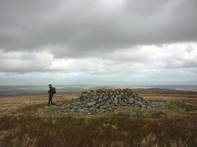
NY4911 : Prehistoric cairn, summit of Selside Pike
Karl and Ali
Hill facts and local notes
Classifications
Elevation
655m
2,149 ft
Prominence
36m
Coordinates
54.4931, -2.7879
NY490111
OS Map
90
Explorer: OL5S
At the Summit
At the summit, you'll find a modest cairn and a visitors' register. For extra points, snap a selfie with the majestic backdrop of the surrounding fells.
Terrain & Geology
Selside Pike is predominantly composed of volcanic rocks from the Skiddaw group, featuring intriguing outcrops of andesite and tuff. The area's geological history reflects significant volcanic activity, which shaped the iconic landscapes we see today.
Views & Scenery
Breathtaking views of Windermere, the Kentmere Valley, and a panorama of the peaks including the Fairfield Horseshoe.
History & Heritage
Name Origin
The name 'Selside' derives from Norse origins, meaning 'the side of the silt,' referring to the nearby river.
Historical Significance
The area is steeped in history, with numerous archaeological sites scattered throughout, hinting at ancient settlements.
Getting There & Facilities
Parking
The nearest parking is in Ambleside, offering multiple options including free roadside parking (with limited spaces) and paid car parks.
Public Transport
Frequent buses run from Windermere to Ambleside, providing an accessible route for outdoor enthusiasts. Check local services for updated schedules.
Nearby Facilities
Ambleside has several facilities, including cafes, shops, and toilets. Don’t miss the chance to sample a slice of homemade cake post-hike!
Safety Information
Known Hazards
- Uneven terrain with loose rocks, potential for sudden weather changes, keep an eye out for sheep wandering onto paths.
General Safety Tips
- Check weather conditions before setting out
- Carry appropriate clothing and equipment
- Let someone know your planned route
- Take a map, compass, and GPS device
- Carry emergency supplies: food, water, first aid kit, torch
Hills
Some common questions about the hills answered
Are there group walks up Selside Pike?
Many walkers use Walkmates to join or organise walks with others. You can check for group walks around Selside Pike through the maps
Are there other walkers around Selside Pike?
Activity varies by location and time, but Walkmates lets you see whether others have shared walks or shown interest in this area. Find other people through the walking friends search walking friends for Selside Pike search or of course create your own walk for Selside Pike
Can I organise a walk to Selside Pike?
Yes. If there aren’t any walks listed already, you can create a walk and make it available for others to join.
If you're signed up to Walkmates, you can create a walk to Selside Pike.
How do I find a walk up this hill?
There are often multiple ways to walk this hill, depending on experience and route preference. Walkmates helps you explore walks and routes that others have shared.
Can I suggest a new route up Selside Pike?
Yes. You can suggest or create routes to share with others. Walkmates focuses on the social side of walking, so routes are used to help people organise walks and explore areas together, rather than as detailed navigation tools or route libraries.
Other uses really appreciate knowledgeable walkers sharing their routes. Share your favourite route to Selside Pike here
The is an error or something incorrect about this hill. How do I let you know?
We always strive to keep the information on Walkmates as accurate as possible. If you find an error, please let us know through the contact form and we'll aim to correct it as quickly as possible
Community Discussion
Comments
Location
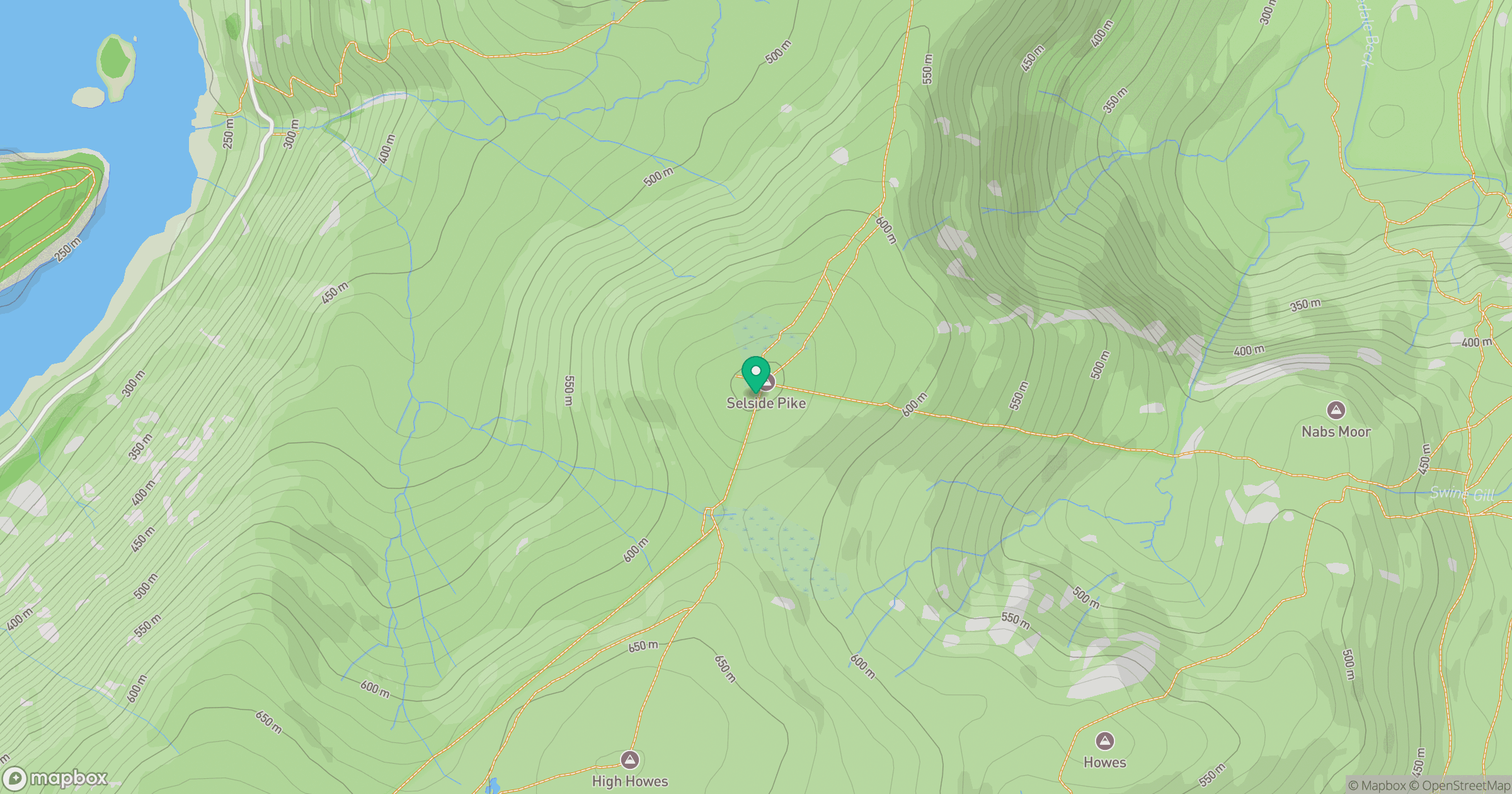
Grid reference: NY490111
View on OpenStreetMapOpens a map in a new tab, centred on the hill.

No comments yet. Be the first.