
Sal-vaich
Good walks are even better shared.
Overview
Sal-vaich: A Jewel in the Scottish Highlands
Overview
Sal-vaich, a Marilyn standing proudly at 657 meters, beckons hikers with its serene beauty and stunning vistas. Situated in the scenic Scottish Highlands, this mountain promises a rewarding experience without needing to be a seasoned alpinist.
Geology
Sal-vaich is adorned with ancient Dalradian schists and gneisses that tell the tales of geological history over millions of years. The landscape around Sal-vaich is a patchwork of rocky outcrops and lush greenery, giving hikers a chance to explore the Earth's former chapters while trekking.
Routes
The most popular route to the summit begins at Benmore Farm. Covering approximately 8 kilometres, this moderate trail meanders through picturesque glens, offering a gentle introduction to the magnificent Scottish Highlands. With a completion time of around 3.5 hours, it's a suitable hike for most feet keen to stretch.
Summit Features
At the summit, you’ll find a modest cairn - a traditional marker used by hikers, perfect for a quick selfie or simply a moment to pause and drink in the breathtaking landscape around you.
Terrain
The journey to Sal-vaich's summit will have you navigating a charming mix of grassy slopes and rocky outcrops. Be prepared, though—there are some boggy patches that might have you questioning your walking shoes' waterproof claim.
Views
The panoramic views from Sal-vaich are nothing short of spectacular. You can gaze out at the Monadhliath Mountains, take in the glimmer of Loch Ness, and on a truly clear day, the majestic Cairngorms can be spotted on the horizon. Spring and autumn are the seasons that offer the best visibility and a riot of colour over the landscape.
Hazards
As is common in the highlands, be aware of rapid weather changes. One minute you could be basking in sunshine, and the next, you might find yourself debating the merits of a raincoat. It’s essential to keep an eye on your surroundings and choose your path carefully—those marshy patches can surprise you!
Access
Parking can be found at Benmore Farm, an easy starting point for your escapade. If you’re relying on buses, you can reach Fort Augustus, the nearest town, where a taxi can whisk you to the trailhead in no time.
Facilities
After conquering Sal-vaich, head over to Fort Augustus, where several cafes and a pub can restore both your energy and spirit. The town also provides public toilets, a necessary perk after a long hike!
History
The name Sal-vaich likely traces its roots to Gaelic, hinting at its historical mossy past. This part of Scotland is steeped in folklore, with tales of clans and the mythical Loch Ness. It’s a place that not only offers natural beauty but also a rich cultural tapestry.
So lace up your boots, pack your rucksack, and get ready for an adventure—Sal-vaich awaits!
Explore routes near Sal-vaich
Public walks starting within 80 km of this hill. Nearby does not mean a route reaches the summit; check its map and access before setting out.
Loch Migdale from Torroy: Spinningdale pinewood and loch shore walk
View route
Ben Klibreck
View route
Findhorn guided night walk
View route
Elgin guided night walk
View route
Route planning notes
These notes describe possible approaches, not verified navigable routes or permission to cross land. Check current paths, local access rules and conditions before setting out.
From Benmore Farm
A popular route starting from the farm and traversing through scenic glens before ascending the gentle slopes of Sal-vaich.
Make a day of it, together
Find someone to share the walk with, or organise a day out along a route you like.
Hill facts and local notes
Classifications
Elevation
412m
1,352 ft
Prominence
103m
Coordinates
58.2129, -3.6419
ND036260
OS Map
17
Explorer: 444E
At the Summit
The summit of Sal-vaich features a modest cairn, a perfect spot for a summit selfie to brag to your mates about your latest conquest.
Terrain & Geology
Sal-vaich is predominantly composed of ancient Dalradian schists and gneisses, featuring fascinating geological formations that have stood the test of time, shaping the rugged highland landscapes we cherish today.
Views & Scenery
From the summit, you can enjoy sweeping views of the impressive Monadhliath Mountains, Loch Ness in the distance, and on a clear day, even the vastness of the Cairngorms.
History & Heritage
Name Origin
The name Sal-vaich is derived from Gaelic, possibly meaning 'the mountain of the moss'.
Historical Significance
Historically, the area is rich in folklore, with tales of clan feuds and tales of the mysterious Loch Ness, making it a culturally significant location.
Getting There & Facilities
Check current local access restrictions, parking rules and transport timetables before travelling. These notes do not confirm public access to the summit.
Parking
Parking is available at Benmore Farm, where you can leave your vehicle and set off on your adventure. Please be considerate and park sensibly.
Public Transport
Public transport options are limited, but buses run to the nearby village of Fort Augustus, from which you can arrange for a short taxi ride to reach the trailhead.
Nearby Facilities
While there are no facilities directly on the mountain, Fort Augustus has several cafes, pubs, and shops where you can refuel after your hike. Public toilets are also available in the town.
Safety Information
Known Hazards
- Watch out for sudden weather changes, as the highlands can turn from sunny to stormy in a blink. Also, be mindful of the marshy areas which can be tricky underfoot.
General Safety Tips
- Check weather conditions before setting out
- Carry appropriate clothing and equipment
- Let someone know your planned route
- Take a map, compass, and GPS device
- Carry emergency supplies: food, water, first aid kit, torch
Hills
Some common questions about the hills answered
Are there group walks up Sal-vaich?
Many walkers use Walkmates to join or organise walks with others. You can check for group walks around Sal-vaich through the maps
Are there other walkers around Sal-vaich?
Activity varies by location and time, but Walkmates lets you see whether others have shared walks or shown interest in this area. Find other people through the walking friends search walking friends for Sal-vaich search or of course create your own walk for Sal-vaich
Can I organise a walk to Sal-vaich?
Yes. If there aren’t any walks listed already, you can create a walk and make it available for others to join.
If you're signed up to Walkmates, you can create a walk to Sal-vaich.
How do I find a walk up this hill?
There are often multiple ways to walk this hill, depending on experience and route preference. Walkmates helps you explore walks and routes that others have shared.
Can I suggest a new route up Sal-vaich?
Yes. You can suggest or create routes to share with others. Walkmates focuses on the social side of walking, so routes are used to help people organise walks and explore areas together, rather than as detailed navigation tools or route libraries.
Other uses really appreciate knowledgeable walkers sharing their routes. Share your favourite route to Sal-vaich here
The is an error or something incorrect about this hill. How do I let you know?
We always strive to keep the information on Walkmates as accurate as possible. If you find an error, please let us know through the contact form and we'll aim to correct it as quickly as possible
Community Discussion
Comments
Location
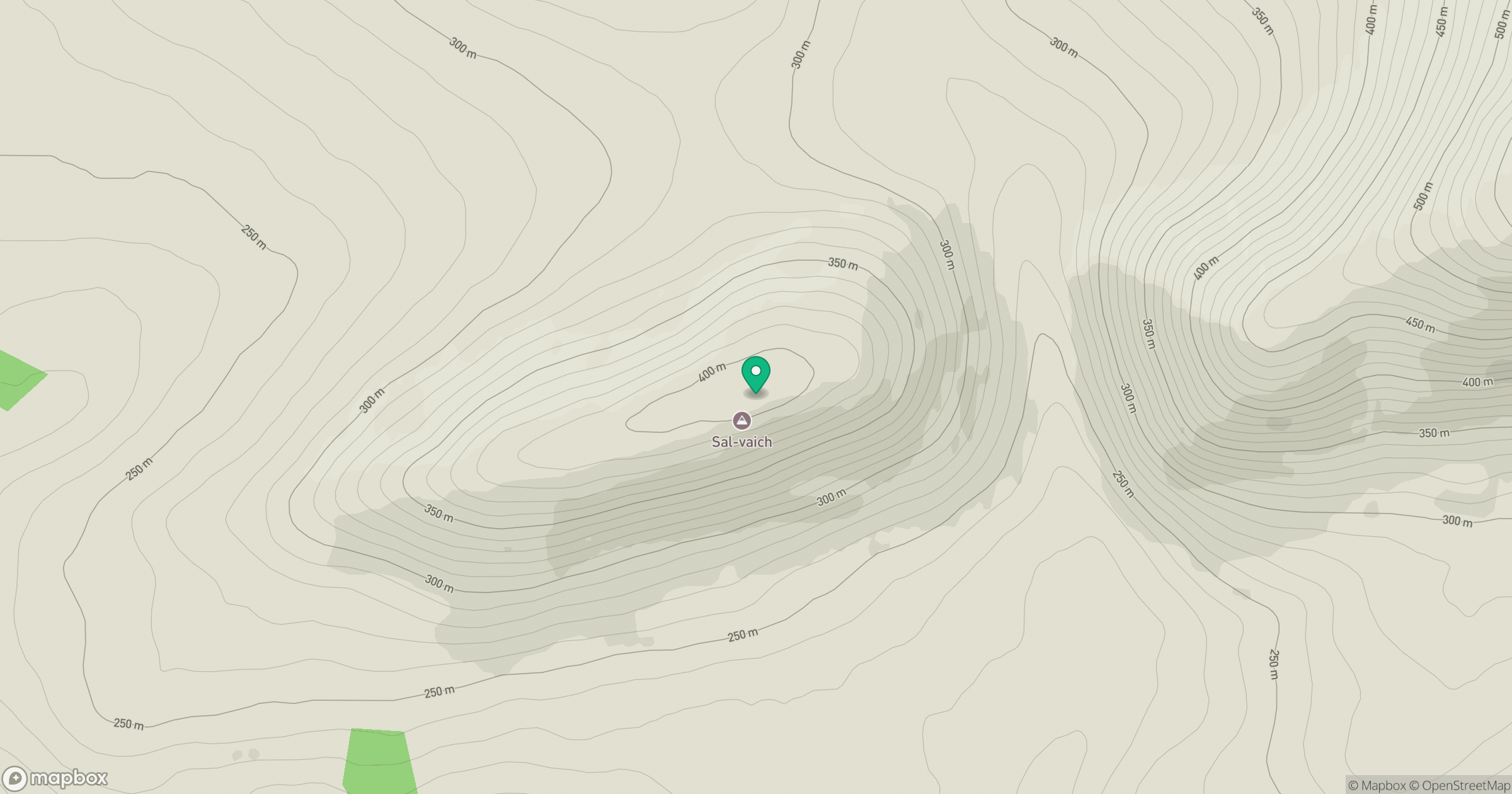
Grid reference: ND036260
View on OpenStreetMapOpens a map in a new tab, centred on the hill.
Hills within 30 km
Straight-line distance, not a walking route or confirmation of access.
No comments yet. Be the first.