

Oldham Edge
Good walks are even better shared.
SD9206 : TV mast, Oldham Edge
Alex McGregor Photo source
Overview
Oldham Edge
Introduction
Oldham Edge, standing at a modest 374 meters, may not be the highest peak in the land, but what it lacks in elevation, it more than makes up for in stunning vistas and invigorating walks. Nestled in the verdant embrace of the Pennines, this Marilyn offers hikers of all skills a slice of nature's best.
Geography and Geology
Oldham Edge is predominantly made up of resilient gritstone, a composition that gives rise to its rocky appeal and unique ecosystems. The gritstone landscape is home to an array of flora and fauna, making every walk a potentially new discovery.
Routes
The Oldham Edge Circular Walk is a popular route, approximately 6 km long and taking about 2.5 hours. It’s a moderate stroll around the hill's perimeter, perfect for families and enthusiasts alike. If you’re feeling ambitious, the Path from Chew Valley Road provides a challenging ascent directly to the summit, covering 1.5 km in about an hour.
Summit Features
When you reach the summit, take a moment to admire the trig point. It’s a classic spot for that all-important summit selfie—don’t forget to tag it with your quest for peak-bagging fame!
Terrain Type
Expect a mix of rocky and grassy terrain, with a few boggy spots to keep you on your toes. Make sure your boots are up to the task, especially after a rainy spell!
Views
The views from Oldham Edge are simply breathtaking. From the summit, you can gaze upon the expanses of the Pennines and even catch a glimpse of Manchester on clear days. The scenic vistas are particularly striking in spring and autumn, with vibrant blooms and autumn hues painting the landscape.
Hazards
While the adventure is rewarding, do keep in mind that weather can turn on a sixpence. Be prepared for swift changes and ensure you have adequate gear.
Nearby Summits
Nearby, you can find Whalley Moor and Knowl Hill, both offering their own unique trails and views.
Access
Parking is conveniently located at Oldham Edge Park, providing free access to the trails. Public transport options include frequented bus routes from Oldham town centre, with the nearest train station also in Oldham.
Facilities
After a brisk hike, rejuvenate with a slice of cake and a cup of tea at one of the local cafes in Oldham.
History
The name 'Oldham' has roots in the Old English term for 'old homestead'. As an industrial hub, Oldham's historical significance stretches back to the textile boom, with rich cultural heritage still evident today.
Conclusion
Oldham Edge may not boast grand heights, but it certainly has its own charm and beauty, making it a delightful outing for all. Whether you're an experienced hiker or just out for a gentle stroll, this local gem won't disappoint.
Happy hiking!
Explore routes near Oldham Edge
Walks starting near this hill. Open a route to check its map, distance and full itinerary.
the Medieval Quarter walking tour
View route
the Real Manchester walking tour
View route
the Real Manchester walking tour
View route
Granadaland walking tour
View route
Route planning notes
These notes describe possible approaches. Check a route's map and access information when planning your walk.
Oldham Edge Circular Walk
A scenic loop that takes you around the edge with stunning views of the surrounding countryside.
Path from Chew Valley Road
This direct path leads you straight up to the summit, perfect for those needing an uphill challenge.
Make a day of it, together
Find someone to share the walk with, or organise a day out along a route you like.
Photo Gallery
View all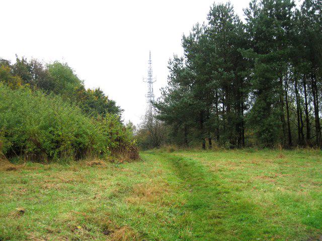 Photo could not load
SD9206 : TV mast, Oldham Edge
Alex McGregor
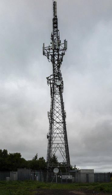 Photo could not load
SD9206 : Oldham Edge
Peter McDermott
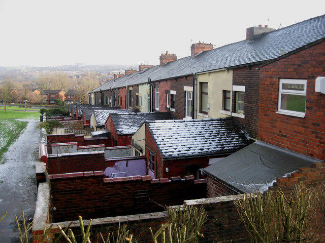 Photo could not load
SD9305 : Rear of Charter Street Oldham
Paul Anderson
Hill facts and local notes
Classifications
Elevation
249m
817 ft
Prominence
61m
Coordinates
53.5497, -2.1084
SD929058
OS Map
109
Explorer: 277
At the Summit
At the summit, you'll find a trig point, which is a favourite spot for selfies, as well as a stone cairn marking the peak.
Terrain & Geology
Oldham Edge is primarily composed of gritstone, which gives it its rugged characteristics. The area's geology has shaped not only the landscape but also the local flora and fauna.
Views & Scenery
Panoramic views of the Pennines, the Peak District, and on a clear day, you can even see as far as Manchester and beyond.
History & Heritage
Name Origin
The name 'Oldham' is derived from 'Ald-ham', meaning old homestead, reflecting the area's long history of settlement.
Historical Significance
Oldham has a rich industrial heritage, particularly known for its contributions to textile manufacturing in the 19th century.
Getting There & Facilities
Parking
There is parking available at Oldham Edge Park, which is free and only a short walk from the trailhead.
Public Transport
Buses regularly run from Oldham town centre to nearby stops. The nearest railway station is in Oldham, providing access to the local bus service.
Nearby Facilities
There are several cafes and shops in Oldham, providing refreshments and the all-important cup of tea after your hike.
Safety Information
Known Hazards
- Be cautious of weather changes; the area can be notoriously blustery. Some sections can be slippery when wet.
General Safety Tips
- Check weather conditions before setting out
- Carry appropriate clothing and equipment
- Let someone know your planned route
- Take a map, compass, and GPS device
- Carry emergency supplies: food, water, first aid kit, torch
Hills
Some common questions about the hills answered
Are there group walks up Oldham Edge?
Many walkers use Walkmates to join or organise walks with others. You can check for group walks around Oldham Edge through the maps
Are there other walkers around Oldham Edge?
Activity varies by location and time, but Walkmates lets you see whether others have shared walks or shown interest in this area. Find other people through the walking friends search walking friends for Oldham Edge search or of course create your own walk for Oldham Edge
Can I organise a walk to Oldham Edge?
Yes. If there aren’t any walks listed already, you can create a walk and make it available for others to join.
If you're signed up to Walkmates, you can create a walk to Oldham Edge.
How do I find a walk up this hill?
There are often multiple ways to walk this hill, depending on experience and route preference. Walkmates helps you explore walks and routes that others have shared.
Can I suggest a new route up Oldham Edge?
Yes. You can suggest or create routes to share with others. Walkmates focuses on the social side of walking, so routes are used to help people organise walks and explore areas together, rather than as detailed navigation tools or route libraries.
Other uses really appreciate knowledgeable walkers sharing their routes. Share your favourite route to Oldham Edge here
The is an error or something incorrect about this hill. How do I let you know?
We always strive to keep the information on Walkmates as accurate as possible. If you find an error, please let us know through the contact form and we'll aim to correct it as quickly as possible
Community Discussion
Comments
Location
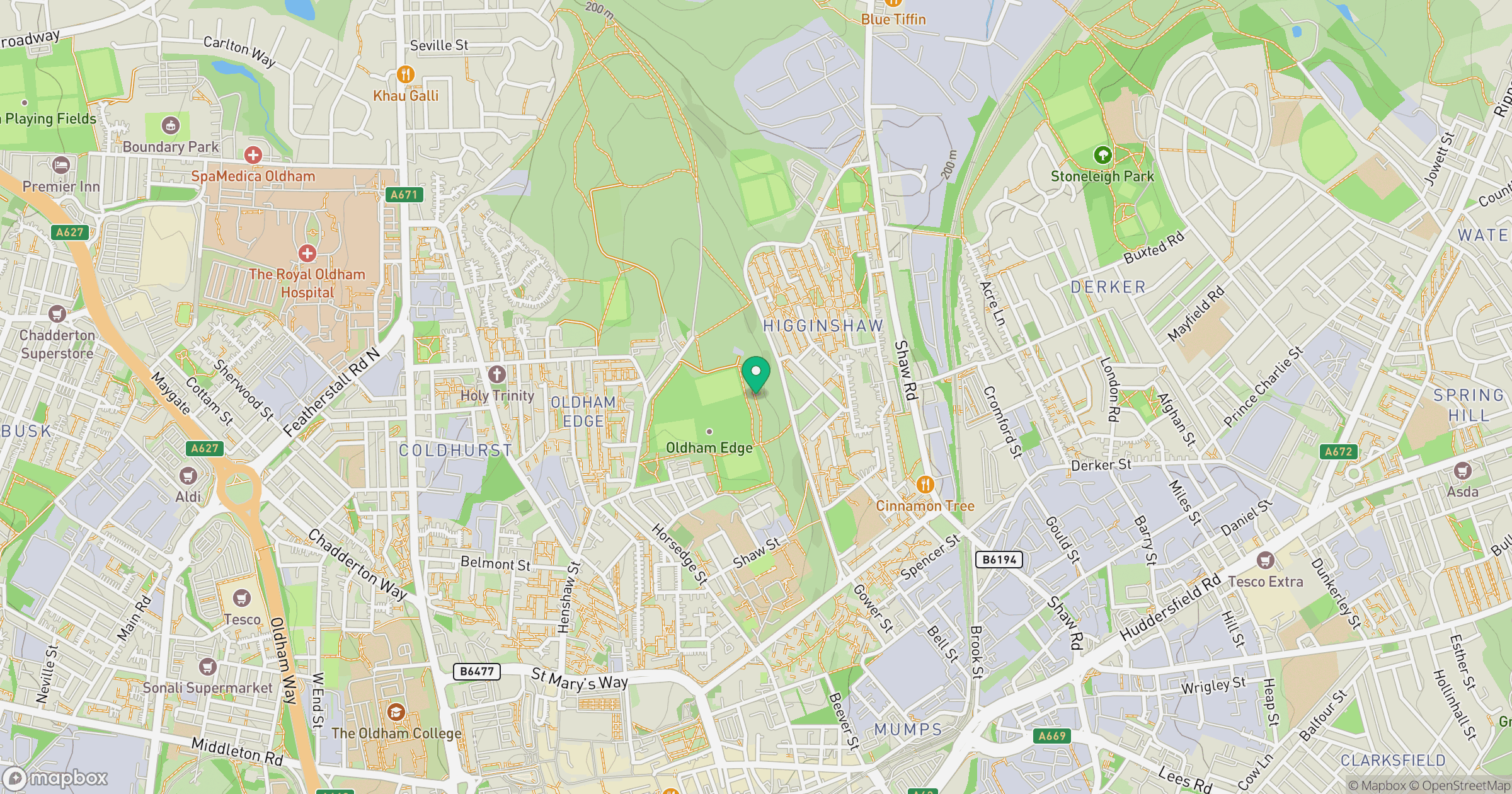
Grid reference: SD929058
View on OpenStreetMapOpens a map in a new tab, centred on the hill.
Nearby Hills

Kinder Scout
636m

Pendle Hill
557m
The Roaches
505m
Winter Hill
456m
Rombalds Moor [Ilkley Moor]
402m
No comments yet. Be the first.