

Oakeley Mynd
Good walks are even better shared.
Overview
Oakeley Mynd: A Hiker’s Delight
Oakeley Mynd stands proudly at 462 meters above sea level, presenting a true gem situated within the enchanting Shropshire Hills. A Marilyn by classification, it boasts a prominence of 103 meters, allowing for incredible views and a sense of achievement at the summit.
Geology
The geology of Oakeley Mynd is an interesting chapter in the geological history books, made up primarily of Ludlow gritstone. The area provides insights into the geological transformations that have occurred over millions of years, once being covered by ancient seas and teeming with life. So, while you're exploring, ponder over which ancient creatures may have roamed these very slopes!
Routes
One of the most popular routes is the Oakeley Mynd Circular Walk, a delightful 5.5 km loop that mighty fine choice for those wanting a blend of scenic woodland paths and open pasture weaving around the hill. Expect this to take roughly two hours, but don't rush; take the time to soak in the atmosphere!
Summit Features
Upon your arrival at the summit, you’ll be welcomed by a modest stone cairn—an ideal setting for that Instagram moment. From here, the views are something to write home about. When the skies are clear, you can gaze upon the iconic Long Mynd and the Stiperstones in the distance.
Terrain
The terrain varies, inviting you through lush woodlands and grassy slopes that lead to the rugged rocky outcrops at the peak. It's a mixed bag that keeps your feet guessing, always a good reason to lace up your best hiking boots!
Views
Views from Oakeley Mynd are truly breathtaking, particularly in the spring when wildflowers bloom and painting the landscape in vivid colours. Autumn offers a spectacular array of foliage too, so if you can time your visit, these seasons will not disappoint.
Hazards
As with any outdoor adventure, there are some considerations to keep in mind. Be wary of the wet and muddy conditions that can ensue, especially during the winter months. As always in the hills, be prepared for quick weather changes that can bloom suddenly, like an unexpected guest at a tea party!
Access
Accessing Oakeley Mynd is straightforward. You can park at a small, free car park near Little Stretton, which is just a hop, skip, and jump away from the trailhead. If you're relying on public transport, local bus services from Shrewsbury to Little Stretton will get you fairly close, though a pleasant stroll will be required.
Facilities
The nearest town, Church Stretton, is well-stocked with cafes and pubs where you can grab a hot drink or a hearty meal after your adventure. Don't forget to pop by the Church Stretton Visitor Centre for the latest on local spots and walking routes.
In Summary
Oakeley Mynd is a splendid mountain for both seasoned hikers and those just dipping their toes into the hiking waters. With its picturesque trails, stunning views, and quaint surroundings, it's a little slice of tranquillity waiting to be explored. So pack your boots, take a deep breath of that fresh air, and set out for an unforgettable outing in the Shropshire Hills!
Happy hiking!
Explore routes near Oakeley Mynd
Public walks starting within 80 km of this hill. Nearby does not mean a route reaches the summit; check its map and access before setting out.
Lightspout Waterfall via Carding Mill Valley Circular
View route
Carding Mill Valley and The Long Mynd walk
View route
Mortimer Forest Lower Evens Circuit
View route
Ludlow Town Walls and Castle Walk
View route
Route planning notes
These notes describe possible approaches, not verified navigable routes or permission to cross land. Check current paths, local access rules and conditions before setting out.
Oakeley Mynd Circular Walk
A picturesque loop starting from the foot of the hill, taking you through woodland and open fields before ascending the hill for spectacular views.
Make a day of it, together
Find someone to share the walk with, or organise a day out along a route you like.
Photo Gallery
View all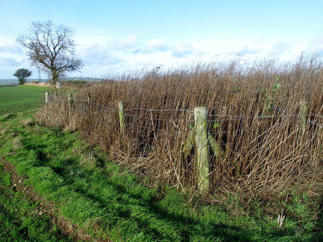 Photo could not load
SO3587 : Oakeley Mynd
Rude Health
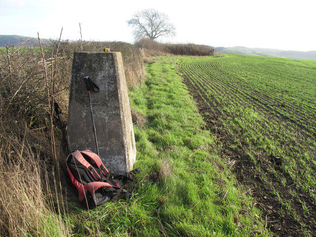 Photo could not load
SO3487 : Oakeley Mynd
Rude Health
Hill facts and local notes
Classifications
Elevation
309m
1,014 ft
Prominence
126m
Coordinates
52.4810, -2.9595
SO349874
OS Map
137
Explorer: 216
At the Summit
At the summit, you'll find a small stone cairn, a perfect spot for a celebratory selfie, along with sweeping vistas of the Shropshire Hills.
Terrain & Geology
Oakeley Mynd is primarily composed of Ludlow gritstone. The rock formations here tell tales of a geological past that included vast river systems and ancient seas.
Views & Scenery
Panoramic views of the Long Mynd, Stiperstones, and even as far as the Welsh hills on a clear day.
History & Heritage
Name Origin
The name 'Mynd' comes from the Old Welsh word 'mynnydd', meaning mountain or hill. Oakeley likely references the local oak trees.
Historical Significance
Oakeley Mynd is part of the Shropshire Hills Area of Outstanding Natural Beauty and holds ecological and historical value as a traditional landscape.
Getting There & Facilities
Check current local access restrictions, parking rules and transport timetables before travelling. These notes do not confirm public access to the summit.
Parking
Free parking is available at the small car park near the village of Little Stretton, just a short walk to the start of the route.
Public Transport
Bus services from Shrewsbury to Little Stretton are available, with a bit of a walk from the stop to the car park.
Nearby Facilities
In Church Stretton, you can find cafes, pubs, and public toilets. The 'Church Stretton Visitor Centre' is very handy for maps and local advice.
Safety Information
Known Hazards
- Wet and muddy conditions can occur, especially in winter; quick changes in weather are not uncommon in the hills.
General Safety Tips
- Check weather conditions before setting out
- Carry appropriate clothing and equipment
- Let someone know your planned route
- Take a map, compass, and GPS device
- Carry emergency supplies: food, water, first aid kit, torch
Hills
Some common questions about the hills answered
Are there group walks up Oakeley Mynd?
Many walkers use Walkmates to join or organise walks with others. You can check for group walks around Oakeley Mynd through the maps
Are there other walkers around Oakeley Mynd?
Activity varies by location and time, but Walkmates lets you see whether others have shared walks or shown interest in this area. Find other people through the walking friends search walking friends for Oakeley Mynd search or of course create your own walk for Oakeley Mynd
Can I organise a walk to Oakeley Mynd?
Yes. If there aren’t any walks listed already, you can create a walk and make it available for others to join.
If you're signed up to Walkmates, you can create a walk to Oakeley Mynd.
How do I find a walk up this hill?
There are often multiple ways to walk this hill, depending on experience and route preference. Walkmates helps you explore walks and routes that others have shared.
Can I suggest a new route up Oakeley Mynd?
Yes. You can suggest or create routes to share with others. Walkmates focuses on the social side of walking, so routes are used to help people organise walks and explore areas together, rather than as detailed navigation tools or route libraries.
Other uses really appreciate knowledgeable walkers sharing their routes. Share your favourite route to Oakeley Mynd here
The is an error or something incorrect about this hill. How do I let you know?
We always strive to keep the information on Walkmates as accurate as possible. If you find an error, please let us know through the contact form and we'll aim to correct it as quickly as possible
Community Discussion
Comments
Location
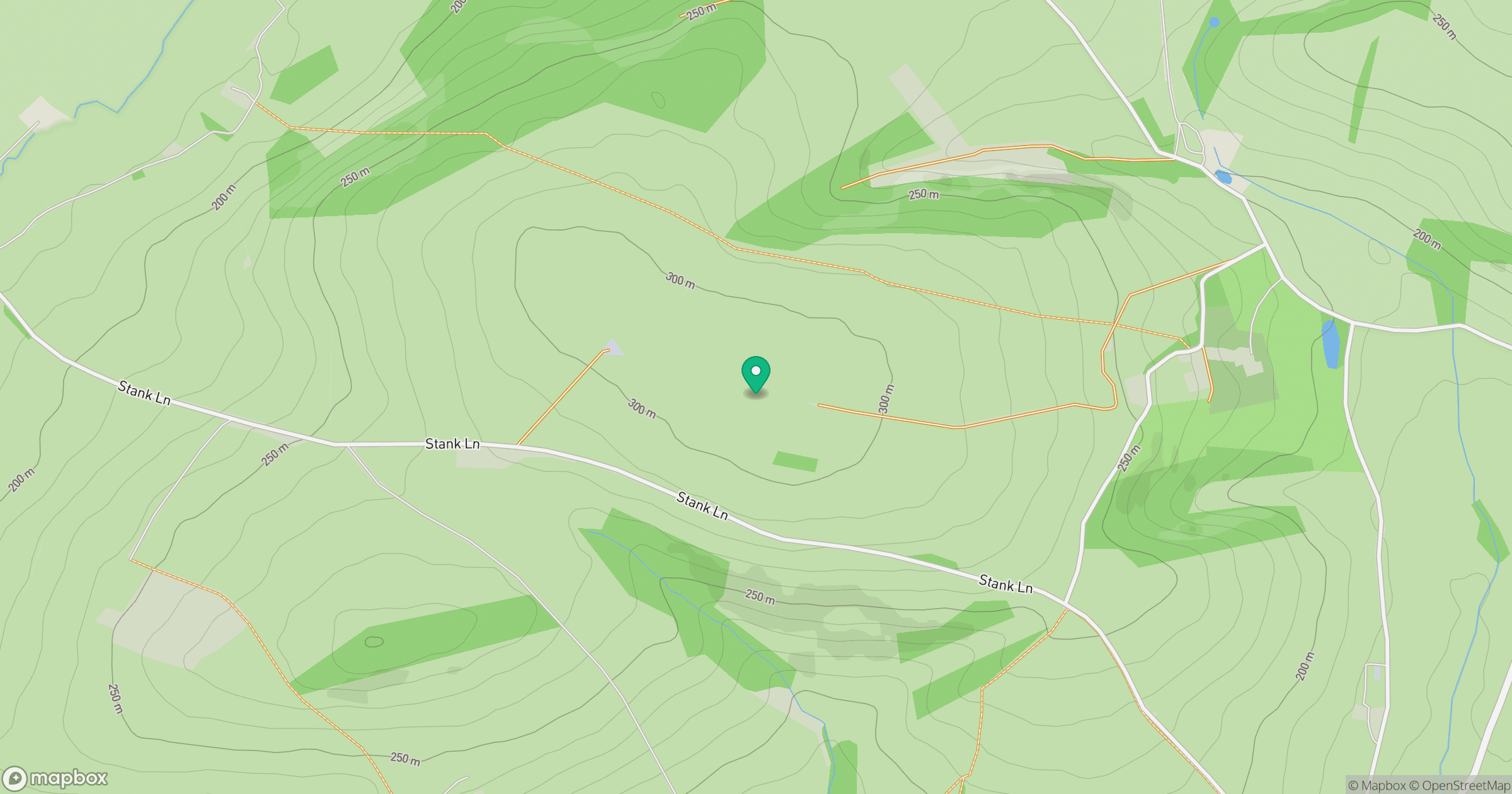
Grid reference: SO349874
View on OpenStreetMapOpens a map in a new tab, centred on the hill.
Hills within 30 km
Straight-line distance, not a walking route or confirmation of access.
No comments yet. Be the first.