

Norton Camp
Good walks are even better shared.
Overview
Norton Camp: An Overview
Norton Camp is a hidden gem nestled in the picturesque Shropshire Hills, with an elevation of 123 meters. Though it might not be the highest peak around, it offers a delightful blend of scenic beauty and historical intrigue.
Geology
The area is mainly composed of Old Red Sandstone, which provides a fascinating glimpse into the earth's history. Lucky geological formations dot the landscape, making it a great spot for inquisitive minds who enjoy examining the rock formations.
Routes
Several routes allow for an enjoyable day out in nature. The Norton Camp Circular is a moderate 5.5 km loop that takes about 2.5 hours, winding through lovely woodlands and open fields. For more adventurous spirits, the Direct Ascent from Norton is a shorter, yet challenging 1 km directly to the summit and can knock off an hour from your day.
Summit Features
At the peak, a lowly stone cairn stands watch, silently witnessing your triumph. Don’t expect refreshments, though; this spot offers nothing more than awe-inspiring views!
Terrain Type
The trek encompasses a mix of terrain types—primarily grassy with some rocky spots, particularly near the summit. This variety keeps the adventure interesting, just like trying to understand British weather!
Views
The panorama from Norton Camp's summit showcases the enchanting Shropshire Hills, with Longmynd in the distance and picturesque Welsh valleys creeping into view. Best seasons to enjoy these sights are spring and early autumn when the air is crisper.
Hazards
Like most outdoor areas, watch your step on uneven ground, especially as you approach the summit. Also, unpredictable weather can surprise the unprepared, so pack an extra jumper.
Nearby Summits
If you're feeling adventurous, consider tackling nearby peaks such as Bury Ditches (399 meters) and Clee Hill (540 meters) to extend your adventure.
Access
Parking can be found at a handy lay-by near the church in Norton—just don’t block any locals! Public transport options are limited, but regular buses from Ludlow keep things moving. The nearest town, Ludlow, is about 6 miles away and has a variety of cafés and amenities for a post-hike treat.
Facilities
Facilities are sparse directly on the mountain. However, Ludlow is near enough to satisfy cravings for cake or a proper cup of tea after your walk.
History
The name 'Norton' suggests a historical significance tied to any settlements that flourished in the North. The faint echoes of ancient fortifications still linger, inviting further exploration.
Norton Camp may not be a peak that dominates the skyline, but with its mix of nature, history, and stunning vistas, it's well worth a visit. So lace up your boots and head out for a cracking day in the hills! Enjoy!
Explore routes near Norton Camp
Public walks starting within 80 km of this hill. Nearby does not mean a route reaches the summit; check its map and access before setting out.
Mortimer Forest Lower Evens Circuit
View route
Ludlow Town Walls and Castle Walk
View route
Carding Mill Valley and The Long Mynd walk
View route
Lightspout Waterfall via Carding Mill Valley Circular
View route
Route planning notes
These notes describe possible approaches, not verified navigable routes or permission to cross land. Check current paths, local access rules and conditions before setting out.
Norton Camp Circular
A delightful circular route starting from the village of Norton, leading hikers through scenic woodlands and open grasslands before culminating at the summit.
Direct Ascent from Norton
A direct approach for those who prefer to cut to the chase and head straight to the top with minimal faffing about.
Make a day of it, together
Find someone to share the walk with, or organise a day out along a route you like.
Photo Gallery
View all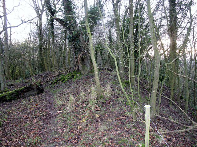 Photo could not load
SO4481 : Norton Camp
Rude Health
Hill facts and local notes
Classifications
Elevation
292m
957 ft
Prominence
133m
Coordinates
52.4316, -2.8178
SO444818
OS Map
137
Explorer: 217
At the Summit
The summit features a small stone cairn, perfect for a quick photo opportunity, but regrettably, it does not offer a summer cocktail service.
Terrain & Geology
Norton Camp is primarily composed of Old Red Sandstone, a sedimentary rock that indicates a rich geological history and offers fascinating formations for those with a keen eye.
Views & Scenery
From the top, you can see the stunning expanse of the Shropshire Hills, including the distant Longmynd and the charming Welsh valleys beyond.
History & Heritage
Name Origin
The name 'Norton' derives from 'North Town', hinting at its geographical roots.
Historical Significance
Historically, Norton Camp is believed to have been an ancient fortification, adding a touch of mystery to your hike.
Getting There & Facilities
Check current local access restrictions, parking rules and transport timetables before travelling. These notes do not confirm public access to the summit.
Parking
Park in the village of Norton at the small lay-by by the church, but be mindful of not blocking locals' driveways.
Public Transport
Regular buses run from Ludlow and Presteigne to Norton, however, service may vary, so check the timetable before setting off.
Nearby Facilities
There are no facilities on the mountain itself, but Ludlow provides ample cafés, restaurants, and public toilets for when you return from your adventure.
Safety Information
Known Hazards
- Uneven ground, particularly near the summit. Beware of sudden weather changes common in the hills, so bring an extra layer, just in case.
General Safety Tips
- Check weather conditions before setting out
- Carry appropriate clothing and equipment
- Let someone know your planned route
- Take a map, compass, and GPS device
- Carry emergency supplies: food, water, first aid kit, torch
Hills
Some common questions about the hills answered
Are there group walks up Norton Camp?
Many walkers use Walkmates to join or organise walks with others. You can check for group walks around Norton Camp through the maps
Are there other walkers around Norton Camp?
Activity varies by location and time, but Walkmates lets you see whether others have shared walks or shown interest in this area. Find other people through the walking friends search walking friends for Norton Camp search or of course create your own walk for Norton Camp
Can I organise a walk to Norton Camp?
Yes. If there aren’t any walks listed already, you can create a walk and make it available for others to join.
If you're signed up to Walkmates, you can create a walk to Norton Camp.
How do I find a walk up this hill?
There are often multiple ways to walk this hill, depending on experience and route preference. Walkmates helps you explore walks and routes that others have shared.
Can I suggest a new route up Norton Camp?
Yes. You can suggest or create routes to share with others. Walkmates focuses on the social side of walking, so routes are used to help people organise walks and explore areas together, rather than as detailed navigation tools or route libraries.
Other uses really appreciate knowledgeable walkers sharing their routes. Share your favourite route to Norton Camp here
The is an error or something incorrect about this hill. How do I let you know?
We always strive to keep the information on Walkmates as accurate as possible. If you find an error, please let us know through the contact form and we'll aim to correct it as quickly as possible
Community Discussion
Comments
Location
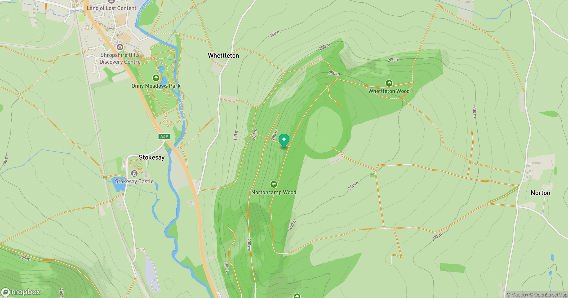
Grid reference: SO444818
View on OpenStreetMapOpens a map in a new tab, centred on the hill.
Hills within 30 km
Straight-line distance, not a walking route or confirmation of access.
Long Mynd - Pole Bank
517m
Stiperstones
537m
Titterstone Clee Hill
533m
View Edge
322m
Callow Hill
340m
No comments yet. Be the first.